App ist vorübergehend nicht verfügbar

Agrisol
Veröffentlicht von:
Agrisol Schoeman Precision Services PTY

Downloads
Umsatz
Beschreibung
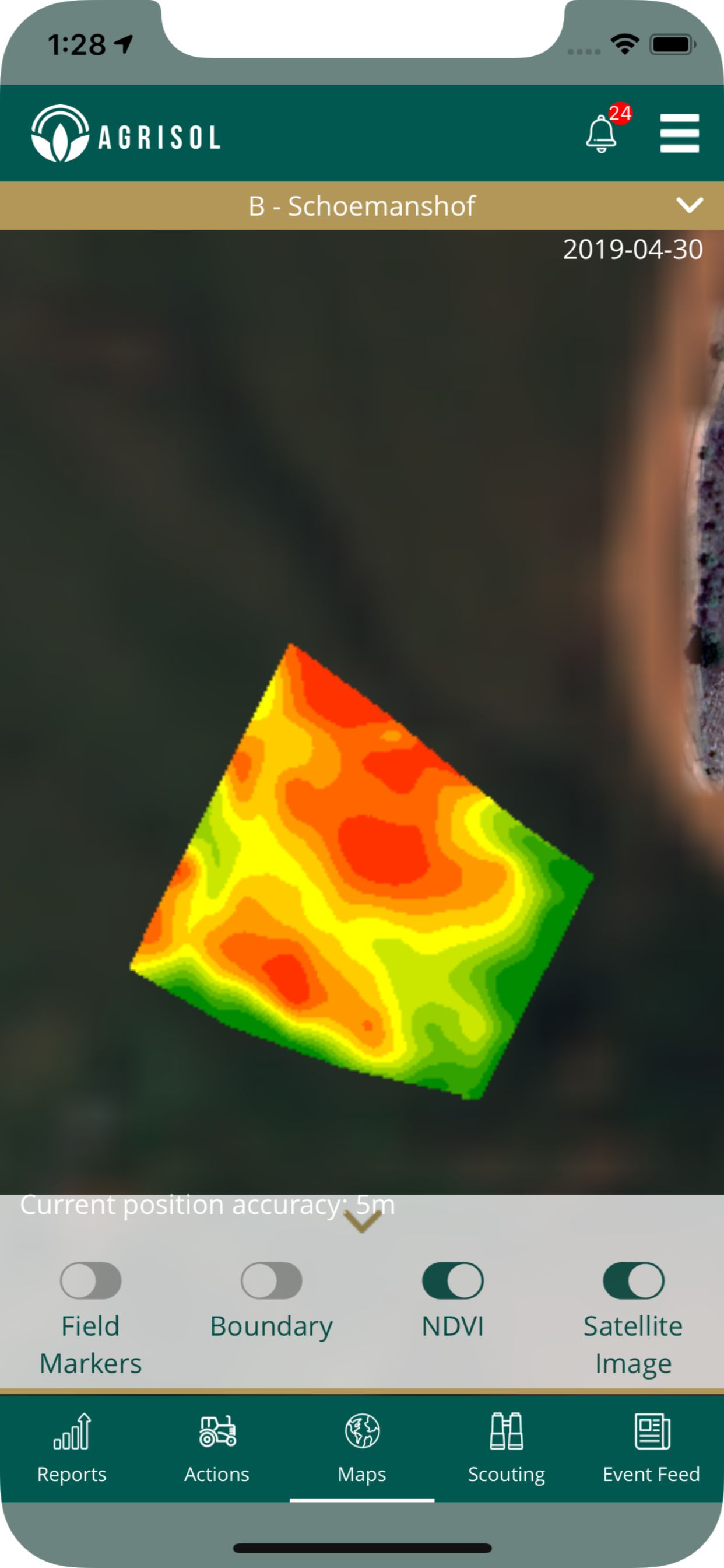
Agrisol developed an advanced geographical information system which are continually being improved and expanded on. After we collect grid samples, we extract other relevant information like physical soil data, satellite images and weather statistics for every field, enabling us to give the absolute best and up to date recommendations to our customers. To make the data more accessible to the farmer and his contributors, we have developed a digital environment where every user has immediate access to the most relevant data on his mobile device or desktop.
Built into this dynamic digital environment, is the ability to invite external collaborators or service providers. With the relevant farmer’s permission, they can then have access to the most recent data, enabling them to customise and target their services and products specifically for our customers. Typical service providers may include companies that provide agricultural resources like fertilizer, lime and chemicals, or even business services like financing or insurance.
This cutting edge development will ensure that the farmer has continuous access to a single platform, that instantly connects him with all the relevant products and services he might need, already tailored to his specific needs.
No product sales, Sustainable, Scientific, Accessible, Understandable, Environmental friendly.
Ausblenden
Mehr anzeigen...
Built into this dynamic digital environment, is the ability to invite external collaborators or service providers. With the relevant farmer’s permission, they can then have access to the most recent data, enabling them to customise and target their services and products specifically for our customers. Typical service providers may include companies that provide agricultural resources like fertilizer, lime and chemicals, or even business services like financing or insurance.
This cutting edge development will ensure that the farmer has continuous access to a single platform, that instantly connects him with all the relevant products and services he might need, already tailored to his specific needs.
No product sales, Sustainable, Scientific, Accessible, Understandable, Environmental friendly.
Screenshots
Agrisol Häufige Fragen
-
Ist Agrisol kostenlos?
Ja, Agrisol ist komplett kostenlos und enthält keine In-App-Käufe oder Abonnements.
-
Ist Agrisol seriös?
Nicht genügend Bewertungen, um eine zuverlässige Einschätzung vorzunehmen. Die App benötigt mehr Nutzerfeedback.
Danke für die Stimme -
Wie viel kostet Agrisol?
Agrisol ist kostenlos.
-
Wie hoch ist der Umsatz von Agrisol?
Um geschätzte Einnahmen der Agrisol-App und weitere AppStore-Einblicke zu erhalten, können Sie sich bei der AppTail Mobile Analytics Platform anmelden.

Benutzerbewertung
Die App ist in Peru noch nicht bewertet.

Bewertungsverlauf
Agrisol Bewertungen
Keine Bewertungen in Peru
Die App hat noch keine Bewertungen in Peru.
Agrisol Installationen
Letzte 30 TageAgrisol Umsatz
Letzte 30 TageAgrisol Einnahmen und Downloads
Gewinnen Sie wertvolle Einblicke in die Leistung von Agrisol mit unserer Analytik.
Melden Sie sich jetzt an, um Zugriff auf Downloads, Einnahmen und mehr zu erhalten.
Melden Sie sich jetzt an, um Zugriff auf Downloads, Einnahmen und mehr zu erhalten.
App-Informationen
- Kategorie
- Productivity
- Herausgeber
-
Agrisol Schoeman Precision Services PTY
- Sprachen
- English
- Letzte Veröffentlichung
- 1.5.17 (vor 4 Jahren )
- Veröffentlicht am
- Dec 7, 2017 (vor 7 Jahren )
- Auch verfügbar in
- Südafrika , Australien , Kanada , China , Indonesien , Italien , Malaysia , Neuseeland , Peru , Vereinigte Staaten
- Zuletzt aktualisiert
- vor 8 Monaten
This page includes copyrighted content from third parties, shared solely for commentary and research in accordance with fair use under applicable copyright laws. All trademarks, including product, service, and company names or logos, remain the property of their respective owners. Their use here falls under nominative fair use as outlined by trademark laws and does not suggest any affiliation with or endorsement by the trademark holders.
- © 2024 AppTail.
- Unterstützung
- Privacy
- Terms
- All Apps


