Blue Light Maps

Smarter Navigation

Veröffentlicht von: Blue Light Maps

Beschreibung

Navegue de forma más inteligente y llegue más rápido con Blue Light Maps: la aplicación de navegación construida por y para los profesionales de primera línea. Diseñada específicamente para policías, paramédicos, bomberos y servicios de ambulancias privadas, nuestra aplicación revoluciona la navegación en respuestas de emergencia.
Detalles de mapas sin igual
• Mapas detallados: Edificios y direcciones claramente visibles, desde bloques de apartamentos hasta casas de campo.
• Siempre sepa dónde está: Mapas mejorados que aseguran una conciencia precisa de la ubicación en todo momento.
Rutas optimizadas utilizando sus exenciones
• Rutas más rápidas: Tenga en cuenta las exenciones legales para giros restringidos, calles solo para buses, zonas de tráfico restringido y más.
• Hasta un 60% más corto: Encuentre rutas significativamente más cortas que las de Google Maps o TomTom.
• Notificaciones anticipadas de giro: Reciba alertas oportunas para giros, incluso a altas velocidades.
Manténgase orientado—Esencial para una coordinación interagencial efectiva
• Conozca su ubicación: Vea claramente su carretera actual y dirección, crucial para llamadas de asistencia e informes precisos durante persecuciones.
• Mejore la comunicación: Facilita el intercambio preciso de ubicaciones entre servicios.
Adaptado para vehículos de emergencia de mayor tamaño como ambulancias y camiones de bomberos
• Evite restricciones: Modos especializados aseguran que no quede atrapado en restricciones de ancho y giros cerrados.
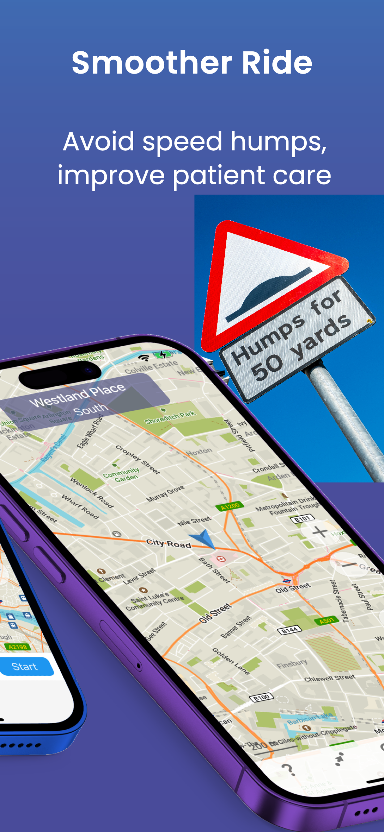
• Viajes suaves: ¿Transportando un paciente? Use nuestro modo que evita badenes.
Búsqueda de destinos sin esfuerzo
• Búsqueda integrada: Use la búsqueda de Google o What3Words para encontrar destinos rápidamente.
• Guía visual: Google Street View integrado le muestra el destino al acercarse.
Mapas sin conexión—Siempre disponibles
• Permanezca conectado: Navegue sin problemas incluso en áreas con mala recepción.
Confiado por profesionales de emergencias
“Nos permitió llegar a un incidente mucho más rápido en comparación con Google Maps.”
“Mejor precisión en el ETA en pantalla.”
“Una ruta más eficiente, utilizando exenciones para un giro prohibido a la derecha, ahorró 3 minutos.”
“A diferencia de la sugerencia de TomTom de desviar el tráfico, pudimos claramente evitarlo y ahorramos unos minutos.”
Comience su prueba gratuita hoy
Experimente la diferencia con una prueba gratuita de Blue Light Maps. Continúe con una suscripción individual disponible dentro de la aplicación, o a través de una suscripción empresarial mediante su empleador.
Términos de uso: https://bluelightmaps.com/terms
Política de privacidad: https://bluelightmaps.com/privacy
Ausblenden Mehr anzeigen...

Screenshots

Blue Light Maps Häufige Fragen

  • Ist Blue Light Maps kostenlos?

    Ja, Blue Light Maps ist komplett kostenlos und enthält keine In-App-Käufe oder Abonnements.

  • Ist Blue Light Maps seriös?

    Nicht genügend Bewertungen, um eine zuverlässige Einschätzung vorzunehmen. Die App benötigt mehr Nutzerfeedback.

    Danke für die Stimme

  • Wie viel kostet Blue Light Maps?

    Blue Light Maps ist kostenlos.

  • Wie hoch ist der Umsatz von Blue Light Maps?

    Um geschätzte Einnahmen der Blue Light Maps-App und weitere AppStore-Einblicke zu erhalten, können Sie sich bei der AppTail Mobile Analytics Platform anmelden.

Benutzerbewertung
Die App ist in Kolumbien noch nicht bewertet.
Bewertungsverlauf

Blue Light Maps Bewertungen

Good idea - needs work

Themavia on

Vereinigtes Königreich

Works well however when using CarPlay says ‘unknown place’ unless app has already been opened before connecting to CarPlay. More road detail would be ideal on CarPlay such as up coming road names. There’s so much detail such as building names and house numbers which isn’t really required as I can look out the window for that. Keeping the faith for the time being as I know the dev team are working to get updates out.

Great idea

Gashman99 on

Vereinigtes Königreich

Love the idea however found a bit clunky to use… When entering destination it would be nice if it auto populated a list like Google/most other maps when partial text is entered as makes inputting destination less efficient. Also found suggestions of locations when partial text searched for were nowhere near my location whereas other map services will suggest those closer geographically. When trialing found routes would take me peculiar ways for instance, through single track country lanes and almost unmade roads when motorway would be much quicker and more efficient especially when driving on blue lights. Although an ‘as the crow flies’ route may be quicker for non-emergency driving when in response mode these become more dangerous and slower as roads are not suitable for high speed driving. Really like the way properties are numbered on the map and the image at the end of the journey from street view however these sometimes can be wrong. All in all I love the idea of this however needs further development before I can justify the price when Google maps is much more user friendly, safer and free

Responsive

InfiniteWelshy on

Vereinigtes Königreich

Really great concept for this type of application and it is nice to have a personal capability. The developers listen to feedback and build on it with all recommendations and issues being responded to. Ultimately it has great potential and will be nice to see when Apple car play compatibility releases and future updates

Not worth the money

NorthernPleb on

Vereinigtes Königreich

Downloaded free trial for two weeks. Found it frustrating having to download maps for new areas on mobile data 'on the go' as it uses tiles - okay if you always work the same area or know where you're working advance. Found no discernible difference in routes and driving times to normal map apps.

Price

FDNY awesome on

Vereinigtes Königreich

Looks like a decent app, I get people have to make a living but the last thing emergency workers want to do is pay money to use an app to get to our jobs.

Finally a nav system for emergency services

CH2226 on

Vereinigtes Königreich

I recently discovered this and it’s great to be able to programme a route that takes into account the exemptions and doesn’t put me on the motorway all the time. It also gives plenty of notice of upcoming junctions which is important when travelling in excess of the speed limit, (the tracking keeps up well too) Having reached out as well with suggestions, its also nice that they respond and engage with the users to see what they want to see, time will tell if they come to fruition. A few further suggestions for them would be the ability to view submit and see feature requests on their page, it would enable us to up/downvote ideas to help them prioritise. My only negative so far is the actually destination input UI could be slicker. The search is simple enough but then to have to click one of 4 options to actual route to it. When in the seat the icon is a bit small. Another nice touch is the image that pops up automatically in the corner showing the street view of the destination when you arrive (maybe make it full screen though)

Love the idea - but charging money for this is a bit ridiculous

Autoholics on

Vereinigtes Königreich

If front line emergency services were paid 60k a year, some may opt to spend a fiver for this a month, but I would rather spend that monthly subscription on something that isn’t work related - considering the wages, the cost of living , and the fact that we shouldn’t be spending our own money to get a faster route to an emergency

Store-Rankings

Ranking-Verlauf
App-Ranking-Verlauf noch nicht verfügbar
Kategorien-Rankings
Diagramm
Kategorie
Rang
Top Umsatz
65
Top Kostenlos
252

Blue Light Maps Installationen

Letzte 30 Tage

Blue Light Maps Umsatz

Letzte 30 Tage

Blue Light Maps Einnahmen und Downloads

Gewinnen Sie wertvolle Einblicke in die Leistung von Blue Light Maps mit unserer Analytik.
Melden Sie sich jetzt an, um Zugriff auf Downloads, Einnahmen und mehr zu erhalten.

App-Informationen

Kategorie
Navigation
Herausgeber
Blue Light Maps
Sprachen
Arabic, Basque, Belarusian, Bulgarian, Catalan, Czech, Danish, Dutch, English, Estonian, Finnish, French, German, Greek (modern), Hebrew (modern), Hungarian, Indonesian, Italian, Japanese, Korean, Marathi, Norwegian Bokmål, Persian, Polish, Portuguese, Romanian, Russian, Chinese, Slovak, Spanish, Swahili, Swedish, Thai, Chinese, Turkish, Ukrainian, Vietnamese
Letzte Veröffentlichung
2024.11.22 (vor 6 Tagen )
Veröffentlicht am
Jun 3, 2024 (vor 5 Monaten )
Zuletzt aktualisiert
vor 4 Tagen