Beschreibung
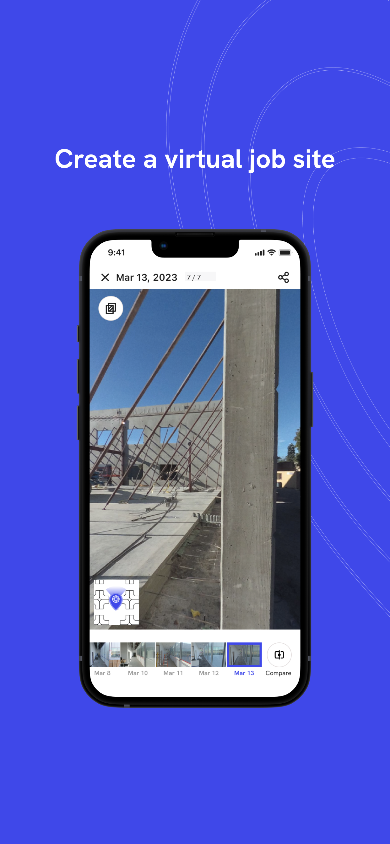
Gain a ground-level perspective for your documentation with the new DroneDeploy Ground app. Formerly the Walkthrough app, our updated app offers a powerful solution for capturing, organizing, viewing and sharing project data efficiently.
Capture your project in 3 simple steps:
Step 1 - Login to your DroneDeploy account and select your project
Step 2 - Connect your 360 camera and tap to record or capture standard photos, 360° panos, and 360° Walks
Step 3 - Sync your content to DroneDeploy
Once uploaded, your 360 captures will process in DroneDeploy. From there you are able to share with your team, compare over time, inspect, and markup.
Your inspections can also be synced to your existing tools like Procore, BIM360, and many more.
---
Supported 360 Cameras include:
• Insta360 OneRS 1"
• Insta360 X3
• Insta360 One X2
- Ricoh Theta Z1
Check out our supported hardware on our website to learn more.
Ausblenden
Mehr anzeigen...
Capture your project in 3 simple steps:
Step 1 - Login to your DroneDeploy account and select your project
Step 2 - Connect your 360 camera and tap to record or capture standard photos, 360° panos, and 360° Walks
Step 3 - Sync your content to DroneDeploy
Once uploaded, your 360 captures will process in DroneDeploy. From there you are able to share with your team, compare over time, inspect, and markup.
Your inspections can also be synced to your existing tools like Procore, BIM360, and many more.
---
Supported 360 Cameras include:
• Insta360 OneRS 1"
• Insta360 X3
• Insta360 One X2
- Ricoh Theta Z1
Check out our supported hardware on our website to learn more.
Screenshots
DroneDeploy Ground App Häufige Fragen
-
Ist DroneDeploy Ground App kostenlos?
Ja, DroneDeploy Ground App ist komplett kostenlos und enthält keine In-App-Käufe oder Abonnements.
-
Ist DroneDeploy Ground App seriös?
Nicht genügend Bewertungen, um eine zuverlässige Einschätzung vorzunehmen. Die App benötigt mehr Nutzerfeedback.
Danke für die Stimme -
Wie viel kostet DroneDeploy Ground App?
DroneDeploy Ground App ist kostenlos.
-
Wie hoch ist der Umsatz von DroneDeploy Ground App?
Um geschätzte Einnahmen der DroneDeploy Ground App-App und weitere AppStore-Einblicke zu erhalten, können Sie sich bei der AppTail Mobile Analytics Platform anmelden.

Benutzerbewertung
Die App ist in Türkei noch nicht bewertet.

Bewertungsverlauf
DroneDeploy Ground App Bewertungen
Keine Bewertungen in Türkei
Die App hat noch keine Bewertungen in Türkei.
Store-Rankings

Ranking-Verlauf
App-Ranking-Verlauf noch nicht verfügbar

Kategorien-Rankings
App ist noch nicht gerankt
DroneDeploy Ground App Konkurrenten
| Name | Downloads (30d) | Monatlicher Umsatz | Rezensionen | Bewertungen | Letzte Veröffentlichung | |
|---|---|---|---|---|---|---|

Skycatch Flight App for DJI —
|
View
|
View
|
0
|
|
vor 7 Jahren | |
|
StructionSite Construction App
360 Photo Progress Tracking
|
View
|
View
|
0
|
|
vor 3 Monaten | |
|
Measure Ground Control
Drone Flight & Data Management
|
View
|
View
|
0
|
|
vor 1 Jahr | |
|
DroneLogbook Companion
|
View
|
View
|
0
|
|
vor 3 Monaten | |
|
DroneUp
|
View
|
View
|
0
|
|
vor 1 Jahr | |
|
Hammer Missions
Quality Drone Data, A to Z.
|
View
|
View
|
0
|
|
vor 2 Jahren |
DroneDeploy Ground App Installationen
Letzte 30 TageDroneDeploy Ground App Umsatz
Letzte 30 TageDroneDeploy Ground App Einnahmen und Downloads
Gewinnen Sie wertvolle Einblicke in die Leistung von DroneDeploy Ground App mit unserer Analytik.
Melden Sie sich jetzt an, um Zugriff auf Downloads, Einnahmen und mehr zu erhalten.
Melden Sie sich jetzt an, um Zugriff auf Downloads, Einnahmen und mehr zu erhalten.
App-Informationen
- Kategorie
- Business
- Herausgeber
-
DroneDeploy
- Sprachen
- English
- Letzte Veröffentlichung
- 2.151.1 (vor 2 Wochen )
- Veröffentlicht am
- Oct 19, 2021 (vor 3 Jahren )
- Auch verfügbar in
- Vereinigte Staaten, Kanada, Philippinen, Japan, Australien, Neuseeland, Irland, Vereinigtes Königreich, Sonderverwaltungsregion Hongkong, Mexiko, Peru, Norwegen, Niederlande, Nigeria, Malaysia, Polen, Luxemburg, Litauen, Libanon, Kasachstan, Pakistan, Italien, Portugal, Rumänien, Saudi-Arabien, Schweden, Singapur, Slowenien, Slowakei, Thailand, Tunesien, Türkei, Taiwan, Ukraine, Vietnam, Südafrika, Algerien, Argentinien, Österreich, Aserbaidschan, Belgien, Bulgarien, Brasilien, Schweiz, Chile, China, Kolumbien, Tschechien, Deutschland, Dänemark, Dominikanische Republik, Kuwait, Ecuador, Estland, Ägypten, Spanien, Finnland, Frankreich, Griechenland, Kroatien, Ungarn, Indonesien, Israel, Indien, Vereinigte Arabische Emirate, Südkorea
- Zuletzt aktualisiert
- vor 2 Tagen
This page includes copyrighted content from third parties, shared solely for commentary and research in accordance with fair use under applicable copyright laws. All trademarks, including product, service, and company names or logos, remain the property of their respective owners. Their use here falls under nominative fair use as outlined by trademark laws and does not suggest any affiliation with or endorsement by the trademark holders.
- © 2025 AppTail.
- Unterstützung
- Privacy
- Terms
- All Apps


