Community R-VI Trojans, MO
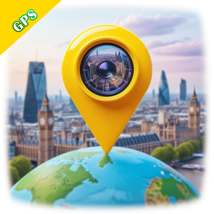
GPS Map Camera
Beschreibung
Capture and tag your moments with the GPS Map Camera, your ultimate geotagging tool! This app allows you to add real-time location, date, time, and map coordinates to your photos, making it the perfect tool for travelers, photographers, and professionals. Whether you're documenting a journey, capturing important events, or simply want to remember where a picture was taken, this app has everything you need!
Key Features:
Geotag Photos Easily
Automatically add GPS location, latitude, longitude, and altitude to your photos.
Embed map views or street views on your photos for precise location references.
Choose from different map types: Satellite, Terrain, Hybrid, and Normal views.
Date and Time Stamping
Embed real-time date and time on photos.
Customize the date and time format to fit your preferences or specific needs.
Professional Tools for Accurate Geotagging
Tag photos with detailed GPS coordinates, address, and maps for accurate documentation.
Adjust and preview photo settings to add only the information you need.
Ideal for fieldwork, real estate, traveling, and photography enthusiasts.
Perfect for Outdoor Adventures
Capture and document your travel experiences, hikes, and road trips with geotagged photos.
Share your adventures with friends and family with map-stamped images.
Use Cases:
Real Estate: Easily document properties with location-tagged images.
Travel Diaries: Save memories with precise geotagging of each moment.
Fieldwork and Research: Create accurate, detailed photo documentation for surveys or site visits.
Offline Geotagging
Use offline maps to capture geotagged photos anywhere.
Share Your Geotagged Images
Share your location-stamped photos with friends and colleagues through social media or email.
Save photos with their GPS information to Google Drive, Dropbox, or other cloud services.
This app makes it incredibly easy to keep track of where and when your photos were taken. Whether you need to geotag photos for work, travel, or personal use, this app helps you create accurate, professional-looking images with precise location information. Save time and effort while documenting your adventures or professional projects with ease.
Download GPS Map Camera now and enhance your photos with precise location data!
You may purchase an auto-renewing subscription through an In-App Purchase.
• Auto-renewable subscription
• Yearly: $9.99/year, Monthly: $3.99/month and Lifetime: $12.99.
• Your subscription will be charged to your iTunes account at confirmation of purchase and will automatically renew (at the duration selected) unless auto-renew is turned off at least 24 hours before the end of the current period.
• Current subscription may not be canceled during the active subscription period; however, you can manage your subscription and/or turn off auto-renewal by visiting your iTunes Account Settings after purchase
• Privacy policy: https://sites.google.com/proxglobal.com/haloplus/home
• Term of Use: https://www.apple.com/legal/internet-services/itunes/dev/stdeula/
Community R Häufige Fragen
-
Ist Community R kostenlos?
Ja, Community R ist komplett kostenlos und enthält keine In-App-Käufe oder Abonnements.
-
Ist Community R seriös?
Nicht genügend Bewertungen, um eine zuverlässige Einschätzung vorzunehmen. Die App benötigt mehr Nutzerfeedback.
Danke für die Stimme -
Wie viel kostet Community R?
Community R ist kostenlos.
-
Wie hoch ist der Umsatz von Community R?
Um geschätzte Einnahmen der Community R-App und weitere AppStore-Einblicke zu erhalten, können Sie sich bei der AppTail Mobile Analytics Platform anmelden.

5 von 5
1 Bewertungen in Griechenland
Community R Bewertungen
GPS Map Camera Installationen
Letzte 30 Tage
GPS Map Camera Umsatz
Letzte 30 TageCommunity R Einnahmen und Downloads
Melden Sie sich jetzt an, um Zugriff auf Downloads, Einnahmen und mehr zu erhalten.
App-Informationen
- Kategorie
- Utilities
- Herausgeber
- HALO PLUS INVESTMENT AND SERVICES DEVELOPMENT
- Sprachen
- English, French, Hindi, Indonesian, Japanese, Portuguese
- Letzte Veröffentlichung
- 1.4 (vor 3 Monaten )
- Veröffentlicht am
- Jan 3, 2025 (vor 5 Monaten )
- Zuletzt aktualisiert
- vor 1 Monat
- © 2025 AppTail.
- Unterstützung
- Privacy
- Terms
- All Apps