Debería mejorar
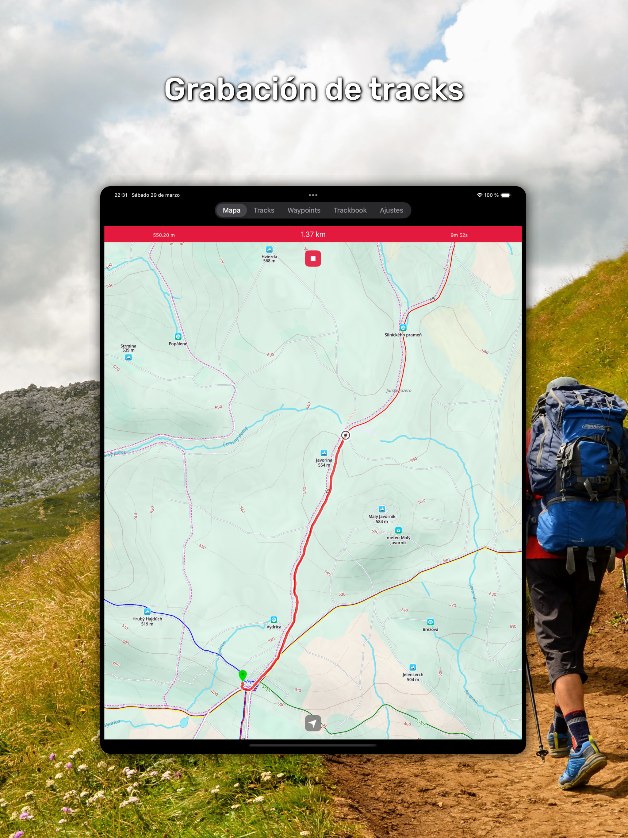
La App en si está muy bien pero pagando 7,99 debería ir perfecta y no es así, los waypoints se van de la pantalla muy a menudo cuando eso no debería pasar y menos pagando, por lo demás funciona bastante bien


Ja, MoodDrop ist kostenlos herunterzuladen, enthält jedoch In-App-Käufe oder Abonnements.
⚠️ Die MoodDrop-App hat schlechte Bewertungen und negatives Feedback. Die Nutzer scheinen mit der Leistung oder den Funktionen unzufrieden zu sein.
MoodDrop bietet mehrere In-App-Käufe/Abonnements, der durchschnittliche In-App-Preis beträgt €1.99.
Um geschätzte Einnahmen der MoodDrop-App und weitere AppStore-Einblicke zu erhalten, können Sie sich bei der AppTail Mobile Analytics Platform anmelden.

4.37 von 5
83 Bewertungen in Spanien
La App en si está muy bien pero pagando 7,99 debería ir perfecta y no es así, los waypoints se van de la pantalla muy a menudo cuando eso no debería pasar y menos pagando, por lo demás funciona bastante bien
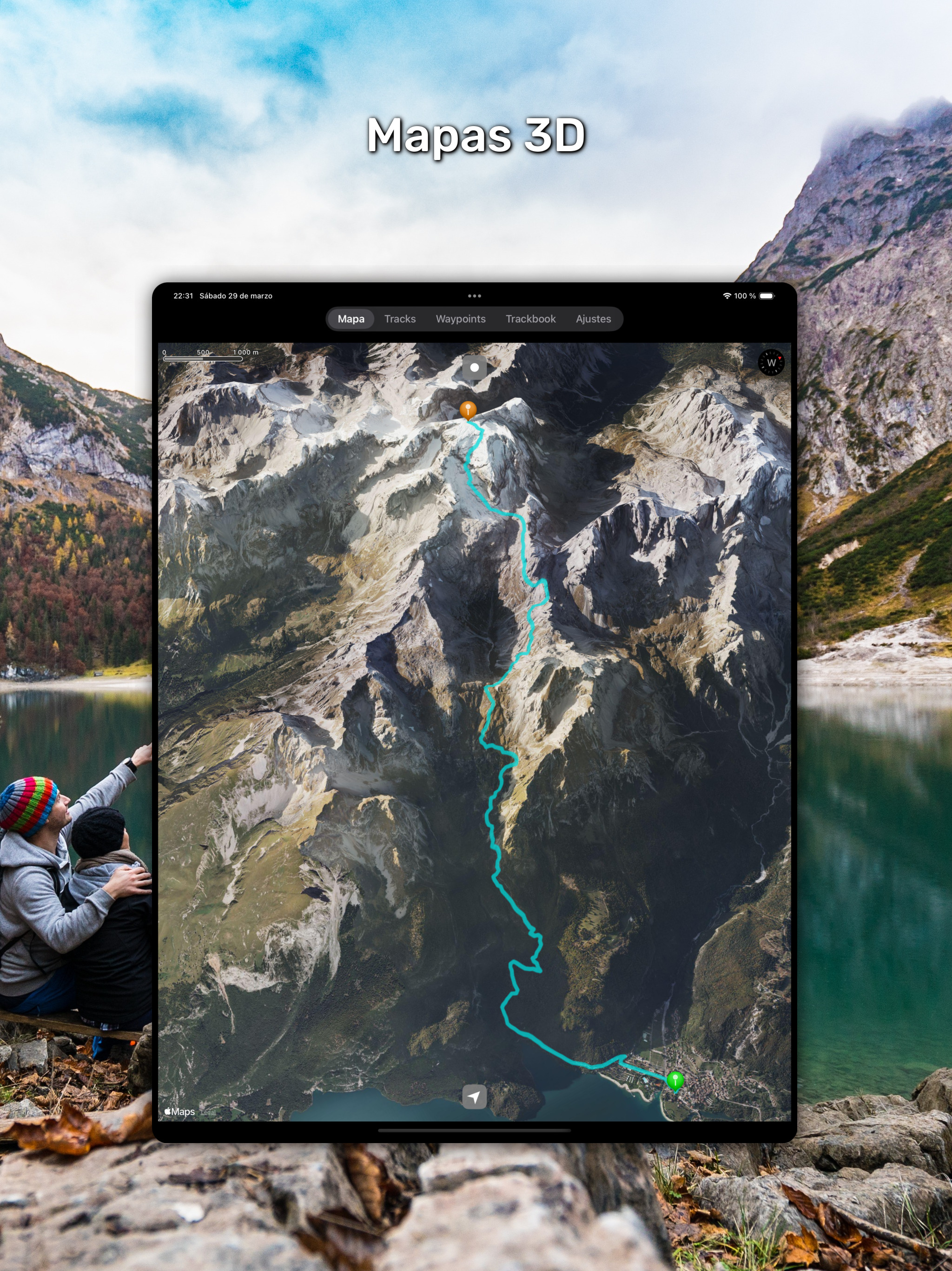
I’m totally in love with this app and its awesome user experience. It allows me to plan my mountain bike rides with alternative routes in the case I can’t stick to the main plan. I can even mark with waypoints exact place of detours. I would suggest some minor features to round this app up: - Ability to zoom in/out the map while in follow mode (currently the workaround implies exiting follow mode, pinching the screen, then starting follow mode again) - Ability to show direction of a route, especially useful when following circular routes - Related to the former, ability to reverse the direction of a route - Folders support in Tracks and Waypoints views, so those can be kept organized (related to an event, for example) - Cloud synchronization between devices Congratulations on a great app!
Tengo un Ipad actualizado y la app no carga los formatos gpx por más que lo he intentado
Can KML be downloaded or just saved to Track Bbok? Thank You
I’ve been trying to load a .gpx file from an email and it never shows up in the app on my iPhone. I am unable to find any instructions anywhere on how to use the app. There’s lots of places telling how great the app is but I’m unable to find instructions. So much for paying for the Pro version.
I used the android app often before getting an iPhone. Instantly bought this as I was used to the android app. My most used feature was sadly not included - copying coordinates from the "cursor" or even from a way point is a bigger pain than it needs to be.
Although one can import waypoints and tracks, there is no way to tap on them from the menu and navigate to a waypoint or follow a track
Complicated to use
Don't buy this product unless you INTEND on making yourself angry and irritable and wasting your money . I'd have giving NO STARS ,That is a lie. NO STARS!
I use the Walkabout offline maps and I’ve set to show elevation in feet in the settings. The elevation on the topography for the Walkabout continues to display in meters and I am not sure how to address this. Otherwise the app is decent, still not as good as the Android version, but this would be at least a four star app if elevation on the topography maps updated to feet as I specified in app settings.
|
Diagramm
|
Kategorie
|
Rang
|
|---|---|---|
|
Top Bezahlt
|

|
1
|
|
Top Bezahlt
|

|
2
|
|
Top Bezahlt
|

|
3
|
|
Top Bezahlt
|
|
6
|
|
Top Bezahlt
|
|
6
|
