Complete Fraud
This software does not scan with iPhone LiDAR it is a AutoCAD drawing viewer. I was ripped off for $18


Ja, LidarCad ist komplett kostenlos und enthält keine In-App-Käufe oder Abonnements.
Nicht genügend Bewertungen, um eine zuverlässige Einschätzung vorzunehmen. Die App benötigt mehr Nutzerfeedback.
LidarCad ist kostenlos.
Um geschätzte Einnahmen der LidarCad-App und weitere AppStore-Einblicke zu erhalten, können Sie sich bei der AppTail Mobile Analytics Platform anmelden.

This software does not scan with iPhone LiDAR it is a AutoCAD drawing viewer. I was ripped off for $18
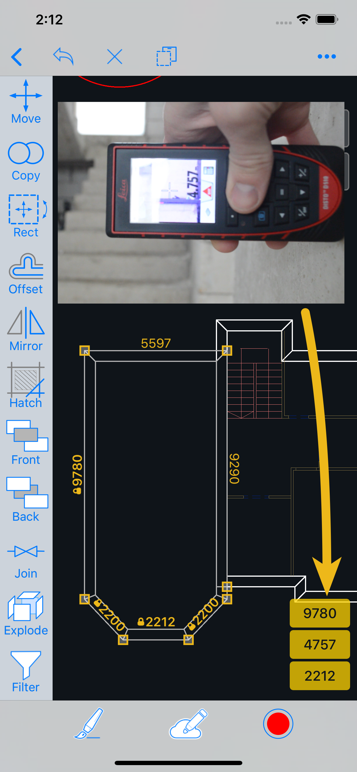
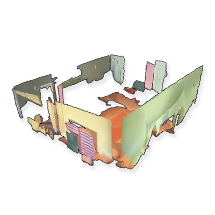
Love this app, use it all time at the underground mine I work at. I was able to scan 300 ft of tunnel and match it with a survey scan. Perfect for scanning cross sections for ventilation stations and measuring distances. I can easily use the data in Maptek Point Studio and Trimble business center. Only complaint is that I can not export my scans as a las file I have to convert the pts file in Trimble in order to use it in Point Studio. So 6 ****** stars if you can add a las as export option.
I can now apply field codes to points as I create them. Several survey applications where this level of accuracy is acceptable. Great tool. Thank you for the amazing app!
I use this app to view drawings.
Apple Pencil (2nd generation) doesn’t work in the app. I could not draw straight shapes. Appears extremely clunky & disfunctional. Why did I pay $17.99 for this?
|
Diagramm
|
Kategorie
|
Rang
|
|---|---|---|
|
Top Bezahlt
|

|
83
|
|
Top Bezahlt
|

|
203
|
|
Top Bezahlt
|

|
231
|
|
Top Bezahlt
|

|
256
|
|
Top Bezahlt
|

|
290
|
| Name | Downloads (30d) | Monatlicher Umsatz | Rezensionen | Bewertungen | Letzte Veröffentlichung | |
|---|---|---|---|---|---|---|

vGIS AR
Augmented reality for GIS
|
Freischalten
|
Freischalten
|
0
|
|
vor 2 Wochen | |

SitePlan
Navigate. Survey. Collaborate.
|
Freischalten
|
Freischalten
|
0
|
|
vor 14 Stunden | |

iDig - Recording Archaeology
A Digital Excavation Notebook
|
Freischalten
|
Freischalten
|
0
|
|
vor 6 Monaten | |

Trimble SiteVision
N/V
|
Freischalten
|
Freischalten
|
0
|
|
vor 1 Monat | |

iPocket Draw
|
Freischalten
|
Freischalten
|
0
|
|
vor 4 Wochen | |

biiCADo Pro - 2D CAD App
|
Freischalten
|
Freischalten
|
1
|
|
vor 2 Jahren | |

FARO ScanPlan
|
Freischalten
|
Freischalten
|
0
|
|
vor 3 Jahren | |

ARchi VR - Create & Browse AR
Capture Spaces as 2D, 3D, & AR
|
Freischalten
|
Freischalten
|
0
|
|
vor 5 Monaten | |
ARPlanar
Professional measurement tool
|
Freischalten
|
Freischalten
|
0
|
|
vor 1 Jahr | |

OrthoGraph BLK360
Capture the world around you.
|
Freischalten
|
Freischalten
|
0
|
|
vor 1 Jahr |
