Magic Earth Navigation & Maps

Offline Maps, Traffic

Veröffentlicht von: Magic Lane International

Beschreibung

Find the best route to your destination even without an internet connection. Magic Earth uses OpenStreetMap data and a powerful search engine to offer you the optimal routes for driving, biking, hiking, and public transportation.
PRIVACY FIRST!
• We do not track you. We do not profile you. We do not trade in your personal data; moreover, we do not have it.
MAPS
• Save big on mobile internet costs and navigate reliably with offline maps powered by OpenStreetMap. 233 countries and regions are ready to be downloaded.
• Choose between 2D, 3D, and Satellite map views.
• Get ready for travel and know every detail of your route like surface, difficulty, distance and elevation profile.
• Learn more about the points of interest near you from Wikipedia articles.
• Spot nearby parking places to easily park your car.
• Stay up-to-date and enjoy regular free map updates.
AI DASH CAM
• Improve safe driving and avoid accidents. Receive alerts to potential problems on the road and record your trip.
• AI Dash Cam features Driver Assistance warnings and Dash Cam functionality.
• Avoid collisions and accidents with Driver Assistance warnings: Headway Warning, Forward Collision Warning, Pedestrian Collision Warning, Lane Departure Warning, Leaving Lane Warning, Stop & Go Assist.
• Record the road ahead during navigation to have an aid in the event of a collision or incident.
• Driver Assistance warnings and Recordings are available when the device is on a car mount in landscape mode, with a clear view of the road ahead.
CARPLAY compatibility
• Connect to Apple CarPlay and enjoy the ultimate navigation experience.
NAVIGATION
• Find the fastest or the shortest route to your destination when you travel by car, bike, on foot or with public transport.
• Plan your route with multiple waypoints.
• Stay safe with the free Head-up Display (HUD) feature which projects the most important navigation info onto the windshield of your car.
• Know in advance which lane to take with precise turn-by-turn navigation and lane assistance.
• Get notified about speed cameras and stay up to date with current speed limits.
TRAFFIC INFO
• Get real-time traffic info, updated every minute.
• Discover alternative routes that avoid traffic jams and save you time on the road.
PUBLIC TRANSPORT
• Get around town quickly and easily. Choose from public transit routes that combine all transportation modes: bus / metro / subway / light rail / train / ferry
• Get walking directions, transfer times, departure times, number of stops. And when available, the cost.
• Find wheelchair or bike-friendly public transportation.
WEATHER
• View current temperature and local weather forecasts for your favorite locations.
• See what weather conditions to expect in the next hours and view the forecast for the next 14 days.

NOTES:
* Some features are not available in all countries.
* Some features require internet connection.
Ausblenden Mehr anzeigen...

Screenshots

Magic Earth Navigation & Maps Häufige Fragen

  • Ist Magic Earth Navigation & Maps kostenlos?

    Ja, Magic Earth Navigation & Maps ist komplett kostenlos und enthält keine In-App-Käufe oder Abonnements.

  • Ist Magic Earth Navigation & Maps seriös?

    🤔 Die Qualität der Magic Earth Navigation & Maps-App ist gemischt. Einige Nutzer sind zufrieden, während andere Probleme melden. Ziehen Sie in Betracht, einzelne Bewertungen für mehr Kontext zu lesen.

    Danke für die Stimme

  • Wie viel kostet Magic Earth Navigation & Maps?

    Magic Earth Navigation & Maps ist kostenlos.

  • Wie hoch ist der Umsatz von Magic Earth Navigation & Maps?

    Um geschätzte Einnahmen der Magic Earth Navigation & Maps-App und weitere AppStore-Einblicke zu erhalten, können Sie sich bei der AppTail Mobile Analytics Platform anmelden.

Benutzerbewertung

4.32 von 5

148 Bewertungen in Italien

5 star
89
4 star
36
3 star
13
2 star
1
1 star
9
Bewertungsverlauf

Magic Earth Navigation & Maps Bewertungen

so&so

grifone1956+ on

Italien

non tiene conto dell’impostazione evitare strade sterrate

Ottimo ma bisogna aggiornare le mappe

Marco67c on

Italien

Ottimo ma bisogna aggiornare le mappe, segna sensi unici contrari

Ottimo

Lupov67 on

Italien

Ottimo navigatore, se ci fosse il microfono su apple carplay, sarebbe il top.

Bella ma da migliorare

lat-max on

Italien

Complimenti per l’app che a me piace molto, noto qualche cosa che a me non funziona ma spero sia risolvibile.

4stars! 5 stars will follow for taller/realistic buildings as for other 3D nav apps.

Athip717 on

Italien

4stars! 5 stars will follow for taller/realistic buildings as for other 3D nav apps.

Vie mancanti!

Luke~Skywalker on

Italien

Nelle mappe mancano alcune vie anche se piccole ma pur sempre mancanti! Pessima!

App molto bella e funzionante

my-fotostore on

Italien

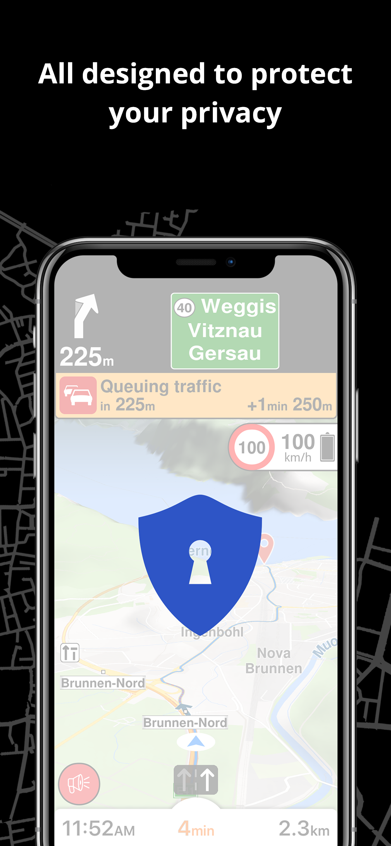
Grande! Complimenti ai sviluppatori. Mi piace anche e soprattutto il concetto privacy.

Buona Applicazione ma scalda troppo

!xDMx! on

Italien

L’applicazione è fatta bene e le indicazioni sono fluide e chiare e soprattutto grandi a schermo, unica pecca è che se si abilità la registrazione su iPhone 12 si surriscalda quasi subito e la funzione viene disattivata e la luminosità dello schermo si abbassa quasi completamente. Peccato altrimenti avrei pensato di sostituire Maps.

Pessima

q-verde on

Italien

La versione precedente era molto affidabile, questa è indecente. Mi ha fatto uscire più volte dall’autostrada per poi farmi rientrare poco più avanti poi mi ha fatto uscire nuovamente per non farmi prendere il traghetto (in montagna?) e così ho dovuto fare 200km di strada di montagna. Non la consiglio

Nuova versione 7.1.23.28

Theland48 on

Italien

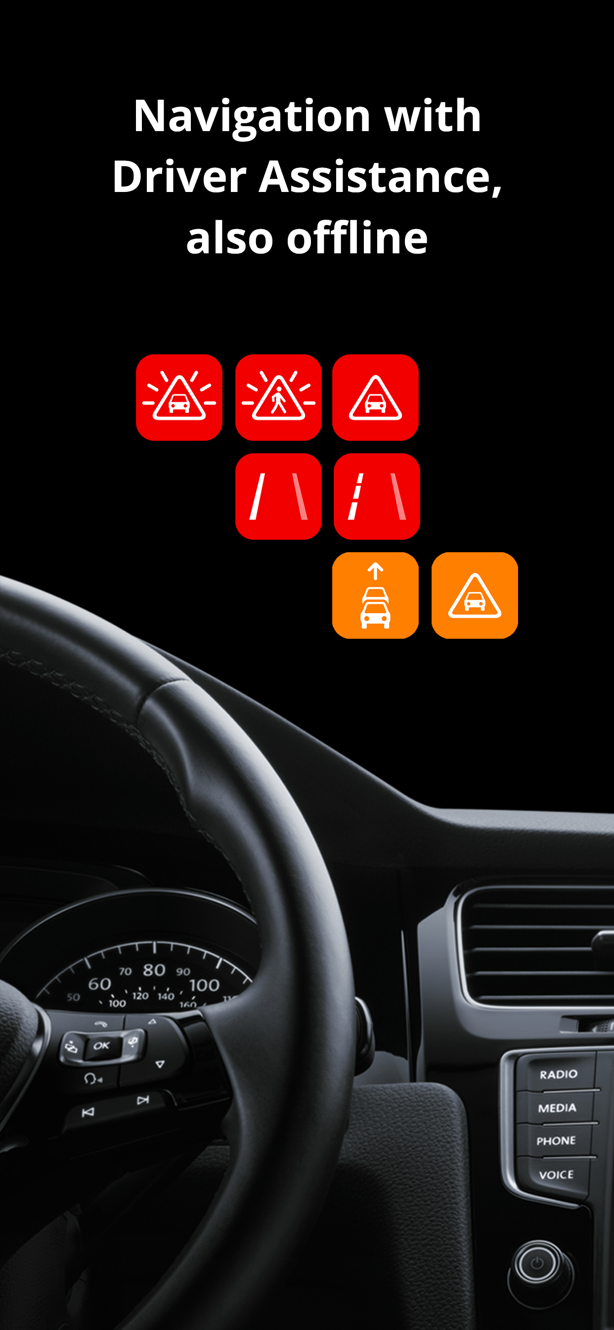
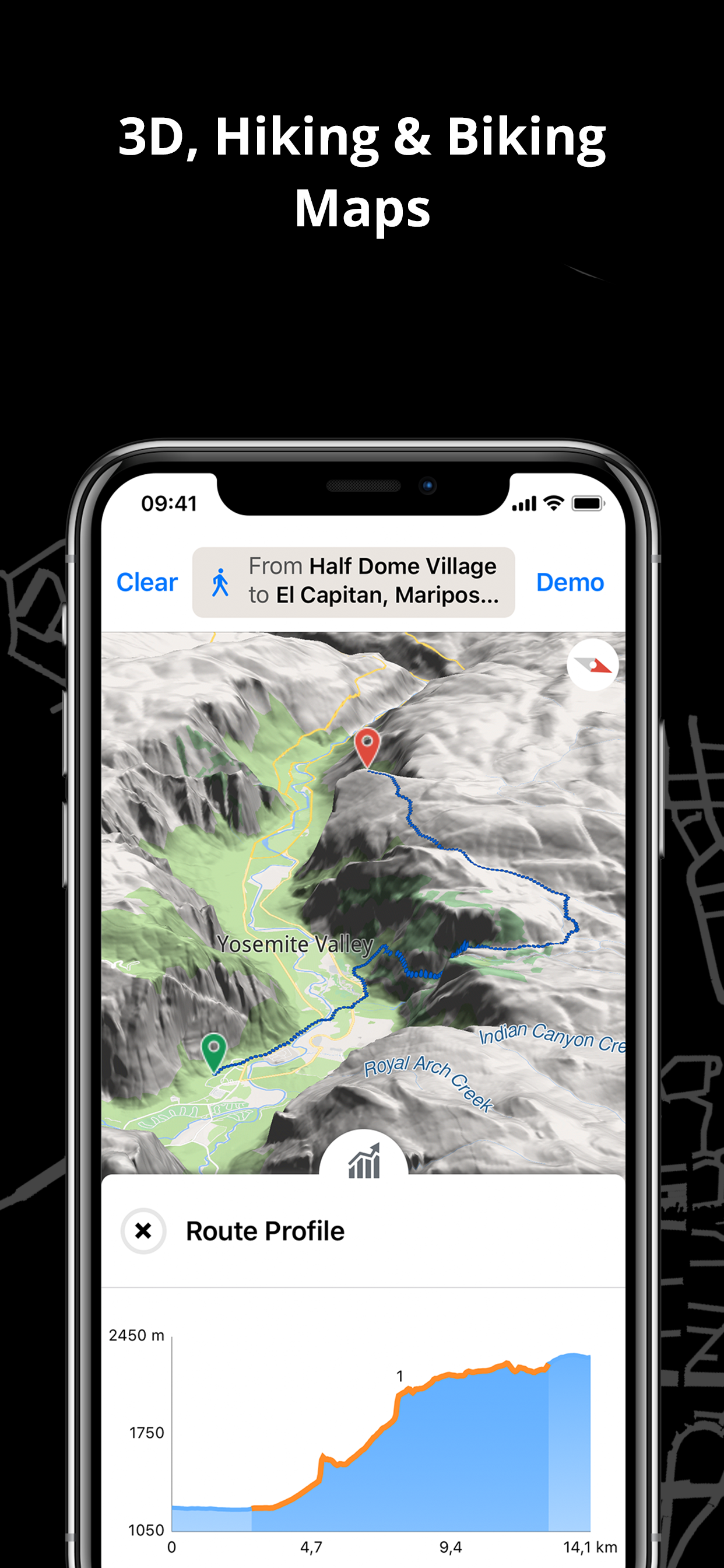
App sempre molto bella e funzionale però non riesco a trovare alcune funzioni descritte per esempio 2 o 3 D. Inoltre non vedo i tracciati fuoristrada per bici o passeggiata. Vedo solo mappa normale 2D o Satellite. L’icona della App a me è restata come quella di prima e non quella nuova che si vede. iPhone 13 Pro 512 Gb IOS 16.5.1 PS. Risolto icona con soft reset ma gli altri problemi rimangono (2D3D e mappe fuoristrada). La risposta data dallo sviluppatore non c’entra nulla con la mia domanda. Comunque con l’ultimo aggiornamento seguito qualche giorno dopo e con lo stesso numero di release è possibile scegliere tra 2d e 3d. I tracciati delle mappe restano identici cioè non si vedono quelli “fuoristrada” per bici e/o trekking.

Store-Rankings

Ranking-Verlauf
Kategorien-Rankings
Diagramm
Kategorie
Rang
Top Kostenlos
42
Top Kostenlos
66
Top Kostenlos
74
Top Kostenlos
75
Top Kostenlos
110

Schlüsselwörter

Magic Earth Navigation & Maps Konkurrenten

Magic Earth Navigation & Maps Installationen

Letzte 30 Tage

Magic Earth Navigation & Maps Umsatz

Letzte 30 Tage

Magic Earth Navigation & Maps Einnahmen und Downloads

Gewinnen Sie wertvolle Einblicke in die Leistung von Magic Earth Navigation & Maps mit unserer Analytik.
Melden Sie sich jetzt an, um Zugriff auf Downloads, Einnahmen und mehr zu erhalten.

App-Informationen

Kategorie
Navigation
Sprachen
Russian, Albanian, English, Bulgarian, Hungarian, Dutch, Greek (modern), Danish, Indonesian, Icelandic, Spanish, Italian, Catalan, Korean, Latvian, Malay, German, Norwegian Bokmål, Norwegian Nynorsk, Persian, Polish, Portuguese, Romanian, Serbian, Slovak, Slovene, Thai, Tamil, Chinese, Turkish, Ukrainian, Finnish, French, Hindi, Croatian, Czech, Swedish, Estonian, Japanese
Letzte Veröffentlichung
8.2.4 (vor 3 Monaten )
Veröffentlicht am
Sep 7, 2015 (vor 9 Jahren )
Zuletzt aktualisiert
vor 1 Tag
This page includes copyrighted content from third parties, shared solely for commentary and research in accordance with fair use under applicable copyright laws. All trademarks, including product, service, and company names or logos, remain the property of their respective owners. Their use here falls under nominative fair use as outlined by trademark laws and does not suggest any affiliation with or endorsement by the trademark holders.