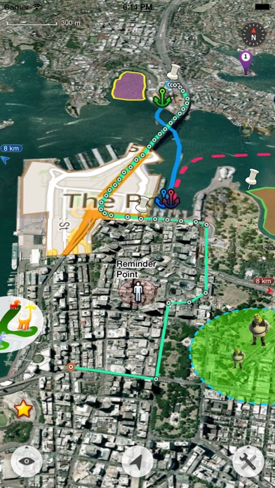
GIS i fickan
Otroligt kompetent app för alla navigerings/karteringssyften. Väldigt flexibel och konfigurerbar. Enda jag saknar är en liten app för Apple Watch också.

Ja, Map Plus ist kostenlos herunterzuladen, enthält jedoch In-App-Käufe oder Abonnements.
✅ Die Map Plus-App scheint von hoher Qualität und legitim zu sein. Die Nutzer sind sehr zufrieden.
Map Plus bietet mehrere In-App-Käufe/Abonnements, der durchschnittliche In-App-Preis beträgt 69.00 kr.
Um geschätzte Einnahmen der Map Plus-App und weitere AppStore-Einblicke zu erhalten, können Sie sich bei der AppTail Mobile Analytics Platform anmelden.

4.21 von 5
14 Bewertungen in Schweden
Otroligt kompetent app för alla navigerings/karteringssyften. Väldigt flexibel och konfigurerbar. Enda jag saknar är en liten app för Apple Watch också.
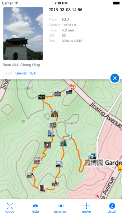
Extremely good app! Have been using it for many years in forest species collection in the field. The only drawback, except that development has stopped, is the lack of support for georeferenced tiffs/pdfs. This has been requested by many and I am still hoping for this functionality to be added, it would help me much.
I use the map mainly for planing MTB trails, the photo function helps a lot with planing lines and also mark things that has to be fixed or adjusted. Easy to share maps with other builders in the group. There’s a lot of functionality if you dig deeper but all the functions I need is easy to use and straight forward. I would love to see some UI updates and smarter GPX editing.
One of the absolut most capable map apps ever, plus the developers are friendly! Highly, highly recommended.
Unproffessional. Ad scam.
All Apple Apps should perform like this.
Love it. Have used for several years. I imported an accurate map of our riding area obtained from US forestry service. Now all of my friends want to use my phone to see where we are on the forestry map. J D
Best app to create a hiking map, mark out trails, keep track of workouts, etc. The tools are not really intuitive, but with some patience, it’s usable, and worth it
I moved to a new area. I wanted to buy a house so I made a map with layers from public maps that included flooding, hillside instability and earthquakes, apartment locations, and crime reports for the last five years. I use the Realestate app Redfin to notify me of houses per my specifications, and then I would look at them on my map to see any major problems. Very easy, very good app.
The new update messed up everything that was coded in with the custom properties and conditional styles. My app is only showing orange lines and not what I have placed. No response for helping to resolve this issue with the new update
|
Diagramm
|
Kategorie
|
Rang
|
|---|---|---|
|
Top Umsatz
|

|
22
|
|
Top Umsatz
|

|
26
|
|
Top Umsatz
|

|
29
|
|
Top Umsatz
|

|
35
|
|
Top Umsatz
|

|
54
|
| Name | Downloads (30d) | Monatlicher Umsatz | Rezensionen | Bewertungen | Letzte Veröffentlichung | |
|---|---|---|---|---|---|---|
Kartor+
För superanvändare
|
Freischalten
|
Freischalten
|
9
|
|
vor 2 Jahren | |

Topo Maps+
Offline Topographic Maps & GPS
|
Freischalten
|
Freischalten
|
0
|
|
vor 5 Tagen | |

Tomstrails GPS UTM
UTM Grid Reference
|
Freischalten
|
Freischalten
|
0
|
|
vor 3 Jahren | |

Compass 55. Map & GPS kit.
Land, air, marine navigation
|
Freischalten
|
Freischalten
|
0
|
|
vor 1 Woche | |

BackCountry Navigator XE
Topo Maps and GPS for Outdoors
|
Freischalten
|
Freischalten
|
0
|
|
vor 2 Wochen | |

Mgrs & Utm Map
|
Freischalten
|
Freischalten
|
0
|
|
vor 3 Wochen | |

KML Collection: Import Maps
N/V
|
Freischalten
|
Freischalten
|
0
|
|
vor 4 Monaten | |

Global Mapper Mobile
|
Freischalten
|
Freischalten
|
0
|
|
vor 1 Monat | |

Coordinator +
Collect Coordinate
|
Freischalten
|
Freischalten
|
0
|
|
vor 3 Monaten | |

CarryMap
Offline maps & data collection
|
Freischalten
|
Freischalten
|
0
|
|
vor 5 Monaten |
