MapSwipe

Humanitarian volunteering

Veröffentlicht von: British Red Cross Society

Beschreibung

Humanitarian organisations can't help people if they can't find them. MapSwipe is a mobile app that lets you search satellite imagery to help put the world's most vulnerable people on the map.
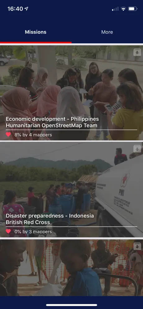
MapSwipe, developed in support of the Missing Maps Project, allows users to remotely contribute to humanitarian missions. Users choose a task in a crisis prone part of the world, such as spotting villages at risk of a cholera outbreak in the Democratic Republic of Congo. They then swipe through satellite images of the region, tapping the screen to mark the location of settlements, roads, rivers, and other features.
This information is fed back to mappers, who build detailed maps that can be used in the field. At present, these mappers must spend days scrolling through thousands of images of uninhabited forest or rural desert in search of small, often remote communities. With MapSwipe, members of the public can donate their time to humanitarian organizations including Médecins Sans Frontières and the Red Cross, crowdsourcing the arduous process of locating the people who need their help. With this generous contribution from users like you, professionals on the ground can get straight to work delivering life-saving aid.
Ausblenden Mehr anzeigen...

Screenshots

MapSwipe Häufige Fragen

  • Ist MapSwipe kostenlos?

    Ja, MapSwipe ist komplett kostenlos und enthält keine In-App-Käufe oder Abonnements.

  • Ist MapSwipe seriös?

    Nicht genügend Bewertungen, um eine zuverlässige Einschätzung vorzunehmen. Die App benötigt mehr Nutzerfeedback.

    Danke für die Stimme

  • Wie viel kostet MapSwipe?

    MapSwipe ist kostenlos.

  • Wie hoch ist der Umsatz von MapSwipe?

    Um geschätzte Einnahmen der MapSwipe-App und weitere AppStore-Einblicke zu erhalten, können Sie sich bei der AppTail Mobile Analytics Platform anmelden.

Benutzerbewertung
Die App ist in Ukraine noch nicht bewertet.
Bewertungsverlauf

MapSwipe Bewertungen

Swipe down is flakey, allow more zooming in

Daboodah on

Vereinigte Staaten

The app is fine, but it’s quite frustrating trying to get the down swipe to work. I end up just triple tapping each tile individually, which slows down progress. Would be nice if it allowed a little more zooming in. Even with low res, it could be helpful.

overall great app

ellagbella on

Vereinigte Staaten

honestly I rarely do reviews but this app is great if you want to do something quick but slowly make an impact. Some of the guidance tutorials can’t be really applied to what some projects are asking for, but definitely wish more people knew about this app. it’s one of the easiest ways I can volunteer online through quarantine and I really hope that this app will blow up and get even more people on the project <3

Great Idea and Execution

ThePapercutNinja on

Vereinigte Staaten

This is a really cool app, it’s good to use when you’ve got some time to sit or are just hanging out. It doesn’t need a very strong connection or a powerful phone to work, and looking for buildings on it gets kind of addicting! It’s an awesome idea to crowdsource this kind of stuff, and the app functions perfectly. It’s simple and easy and has a good tutorial, so you should at least give it a try.

iPad Functionality is missing

Hajdinak on

Vereinigte Staaten

Love the app and the cause, the app is simple and quick to pickup. Would like to see more optimization for the iPad or a potential standalone app with greater tools and functionality.

Great app. Need more guidance

rider in brooklyn on

Vereinigte Staaten

This is really fulfilling an important need. I would like more guidance on what is the shadow of a tree and what is a round building. Thank you!

v1.1.0 does NOT work

what8ever on

Vereinigte Staaten

8/12/2016 v1.1.0 still does NOT work. Same as reported on 7/15/2016. 7/15/2016 v1.0 does NOT work. Tap the app icon, get black screen, and then it quits. iOS 7.1.2 on both iPhone and iPad. Sent feedback but no response.

Good feel good app

iolaire on

Vereinigte Staaten

Simple app, look at arial photos and tap once if it has the desired features, can be home/hut, roads or "tracks" depending on the tasks, tap twice for a maybe or three times for bad image. So very simple. I would like better definitions of a "track" since I think that means a path, so lots of paths show up which could be animal tracks or maybe even stream beds. I worry I'm flagging too many tracks. I think it would be good to have a gallery of normal objects. I'm sure someone is highly skilled at this task already and could provide examples of say six hut styles to help make sure we know what the look like.

Love Idea, Small Bugs

BlindUser1968 on

Vereinigte Staaten

This is an awesome idea! There are some lingering bugs tho. If you adjust the iPhone text size in settings, part of the text in the app flows off of the screen and makes it unreadable. Keep up the good work!

Store-Rankings

Ranking-Verlauf
App-Ranking-Verlauf noch nicht verfügbar
Kategorien-Rankings
App ist noch nicht gerankt

MapSwipe Installationen

Letzte 30 Tage

MapSwipe Umsatz

Letzte 30 Tage

MapSwipe Einnahmen und Downloads

Gewinnen Sie wertvolle Einblicke in die Leistung von MapSwipe mit unserer Analytik.
Melden Sie sich jetzt an, um Zugriff auf Downloads, Einnahmen und mehr zu erhalten.
This page includes copyrighted content from third parties, shared solely for commentary and research in accordance with fair use under applicable copyright laws. All trademarks, including product, service, and company names or logos, remain the property of their respective owners. Their use here falls under nominative fair use as outlined by trademark laws and does not suggest any affiliation with or endorsement by the trademark holders.