Outdooractive

Reliable planning & navigation

Veröffentlicht von: Outdooractive

Beschreibung

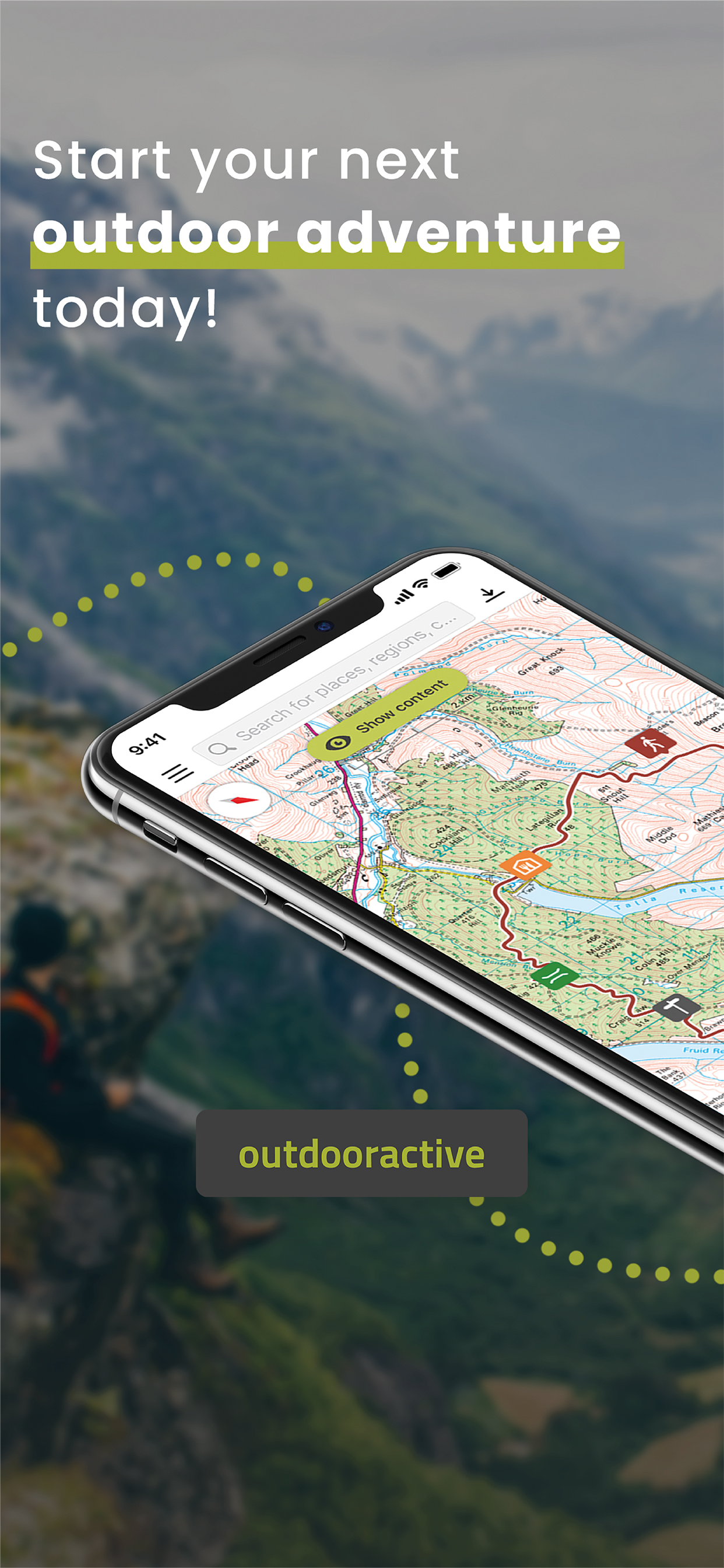
Confidently explore the great outdoors with Outdooractive - Hike and Ride: The most reliable outdoor navigation app, as trusted by thousands of trail wardens, mountain guides and outdoor industry professionals worldwide.
The Outdooractive - Hike and Ride app helps you find officially approved routes near you and around the world, with suggestions for dozens of sports including: hiking paths, trekking trails, mountain biking routes, trail running paths, ski touring routes and more.
Or plan your own routes using the deepest catalog of official maps to take adventures into your own hands with our map route planner.
Find routes you can rely on: Browse thousands of officially-approved routes near you and across the world, including routes for hiking, road cycling, bike touring, ski touring, gravel riding, trail running, horseback riding, mountaineering and more.
Plan your own routes with tools trusted by professionals: Easily plot your own outdoor routes in the route planner in just a few taps, and see all need to know distance, elevation and terrain info.
Save everything offline: Save individual plans or entire areas offline for reliable navigation when you don't have a phone signal.
Navigate with the most reliable maps on the planet: Browse the deepest collection of different map types to track or plan your adventures with confidence. Simply switch between different layers to get a clearer picture of the terrain you're planning to visit, and get the most reliable understanding of conditions on the ground. Outdooractive's map catalog currently includes:
Official topo maps in 25 countries, including:
Ordnance Survey (Landranger & Explorer) in the United Kingdom, New Zealand Land Information in NZ, USGS in the USA, BKG in Germany, BEV in Austria, Swisstopo in Switzerland, IGN in France, PDOK in the Netherlands, Kartverket in Norway, Lantmäteriet in Sweden, Finland National Land Survey in Finland, Harvey Maps in the UK, the official Alpine Club maps for climbing in the Alps. As well as the specially-designed Outdooractive map across France, Germany, Austria and Switzerland.
Share your live location with family and friends: Give yourself and your loved ones complete peace of mind when you're out in the great outdoors thanks to BuddyBeacon.
Join a global community of outdoor tourists and adventurers: Share your activities with the community, join challenges to stay motivated, and get inspired by officially-approved content from our thousands of industry partners.
Recorded tracks can be saved as workouts in Apple Health. Your heart rate and biometric data from Apple Health can be used to calculate calories spent during the track recording. No Health data is used for marketing or advertising purposes
FAQs:
Can Outdooractive find walking trails near me?
Outdooractive helps you find walking, hiking, cycling and many more types of trails both in your area, and around the world. You're able to filter and view multiple types of activities in an area of your choosing, created and shared by outdoor experts.
How can I find hiking trails near me?:
Using Outdooractive, you're able to find hiking trails in your local area by opening our app and browsing the map. You'll be able to see hiking trails with a range of distances, difficulties and distance from your location.
Your iTunes account will be charged to the amount of the subscription fee after your purchase has been confirmed and after the trial period has expired. The subscription renews annually unless the automatic renewal is deactivated at least 24 hours before the end of the current billing cycle or during the trial period. Costs for any unused periods of the term will not be reimbursed. The option to deactivate can be found in your iTunes account settings. Your account will be charged for the renewal amount within the 24-hour period before the end of the current billing cycle. www.outdooractive.com/en/terms-and-conditions.html
Ausblenden Mehr anzeigen...

In-App-Käufe

Premium Tour
$1.99
Pro Subscription
$48.99
Pro subscription
$49.99
Pro+ Subscription
$97.99
Pro+ subscription
$99.99
Premium Tour Collection
$14.99

Screenshots

Outdooractive Häufige Fragen

  • Ist Outdooractive kostenlos?

    Ja, Outdooractive ist kostenlos herunterzuladen, enthält jedoch In-App-Käufe oder Abonnements.

  • Ist Outdooractive seriös?

    ⚠️ Die Outdooractive-App hat schlechte Bewertungen und negatives Feedback. Die Nutzer scheinen mit der Leistung oder den Funktionen unzufrieden zu sein.

    Danke für die Stimme

  • Wie viel kostet Outdooractive?

    Outdooractive bietet mehrere In-App-Käufe/Abonnements, der durchschnittliche In-App-Preis beträgt $52.32.

  • Wie hoch ist der Umsatz von Outdooractive?

    Um geschätzte Einnahmen der Outdooractive-App und weitere AppStore-Einblicke zu erhalten, können Sie sich bei der AppTail Mobile Analytics Platform anmelden.

Benutzerbewertung

2.2 von 5

20 Bewertungen in Neuseeland

5 star
6
4 star
0
3 star
0
2 star
0
1 star
14
Bewertungsverlauf

Outdooractive Bewertungen

Hate it

Nickname No Nickname on

Neuseeland

Bring back ViewRanger. Have been totally cheated. This is unusable. Endless going round in circles trying to find the functions I am looking for. And relentless upselling to boot. I want a refund for all that money I put into maps on ViewRanger - they are of no benefit now. Especially as they are not available offline without a hugely expensive subscription - I ALREADY PAID FOR THEM. PS don’t you hate all the patronising developer responses? Still can’t do anything without an upselling pop-up.

If I could give 0 stars I would

snikpohsemaj on

Neuseeland

[Update after a free trial] App repeatedly has logged me out, meaning I can’t do anything without logging in… but when I’m outdoors being active I’m often out of wifi/cell coverage - so can’t log in. So, repeatedly, I have had to cancel adventures (after driving 100’s of km) because I have no topo maps. Have given up and gone back to handheld GPS as this app has ruined the only good topo app app available. [original post] Immoral - outdoor active bought out view ranger. And then took away the perceptual licences for maps that I have bought outright and now expect me to pay again via subscription. But the new app is terrible. The worst part is their decision to nerf the viewranger app so I couldn’t even continue to use it left me stranded in the bush - lost without a map - with no warning. You are lucky a death didn’t result as this could have been a body hunt. No-one should support a company that acts like this. You will never get my money.

View Ranger vs Outdoor whatever

leolionkinguk on

Neuseeland

Wow! Paid for an app and then they sell to a company that what’s me to pay again. I will go elsewhere with a very bad taste in my mouth. Money for nothing. Should be banned on App Store Another kiwi lost in the mountains without my map

Will use alternative

cojo54 on

Neuseeland

Poor resolution. Could find anyway to get same map as viewranger which has served me well for years

Unusable

DougLG on

Neuseeland

This app is almost unusable- slow to load, crashes constantly, poor graphics and illogical layout. ViewRanger has totally sold out here and I imagine a lot of users are going to be very irritated. Having to download individual tiles is a pain and takes up a lot more space than ViewRanger and being expected to pay for Pro access is a joke. Maptoaster or NZ Topo are far better options than this one and hopefully Outdoor active will lose a lot of custom to other platforms.

Screwed over

GreenGauge on

Neuseeland

Was very happily using ViewRanger for years…then these jokers bought it and expect me to pay $50 a year for the same experience. Pure corporate greed. In NZ recommend MapToaster instead- not as good as ViewRanger but they’re based in Christchurch and I don’t feel like I’m being shafted. Very disappointed in ViewRanger.

Booky

Booky007 on

Deutschland

Sehr gut

Leider veraltete OSM Karten

The Sighthound on

Deutschland

Outdooractive ist mit Sicherheit eine großartige App mit einer sehr schönen und detaillierten Karte, ideal für Radfahrer, Mountainbiker und Wanderer. Leider gibt es einen großen Nachteil: Die OSM-Karten sind veraltet und werden nicht regelmäßig aktualisiert. Jetzt komme ich aber zu den drei vergebenen Sternen. Ich habe mehrfach nachgefragt, wann die Karten erneuert werden, und jedes Mal wird erklärt, dass es schwierig sei. Andere Apps wie Komoot, AllTrails oder die Bosch Flow App schaffen es jedoch, alle zwei Wochen ein Kartenupdate bereitzustellen. Für den Abopreis von über 50 € im Jahr erwarte ich, dass auch Outdooractive regelmäßig Updates liefert. Gerade im Sauerland, wo durch den Borkenkäfer viele Fichten abgeholzt wurden, ändern sich die Wege ständig – neue entstehen, alte verschwinden oder werden angepasst. Ich bin sicher, dass Outdooractive das genauso gut und schnell umsetzen kann wie die Konkurrenz. Ein klares Statement, dass OSM-Karten zukünftig in regelmäßigen Abständen aktualisiert werden, würde mich sofort wieder als Pro+ Kunden zurückgewinnen.

Pausenlos Absturz

Habakuk46 on

Deutschland

Stürzt am iPhone 16pro mit neuester Software beim Start immer ab. App gelöscht.

Top!

Chrisi S. on

Deutschland

Ausgezeichnete App um Outdoor Aktivitäten zu planen!

Store-Rankings

Ranking-Verlauf
Kategorien-Rankings
Diagramm
Kategorie
Rang
Top Umsatz
2
Top Umsatz
2
Top Umsatz
2
Top Umsatz
2
Top Umsatz
2

Schlüsselwörter

Outdooractive Konkurrenten

Outdooractive Installationen

Letzte 30 Tage

Outdooractive Umsatz

Letzte 30 Tage

Outdooractive Einnahmen und Downloads

Gewinnen Sie wertvolle Einblicke in die Leistung von Outdooractive mit unserer Analytik.
Melden Sie sich jetzt an, um Zugriff auf Downloads, Einnahmen und mehr zu erhalten.

App-Informationen

Kategorie
Travel
Herausgeber
Outdooractive
Sprachen
Czech, Dutch, English, Finnish, French, German, Greek (modern), Hebrew (modern), Hindi, Hungarian, Italian, Japanese, Norwegian Bokmål, Portuguese, Romanian, Russian, Chinese, Slovak, Spanish, Turkish, Ukrainian
Letzte Veröffentlichung
3.19.0 (vor 1 Woche )
Veröffentlicht am
Aug 17, 2018 (vor 6 Jahren )
Zuletzt aktualisiert
vor 5 Tagen
This page includes copyrighted content from third parties, shared solely for commentary and research in accordance with fair use under applicable copyright laws. All trademarks, including product, service, and company names or logos, remain the property of their respective owners. Their use here falls under nominative fair use as outlined by trademark laws and does not suggest any affiliation with or endorsement by the trademark holders.