Beschreibung
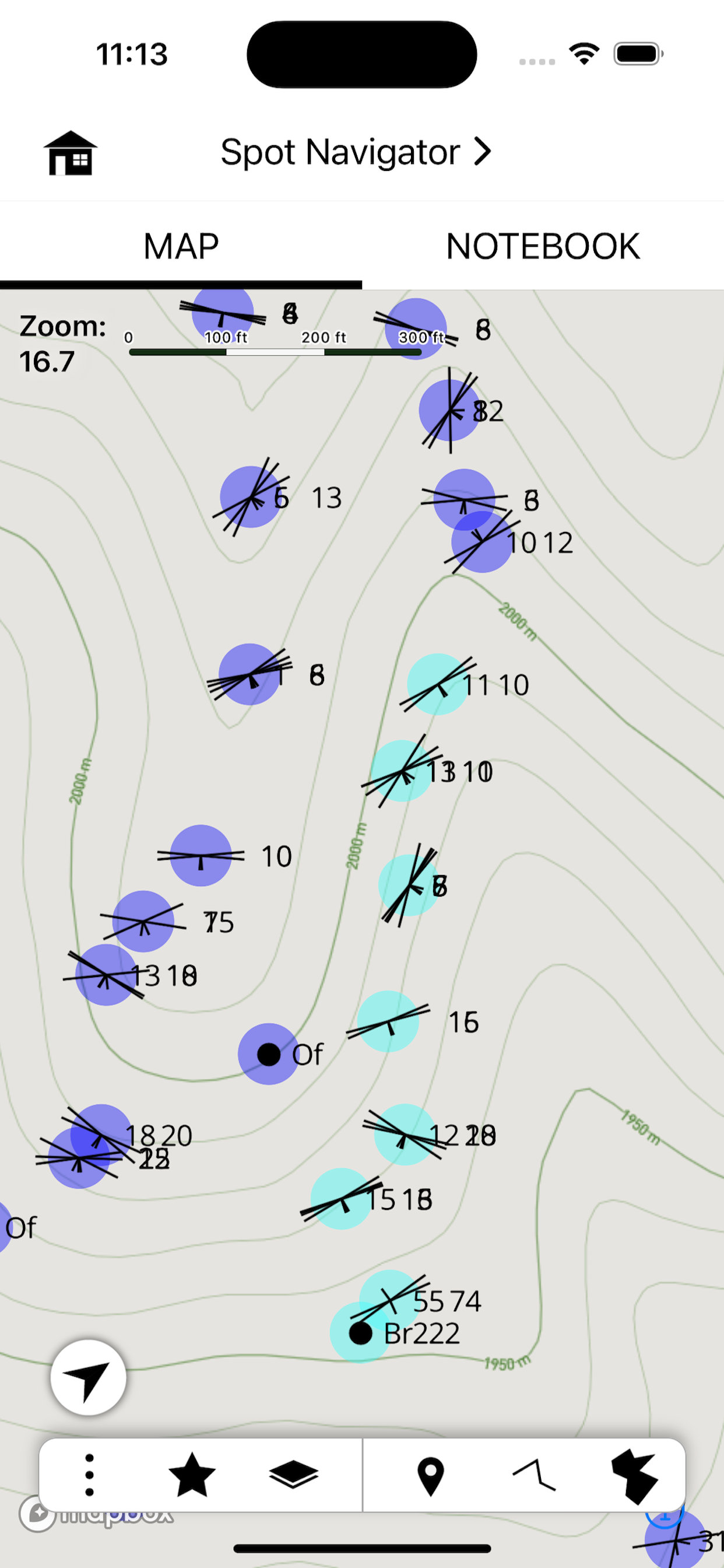
StraboSpot2 is a sophisticated tool for collecting data during geological fieldwork. Data are organized spatially into Spots or conceptually using Tags. A spot is a point, line, or polygon that contains geologic data. Spots can be spatially referenced by your device’s GPS, Drawn manually onto the map, or can be referenced on images that you take in the field. Tags are flexible data or interpretations that apply to many spots over a varied spatial extent. Examples of tags are geologic units, metamorphic grade, or fold generations.
StraboSpot2 integrates with the StraboSpot digital data system, an open-source database for field geologic data funded by the National Science Foundation. All data collected in StraboSpot2 can be easily uploaded to your Strabospot.org account, or it can be exported locally to your device’s file system.
You can add custom basemaps or overlays to your StraboSpot2 project using the StraboSpot My Maps tool at strabospot.org, mapwarper, or MapBox Studio. Custom basemaps as well as the built in basemaps can be downloaded for offline use.
Ausblenden
Mehr anzeigen...
StraboSpot2 integrates with the StraboSpot digital data system, an open-source database for field geologic data funded by the National Science Foundation. All data collected in StraboSpot2 can be easily uploaded to your Strabospot.org account, or it can be exported locally to your device’s file system.
You can add custom basemaps or overlays to your StraboSpot2 project using the StraboSpot My Maps tool at strabospot.org, mapwarper, or MapBox Studio. Custom basemaps as well as the built in basemaps can be downloaded for offline use.
Screenshots
StraboField Häufige Fragen
-
Ist StraboField kostenlos?
Ja, StraboField ist komplett kostenlos und enthält keine In-App-Käufe oder Abonnements.
-
Ist StraboField seriös?
Nicht genügend Bewertungen, um eine zuverlässige Einschätzung vorzunehmen. Die App benötigt mehr Nutzerfeedback.
Danke für die Stimme -
Wie viel kostet StraboField?
StraboField ist kostenlos.
-
Wie hoch ist der Umsatz von StraboField?
Um geschätzte Einnahmen der StraboField-App und weitere AppStore-Einblicke zu erhalten, können Sie sich bei der AppTail Mobile Analytics Platform anmelden.

Benutzerbewertung
Die App ist in Kasachstan noch nicht bewertet.

Bewertungsverlauf
StraboField Bewertungen
Keine Bewertungen in Kasachstan
Die App hat noch keine Bewertungen in Kasachstan.
Store-Rankings

Ranking-Verlauf
App-Ranking-Verlauf noch nicht verfügbar

Kategorien-Rankings
App ist noch nicht gerankt
StraboField Konkurrenten
| Name | Downloads (30d) | Monatlicher Umsatz | Rezensionen | Bewertungen | Letzte Veröffentlichung | |
|---|---|---|---|---|---|---|
|
Emlid Flow
Reach companion app
|
View
|
View
|
0
|
|
vor 2 Wochen | |
|
CavernSeer
|
View
|
View
|
0
|
|
vor 3 Jahren | |
|
CrowdMag
|
View
|
View
|
0
|
|
vor 3 Wochen | |
|
RLM-11CX
Scientific & Programable
|
View
|
View
|
0
|
|
vor 8 Monaten | |
|
HydroColor: Water Quality App
|
View
|
View
|
0
|
|
vor 1 Jahr | |
|
Birefringence
Michel-Lévy Color Chart
|
View
|
View
|
0
|
|
vor 2 Jahren | |
|
Outcropedia
|
View
|
View
|
0
|
|
vor 3 Jahren | |
|
Bad Elf Flex
Utility for Flex GNSS receiver
|
View
|
View
|
0
|
|
vor 4 Monaten | |
|
OPie Mohr's Circle
2D/3D Shear, Stress Solver
|
View
|
View
|
0
|
|
vor 3 Jahren | |
|
NVS Tsunami Evacuation
|
View
|
View
|
0
|
|
vor 1 Jahr |
StraboField Installationen
Letzte 30 TageStraboField Umsatz
Letzte 30 TageStraboField Einnahmen und Downloads
Gewinnen Sie wertvolle Einblicke in die Leistung von StraboField mit unserer Analytik.
Melden Sie sich jetzt an, um Zugriff auf Downloads, Einnahmen und mehr zu erhalten.
Melden Sie sich jetzt an, um Zugriff auf Downloads, Einnahmen und mehr zu erhalten.
App-Informationen
- Kategorie
- Utilities
- Herausgeber
- The University of Kansas
- Sprachen
- English
- Letzte Veröffentlichung
- 2.12.13 (vor 3 Wochen )
- Veröffentlicht am
- May 4, 2021 (vor 3 Jahren )
- Auch verfügbar in
- Vereinigte Staaten, Italien, Chile, Pakistan, Norwegen, Kanada, Mexiko, Libanon, Kasachstan, Malaysia, Südkorea, Nigeria, Niederlande, Japan, Neuseeland, Peru, Rumänien, Portugal, Israel, Russland, Saudi-Arabien, Schweden, Singapur, Thailand, Türkei, Taiwan, Ukraine, Vietnam, Südafrika, Algerien, Argentinien, Österreich, Australien, Aserbaidschan, Belgien, Brasilien, Belarus, Schweiz, China, Kolumbien, Deutschland, Dänemark, Dominikanische Republik, Indien, Ecuador, Ägypten, Spanien, Finnland, Frankreich, Vereinigtes Königreich, Griechenland, Sonderverwaltungsregion Hongkong, Ungarn, Indonesien, Irland, Vereinigte Arabische Emirate
- Zuletzt aktualisiert
- vor 4 Wochen
This page includes copyrighted content from third parties, shared solely for commentary and research in accordance with fair use under applicable copyright laws. All trademarks, including product, service, and company names or logos, remain the property of their respective owners. Their use here falls under nominative fair use as outlined by trademark laws and does not suggest any affiliation with or endorsement by the trademark holders.
- © 2025 AppTail.
- Unterstützung
- Privacy
- Terms
- All Apps

