
Downloads
Umsatz
Beschreibung
*** Appreciated by "Le Nouvelliste", "mac4ever.com", "iPhone-blog.ch" and perhaps you!
*** "Best of Swiss Apps Award 2017" nominated
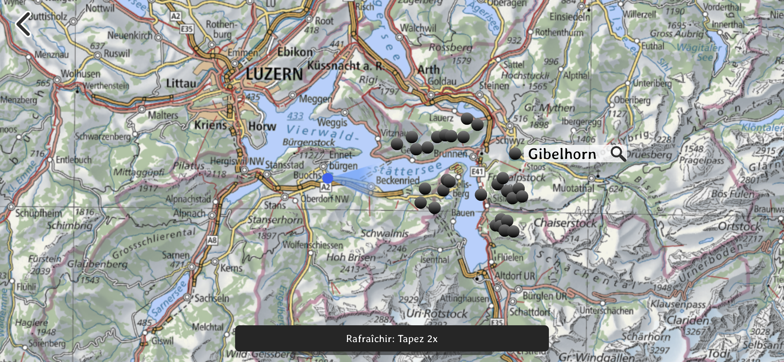
- At which altitude and distance is the cliff over there?
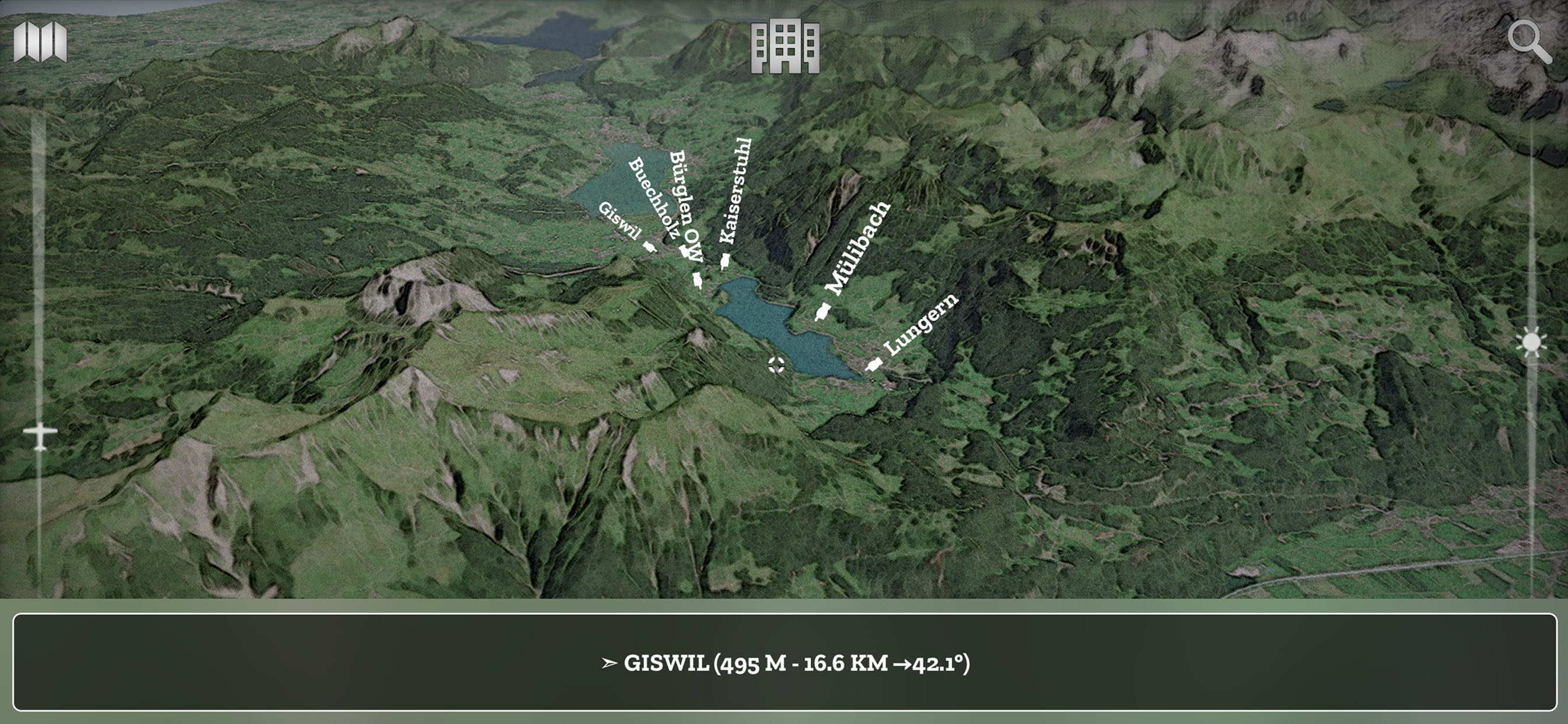
- What is the name of this small town below?
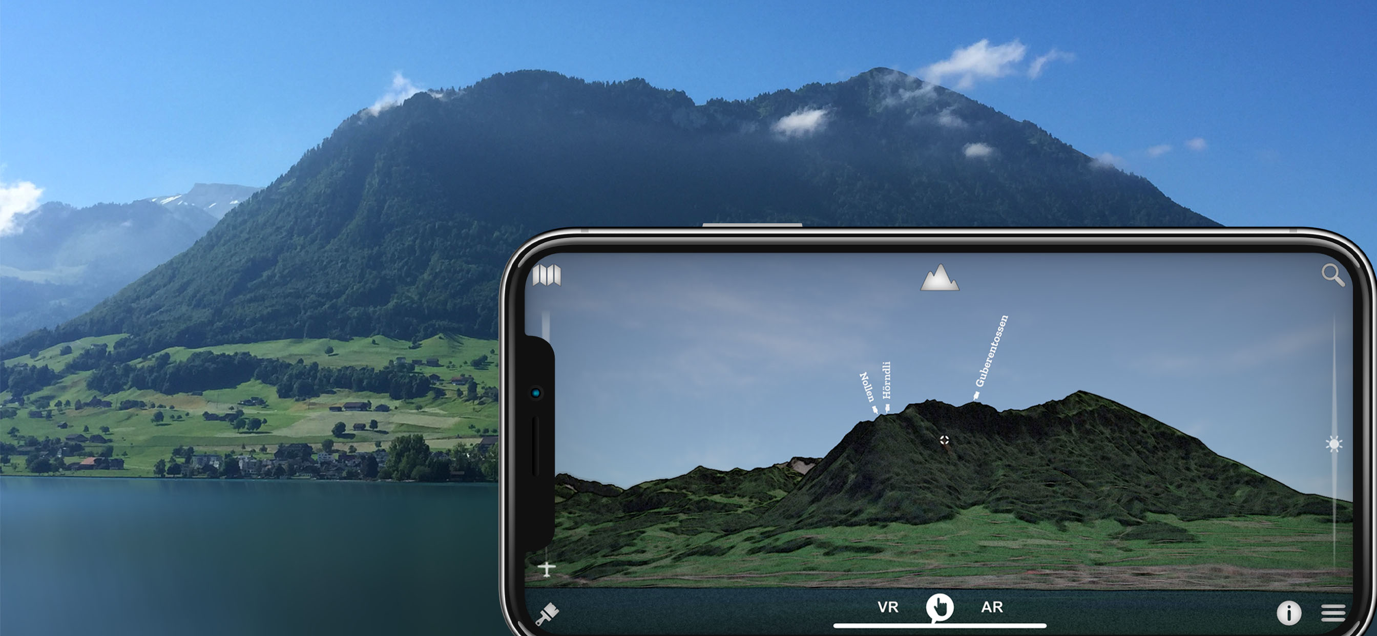
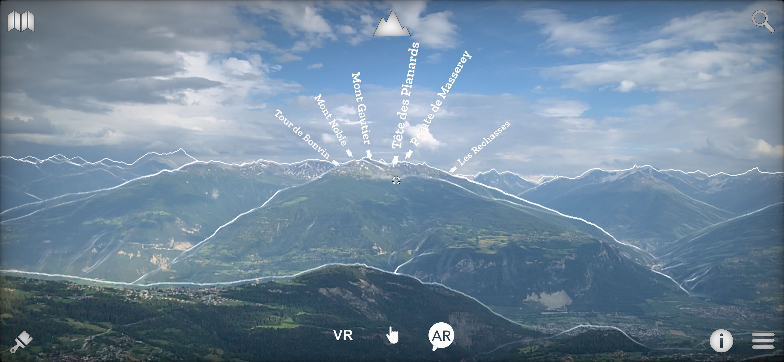
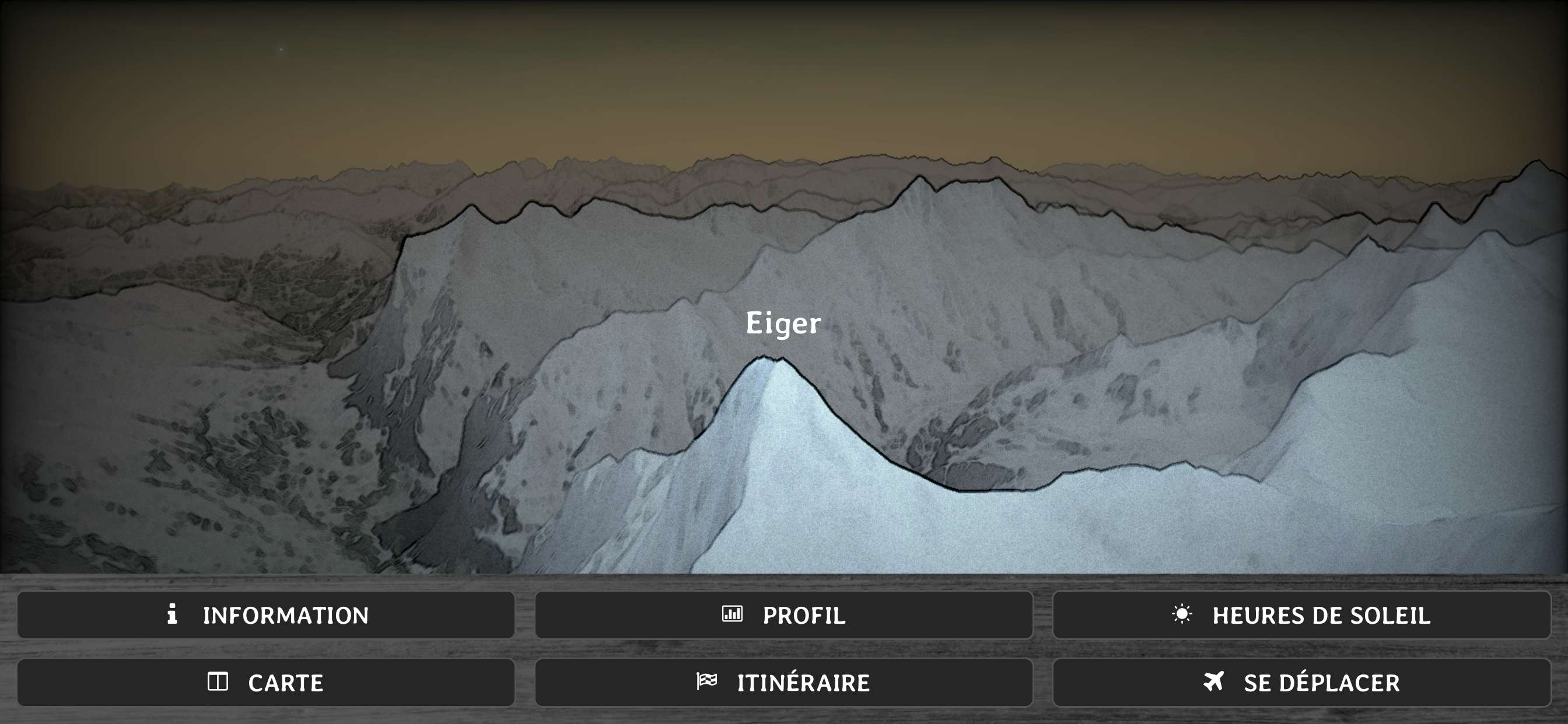
- How is called the peak we are seeing?
- What is the altitude of the Grimsel pass?
- Which mountain is the highest of the region?
- Is there a camping or a mountain refuge nearby?
- What is the name of this glacier or that lake?
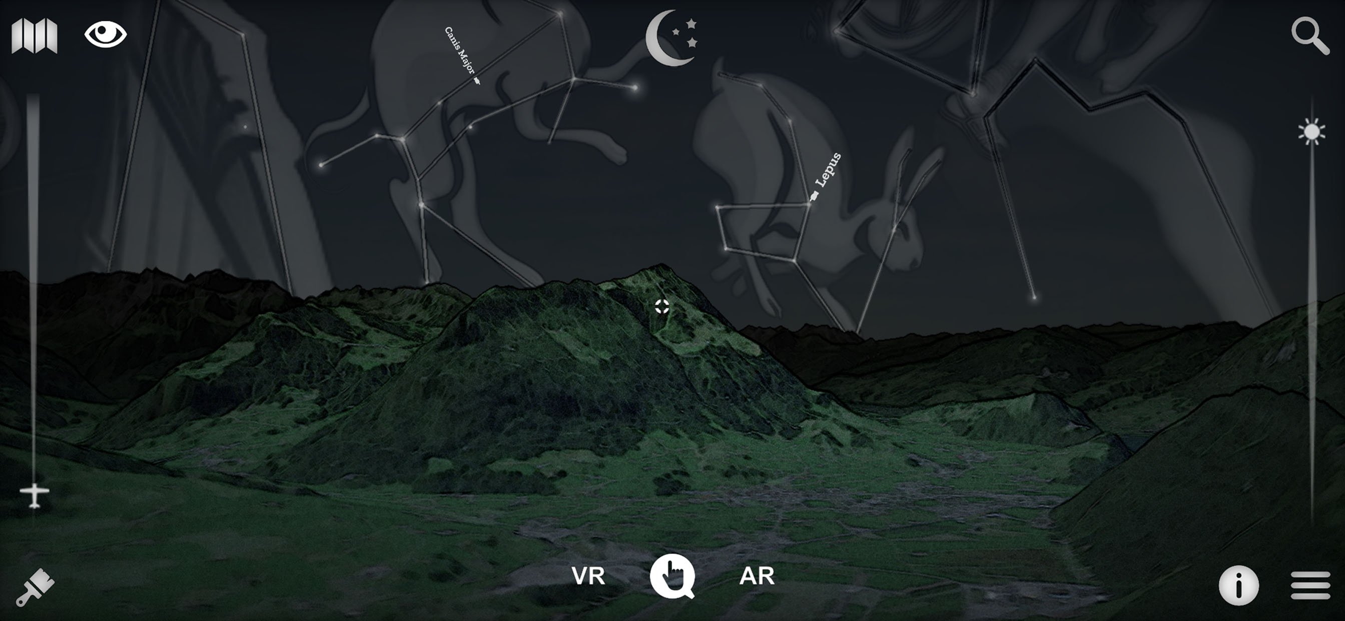
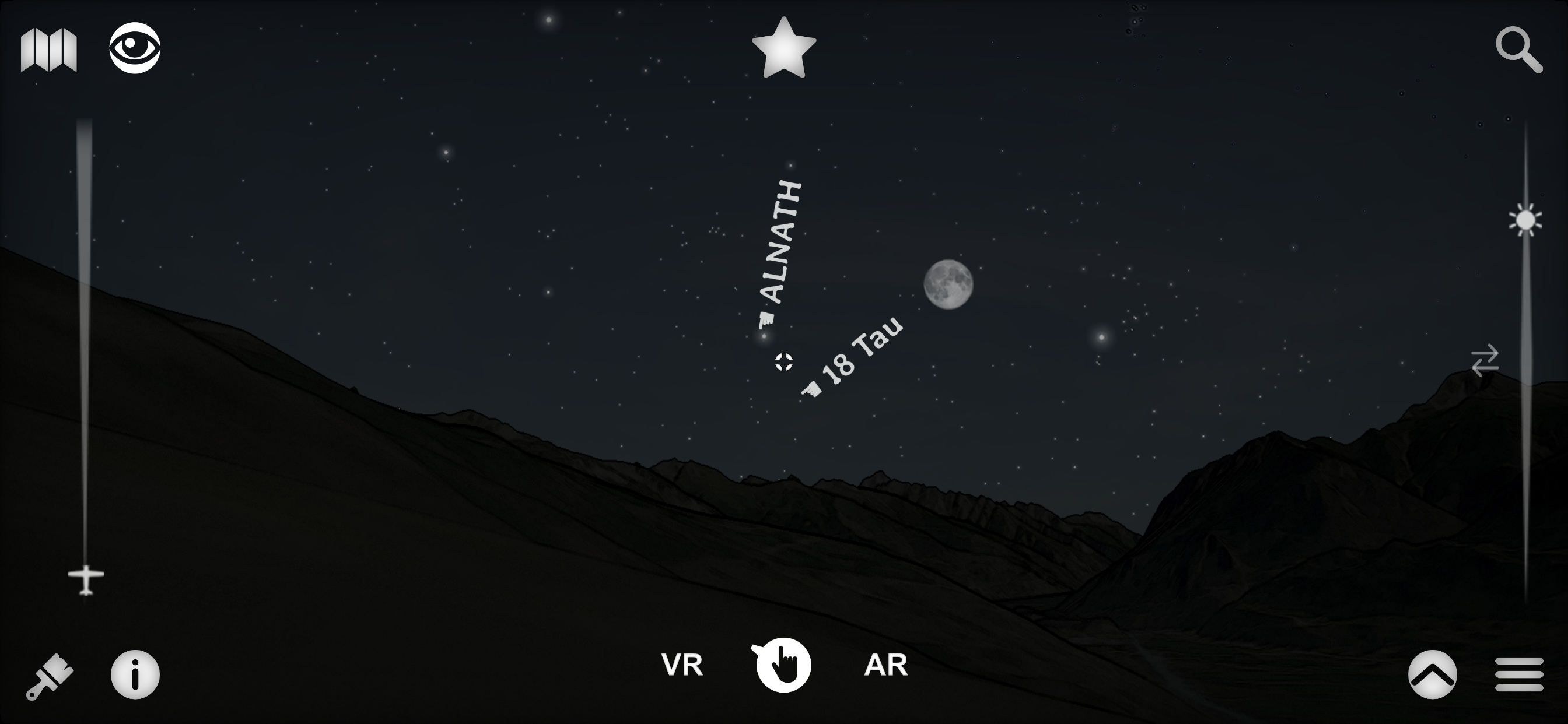
- Is it Jupiter right over this peak?
- The region on this hill has a lot of sun?
- How much walk time is needed to reach that crest, is it steep?
- Is there any message posted by somebody in this area?
- I am asking myself where is the Mattherhorn from here?
- What view do we have from the top of this mountain?
- Is it full moon and where is the moon?
- Is this whole valley over 1000m?
...
It is a question list sample that can be answered with Swiss3D!
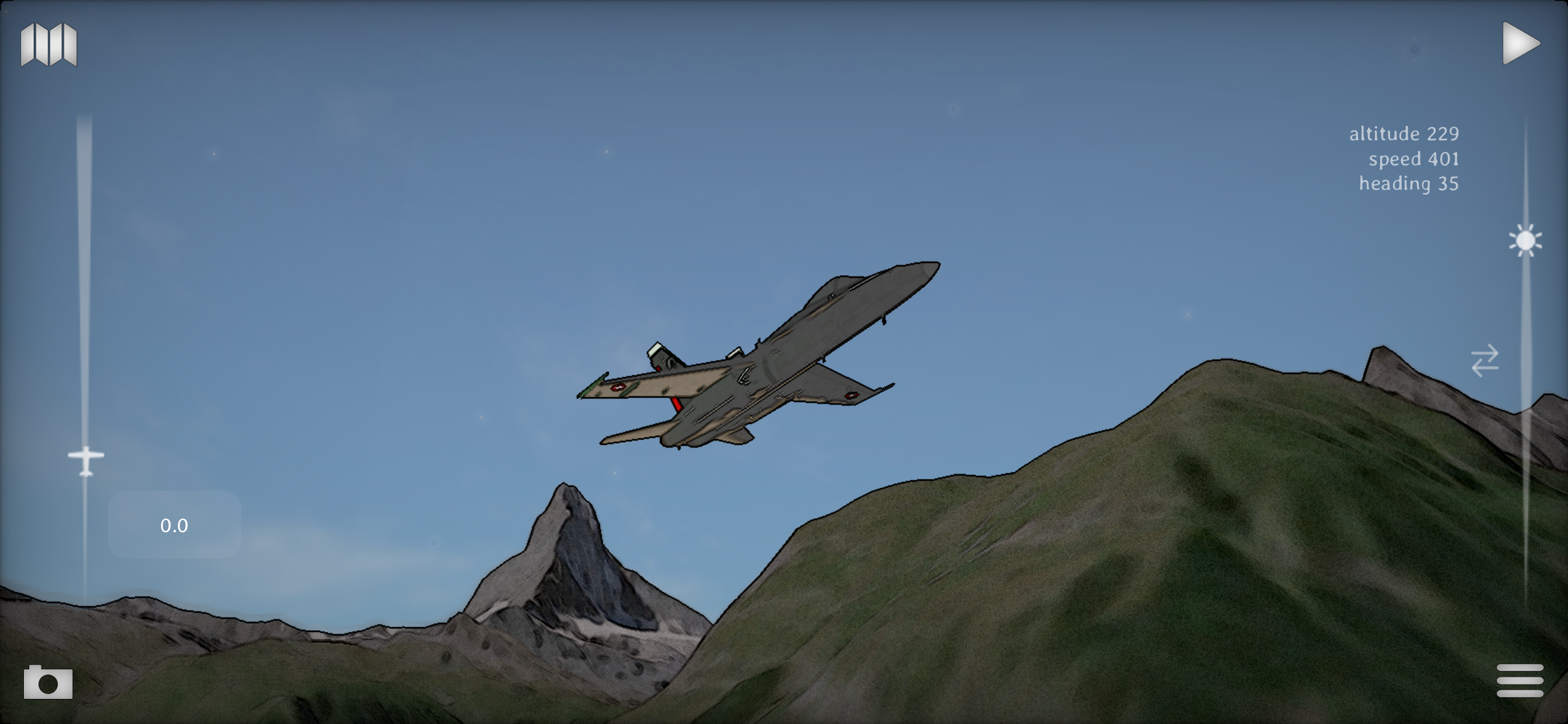
Swiss 3D is a, fully offline, precise, real time, virtual 3D map of Switzerland.
It reconstructs your surrounding landscape with accuracy and displays all peaks, towns, cities, places, lakes, passes, glaciers, mountain huts, ...
It also rebuild the current time sky and shows all brightest stars, solar system planets and all constellations.
The app contains an VR and AR mode that enable you to see the environment as seen through binoculars.
You can also share your current favorite position to everybody.
Reading a map has never been that fun and easy!
Features:
▫ no internet connection required
▫ virtual and augmented reality (ARKit) or manual mode
▫ accurate Swisstopo data
▫ 54000 places, 15000 peaks, 9000 stars, pass, lakes, mountain huts, ...
▫ landsat satellite imagery
▫ summer and winter
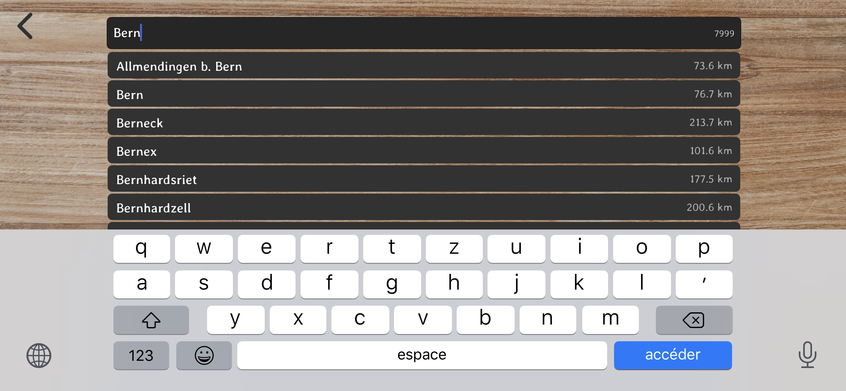
▫ search function
▫ dynamic aerial view
▫ easy controls
▫ map
▫ flight simulator
▫ share and comment your favorite location
▫ target information: distance, altitude, slope, sun time, walk time...
▫ only on iOS
▫ made in Switzerland for Switzerland
-> iPhone 6s (A9) and more required for the AR!
Source: Office fédéral de topographie / geonames
Satellite Image: Modified Copernicus Sentinel data [2019] swisstopo, NPOC
Elevation Data: ViewFinderPanoramas
Stars: Bright Star/Hipparcos catalogue, Jean Meeus
Constellations: Stellarium / Johan Meuris pictures
Cockpit: Vertical Reality Simulations
Ausblenden
Mehr anzeigen...
*** "Best of Swiss Apps Award 2017" nominated
- At which altitude and distance is the cliff over there?
- What is the name of this small town below?
- How is called the peak we are seeing?
- What is the altitude of the Grimsel pass?
- Which mountain is the highest of the region?
- Is there a camping or a mountain refuge nearby?
- What is the name of this glacier or that lake?
- Is it Jupiter right over this peak?
- The region on this hill has a lot of sun?
- How much walk time is needed to reach that crest, is it steep?
- Is there any message posted by somebody in this area?
- I am asking myself where is the Mattherhorn from here?
- What view do we have from the top of this mountain?
- Is it full moon and where is the moon?
- Is this whole valley over 1000m?
...
It is a question list sample that can be answered with Swiss3D!
Swiss 3D is a, fully offline, precise, real time, virtual 3D map of Switzerland.
It reconstructs your surrounding landscape with accuracy and displays all peaks, towns, cities, places, lakes, passes, glaciers, mountain huts, ...
It also rebuild the current time sky and shows all brightest stars, solar system planets and all constellations.
The app contains an VR and AR mode that enable you to see the environment as seen through binoculars.
You can also share your current favorite position to everybody.
Reading a map has never been that fun and easy!
Features:
▫ no internet connection required
▫ virtual and augmented reality (ARKit) or manual mode
▫ accurate Swisstopo data
▫ 54000 places, 15000 peaks, 9000 stars, pass, lakes, mountain huts, ...
▫ landsat satellite imagery
▫ summer and winter
▫ search function
▫ dynamic aerial view
▫ easy controls
▫ map
▫ flight simulator
▫ share and comment your favorite location
▫ target information: distance, altitude, slope, sun time, walk time...
▫ only on iOS
▫ made in Switzerland for Switzerland
-> iPhone 6s (A9) and more required for the AR!
Source: Office fédéral de topographie / geonames
Satellite Image: Modified Copernicus Sentinel data [2019] swisstopo, NPOC
Elevation Data: ViewFinderPanoramas
Stars: Bright Star/Hipparcos catalogue, Jean Meeus
Constellations: Stellarium / Johan Meuris pictures
Cockpit: Vertical Reality Simulations
Screenshots

Swiss3D Pro Häufige Fragen
-
Ist Swiss3D Pro kostenlos?
Ja, Swiss3D Pro ist komplett kostenlos und enthält keine In-App-Käufe oder Abonnements.
-
Ist Swiss3D Pro seriös?
Nicht genügend Bewertungen, um eine zuverlässige Einschätzung vorzunehmen. Die App benötigt mehr Nutzerfeedback.
Danke für die Stimme -
Wie viel kostet Swiss3D Pro?
Swiss3D Pro ist kostenlos.
-
Wie hoch ist der Umsatz von Swiss3D Pro?
Um geschätzte Einnahmen der Swiss3D Pro-App und weitere AppStore-Einblicke zu erhalten, können Sie sich bei der AppTail Mobile Analytics Platform anmelden.

Benutzerbewertung
Die App ist in Mexiko noch nicht bewertet.
Bewertungsverlauf
Swiss3D Pro Bewertungen
Keine Bewertungen in Mexiko
Die App hat noch keine Bewertungen in Mexiko.
Store-Rankings
Ranking-Verlauf
App-Ranking-Verlauf noch nicht verfügbar
Kategorien-Rankings
|
Diagramm
|
Kategorie
|
Rang
|
|---|---|---|
|
Top Bezahlt
|

|
21
|
|
Top Bezahlt
|

|
28
|
|
Top Bezahlt
|

|
91
|
|
Top Bezahlt
|

|
100
|
|
Top Bezahlt
|

|
123
|
Swiss3D Pro Konkurrenten
| Name | Downloads (30d) | Monatlicher Umsatz | Rezensionen | Bewertungen | Letzte Veröffentlichung | |
|---|---|---|---|---|---|---|

SwitzerlandMobility
Non-motorized traffic network
|
Freischalten
|
Freischalten
|
0
|
|
vor 2 Monaten | |

swisstopo
Official Swiss Maps
|
Freischalten
|
Freischalten
|
0
|
|
vor 3 Wochen | |

SAC – Swiss Alpine Club
Mountain tours, huts & more
|
Freischalten
|
Freischalten
|
0
|
|
vor 1 Woche | |

Swiss Pro Map
Maps for Switzerland and Alps
|
Freischalten
|
Freischalten
|
0
|
|
vor 1 Woche | |

Schwarz
Urlaub im Alpenresort Schwarz
|
Freischalten
|
Freischalten
|
0
|
|
vor 2 Monaten | |

emotì
|
Freischalten
|
Freischalten
|
0
|
|
vor 1 Woche | |

Hoover Dam Audio Tour Guide
Offline GPS Self Guided Tours
|
Freischalten
|
Freischalten
|
0
|
|
vor 1 Monat | |

EPFL Panel Lémanique
|
Freischalten
|
Freischalten
|
0
|
|
vor 9 Monaten | |

Sunnyside Engadin - St. Moritz
|
Freischalten
|
Freischalten
|
0
|
|
vor 2 Wochen | |

myJourney
|
Freischalten
|
Freischalten
|
0
|
|
vor 1 Woche |
Swiss3D Pro Installationen
Letzte 30 Tage
Swiss3D Pro Umsatz
Letzte 30 TageSwiss3D Pro Einnahmen und Downloads
Gewinnen Sie wertvolle Einblicke in die Leistung von Swiss3D Pro mit unserer Analytik.
Melden Sie sich jetzt an, um Zugriff auf Downloads, Einnahmen und mehr zu erhalten.
Melden Sie sich jetzt an, um Zugriff auf Downloads, Einnahmen und mehr zu erhalten.
App-Informationen
- Kategorie
- Travel
- Herausgeber
- MYZ Studio
- Sprachen
- English, French, German
- Letzte Veröffentlichung
- 12.9.1 (vor 3 Monaten )
- Veröffentlicht am
- Sep 5, 2012 (vor 12 Jahren )
- Auch verfügbar in
- Schweiz , Deutschland , Frankreich , Vereinigte Staaten , Vereinigtes Königreich , Belgien , Niederlande , Tschechien , Indien , Spanien , Kolumbien , Italien , Australien , Österreich , Luxemburg , Malaysia , Nigeria , Mexiko , Madagaskar , Norwegen , Neuseeland , Peru , Sri Lanka , Rumänien , Philippinen , Pakistan , Polen , Portugal , Südafrika , Saudi-Arabien , Schweden , Singapur , Slowenien , Thailand , Türkei , Taiwan , Ukraine , Vietnam , Vereinigte Arabische Emirate , Ecuador , Armenien , Argentinien , Aserbaidschan , Bulgarien , Brunei Darussalam , Brasilien , Belarus , Kanada , Chile , Zypern , Dänemark , Dominikanische Republik , Algerien , Libanon , Ägypten , Finnland , Griechenland , Sonderverwaltungsregion Hongkong , Ungarn , Indonesien , Irland , Israel , Japan , Südkorea , Kuwait , Kasachstan
- Zuletzt aktualisiert
- vor 1 Woche
This page includes copyrighted content from third parties, shared solely for commentary and research in accordance with fair use under applicable copyright laws. All trademarks, including product, service, and company names or logos, remain the property of their respective owners. Their use here falls under nominative fair use as outlined by trademark laws and does not suggest any affiliation with or endorsement by the trademark holders.
- © 2024 AppTail.
- Unterstützung
- Privacy
- Terms
- All Apps