Theodolite

AR Navigation Viewfinder

Veröffentlicht von: Craig Hunter

Beschreibung

Theodolite is a multi-function viewfinder that combines a compass, two-axis inclinometer, rangefinder, GPS, map, nav calculator, and geo-overlay photo/movie camera into one indispensable app. Theodolite was one of the very first augmented reality (AR) apps when it was released in 2009, and it’s been downloaded and used by millions of customers since then. Uses are endless, and the app is great for land measurements, outdoor sports, sightseeing, navigation, and finding your way around. Theodolite is a pro grade app and is used extensively by surveyors, geologists, architects, engineers, competitive sportsmen, first responders, military personnel, and search and rescue workers around the world.
Theodolite lets you take data-overlay photos and movies with 2X-8X zoom. Overlay geographical data, angle markings, date/time, author/company info, and project notes directly on photos and movies for later reference. The same data is written into the metadata record of images, making image files self-contained data records. Third-party apps can tap into Theodolite's advanced camera functions with a camera sharing feature.
View current position on the built-in map with optional offline Outdoors maps that include topo contours, roads, trails, landmarks, campgrounds, ski lifts, and more. Live map markers continually update distance/heading relative to the current location and also show wayfinding info in the main viewfinder. Draw polygons on the map to mark things like property boundaries and trails, and import/export polygon data via KML.
Share map markers and nav calculator points with other users of Theodolite via text messages or e-mail. This powerful capability opens up a wide range of collaborative uses including team land surveying, accident investigations, spotting wild fires, triangulation of landmarks, and advanced tactical observation and targeting. With an optional in-app purchase to enable team tracking, you can share location with up to 20 people on Theodolite's map.
Theodolite includes features for serious users like a reference angle mode, nav calculator, map marker import/export, manual and automatic data logging with CSV and KML export, clipboard integration, %grade display, mil compass readout, optical rangefinders (including a mil-based reticle, sniper-style stadiametric graphs, and a variable 4X-24X scope), and night filters to improve use in dark conditions.
Theodolite can provide location in military grid reference system (MGRS) coordinates, Universal Transverse Mercator (UTM) coordinates, British/Irish National Grids, US National Grid, Maidenhead locator system, Map Grid of Australia, and six latitude/longitude formats. Optional US State Plane coordinates include SPCS27 and SPCS83 zones covering all US States. The optional Datum Pack adds over 230 geodetic datums to the app to improve position computation from GPS data, covering regions and countries on all continents around the world.
AR Layers include navigational aids like the sun, moon, planets, and Polaris (North star), and the optional US Mountain Summits layer that shows over 70,000 US mountain summits in the viewfinder.
Theodolite has been shown in Apple Keynotes, featured on the App Store, and has been a #1 selling Navigation app in App Stores around the world. Since its introduction in 2009, Theodolite has defined augmented reality navigation. The app continually introduces new technologies, pushing the limits of iOS app development and taking advantage of new hardware capabilities.
Find out why Apple named Theodolite one of the most amazing apps available and showed it being used to explore the Great Wall of China. Where will you take it on your next adventure?
Note: Theodolite is an iPhone app -- see “Theodolite HD” for use on an iPad. And be sure to check out the all-new "Theodolite for Watch" and put Theodolite on your wrist!
Ausblenden Mehr anzeigen...

In-App-Käufe

Team Tracking
¥300
World Datum Pack
¥400
1,000 Outdoors Map Tiles
¥100
5,000 Outdoors Map Tiles
¥700
10,000 Outdoors Map Tiles
¥1,300
20,000 Outdoors Map Tiles
¥2,500
US State Plane Coordinates
¥3,500
US Mountain Summits AR Layer
¥400

Screenshots

Theodolite Häufige Fragen

  • Ist Theodolite kostenlos?

    Nein, Theodolite ist nicht kostenlos (es kostet 1500.00), und es enthält auch In-App-Käufe.

  • Ist Theodolite seriös?

    ✅ Die Theodolite-App scheint von hoher Qualität und legitim zu sein. Die Nutzer sind sehr zufrieden.

    Danke für die Stimme

  • Wie viel kostet Theodolite?

    Theodolite kostet 1500.00 zum Herunterladen (und es gibt auch zusätzliche In-App-Käufe).

  • Wie hoch ist der Umsatz von Theodolite?

    Um geschätzte Einnahmen der Theodolite-App und weitere AppStore-Einblicke zu erhalten, können Sie sich bei der AppTail Mobile Analytics Platform anmelden.

Benutzerbewertung

5 von 5

3 Bewertungen in Japan

5 star
3
4 star
0
3 star
0
2 star
0
1 star
0
Bewertungsverlauf

Theodolite Bewertungen

fieldworkの記録にはとても便利

jyuroujinn on

Japan

fieldworkで発見した地物の位置情報のちょっとした記録には便利。樹木高の記録にも

😺

どえりぁ on

Japan

Good

useful

esist on

Japan

I love this app

非常に出来が良い。

まあまあ、なかなか on

Japan

野外での簡易的な測量作業に使っています。 使いやすく、非常に便利です。アップデートも定期的に行っていて機能性も向上しています。 追加してほしい機能としては、写真で取った測量データをフォルダかなにかで、複数枚保存できると嬉しいです。

とても気に入って使ってます

森林2 on

Japan

1年以上前にiPhoneの機能を知って、測量機器ができないかと密かに検討していたら、すでにこのAppがリリースされていて、驚きました。1年の間に改良が進み、使い安い。森林の調査で、木の高さを測る機器を持ち歩かなくても、iPhoneで十分に使えると思います。方位角の精度は、1度以上ですので、ポケットコンパスのレベルより劣るものの、概況調査には使えるのではないでしょうか。 画面上のMailボタンをクリックすれば、写真、測定情報をメールで送れるので、便利です。 追加して欲しい機能としては、複数箇所のデータを送るたびに、送信先メールアドレスを入力するのは面倒です。自分宛のメールアドレスが選択できると都合がよいと思います。

なんかカッコイイ

盆地 on

Japan

方角と水平とヨー角を正確に捉えて撮影できるので綺麗に撮れます。 それに何かちょっと近未来的なHUDでカッコイイです。

Theodolite

Molly's Pet on

Vereinigte Staaten

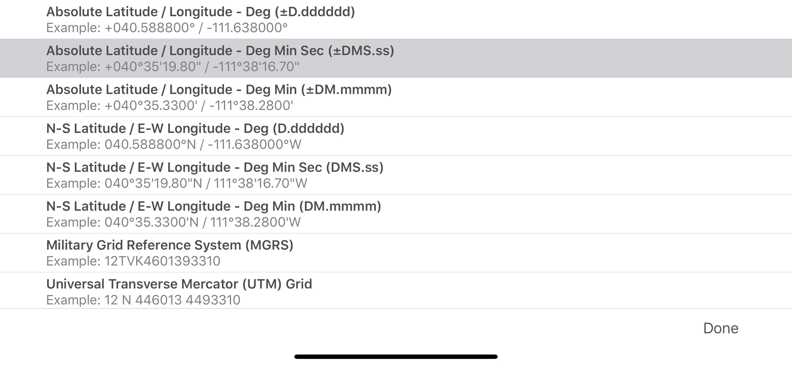
This is a very handy app. My only issue with it is , it doesn’t have a setting fo Deg. Min. Sec. For angular measurements. Military (mils) are not used on the large percentage of maps. Other than that it is a great app.

Theodolite

Razzle1111 on

Vereinigte Staaten

What a great tool!

Excellent

cwest703 on

Vereinigte Staaten

Perfect

Great app used it for years.

charleslon on

Vereinigte Staaten

This app will give you a lot of info on the lay of the land. The only caveat I have is the camera button placement. I would like to use my right hand index finger at the upper right hand corner with a decent size button and right underneath it the zoom button. At the moment I have to search for it which in turn disrupts the photo.

Store-Rankings

Ranking-Verlauf
Kategorien-Rankings
Diagramm
Kategorie
Rang
Top Bezahlt
3
Top Bezahlt
6
Top Bezahlt
6
Top Bezahlt
7
Top Bezahlt
7

Schlüsselwörter

Theodolite Konkurrenten

Name
Spyglass
GPS, compass and maps toolkit
Tactical NAV
Precision MGRS Navigation
aprs.fi
APRS in real time
CalTopo: Backcountry Mapping
Topo Maps, Offline Maps & More
iTAK
Team Awareness Kit
Earthmate
Text and Navigate with inReach
Garmin Messenger™
Wasatch Backcountry Skiing Map
Trimble Mobile Manager
Eos Tools Pro

Theodolite Installationen

Letzte 30 Tage

Theodolite Umsatz

Letzte 30 Tage

Theodolite Einnahmen und Downloads

Gewinnen Sie wertvolle Einblicke in die Leistung von Theodolite mit unserer Analytik.
Melden Sie sich jetzt an, um Zugriff auf Downloads, Einnahmen und mehr zu erhalten.
This page includes copyrighted content from third parties, shared solely for commentary and research in accordance with fair use under applicable copyright laws. All trademarks, including product, service, and company names or logos, remain the property of their respective owners. Their use here falls under nominative fair use as outlined by trademark laws and does not suggest any affiliation with or endorsement by the trademark holders.