Download high resolution USGS topographical maps for offline GPS* use.
Topo Nomad is designed for road trips, camping, hiking, exploration and geographical history. Map images are accurately center aligned regardless of datum and placed on top of Apple's map kit for easy referencing and intuitive touch navigation.
This software utilizes the latest capabilities of IOS offering the highest performance with fast start up, map rotation, rendering and zoom with unbeatable details and undistorted resolution. Map downloads are dispatched in the background so you can continue using the app while new maps concurrently install.
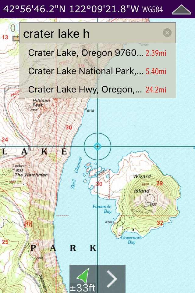
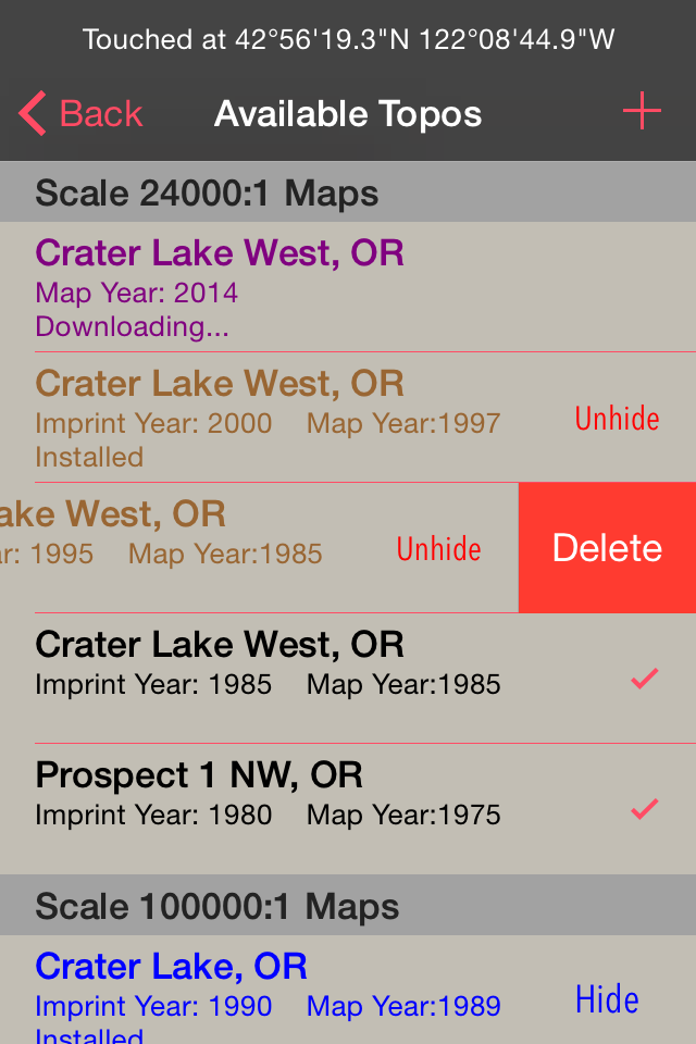
Topo Nomad indexes of over 250,000+ U.S. Geological Survey current and historical topographic maps describing the topography of every region and island territories of the United States of America. Historical versions date as far back as year 1884. Install a map quad by pressing and holding a point on the reference map and discover the USGS historical maps available at that coordinate and the unique names given to every quad by the cartographers.**
The limits don't stop there with just USGS maps. Import "Geospatial PDF" maps from the web, iTunes and email. Many local and national park services offer PDF map downloads from their web sites which automatically install into the Topo Nomad app. And, if you reside outside the United States check with your government services for topographic and aeronautical sectional maps with embedded geospatial metadata.‡
Cannot find that map you downloaded but know where in the world it's located. Simply zoom out the reference map view and all the topo maps become a colorful violet and partially transparent so you can spot your map. Installed maps are managed in a table format which can be sorted by name, distance, and scale. Multiple versions of the same map can be stacked on top of one another and made visible or hidden using two finger swipes.
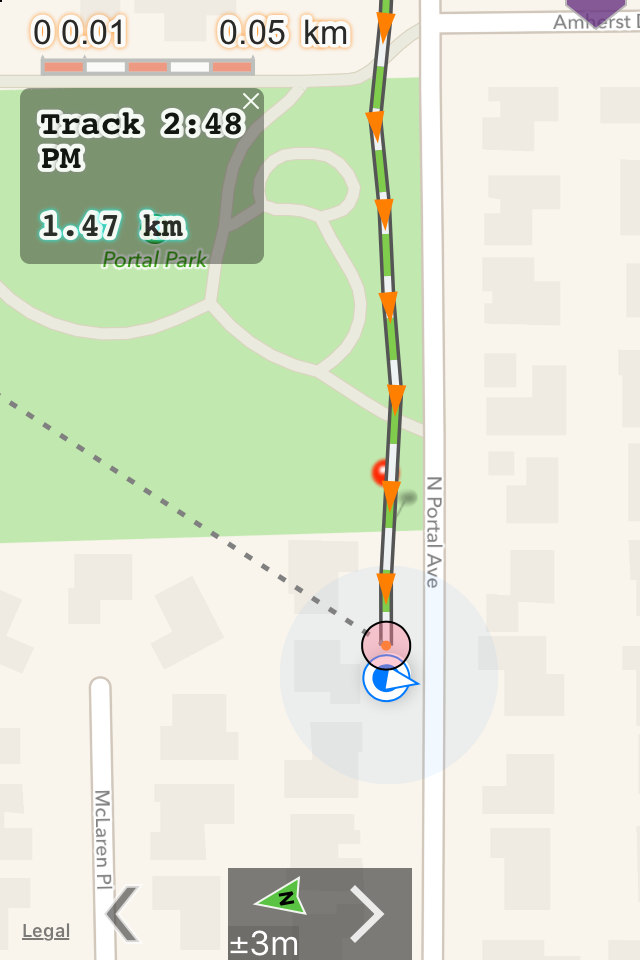
Planning a hike somewhere and want to know the distance of your jaunt. Download the map and use the dual mode ruler to measure the path distance and know the answer to "how much farther?"
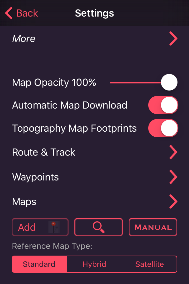
Purchase a subscription for unlimited map downloading. A subscription stops ads and doesn't auto-renew. The first few map download are complementary.‡
Features:
• No need for cellular service to use maps
• GPS location on downloaded topo maps while offline
• Find geographic features with geocode search
• Track path GPS recording*
• Route paths and distance
• Dual mode ruler with orthographic line and path measuring
• Full app usability while maps download in the background
• Displays footprint grid and quadrangle names
• Aligns all map datums to WGS84 GPS coordinates
• Dynamic map stitching
• Cropping of map margins for one big map grid
• Automatic map download for your current location
• Uses GPS location service to identify your location on a topo map
• Miles, Feet, Kilometers, Meters, Nautical Miles units
• MGRS, UTM and geodetic Latitude and Longitude decimal and minutes seconds coordinate display
• Import maps downloaded from the USGS in zip and PDF file formats
• Import Geospatial PDF map images via a the web, email attachment & iTunes
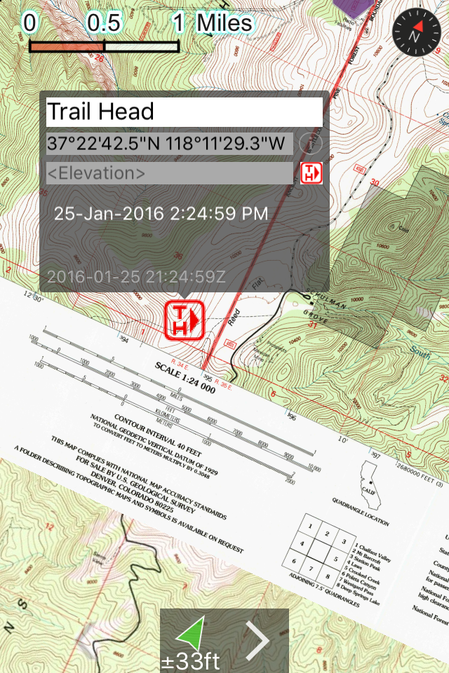
• MSL elevation for GPS location
• Waypoints with Augmented Reality finder
• Email and SMS text waypoints, tracks and routes as GPX files with subscription purchase
Not currently supported: geo-TIFF; PDF OCG Layers. Not all geospatial datums and metadata formats are supported, please email support with Geospatial PDF issues.
* Continued use of GPS running in the background can dramatically decrease battery life. Location feature may not function on iPod and wifi-only iPad devices without GPS hardware.
** Not preloaded with maps. WiFi recommended. Downloading queue caps to around 36 maps.
‡ After a subscription period expires, advertisement may resume from usage of the import features.
AusblendenMehr anzeigen...
In-App-Käufe
1 Year
$7.99
Lifetime
$29.99
Screenshots
Topo Nomad Häufige Fragen
Ist Topo Nomad kostenlos?
Ja, Topo Nomad ist kostenlos herunterzuladen, enthält jedoch In-App-Käufe oder Abonnements.
Ist Topo Nomad seriös?
✅ Die Topo Nomad-App scheint von hoher Qualität und legitim zu sein. Die Nutzer sind sehr zufrieden.
Danke für die Stimme
Wie viel kostet Topo Nomad?
Topo Nomad bietet mehrere In-App-Käufe/Abonnements, der durchschnittliche In-App-Preis beträgt $18.99.
Wie hoch ist der Umsatz von Topo Nomad?
Um geschätzte Einnahmen der Topo Nomad-App und weitere AppStore-Einblicke zu erhalten, können Sie sich bei der AppTail Mobile Analytics Platform anmelden.
Benutzerbewertung
4 von 5
1 Bewertungen in Kanada
5 star
0
4 star
1
3 star
0
2 star
0
1 star
0
Bewertungsverlauf
Topo Nomad Bewertungen
Great App for USGS Topo Maps
If you like using the classic USGS Topo maps, this app works very well. Many generations of these maps are available for very reasonable subscription prices. I’ve found that a lot of trails and information on these maps - like place names, peak names, benchmarks, etc - have been omitted from the modern digital Topo databases.
TOPO Nomad
TOPO Nomad works really well for me. I had trouble previously getting TOPO Nomad to track reliably with the Dual XGPS150A WiFi gps, now it works great. I could not be more pleased with the ease of use.
Ed S.
Love transparent overlays
I love the ability to overlay usgs maps with satellite hybrid maps. Used to use Trimble outdoors for this; first real alternative I’ve found.
Topo Nomad
Topo Nomad is a great app. Far better than many other apps like it. I have purchased copies for myself and the people in my company. I do forestry and fire management and this will be our go to map software. The only improvments it needs is the abilty to export gpx files through email (currently only able to do this through iTunes) and I wish it worked on other phones since not everyone has an iPhone. If it also had the ability to share peoples locations with a log in that would be amazing and I would pay additional for that feature.
The best
I have wanted a app like this forever.i recently was given historic topo maps with coords to ancient native camps, burials and caves. I've been need a app that can be used offline and shared waypoints. I am using this app to find the sites to publish a book of photos w/I locations. Again thank you for the app and I will be donating and so should you.
Amazing App!
This has got to be one of the most amazing apps I have found so far! Beyond amazing utility. By far the best hiking and outdoor awareness app I have seen / used. The fact that it runs on an iPhone usable is- amazing!if the maps can be kept reasonably up to date, it will be my constant companion in the out-and-about. This one I will donate to! Thanks!
I think about the only thing I could possibly add is that having a symbol key built in in the manual ( which is also - you guessed it - AMAZING!) might be useful to neophytes...
Good app
Simple no nonsense mapping tool. Features? Battery draining gimmicks? Flashy interface? Look elsewhere. Here u get the best terrain maps (USGS Quads) and a position. Done. And when it comes down to it, this is really all that's needed out there.
Great app
I used it for bow hunting this last year a great app shows everything you need to hunt
Amazing. Historical research as I never imagined it could be.
I search for lost, forgotten and abandoned cemeteries. I have spent hours pouring over old maps, comparing historical maps to existing maps and aerial/satellite images and have already made a huge discovery using this app.
Less than 10 miles from me, I found a cemetery noted on a 1916 map and on another map in 1922 but, after that, it is not shown on later maps.
Using the information I found using Topo Nomad, I drove out and found that the cemetery is, indeed, still there. It is severely neglected and, without this app, I never would have known it existed. It’s an exciting discovery as none of my colleagues were aware of it either.
I’m use this every day. Kudos to the developers!!
Edit: Update on November 25 seems to have improved speed. Thank you.
Request: Putting this here because I don’t see a way to contact developer directly (although it’s probably right in front of me). Are there plans to make this available on the Mac? It would be very handy to have it on my desktop.
Great new app for true hikers
Just downloaded and impressed with the ease of use. Can't wait to use on a hike.
Gewinnen Sie wertvolle Einblicke in die Leistung von Topo Nomad mit unserer Analytik. Melden Sie sich jetzt an, um Zugriff auf Downloads, Einnahmen und mehr zu erhalten.
This page includes copyrighted content from third parties, shared solely for commentary and research in accordance with fair use under applicable copyright laws. All trademarks, including product, service, and company names or logos, remain the property of their respective owners. Their use here falls under nominative fair use as outlined by trademark laws and does not suggest any affiliation with or endorsement by the trademark holders.