
Downloads
Umsatz
Beschreibung
topoXpress provides the following features:
• Multiplatform design: the same software with the same rich functionality for both GIS data collectors and Surveyors on iOS & macOS.
• Handling and displaying large spatial datasets (raster and vector).
• Responsive and intuitive user interface: easy to learn and use, automatic adjustment to different screen sizes, orientations, and resolutions of mobile (iPhone, iPad) and desktop devices.
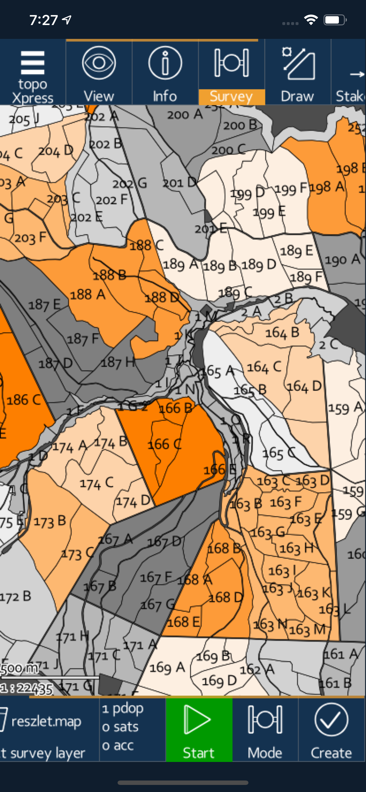
• Online and offline operation: online data sources (Cloud storage, TMS, WMS, KML), offline raster datasets (jpeg, ecw, ers, tiff, png, lan, bil, ENVI bsq), offline vector datasets (shp, dxf, map, GeoJSON, mif, txt, crd, dat, dbf, tab, mid).
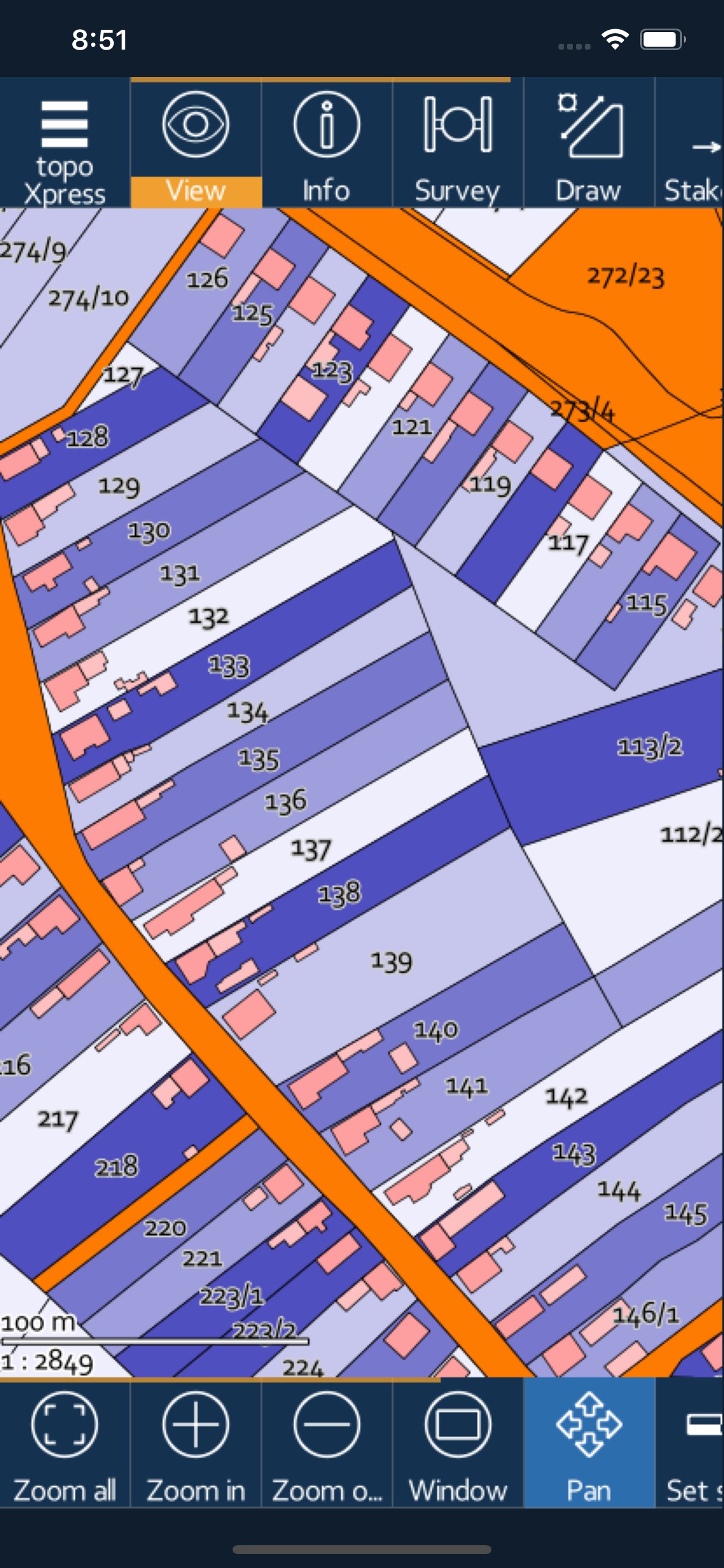
• Powerful GIS visualization functions: thematic mapping, transparency, labeling, query, layer groups, vector symbols, line types, fill types, event mapping.
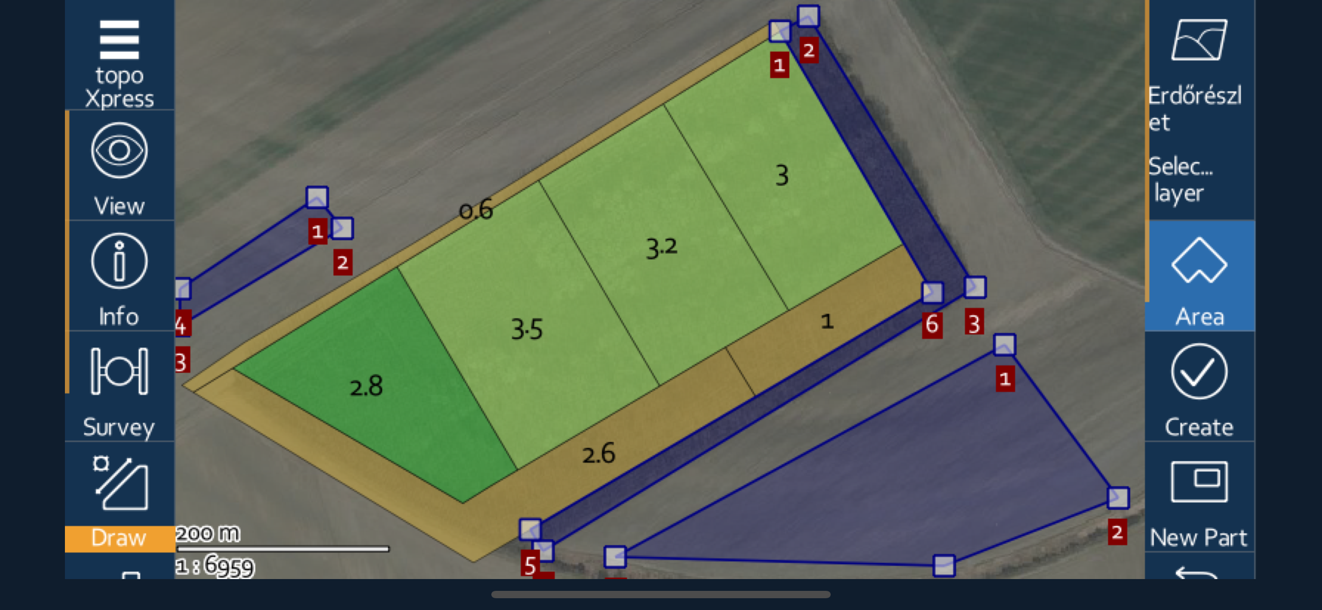
• Productive data collection: templates, surveying, stakeout, CoGo (Coordinate Geometry), forms, lists, calculated fields, GIS editing functions, sampling tool, and more.
• Collaborative mapping for professional users through the topoXpress cloud service.
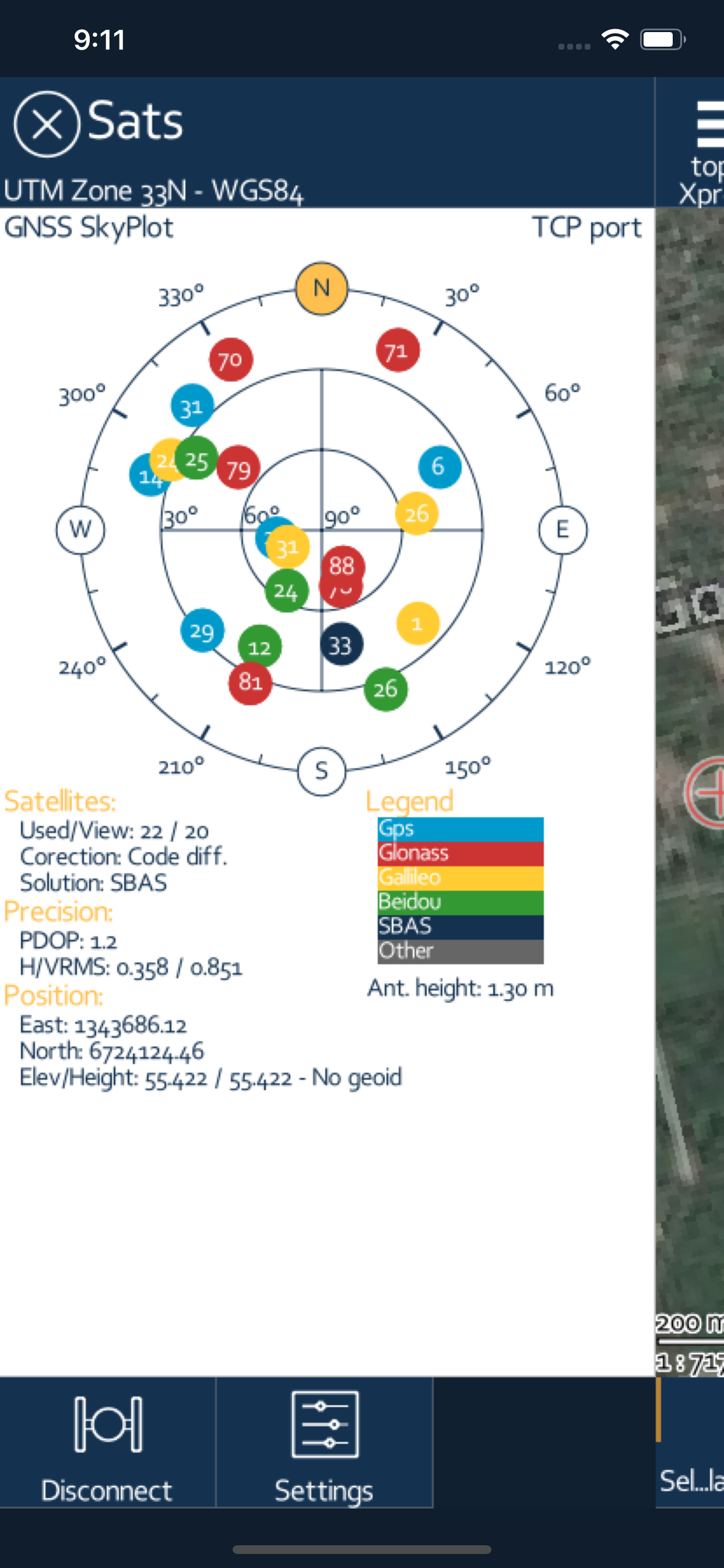
• Extensive support of GNSS receivers through TCP port & Bluetooth, projection systems, geoids, shift grids. Bluetooth Rangefinder support for CoGo tasks.
The app can be used in many different sectors:
• Field data collection and inspection
• Land Surveying
• Topographic mapping
• Forestry
• Farm mapping
• Utility mapping and inspection
• Archeology
*** NOTE: topoXpress offers all specified GIS functions free of charge. However, loading more than 10.000 records, saving and exporting your job can be done through our cloud service. Please visit our website for further details: https://topoXpress.com
**NOTE ON BATTERY USAGE: The app may dramatically decrease battery life during the use with large spatial datasets. The app supports optional background location services, which can may cause a faster battery drain than usual.
Ausblenden
Mehr anzeigen...
• Multiplatform design: the same software with the same rich functionality for both GIS data collectors and Surveyors on iOS & macOS.
• Handling and displaying large spatial datasets (raster and vector).
• Responsive and intuitive user interface: easy to learn and use, automatic adjustment to different screen sizes, orientations, and resolutions of mobile (iPhone, iPad) and desktop devices.
• Online and offline operation: online data sources (Cloud storage, TMS, WMS, KML), offline raster datasets (jpeg, ecw, ers, tiff, png, lan, bil, ENVI bsq), offline vector datasets (shp, dxf, map, GeoJSON, mif, txt, crd, dat, dbf, tab, mid).
• Powerful GIS visualization functions: thematic mapping, transparency, labeling, query, layer groups, vector symbols, line types, fill types, event mapping.
• Productive data collection: templates, surveying, stakeout, CoGo (Coordinate Geometry), forms, lists, calculated fields, GIS editing functions, sampling tool, and more.
• Collaborative mapping for professional users through the topoXpress cloud service.
• Extensive support of GNSS receivers through TCP port & Bluetooth, projection systems, geoids, shift grids. Bluetooth Rangefinder support for CoGo tasks.
The app can be used in many different sectors:
• Field data collection and inspection
• Land Surveying
• Topographic mapping
• Forestry
• Farm mapping
• Utility mapping and inspection
• Archeology
*** NOTE: topoXpress offers all specified GIS functions free of charge. However, loading more than 10.000 records, saving and exporting your job can be done through our cloud service. Please visit our website for further details: https://topoXpress.com
**NOTE ON BATTERY USAGE: The app may dramatically decrease battery life during the use with large spatial datasets. The app supports optional background location services, which can may cause a faster battery drain than usual.
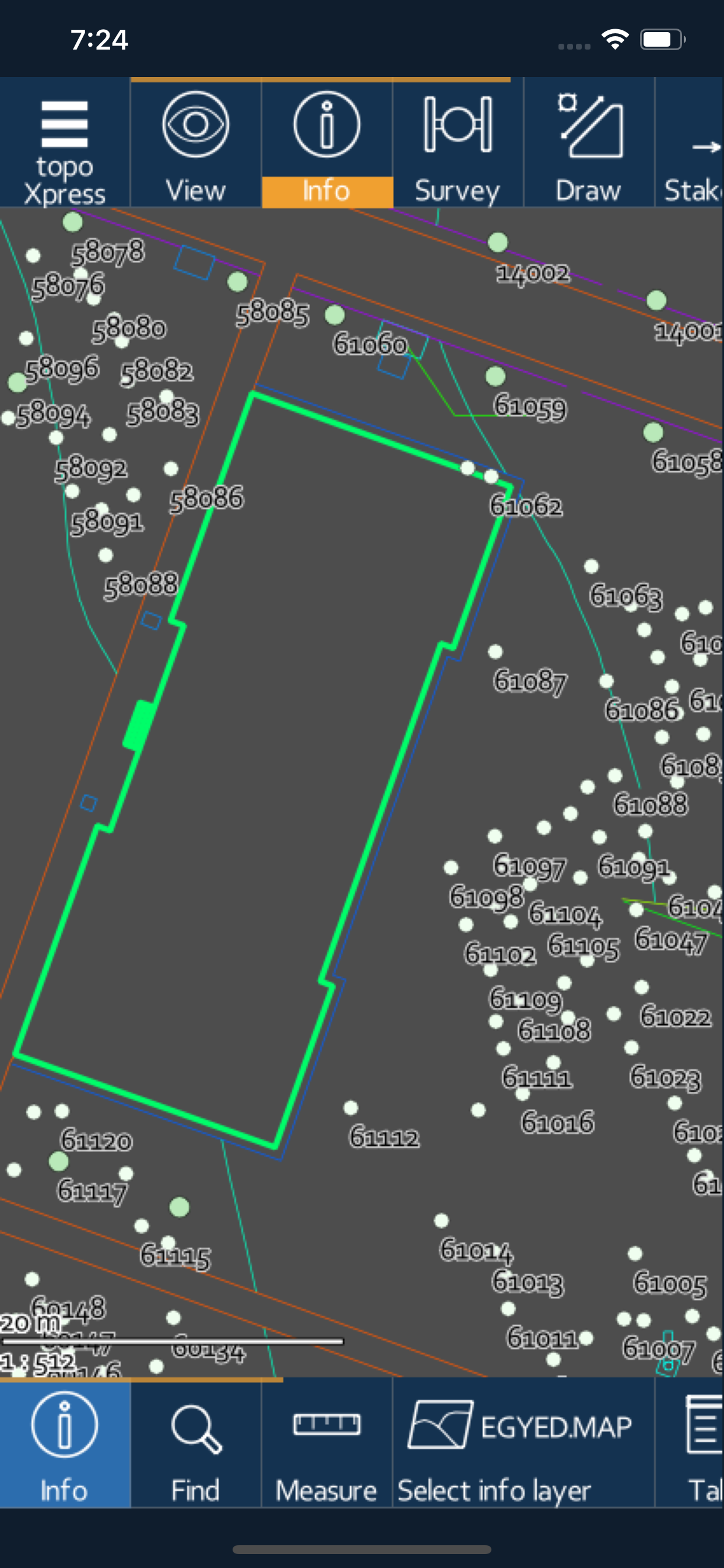
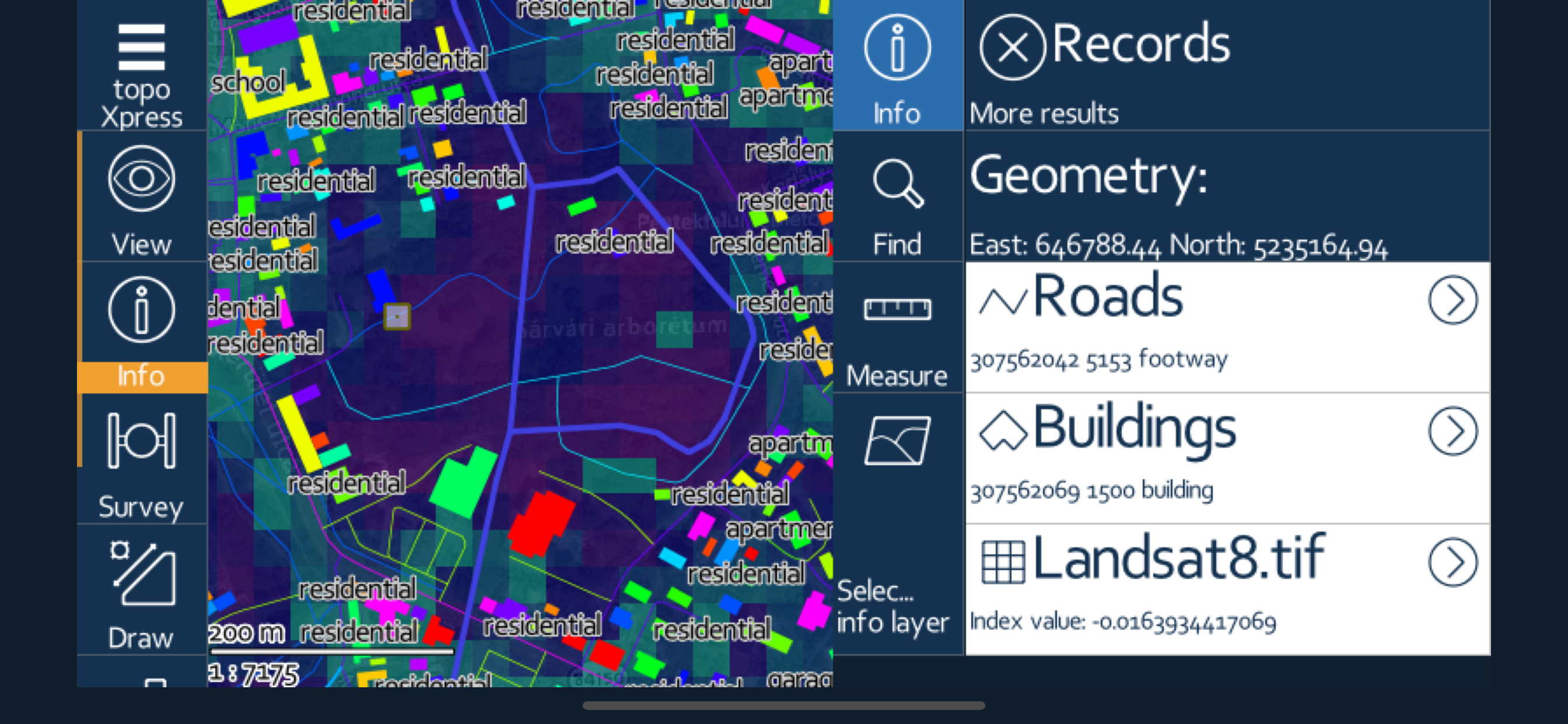
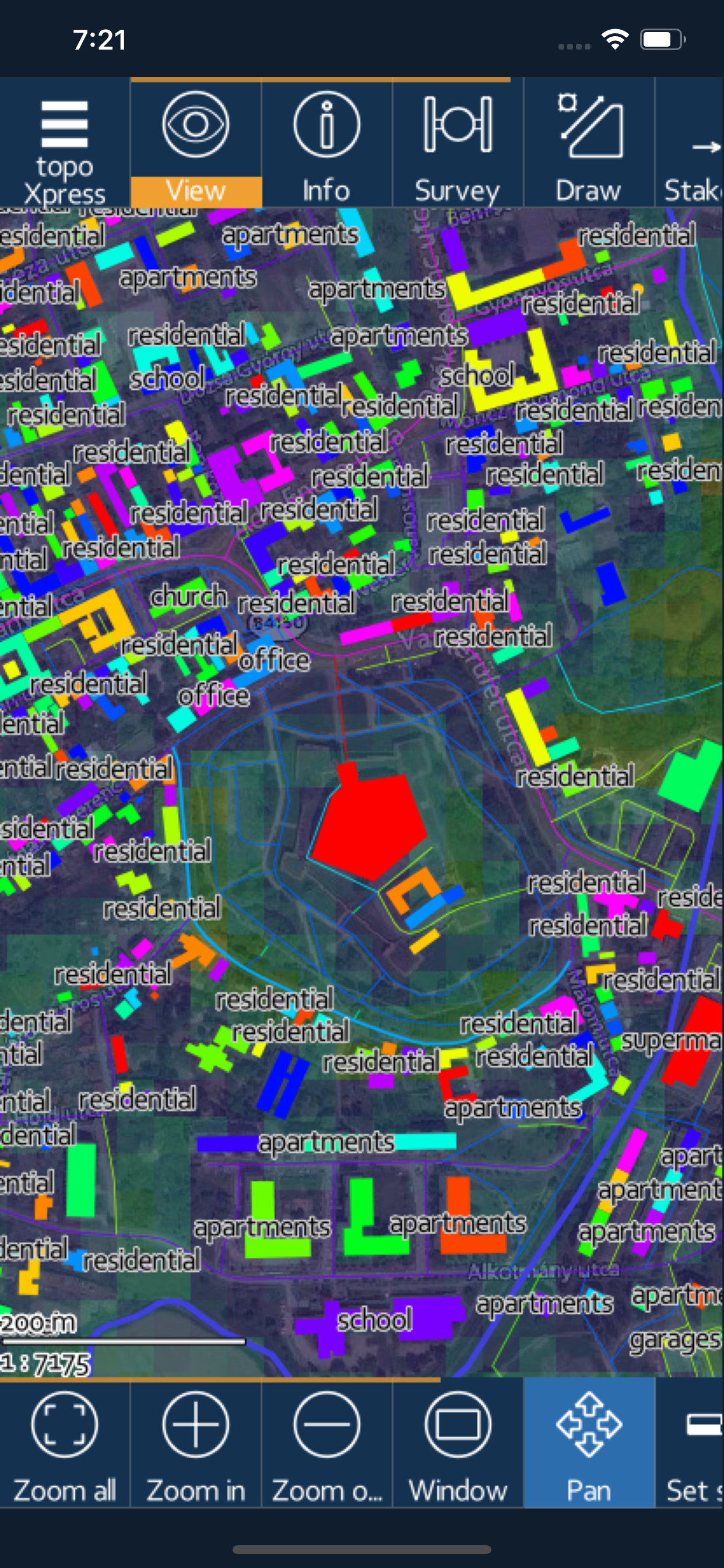
Screenshots


topoXpress Häufige Fragen
-
Ist topoXpress kostenlos?
Ja, topoXpress ist komplett kostenlos und enthält keine In-App-Käufe oder Abonnements.
-
Ist topoXpress seriös?
Nicht genügend Bewertungen, um eine zuverlässige Einschätzung vorzunehmen. Die App benötigt mehr Nutzerfeedback.
Danke für die Stimme -
Wie viel kostet topoXpress?
topoXpress ist kostenlos.
-
Wie hoch ist der Umsatz von topoXpress?
Um geschätzte Einnahmen der topoXpress-App und weitere AppStore-Einblicke zu erhalten, können Sie sich bei der AppTail Mobile Analytics Platform anmelden.

Benutzerbewertung
Die App ist in Kasachstan noch nicht bewertet.
Bewertungsverlauf
topoXpress Bewertungen
Keine Bewertungen in Kasachstan
Die App hat noch keine Bewertungen in Kasachstan.
Store-Rankings
Ranking-Verlauf
App-Ranking-Verlauf noch nicht verfügbar
Kategorien-Rankings
|
Diagramm
|
Kategorie
|
Rang
|
|---|---|---|
|
Top Kostenlos
|

|
468
|
topoXpress Konkurrenten
| Name | Downloads (30d) | Monatlicher Umsatz | Rezensionen | Bewertungen | Letzte Veröffentlichung | |
|---|---|---|---|---|---|---|

Topo Nomad
USGS Topographical Maps
|
Freischalten
|
Freischalten
|
0
|
|
vor 1 Jahr | |

NMEA Talker
|
Freischalten
|
Freischalten
|
0
|
|
vor 2 Jahren | |

Eos Tools Pro
|
Freischalten
|
Freischalten
|
0
|
|
vor 4 Monaten | |

Global Mapper Mobile
|
Freischalten
|
Freischalten
|
0
|
|
vor 1 Monat | |

Touch GIS
Advanced field data collection
|
Freischalten
|
Freischalten
|
0
|
|
vor 3 Wochen | |

MyGIS
Your Navigation Companion
|
Freischalten
|
Freischalten
|
0
|
|
vor 8 Monaten | |

Topo Reader
USGS Topographical Maps
|
Freischalten
|
Freischalten
|
0
|
|
vor 1 Jahr | |

GRTech NBV1 NTRIP Client
|
Freischalten
|
Freischalten
|
0
|
|
vor 1 Jahr | |

Survey360
|
Freischalten
|
Freischalten
|
0
|
|
vor 7 Monaten | |

iGIS for iPad
|
Freischalten
|
Freischalten
|
0
|
|
vor 3 Jahren |
topoXpress Installationen
Letzte 30 Tage
topoXpress Umsatz
Letzte 30 TagetopoXpress Einnahmen und Downloads
Gewinnen Sie wertvolle Einblicke in die Leistung von topoXpress mit unserer Analytik.
Melden Sie sich jetzt an, um Zugriff auf Downloads, Einnahmen und mehr zu erhalten.
Melden Sie sich jetzt an, um Zugriff auf Downloads, Einnahmen und mehr zu erhalten.
App-Informationen
- Kategorie
- Navigation
- Sprachen
- English
- Letzte Veröffentlichung
- 1.3.1 (vor 3 Tagen )
- Veröffentlicht am
- Apr 15, 2020 (vor 4 Jahren )
- Auch verfügbar in
- Ungarn, Vereinigte Staaten, Niederlande, Pakistan, Italien, Japan, Südkorea, Kuwait, Kasachstan, Libanon, Mexiko, Malaysia, Nigeria, Norwegen, Neuseeland, Peru, Philippinen, Indien, Polen, Portugal, Rumänien, Russland, Saudi-Arabien, Schweden, Singapur, Thailand, Türkei, Taiwan, Ukraine, Vietnam, Südafrika, Dänemark, Argentinien, Österreich, Australien, Aserbaidschan, Belgien, Brasilien, Belarus, Kanada, Schweiz, Chile, China, Kolumbien, Tschechien, Deutschland, Vereinigte Arabische Emirate, Dominikanische Republik, Algerien, Ecuador, Ägypten, Spanien, Finnland, Frankreich, Vereinigtes Königreich, Griechenland, Sonderverwaltungsregion Hongkong, Indonesien, Irland, Israel
- Zuletzt aktualisiert
- vor 1 Monat
- © 2024 AppTail.
- Unterstützung
- Privacy
- Terms
- All Apps