Difficult to do without
Nice for the ICW ... possibly a necessity

Да, Smokeless можно скачать бесплатно, однако в приложении есть встроенные покупки или подписки.
🤔 Качество приложения Smokeless спорное. Некоторые пользователи довольны, в то время как другие сообщают о проблемах. Рекомендуем ознакомиться с отдельными отзывами для получения более полной картины.
Smokeless имеет несколько покупок/подписок внутри приложения, средняя цена покупки составляет €24.84.
Чтобы получить оценку дохода приложения Smokeless и другие данные AppStore, вы можете зарегистрироваться на платформе мобильной аналитики AppTail.

4.56 из 5
68 оценок в Нидерланды
Nice for the ICW ... possibly a necessity
Fijne app, alleen de Westerschelde heeft geen fijne lay-out met al die dieptelijnen. Waarom is die kaart zo anders dan de andere kaarten? Niet fijn. Ook de tonnen ontbreken. En de route Everdingen is tegenwoordig anders betond.
Werk er langer dan een jaar mee naar volle tevredenheid Betonning reevediep nog even aanpassen
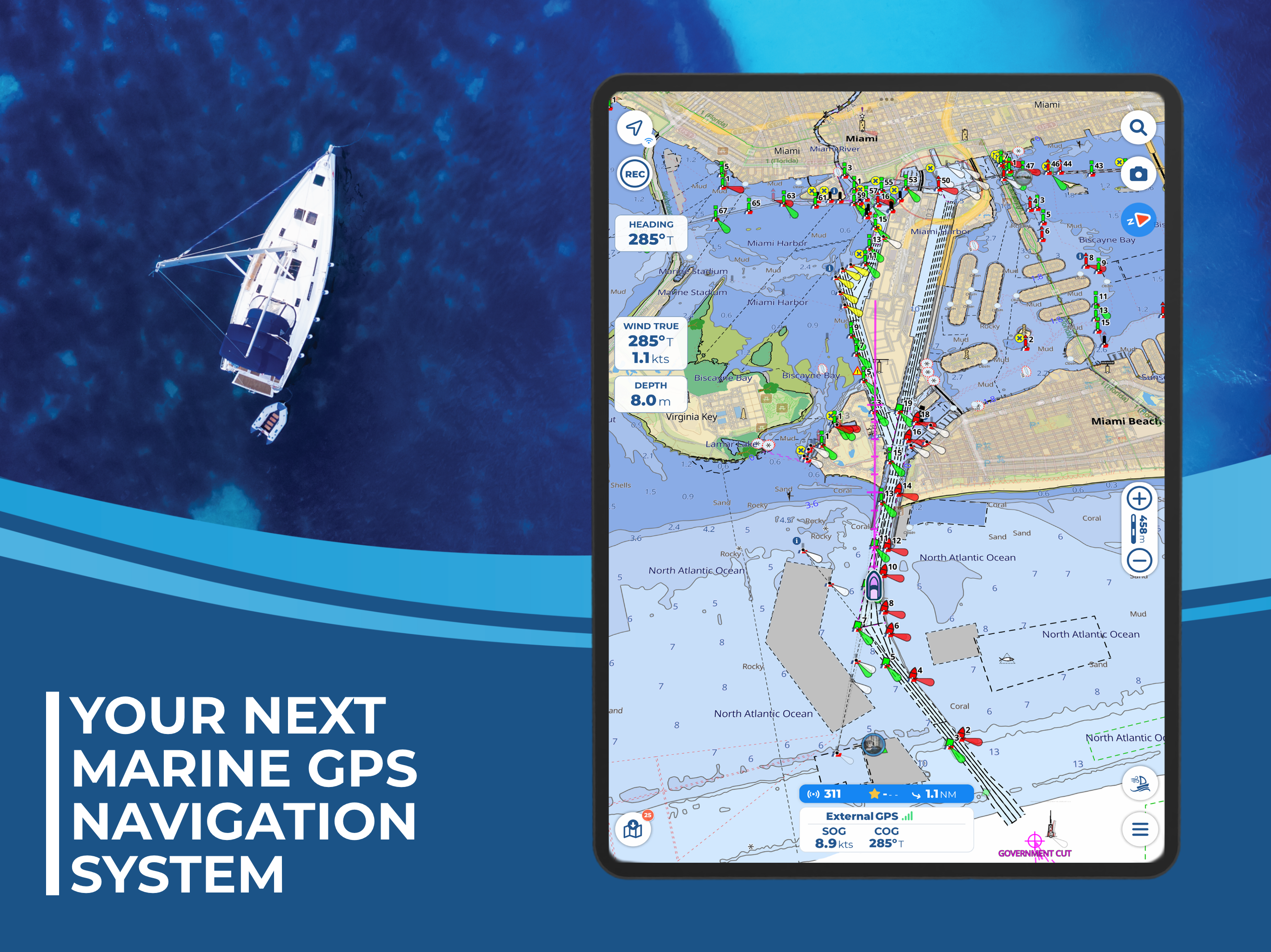
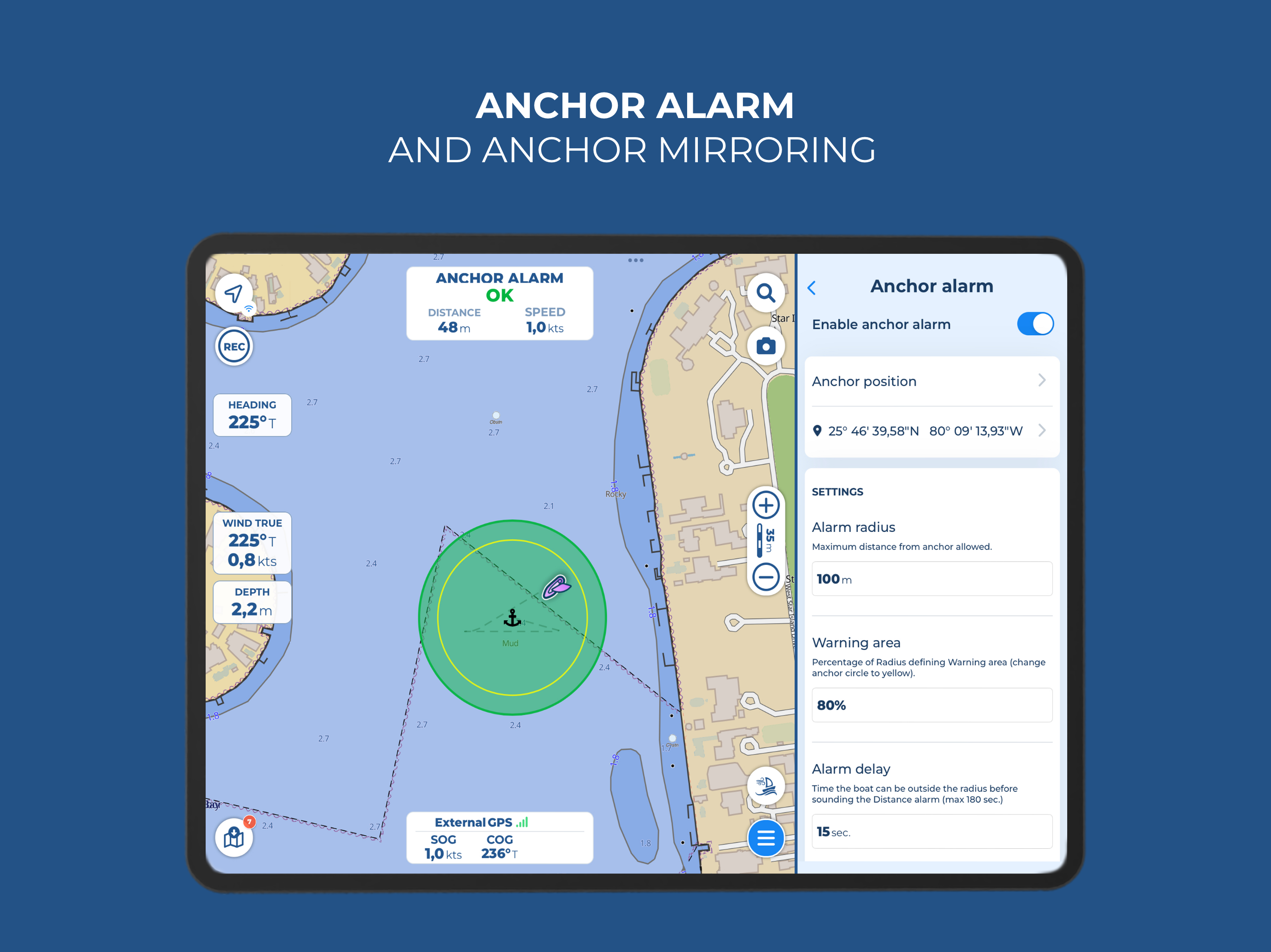
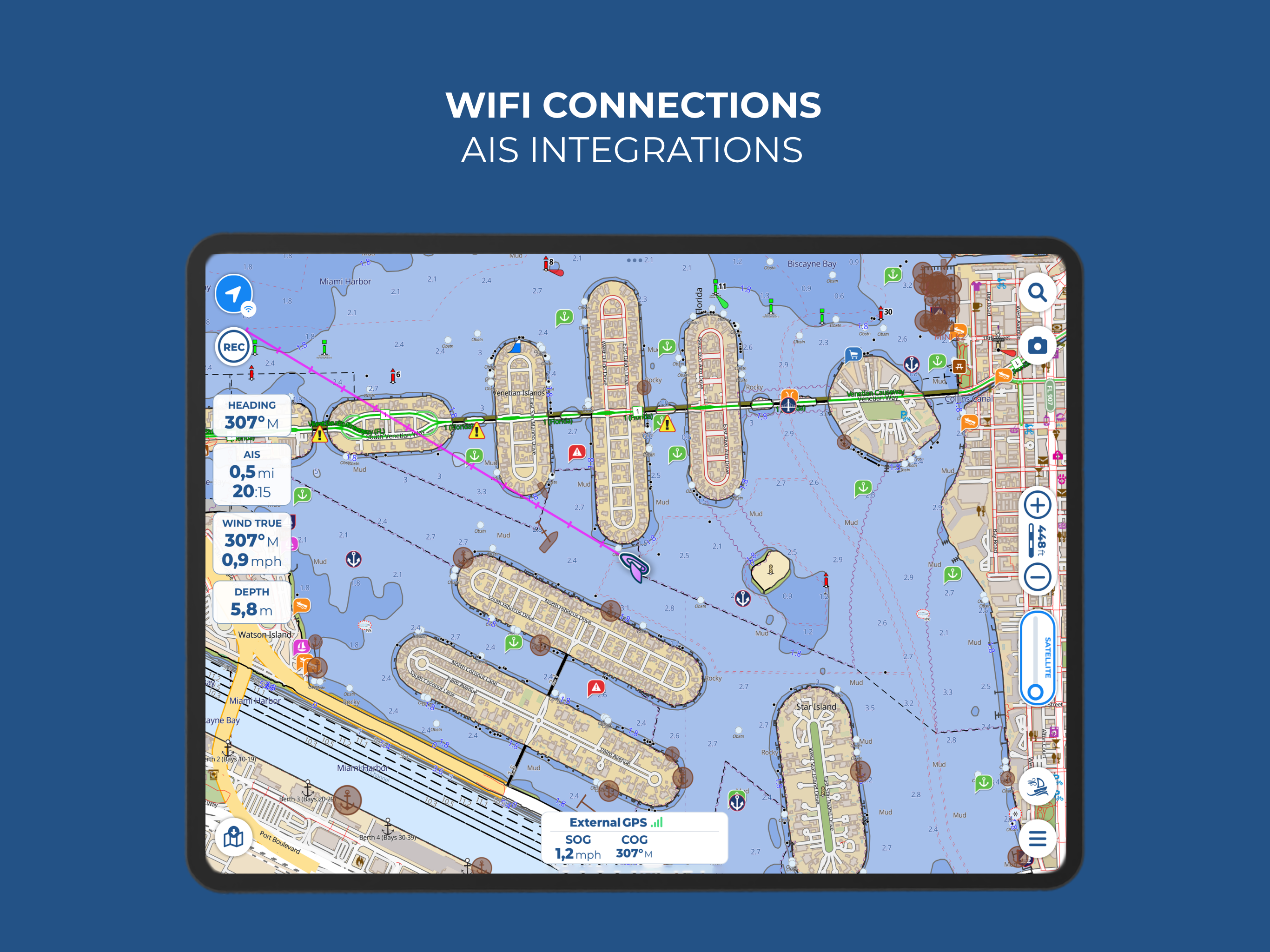
I have used all the other navigation software… Aqua Map is absolutely the easiest to use, the most clear and simple for navigating areas you are unfamiliar with. If you are transiting the ICW, you are literally being irresponsible if you don’t use Aqua Map with Bob423 Tracks and USACE data. The anchor alarm function is also outstanding.
Created an account and first the email verification page link would result in a page not found. Finally confirmed the account and the app won’t allow me to log in.
Love the app…graphics and content are great…I only wish it would auto route like Active Captain and Navionics.
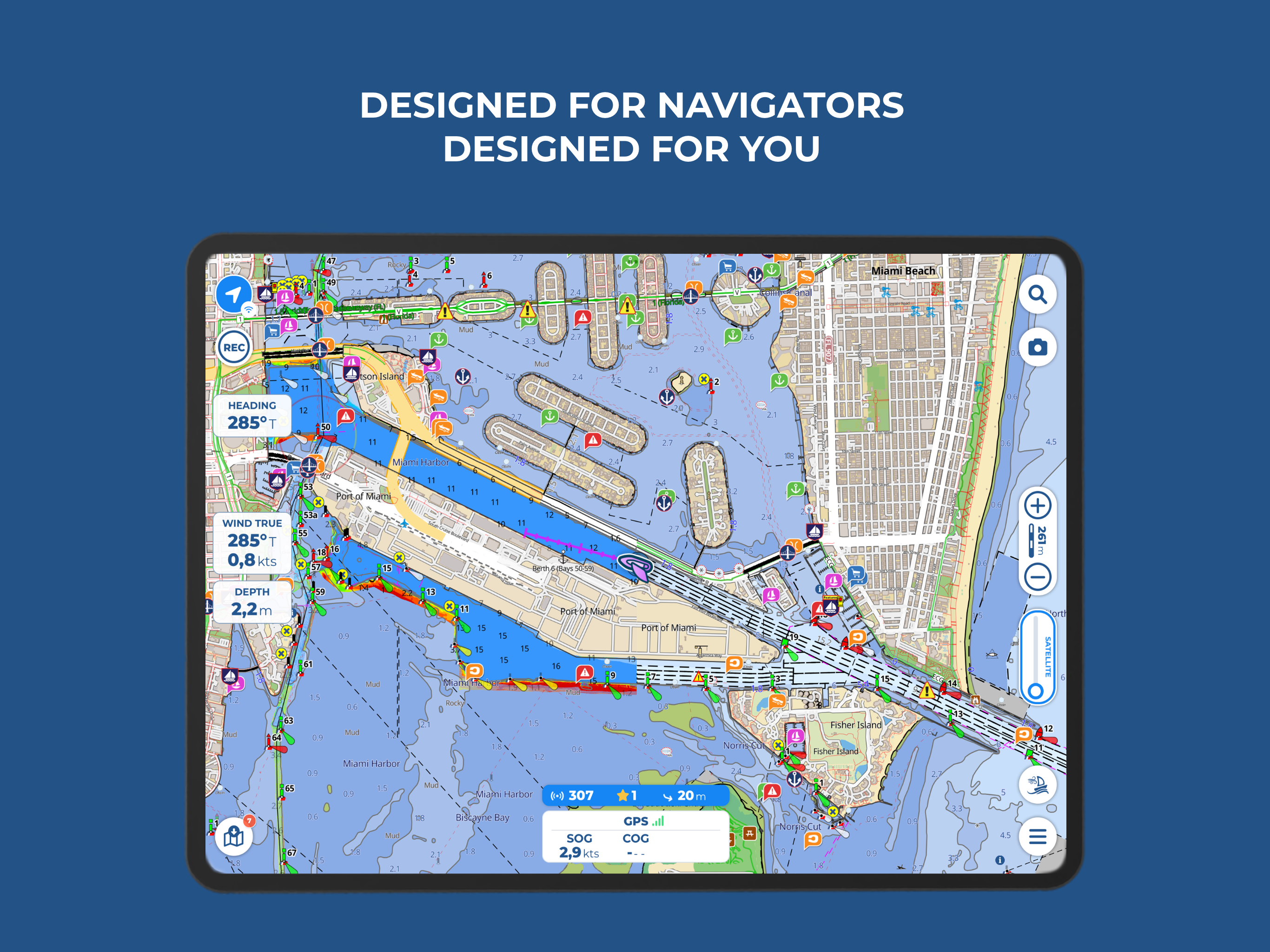
Professional Captain. I use this to plan and as a back up on vessels I move. Very accurate and useful. With ACOE soundings overlaid on charts, it’s the best way to navigate dangerous areas.
This does me no good
It’s not practical, I couldn’t setup a router.
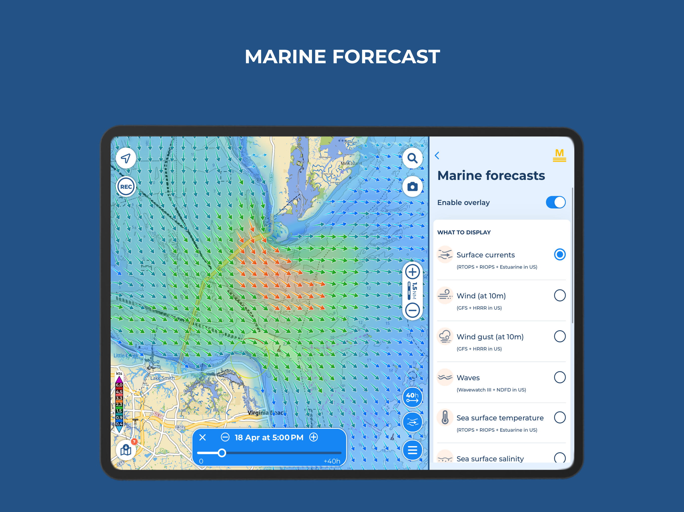
I use Aqua Map master version extensively for navigation and exploring. The available overlays include the Waterway Guide and Active Captain suggested anchorages, and also the most recent Army Corps of Engineers depth survey info (overlaid on the charts), which is of HUGE help when navigating the Intracoastal Waterway and nearby inlets.
|
Рейтинг
|
Категория
|
Позиция
|
|---|---|---|
|
Топ по доходу
|

|
30
|
|
Топ по доходу
|

|
43
|
|
Топ по доходу
|

|
49
|
|
Топ по доходу
|

|
53
|
|
Топ по доходу
|

|
59
|

