Описание
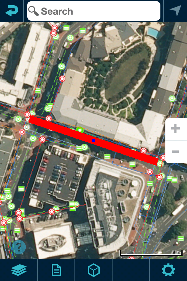
Augview is an augmented reality application that enables the user to display and visualize infrastructure asset data. It has been developed for field service personnel who require online access to a variety of GIS and asset management systems via the internet. Augview provides traditional GIS map views of the asset data plus an augmented reality mode that displays 3D objects of the networks overlaid over the video stream.
Features
* 2D map
* 3D augmented reality mode
* Combines multiple GIS data sets into one map (Data access is based on pre-arranged permission)
* Supports ESRI Rest API: MapServer, FeatureServer, ImageServer
* Supports Smallworld: GSS
* Supports OGC services: WMS, WMTS, WFS, WCS
* Integrates Digital Elevation Models with ArcGIS ImageServer or OGC WCS
* Database interrogation
* "Live" attribute and spatial updates (requires “write” permission from the data administrator)
* Photo capture with geotagging and association with an asset
Скрыть
Показать больше...
Features
* 2D map
* 3D augmented reality mode
* Combines multiple GIS data sets into one map (Data access is based on pre-arranged permission)
* Supports ESRI Rest API: MapServer, FeatureServer, ImageServer
* Supports Smallworld: GSS
* Supports OGC services: WMS, WMTS, WFS, WCS
* Integrates Digital Elevation Models with ArcGIS ImageServer or OGC WCS
* Database interrogation
* "Live" attribute and spatial updates (requires “write” permission from the data administrator)
* Photo capture with geotagging and association with an asset
Скриншоты
Augview Частые Вопросы
-
Приложение Augview бесплатное?
Да, Augview полностью бесплатное и не содержит встроенных покупок или подписок.
-
Является ли Augview фейковым или мошенническим?
Недостаточно отзывов для надежной оценки. Приложению нужно больше отзывов пользователей.
Спасибо за ваш голос -
Сколько стоит Augview?
Приложение Augview бесплатное.
-
Сколько зарабатывает Augview?
Чтобы получить оценку дохода приложения Augview и другие данные AppStore, вы можете зарегистрироваться на платформе мобильной аналитики AppTail.

Оценки пользователей
Приложение еще не оценено в Португалия.

История оценок
Augview Отзывы Пользователей
Нет отзывов в Португалия
Приложение пока не имеет отзывов в Португалия.
Оценки

История позиций в топах
История рейтингов пока не доступна

Позиции в категории
Приложение еще не было в топах
Augview Конкуренты
| Name | Скачивания (30d) | Ежемесячный доход | Отзывы | Оценки | Последнее обновление | |
|---|---|---|---|---|---|---|
|
vGIS AR
Augmented reality for GIS
|
Открыть
|
Открыть
|
0
|
|
2 недели назад | |
|
The Argis® Lens
Augmented Reality for GIS
|
Открыть
|
Открыть
|
0
|
|
1 год назад | |
|
Trek2There
|
Открыть
|
Открыть
|
0
|
|
3 года назад | |
|
HoloCapture for HoloLens
|
Открыть
|
Открыть
|
0
|
|
1 год назад | |
|
vGIS HoloLens Bridge
Bridge for Hololens
|
Открыть
|
Открыть
|
0
|
|
1 год назад | |
|
EasyAsset Mobile
|
Открыть
|
Открыть
|
0
|
|
2 недели назад | |
|
HiperGIS
Your GIS powered by Hiperweb
|
Открыть
|
Открыть
|
0
|
|
1 год назад | |
|
Mobile Asset Management
|
Открыть
|
Открыть
|
0
|
|
6 месяцев назад | |
|
MiniCarta
Simple mapping for groups
|
Открыть
|
Открыть
|
0
|
|
2 года назад | |
|
Surveya
automate your surveys
|
Открыть
|
Открыть
|
0
|
|
1 год назад |
Augview Установки
30дн.Augview Доход
30дн.Augview Доходы и Загрузки
Получите ценные инсайты о производительности Augview с помощью нашей аналитики.
Зарегистрируйтесь сейчас, чтобы получить доступ к статистика загрузок и доходов и многому другому.
Зарегистрируйтесь сейчас, чтобы получить доступ к статистика загрузок и доходов и многому другому.
Информация о приложении
- Категория
- Productivity
- Разработчик
- Augview
- Языки
- English
- Последнее обновление
- 3.8.8 (4 дня назад )
- Выпущено
- Oct 8, 2014 (10 лет назад )
- Также доступно в
- Новая Зеландия, Германия, Греция, Великобритания, Филиппины, Пакистан, Перу, Норвегия, Нидерланды, Нигерия, Малайзия, Мексика, Ливан, Казахстан, Кувейт, Республика Корея, Япония, Индия, Польша, Португалия, Румыния, Россия, Саудовская Аравия, Швеция, Сингапур, Таиланд, Турция, Тайвань, Украина, Соединенные Штаты, Вьетнам, Южно-Африканская Республика, Дания, Аргентина, Австрия, Австралия, Азербайджан, Бельгия, Болгария, Бразилия, Беларусь, Канада, Швейцария, Китай, Колумбия, Чехия, Италия, Доминиканская Республика, Алжир, Эквадор, Египет, Испания, Финляндия, Франция, Гонконг (САР), Венгрия, Индонезия, Ирландия, Израиль, ОАЭ
- Обновлено
- 1 месяц назад
AppTail.


