NAUTICAL CHART SYMBOLS & ABBREVIATIONS

Essential reference

Разработчик: The Other Hat
Скачивания
Доход

Описание

SYMBOLS USED ON NAUTICAL CHARTS SPECIFIED BY THE INTERNATIONAL HYDROGRAPHIC ORGANIZATION (IHO), PLUS INTERNATIONAL ABBREVIATIONS AND SUPPLEMENTARY NATIONAL SYMBOLS USED BY THE U.S. AND U.K. HYDROGRAPHIC OFFICES.
************ FEATURES and BENEFITS ************
- Perfect for reference, learning & revision
- Hi-res graphics
- Tap & Enlarge feature for greater detail
- Fully searchable index to all the symbols
- Always with you on your iPhone or iPad
- No internet connection needed
************ Plus FREE Bonus Content from "Safe Skipper" ************
"CHART SYMBOLS & ABBREVIATIONS" provides quick reference to the "INT 1" symbols specified by the International Hydrographic Organization (IHO) for use on International marine charts.
There are five main sections in this app, each with lettered sub-sections organized into categories to guide users through the hundreds of symbols. The main sections are:
GENERAL - chart layouts, positions, distances, directions and compass.
TOPOGRAPHY - landmarks, ports and coastal land features.
HYDROGRAPHY - tides, currents, depths, nature of the seabed, underwater obstructions, tracks, areas, limits and hydrographic terms.
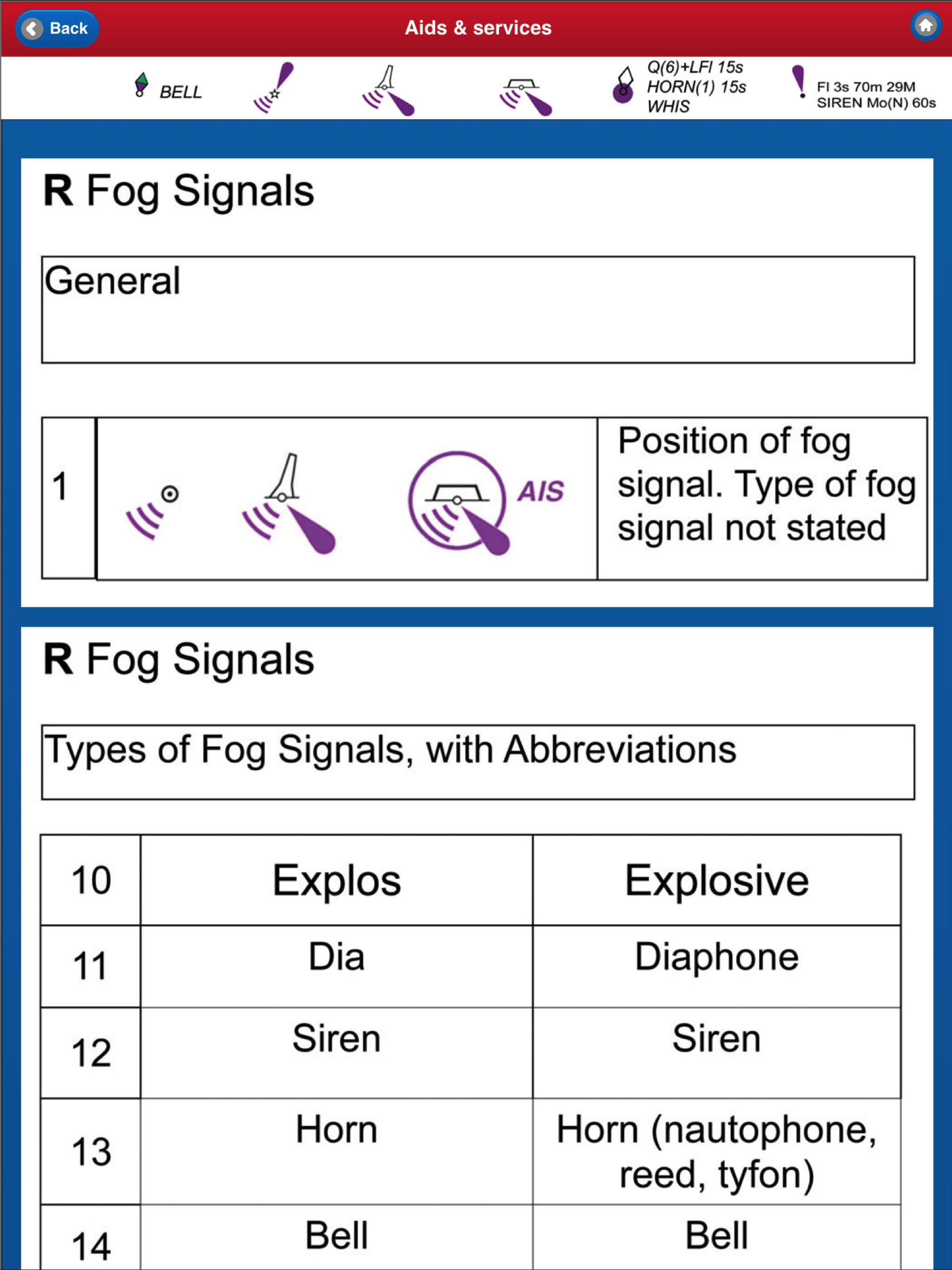
NAVIGATION AIDS & SERVICES - lights, buoys, fog signals, radar, radio, services and small craft facilities.
INDEX & ABBREVIATIONS - international abbreviations and index to symbols and abbreviations.
SUPPLEMENTARY NATIONAL SYMBOLS Supplementary National Symbols for nautical charts used by the United States and United Kingdom are included at the end of each section.
************* FREE Bonus Content from "Safe Skipper" *****************************
A bonus section has tips on how to deal with emergencies including: Abandon ship; Dismasting; Distress Signals; Engine Failure; Fire Fighting; Flares; Getting a tow; Helicopter rescue; Holed hull; Man overboard; Medical emergency; Mayday; Panpan; Securité.
INDEX The index is an A-Z of symbols and abbreviations and enables the user to quickly look up the symbols and see them in context with others in the same categories.
This app is based on the United Kingdom Hydrographic Office's print publication "Chart 5011 (INT 1) EDITION 2" Admiralty Charts Publication and "Chart No.1 United States of America Nautical Chart Symbols, Abbreviations and Terms".
NOTE: ECDIS symbols used to display Electronic Navigational Chart (ENC) data on Electronic Chart Display and Information Systems (ECDIS) as specified by the IHO are not included on this app.
We have an on-going program of marine navigation and boating safety apps, so please contact us with any ideas or features that you would like to see included.
Safe boating!
Скрыть Показать больше...

Скриншоты

NAUTICAL CHART SYMBOLS & ABBREVIATIONS Частые Вопросы

  • Приложение NAUTICAL CHART SYMBOLS & ABBREVIATIONS бесплатное?

    Да, NAUTICAL CHART SYMBOLS & ABBREVIATIONS полностью бесплатное и не содержит встроенных покупок или подписок.

  • Является ли NAUTICAL CHART SYMBOLS & ABBREVIATIONS фейковым или мошенническим?

    Недостаточно отзывов для надежной оценки. Приложению нужно больше отзывов пользователей.

    Спасибо за ваш голос

  • Сколько стоит NAUTICAL CHART SYMBOLS & ABBREVIATIONS?

    Приложение NAUTICAL CHART SYMBOLS & ABBREVIATIONS бесплатное.

  • Сколько зарабатывает NAUTICAL CHART SYMBOLS & ABBREVIATIONS?

    Чтобы получить оценку дохода приложения NAUTICAL CHART SYMBOLS & ABBREVIATIONS и другие данные AppStore, вы можете зарегистрироваться на платформе мобильной аналитики AppTail.

Оценки пользователей
Приложение еще не оценено в Испания.
История оценок

NAUTICAL CHART SYMBOLS & ABBREVIATIONS Отзывы Пользователей

Not impressed... Could be great, but needs work

GlennC650 on

Соединенные Штаты

Just downloaded this app, and while at first glance it looks really amazing, it has some serious flaws. First, it frequently crashes on my iPhone 7 running 11. For iOS, just updated two days ago. But what is more troubling, is that while on his App Store page he advertises “fully searchable”, I have yet to see where in hell a workable solution actually exists to do that. The index says it searchable, but hydrography symbols, for instance, cannot be searched in a way that takes you directly to its definition. Hope this app get some attention soon, as it has incredible potential! But for now, I would not waste your money.

Good for learning & quick reference

SunnyDazeX on

Соединенные Штаты

I like the way you can quickly search for a symbol, and that the images are tap to enlarge - helps my not too good eyes! The info itself is just what you want if you can’t remember what they all mean. Good for learning and referring to at the chart table and when passage planning.

Оценки

История позиций в топах
История рейтингов пока не доступна
Позиции в категории
Рейтинг
Категория
Позиция
Топ платных
48
Топ платных
50
Топ платных
72
Топ платных
72
Топ платных
96

NAUTICAL CHART SYMBOLS & ABBREVIATIONS Конкуренты

Name
StarPilot
TrackLink NauticEd
GPS Track Log for Sailors
Boat Beacon
AIS de navegación marina
Compass Eye Bearing Compass
Augmented Reality compass
EZ Celestial Navigation
ezAlmanacOne
SeaNav UK & Ireland
HD Marine Navigation & Charts
iSailGPS NZ : NZ Marine Charts
New Zealand RNC Marine Charts
SailTies: Logbook GPS Tracking
Sailing Resume, Qualifications
UK Ireland Nautical Charts HD
Same detail as a Chart plotter
Navathome.com
RYA Training Centre

NAUTICAL CHART SYMBOLS & ABBREVIATIONS Установки

30дн.

NAUTICAL CHART SYMBOLS & ABBREVIATIONS Доход

30дн.

NAUTICAL CHART SYMBOLS & ABBREVIATIONS Доходы и Загрузки

Получите ценные инсайты о производительности NAUTICAL CHART SYMBOLS & ABBREVIATIONS с помощью нашей аналитики.
Зарегистрируйтесь сейчас, чтобы получить доступ к статистика загрузок и доходов и многому другому.