Relief Maps - Skitour & hiking

Explore the mountains in 3D

Разработчик: Batiste Vonderweidt
Скачивания
Доход

Описание

Relief Maps is your ultimate guide to all your mountain adventures.
Whether you're hiking, skiing, trekking, paragliding or even mountaineering, our 3D map makes it easy to find your way.
See the USGS maps as you've never seen it before in 3D!

Hiking to an area with no internet connection? No problem! Our gps app offers offline maps so you can continue your navigation even without a network. You can download USGS maps and use them in offline mode, so you'll always be sure of your position and direction.

Hiking :
Find hikes nearby, our route catalog will help you find interesting trails all around you, whether you just want to go for a stroll or a sporty hike.
Our route planning system also lets you easily plot your own routes, then export them to GPX.

Mountaineering :
Consult camp-to-camp and skitour topos with GPS tracks and easily find the start of your dream route! From Mont Blanc to Aiguille Verte via the whymper couloir, climb every peak in the Alps!
Enjoy the best 3D visualization available on Chamonix and the French Alps.
Climbing:
Stop searching for hours for the start of a route! Find the start of a route with the GPX tracks available in the app.

Trek :
A trek lasting several days? You can plan your adventure easily with Relief Maps.
Find a list of points of interest that will help you, refuges, free parking lots, water points, toilets, campsites & bivouacs etc.
Find the best paths on our topo and IGN maps, and calculate the distance, altitude difference and duration of your route easily.
Whether you're trekking on the PCT or on the Appalachian Trail Relief Maps goes everywhere with you!

Ski touring :
Explore the mountains on skis with our ski touring tools.
Analyze the terrain with augmented reality or 3D slope maps.
Take advantage of detailed weather forecasts with snowfall, temperatures by altitude, etc.
Consult skitour and camp-to-camp topos all over France and Europe.
Enjoy the best 3D visualization available on Chamonix and the French Alps.

Paragliding :
Used by many Xalps athletes, the app offers you all the tools you need for paragliding:
- Precise paragliding weather, wind, thermals, etc.
- Map of the best-known thermals
- Glide ratio calculator
- Live tracking
- Track replay

Downhill skiing:
- Find the piste maps of major resorts such as Park City, Breckenridge, Jackson Hole and many others.

Free features :
- 3D map consultation
- Route planning
- Nearby routes
- Hiking, walking, mountaineering, climbing, ski touring, mountain skiing, walking and paragliding routes
- Points of interest (refuges, water points, free parking, etc.)
- Track recording
- GPX track replay
- Track synchronization with Suunto watch
- Augmented reality
- Glide calculation (paragliding)
Premium :
- Off-line maps
- Livetracking
- IGN map
- Weather forecasts
- Route saving/tracking
- Slope maps (for avalanche risk in ski touring)
- Winter map
- USGS Maps
- GPX import/export
Maps:
- USGS topo
- USGS satellite
- 3D terrain
- IGN free map
- IGN scan
- IGN satellite
- Avalanche slope
- Satellite
- Swisstopo
- Swisstopo satellite
- osm summer
- osm winter
--
Premium subscription : 29.99€/an
Terms of use: https://reliefmaps.io/terms.html
Privacy policy: https://reliefmaps.io/privacy.html
Скрыть Показать больше...

Встроенные покупки

Premium Yearly
$49.99
Premium Monthly
$1.29
Premium Lifetime
$39.99
Premium + IGN -30%
$26.99

Скриншоты

Relief Maps Частые Вопросы

  • Приложение Relief Maps бесплатное?

    Да, Relief Maps можно скачать бесплатно, однако в приложении есть встроенные покупки или подписки.

  • Является ли Relief Maps фейковым или мошенническим?

    🤔 Качество приложения Relief Maps спорное. Некоторые пользователи довольны, в то время как другие сообщают о проблемах. Рекомендуем ознакомиться с отдельными отзывами для получения более полной картины.

    Спасибо за ваш голос

  • Сколько стоит Relief Maps?

    Relief Maps имеет несколько покупок/подписок внутри приложения, средняя цена покупки составляет 29.57 $.

  • Сколько зарабатывает Relief Maps?

    Чтобы получить оценку дохода приложения Relief Maps и другие данные AppStore, вы можете зарегистрироваться на платформе мобильной аналитики AppTail.

Оценки пользователей

4.14 из 5

7 оценок в Канада

5 star
4
4 star
2
3 star
0
2 star
0
1 star
0
История оценок

Relief Maps Отзывы Пользователей

Mon avis

Moroges on

Франция

Cartes extrêmement détaillées et précises Design excellent Bravo !

Rapide pour programmer un itinéraire

thomasd74 on

Франция

Rapide et efficace pour planifier une sortie. Dommage que le GPS continue en arrière plan (consomme beaucoup de batterie) : il faut fermer l’application. Et dommage qu’on ne puisse pas ouvrir sur la carte IGN directement.

Timlyn

Bulli concept on

Франция

Super application mais… toutes les rubriques ou pictogrammes sont trop petites et quasi impossibles à lire en pleine activité !!

Perfect outdoors activities app

Polygolof on

Франция

Just the best one Works perfectly my iPhone

Mon application préférée

Mouchetteht on

Франция

Je l’utilise depuis un an. Je la trouvais top mais avec un petit bémol car le téléchargement des cartes pouvait planter. Mais depuis la nouvelle mise à jour c’est parfait. En plus le rajout des pourcentages de pentes c’est top pour le ski. Merci

App très prometteuse

Jiyuu42 on

Франция

Je viens de découvrir cette app et elle semble vraiment bien. Est-il nécessaire de reprendre un abonnement IGN pour ces cartes si on a déjà un abonnement existant ? Pour être parfaite, il manquerait quelques fonctionnalités, comme : - stats de km, d+, temps... (peut être avec la version premium ? Je me tâte à la prendre) - synchro directe avec les montres garmin - avoir la possibilité d’afficher des indicateurs tous les km, ou 2, 5... km sur une trace - fusion de trace - ... Quelques fonctionnalités qui me feraient quitter Relive (je n’utilise pas STRAVA 😁) Bravo au dev. C’est dans tous les cas du beau boulot.

???

Pacman#Chacha on

Франция

Cette appli est-elle payante

Génial

fabdelamontagne on

Франция

Super appli !

Pratique!

pierredawan on

Франция

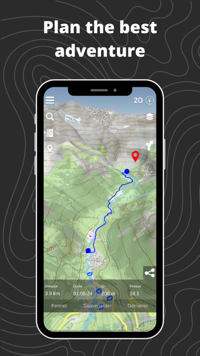
Ce qui me l’a fait préférer à d’autres applications :s’ouvre directement sur la carte, carte IGN 250000 avec sentiers de randonnées, possibilité de recherche un lieu, vue à plat et 3D pour mieux appréhender le relief...et son prix

Super Appli

Kitefoil Alpinefoil on

Франция

Bravo belle appli , le top serai que l’appli est un paramètre pour que le tel ne passe pas en veille pour de la pratique Vtt. Les applications Vtt ont généralement cette option

Оценки

История позиций в топах
Позиции в категории
Рейтинг
Категория
Позиция
Топ по доходу
15
Топ по доходу
21
Топ по доходу
22
Топ по доходу
29
Топ по доходу
51

Ключевые слова

Relief Maps Конкуренты

Name
Flyskyhy
Trail Connect
Connect your outdoor activity
AR AlpineGuide
Altimeter - GPS Altitude & Map
Check altitude, record hiking!
OpenRunner – Bike, hike, trail
Route planner & topo maps
White Risk
SLF Lawinen-App
SportsTrackLive: Action Sports
Real-time Tracking & 3D Replay
Syride
Connect your Sys'Nav XL!
Paragliding Map
Most popular free-flight app!
Paragliding Tracker: Wingman
Record, Log flight, Variometer

Relief Maps Установки

Last 30 days

Relief Maps Доход

Last 30 days

Relief Maps Доходы и Загрузки

Получите ценные инсайты о производительности Relief Maps с помощью нашей аналитики.
Зарегистрируйтесь сейчас, чтобы получить доступ к статистика загрузок и доходов и многому другому.

Информация о приложении