Описание
Roadbook Rally offers a new form of entertainment experience for those seeking rally-raid style adventure on two and four wheels.
This app has the ability to automatically generate a roadbook and uses an integrated rally computer to help users easily enjoy rallying.
To create a roadbook, simply specify the start and finish points and it will be created automatically.
Anytime, anywhere, alone or with friends. We hope you enjoy the rally.
supported language
This version only supports English and Japanese. Directions are not displayed in other languages.
In supported languages, it can be used worldwide in areas where the navigation function of Apple genuine maps is enabled.
(Navigation is not possible in Mongolia and some areas of Africa, etc.)
Function introduction
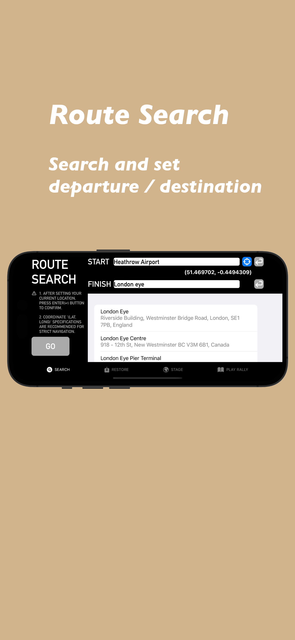
1. Route search
・Coordinate search
By entering the latitude and longitude, you can specify the exact origin and destination. Please copy and paste the coordinates from a map app, etc.
You can specify your current location as the departure point. After pressing the blue button, press the gray enter button to confirm your input.
・Landmark search
You can search for landmarks such as stations, parks, tourist spots, shops, etc. within the app. When you enter a string in the search box, candidates will appear, so please select from them.
Please note that since the registered coordinates of landmarks are used, there may be a difference from the intended location, such as the north/south exit of a station or a parking lot at a tourist spot.
2. Root restoration
You can recreate the route from your search history. History can be deleted individually or all at once.
3. Route display
Automatically creates the optimal route based on the information between the specified starting point and destination.
The route will be displayed as a yellow line on the map. Make sure the destination is in the intended location.
4. Play Rally
The app automatically generates a roadbook based on the route you created.
Users can check the generated roadbook and start the rally using the trip meter placed at the top of the screen.
The trip meter using GPS can be increased or decreased in 10m/100m increments, so if there is a discrepancy with the roadbook, it can be corrected.
You can also adjust the trip meter to the distance listed in the roadbook by long-pressing the total distance on the roadbook.
It also supports automatic scrolling of the roadbook according to the distance on the trip meter.
5. Save to Files
You can save the created route as a PDF.
The saved file can be printed and used as a traditional paper roadbook.
6. Other features
Simple user interface: The app provides an intuitive and easy-to-use interface that anyone can easily operate.
Supports background operation: If you need to perform operations such as making calls or responding to emails, please park in a safe place and operate. Distance measurement continues in the background.
Notes
Please drive according to the actual signs and traffic rules.
The developer is not responsible for any accidents or troubles that occur while using this application, or for any death, injury, or damage caused to third parties involved.
Securely fix the device you are using the app on in a visible position in front of the cockpit, always check your surroundings without staring at the screen while driving, and enjoy your ride with safety first.
Скрыть
Показать больше...


