SW Maps

GIS and Data Collector

Разработчик: Aviyaan Tech
Скачивания
Доход

Описание

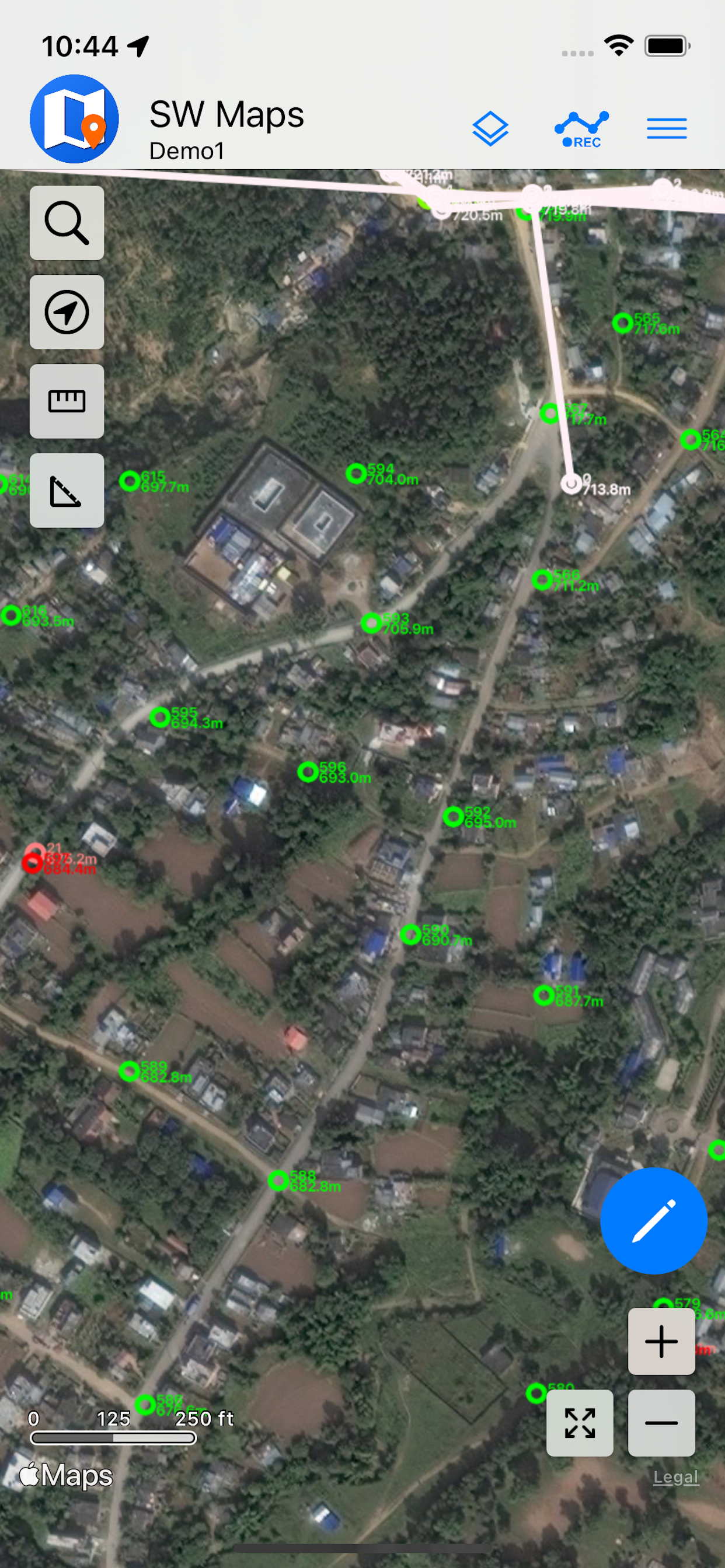
SW Maps is a free GIS and mobile mapping app for collecting, presenting and sharing geographic information.
Whether you are conducting a full scale GNSS survey with high precision instruments, need to collect large amount of location based data using nothing but your phone, or just need to view a few shapefiles with labels over a background map on the go, SW Maps has it all covered.
Record points, lines, polygons and even photos and have them displayed over your choice of background map, and attach custom attribute data to any feature. Attribute types include text, numbers, an option from a predefined set of choices, photos, audio clips and videos.
Conduct high accuracy GPS surveys using external RTK capable receivers over Bluetooth LE.
Draw features on the map by adding markers, and measure distance and area.
Reuse the layers and attributes of a previous project for another survey, or create templates and share them with other users.
Share the collected data with other users as Geopackages, KMZ or shapefiles, or export them to your device storage. Also share and export recorded data as Spreadsheets or CSV files.
All data is recorded and exported in the standard WGS84 Geographic coordinate system (EPSG:4326).
Features
-Online Base maps: Apple Maps or Open Street Map
-Support for multiple mbtiles and KML overlays
-Shapefile and Geopackage layers, with attribute categorized styling. View shapefiles in any coordinate system supported by the PROJ.4 library.
-Add multiple online WMTS, TMS, XYZ or WMS layers and cache tiles for offline use.
-Connect to external GPS receivers using Bluetooth for high accuracy surveying using RTK with built-in NTRIP client. Also record data from external receiver for post processing.
-Define multiple number of feature layers, each with a set of custom attributes
Feature Types: Point, Line, Polygon
Attribute Types:Text, Numeric, Drop down Options, Photos, Audio, Video
Save as Template for re-use or sharing
-Record GPS tracks, with distance measurement
-Label features based on attribute values.
-Import feature layers from templates or existing projects.
-Share or export collected data as KMZ (with embedded photographs) , shapefiles, GeoJSON, Geopackage (GPKG), XLS/ODS spreadsheets or csv files.
-Share templates or projects with other users
-Supports use of GTX geoid files. To use custom geoids, prepare a GTX file with offsets in meters from WGS84.
This product is made in Nepal and is FREE (no Ads). If you find this useful, please let your friends know that you have used a product from Nepal. Spare sometime to visit this wonderful country and know the Nepali people.
Скрыть Показать больше...

Скриншоты

SW Maps Частые Вопросы

  • Приложение SW Maps бесплатное?

    Да, SW Maps полностью бесплатное и не содержит встроенных покупок или подписок.

  • Является ли SW Maps фейковым или мошенническим?

    Недостаточно отзывов для надежной оценки. Приложению нужно больше отзывов пользователей.

    Спасибо за ваш голос

  • Сколько стоит SW Maps?

    Приложение SW Maps бесплатное.

  • Сколько зарабатывает SW Maps?

    Чтобы получить оценку дохода приложения SW Maps и другие данные AppStore, вы можете зарегистрироваться на платформе мобильной аналитики AppTail.

Оценки пользователей
Приложение еще не оценено в Беларусь.
История оценок

SW Maps Отзывы Пользователей

BLE sensor and NTRIP servers constantly disconnect

Patrick Kramer on

Соединенные Штаты

There really should be an auto reconnect mechanism for these, without this app is pretty useless.

Solid App but has its limits

Hockgodtom on

Соединенные Штаты

I intended to use this app to connect to my RTK receiver and collect data on my iPhone. Unfortunately it will not connect to the app!

Where is version 1.1.1?

Chuck.carla on

Соединенные Штаты

Great app, but version 1.1.1 with improved BLE GNSS support is not in App Store.l?!?

Bug Fix Required

JohirulBD on

Соединенные Штаты

The application has lots of bug, which need to be fix immediately. If I have more template, it’s doesn’t has scroll and we didn’t able to Ok that template. Area boundary also has some issue and when we show the level, it doesn’t show in the screen. This updates need to be improve as like android application. The android application is very smooth and user friendly. Which need to follow.

Works alright

saturnglide on

Соединенные Штаты

Works alright altho the NTRIP client doesn’t work for me unless I’m on wifi, which really limits what I can do with my RTK survey receiver.

The best gis for iOS

opinionsmayvery on

Соединенные Штаты

The best gis for iOS

Menus don’t work

AB in NV on

Соединенные Штаты

None of the side menus work, so I’m unable to connect it to an external device. Looks like the android version works a lot better.

Оценки

История позиций в топах
История рейтингов пока не доступна
Позиции в категории
Рейтинг
Категория
Позиция
Топ бесплатных
278
Топ бесплатных
382
Топ бесплатных
388

SW Maps Конкуренты

Name
FieldMove Clino
ArcGIS Field Maps
Locus Field Assets and Data
The way it should be
GIS Lite
Explore space
GIS4Mobile
Recording is rewarding
Mobile Data Collection
Collect using custom forms
QField for QGIS
Efficient field work for QGIS
ArcGIS Earth
GIC Collect
Compatible with ODK
Touch GIS
Advanced field data collection

SW Maps Доходы и Загрузки

Получите ценные инсайты о производительности SW Maps с помощью нашей аналитики.
Зарегистрируйтесь сейчас, чтобы получить доступ к статистика загрузок и доходов и многому другому.