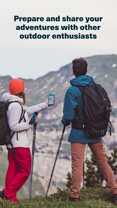
Appli nulle
Nul

Да, Whympr можно скачать бесплатно, однако в приложении есть встроенные покупки или подписки.
🤔 Качество приложения Whympr спорное. Некоторые пользователи довольны, в то время как другие сообщают о проблемах. Рекомендуем ознакомиться с отдельными отзывами для получения более полной картины.
Whympr имеет несколько покупок/подписок внутри приложения, средняя цена покупки составляет 23.39 $.
Чтобы получить оценку дохода приложения Whympr и другие данные AppStore, вы можете зарегистрироваться на платформе мобильной аналитики AppTail.

5 из 5
2 оценок в Канада
Nul
The content is many years out of date. You have to pay for the tracker (Strava gives it for free). You have to pay for the route builder (many apps give it for free). The maps and layers are very limited. There’s no reason not to go for Komoot, Outdoor X or Fatmap instead. Price the same and they’re ten times better.
Je suis déçue de cette application. Elle doit être connectée alors qu’il n’y a pas de réseau en montagne. Plusieurs fois je me suis retrouvée en train d’ enregistrer ou de suivre une trace et l’appli quitte inopinément au milieu, alors que je l’avais téléchargée hors ligne. Une fois même totalement déconnectée de mon compte et alors là sans réseau, impossible de se reconnecter. Du coup pas confiance, il faut avoir plusieurs backup, mais je ne peux pas m’y fier. Heureusement les développeurs sont réactifs a répondre aux mails, ils ont pu récupérer mes données perdues, mais je ne pense pas que les bugg ont étés corrigés. Point positifs : les fonds de cartes Norvégiens . Pour un séjours en Norvège j’ai pu bosser. Mais sur terrain pas confiance a la stabilité de l’appli. Heureusement qu’il y a du réseau partout la bas. Je ne renouvelle pas mon abonnement.
Dingue L inclinaisons en couleur est top pour préparer les rando. Merci
Deux étoiles pour: Ne pas valoriser un site qui voudrait faire aussi bien que des sites internet gratuits Ne pas prendre pour des pigeons les utilisateurs. Je m’explique : l’intérêt de ce site voudrait qu’il soit participatif car ce serait bien sûr la qualité d’Iphigénie et des cartes irremplaçables IGN augmenté des traces et des avis en temps réel des meilleures courses à faire en fonction des conditions météo et de la neige. Ce qui signifierait que les randonneurs non contents d’enrichir gratuitement la base de données de Whympr se feraient en plus plumer par un abonnement hors norme. Désolé pour les développeurs: ce n’est pas l’esprit montagne, mais bon courage sauf à changer l’orientation commerciale du logiciel avec par exemple, un encouragement participatif gratuit…!
Impossible d’ouvrir l’application 3 messages d’erreurs et des ressources non disponibles File get content Authkey No such file or directory Application pas terminée Développeurs amateurs
Tres bon travail dont le résultat est très incitatif
Pas encore testé mais infos sur les fonctionnalités bien indiquées. En attente de mise en pratique
Site prévu en grande partie pour l’escalade et le ski Très peu de randonnées répertoriées
Tout est dans le titre
|
Рейтинг
|
Категория
|
Позиция
|
|---|---|---|
|
Топ бесплатных
|

|
313
|
|
Топ бесплатных
|

|
352
|
| Name | Скачивания (30d) | Ежемесячный доход | Отзывы | Оценки | Последнее обновление | |
|---|---|---|---|---|---|---|

Paradiski YUGE
Your Paradiski partner
|
Открыть
|
Открыть
|
1
|
|
1 день назад | |

N'PY
Pyrenean skiing leading brand
|
Открыть
|
Открыть
|
0
|
|
2 месяца назад | |

Trail Connect
Connect your outdoor activity
|
Открыть
|
Открыть
|
0
|
|
4 месяца назад | |

OpenRunner – Bike, hike, trail
Route planner & topo maps
|
Открыть
|
Открыть
|
1
|
|
3 недели назад | |

White Risk
SLF Lawinen-App
|
Открыть
|
Открыть
|
0
|
|
10 месяцев назад | |
Patrouille des Glaciers – PdG
Map, teams, rankings and news
|
Открыть
|
Открыть
|
0
|
|
7 месяцев назад | |

Relief Maps - Skitour & hiking
Explore the mountains in 3D
|
Открыть
|
Открыть
|
0
|
2
|
1 день назад | |

Rock Climbing Guide | 27 Crags
Climbing Topo, Map and Photos
|
Открыть
|
Открыть
|
0
|
|
3 месяца назад | |

Rockfax Climbing Guidebooks
Worldwide Climbing Information
|
Открыть
|
Открыть
|
2
|
|
2 месяца назад | |

Topo Guru
Smart climbing guide app
|
Открыть
|
Открыть
|
0
|
|
11 месяцев назад |
