
3D GIS Digital Elevation Model
Real-World Data Digital Model
#1 Keyword Rankings
Today
Top 10 Rankings
Today
Top 30 Rankings
Today
Top 100 Rankings
Today
Description
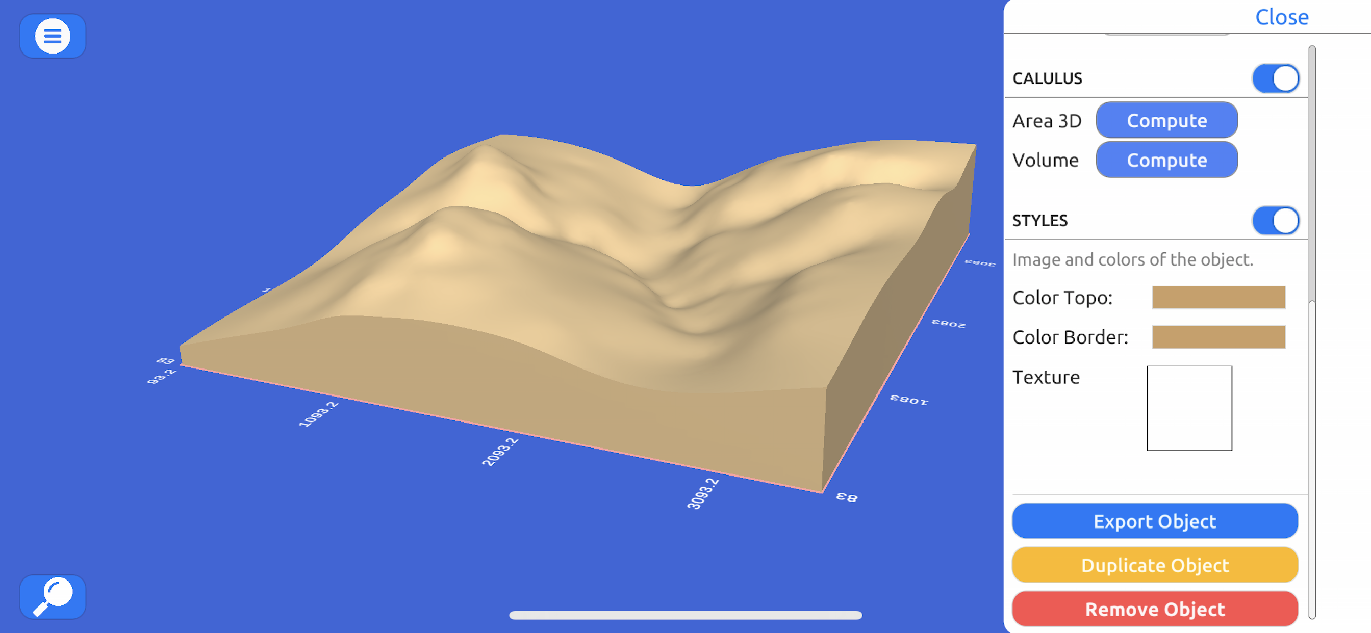
Quickly generate 3D models:
Directly from the internet; Bing Maps, Mapbox, and ArcGIS or from a cloud point stored locally.
Export real data:
From point cloud data in CSV or TXT to 3D models in STL or OBJ and satellite images.
Operate:
Cut, re-scale, and animate models for representation, analysis, and calculations.
Compute operations:
Calculate surface areas and volumes of a model in real-world units with little difference compared to ArcGIS.
Explore:
Character controller geo positioned in real-world coordinate systems such as UTM and Geographic Coordinate System.
Hide..
Show more..
Directly from the internet; Bing Maps, Mapbox, and ArcGIS or from a cloud point stored locally.
Export real data:
From point cloud data in CSV or TXT to 3D models in STL or OBJ and satellite images.
Operate:
Cut, re-scale, and animate models for representation, analysis, and calculations.
Compute operations:
Calculate surface areas and volumes of a model in real-world units with little difference compared to ArcGIS.
Explore:
Character controller geo positioned in real-world coordinate systems such as UTM and Geographic Coordinate System.
Screenshots


 User Rating
0 out of 5
0 ratings in Greece
Ratings History
Reviews
App doesn't have any reviews yet
Store Rankings
Ranking History
App Ranking History not available yet
Category Rankings
App is not ranked yet
Keywords
Revenue and Downloads
Gain valuable insights into 3D GIS Modelo Digital Terreno performance with our analytics. Sign up now
to
access downloads, revenue, and more.
App Info
- Category
- Navigation
- Publisher
- Andres Narvaez
- Languages
- English
- Recent version
- 1.1 (2 years ago )
- Released on
- Jun 15, 2021 (3 years ago )
- Also available in
- Ecuador, Peru, United Arab Emirates, Hungary, Indonesia, Israel, Japan, South Korea, Lebanon, Mexico, Netherlands, Norway, New Zealand, Philippines, Portugal, Russia, Saudi Arabia, Sweden, Singapore, Thailand, Taiwan, Ukraine, South Africa, Colombia, Argentina, Austria, Australia, Azerbaijan, Belgium, Brazil, Belarus, China, Denmark, Dominican Republic, Egypt, Spain, Finland, France, Greece, Germany, Czechia, Hong Kong, Poland, Chile, Nigeria, Algeria, Vietnam
- Last updated
- 1 month ago