Description
Detailed and easy-to-use offline maps. We have millions of points of interest (POI) on our maps. Record your GPS tracks and bookmark your favorite locations.
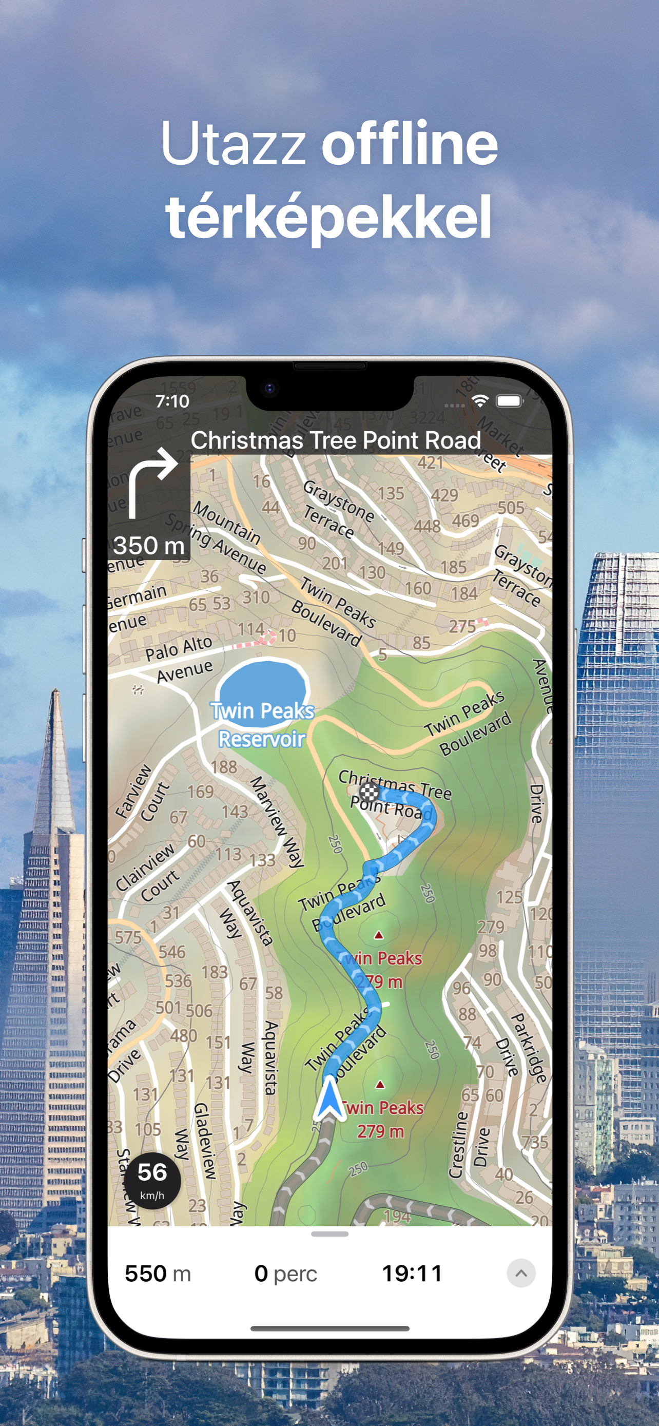
OFFLINE MAPS
• Amazingly-detailed maps covering the entire world.
• Based on open data from OpenStreetMap project.
• Download once, then use offline without restriction.
• Maps updated monthly with most-recent fixes and additions.
OFFLINE NAVIGATION
• Turn-by-turn driving directions.
• Voice instructions while navigating available in 9 languages.
• Routes for Driving/Cycling/Walking/Shortest Distance.
• Automatic rerouting gets you back along your way.
• Supports intermediate points on your itinerary.
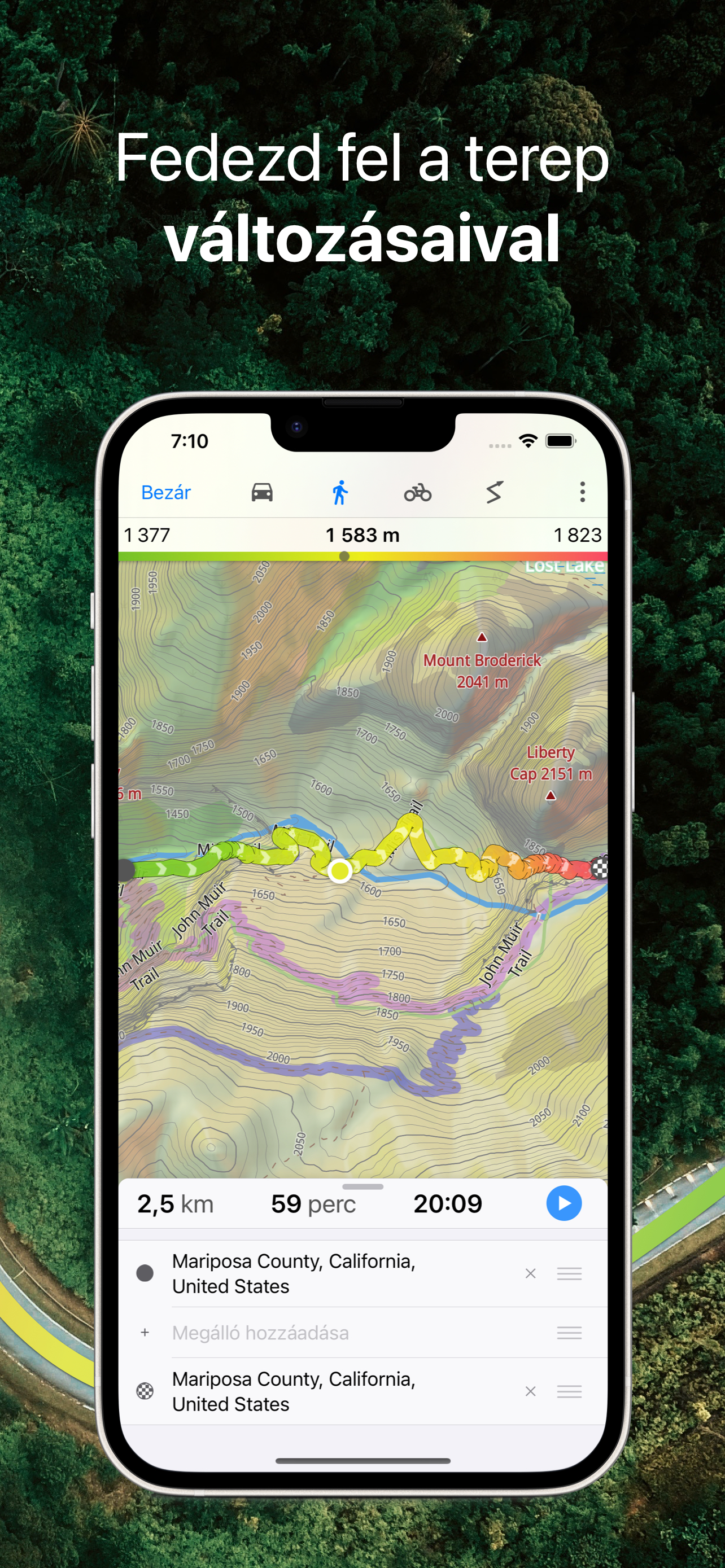
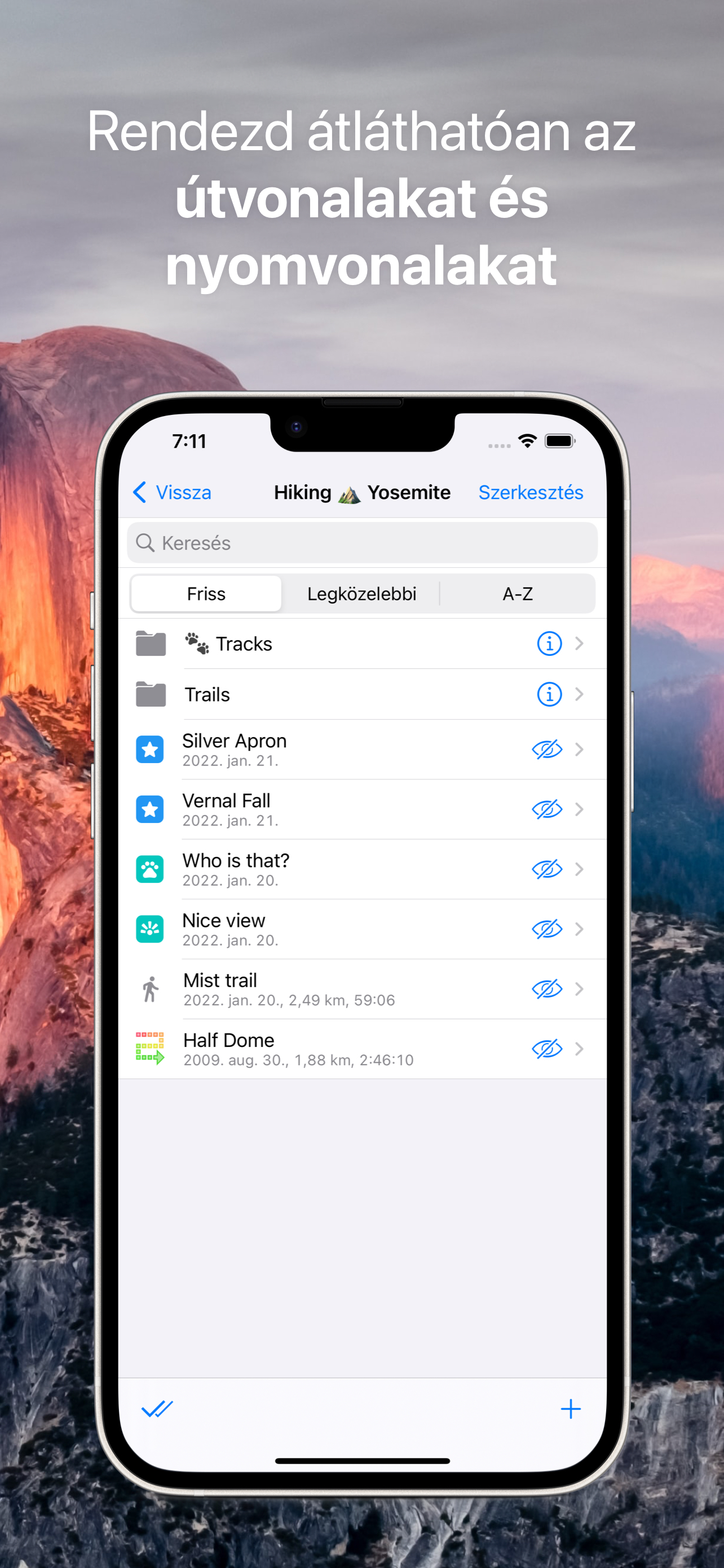
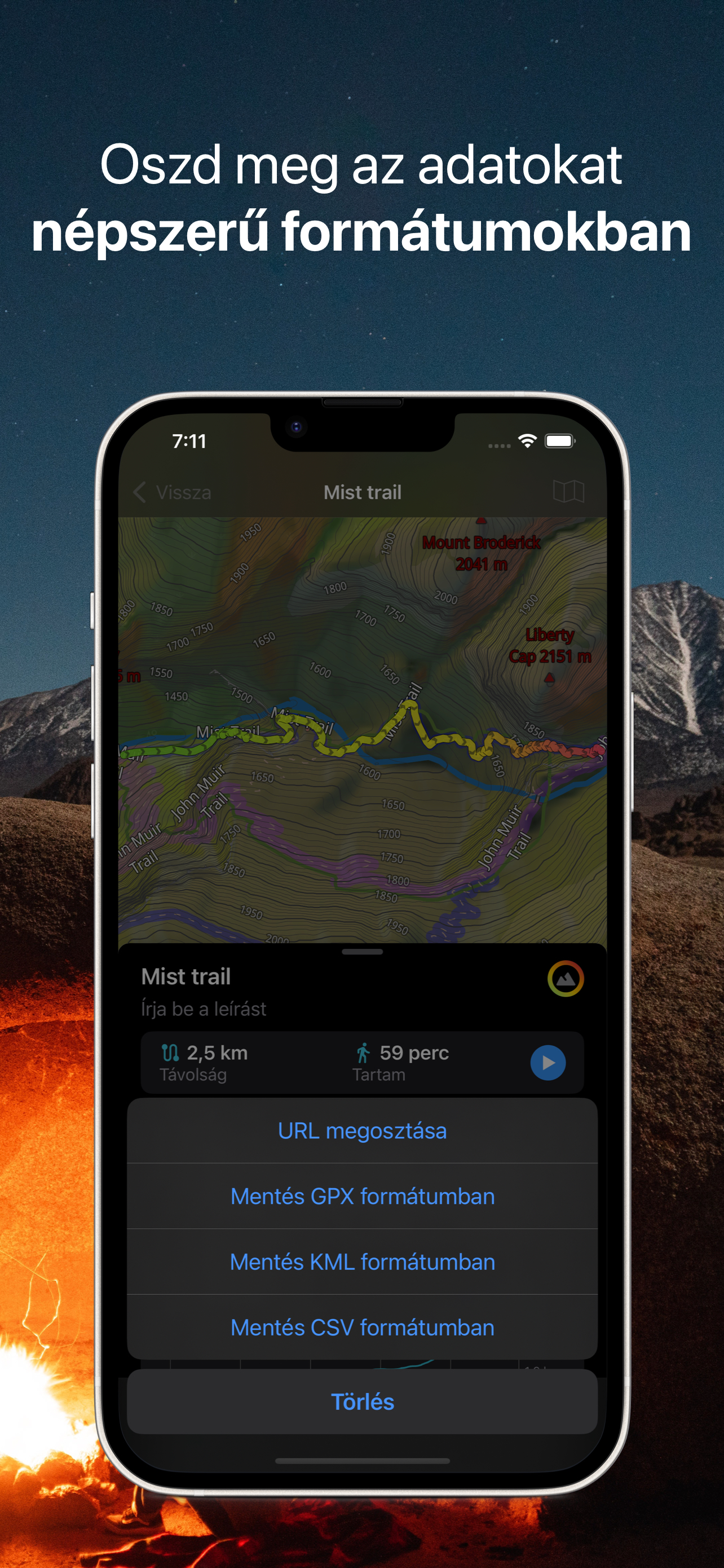
GPS TRACKS
• Record your trips even when the app is in the background.
• Monitor your real-time speed, distance, and time traveled, as well as altitude right on the map during the trip.
• Choose from seven solid track colors, or altitude and speed gradients.
OFFLINE SEARCH
• Incredibly fast – results appear instantly as you type.
• Search in a variety of ways – by address, object name, category, or even by GPS coordinates.
• Searches simultaneously in multiple languages, making searching easier than ever.
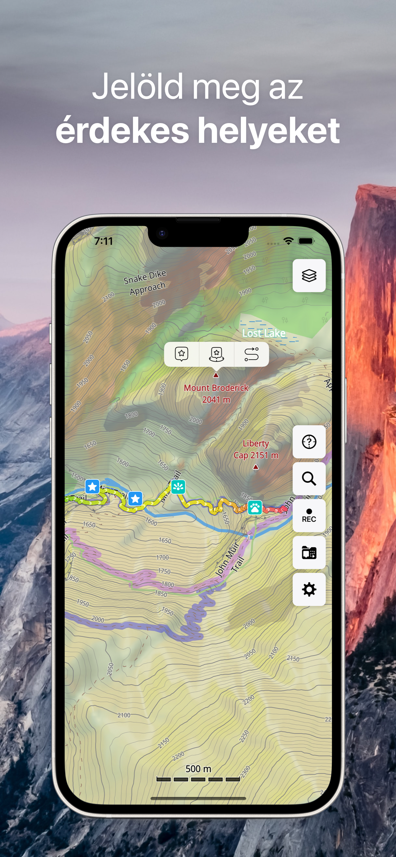
BOOKMARKS
• Save favorite places on your map.
• Choose from a variety of map icons.
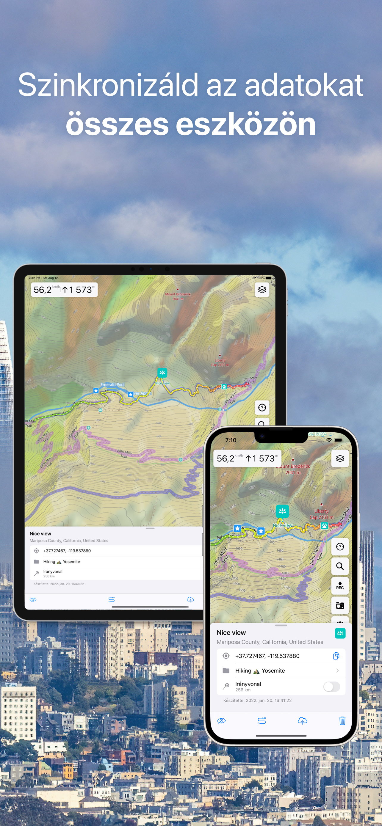
SYNCHRONIZATION [Pro]
• Sync your data across multiple devices.
• Data saved on a server as a backup.
OFFLINE MAP FILES SUPPORT [Pro]
• MBTiles (.mbtiles)
• SQLite (.sqlitedb)
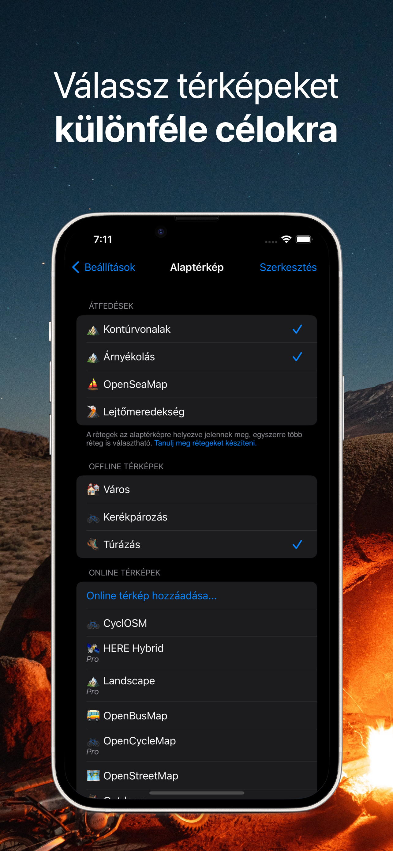
ONLINE MAP SOURCES from thunderforest.com [Pro]:
OpenCycleMap, Outdoors, Transport, Transport Dark, Landscape, Mobile Atlas, Neighbourhood.
IMPORT AND EXPORT
• It's easy to export your tracks, bookmarks, or your whole travel collection as a KML or GPX file.
• Organized into collections for easy access.
SMALL FEATURES
• .GeoJSON format is supported to display map overlays.
• One-finger zooming.
• Trip computer with speed and altitude.
• Tracking mode.
• Coordinates and scale.
• Customize what objects are visible.
• 11 different map languages to choose from.
• Adjustable label size – large labels on maps are extremely useful while driving.
PRO SUBSCRIPTION
Without subscription it's possible to create up to 15 bookmarks, record up to 15 tracks and have only 3 vector maps downloaded on your device.
Subscription allows you to create unlimited bookmarks and record unlimited GPS tracks, download unlimited maps, sync between devices, use Pro map sources and import offline raster maps in sqlitedb/mbtiles format.
Guru Maps offers two payment options (prices may vary by location):
• monthly/yearly subscription (with 7-day trial version),
• one-time purchase for the lifetime license.
For those who paid for any in-app purchase earlier, a lifetime subscription is activated automatically.
Should you choose to upgrade to a Pro subscription, payment will be charged to your iTunes account at confirmation of purchase. Subscription automatically renews unless auto-renew is turned off at least 24-hours before the end of the current period. Account will be charged for renewal within 24-hours prior to the end of the current period.
You may cancel automatic renewal and manage your subscription by selecting Manage App Subscriptions in your iTunes Account settings and selecting the subscription you want to modify. Any unused portion of a free trial period, if offered, will be forfeited when you purchase a Premium subscription, where applicable.
Terms of Service and Privacy Policy: https://gurumaps.app/terms_of_service
Continued use of GPS running in the background can dramatically decrease battery life.
Hide
Show More...