Description
Detailed and easy-to-use offline maps. We have millions of points of interest (POI) on our maps. Record your GPS tracks and bookmark your favorite locations.
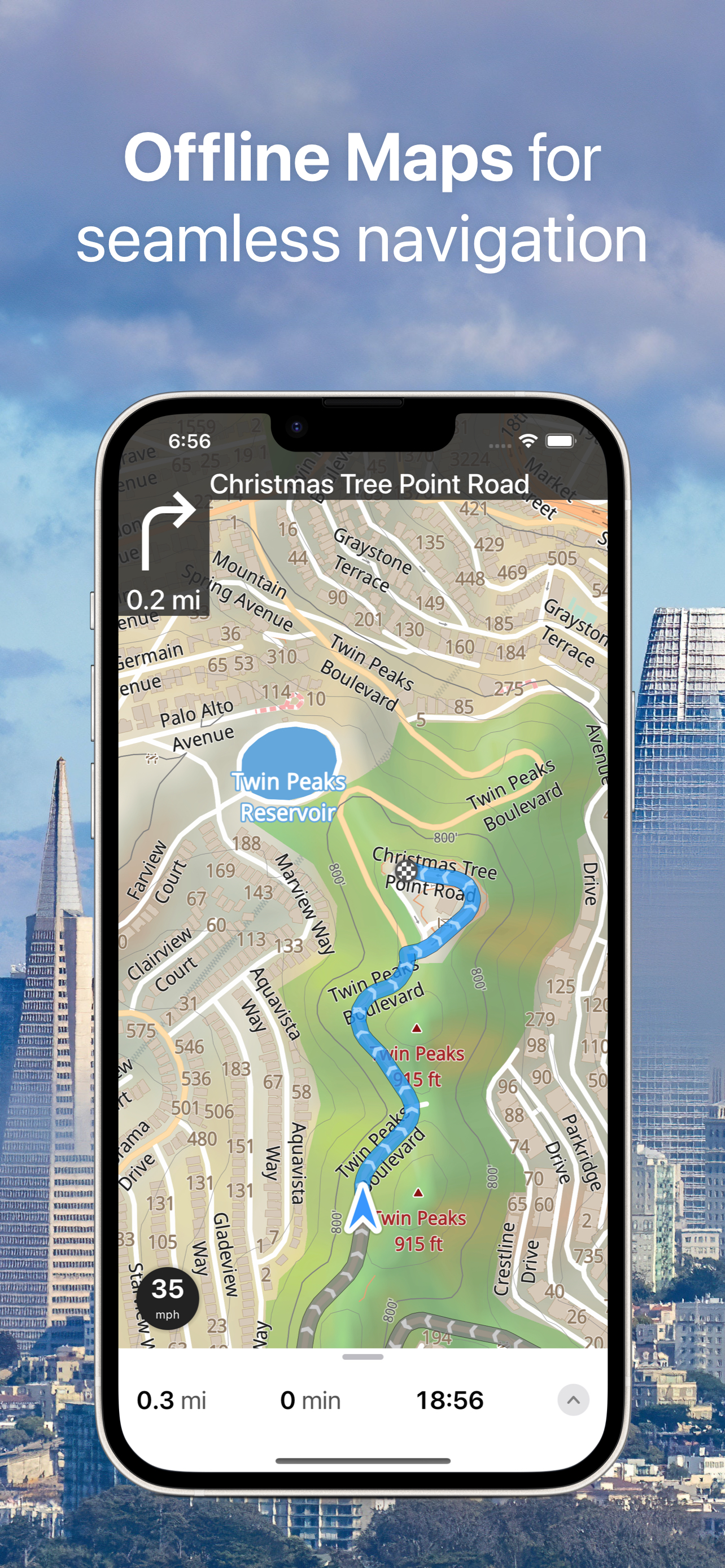
OFFLINE MAPS
• Explore every corner of the globe with our amazingly-detailed offline maps, ensuring you're never lost, even without an internet connection.
• Powered by open data from the OpenStreetMap project, offering rich, community-driven map content.
• Download your maps once and use them offline indefinitely – perfect for travel in areas with limited or no connectivity.
• Stay up-to-date with monthly map updates, providing the latest fixes and new points of interest.
OFFLINE NAVIGATION
• Never miss a turn with clear, turn-by-turn driving directions.
• Navigate with ease using voice instructions, available in 9 languages.
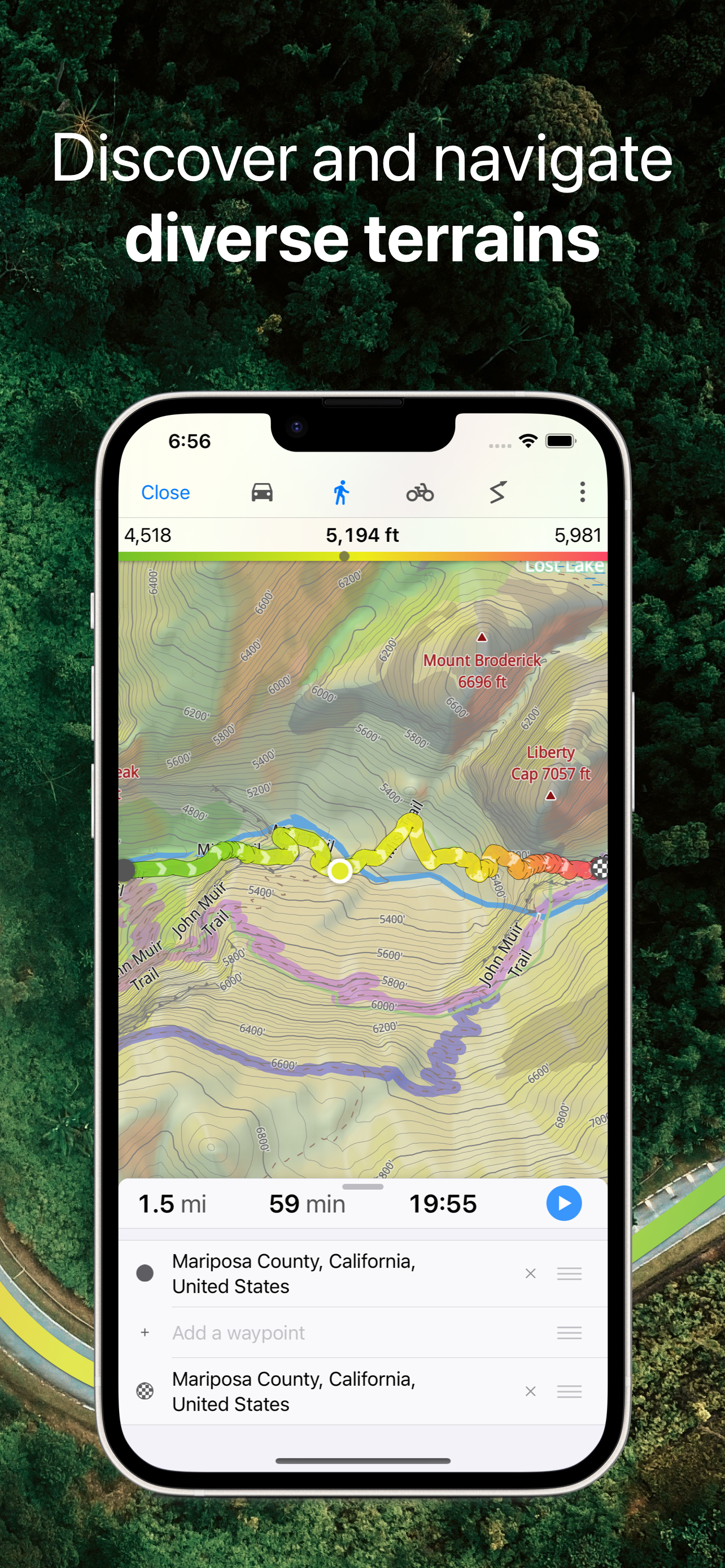
• Choose the perfect route for your journey: Driving, Cycling, Walking, Trucking, Motorcycling, or the Shortest Distance.
• Get back on track quickly with automatic rerouting if you take a wrong turn.
• Plan complex trips effortlessly with support for intermediate waypoints.
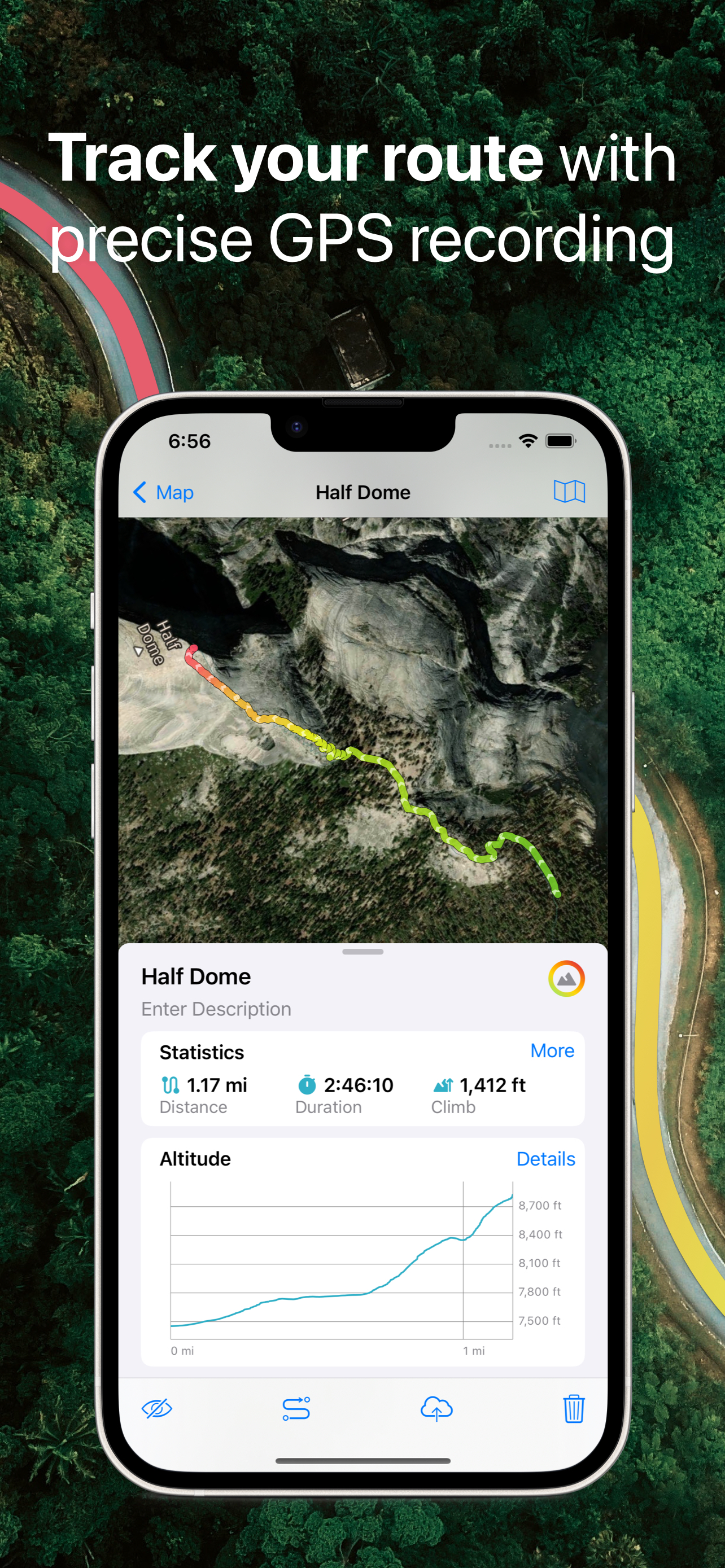
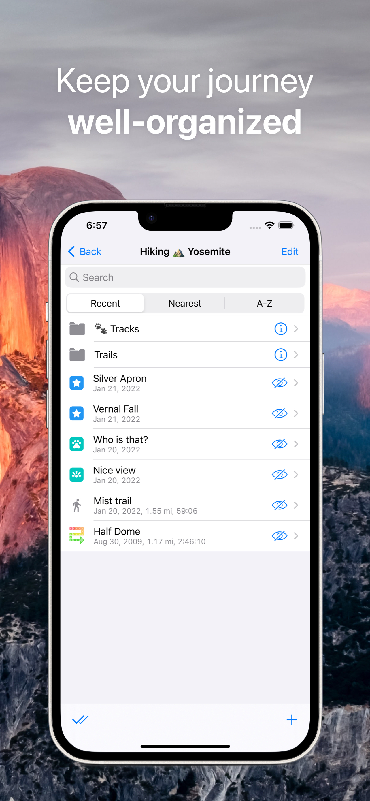
GPS TRACKS
• Record your adventures, hikes, and road trips, even when the app is running in the background.
• Monitor your real-time speed, distance, time, and altitude directly on the map during your trip.
• Personalize your track appearance with seven solid color options, or dynamic altitude and speed gradients.
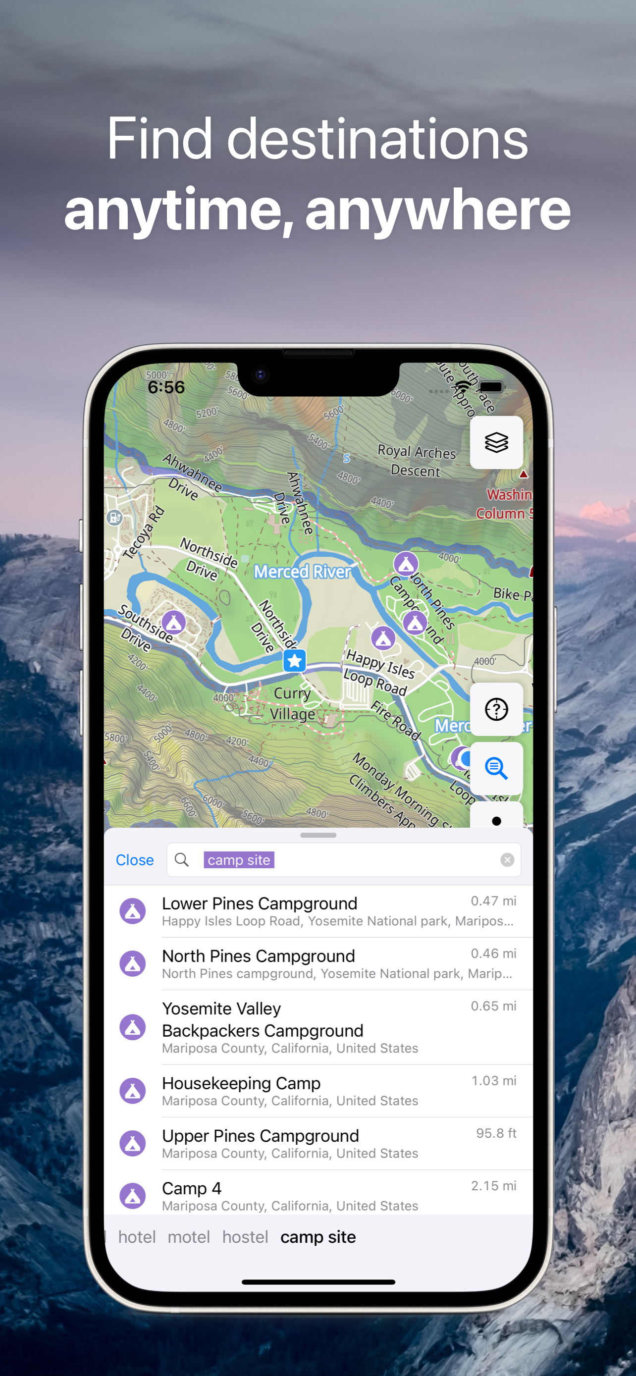
OFFLINE SEARCH
• Find what you need in an instant – our incredibly fast search delivers results as you type.
• Search flexibly by address, place name, category, or precise GPS coordinates.
• Break language barriers with simultaneous multi-language search capabilities.
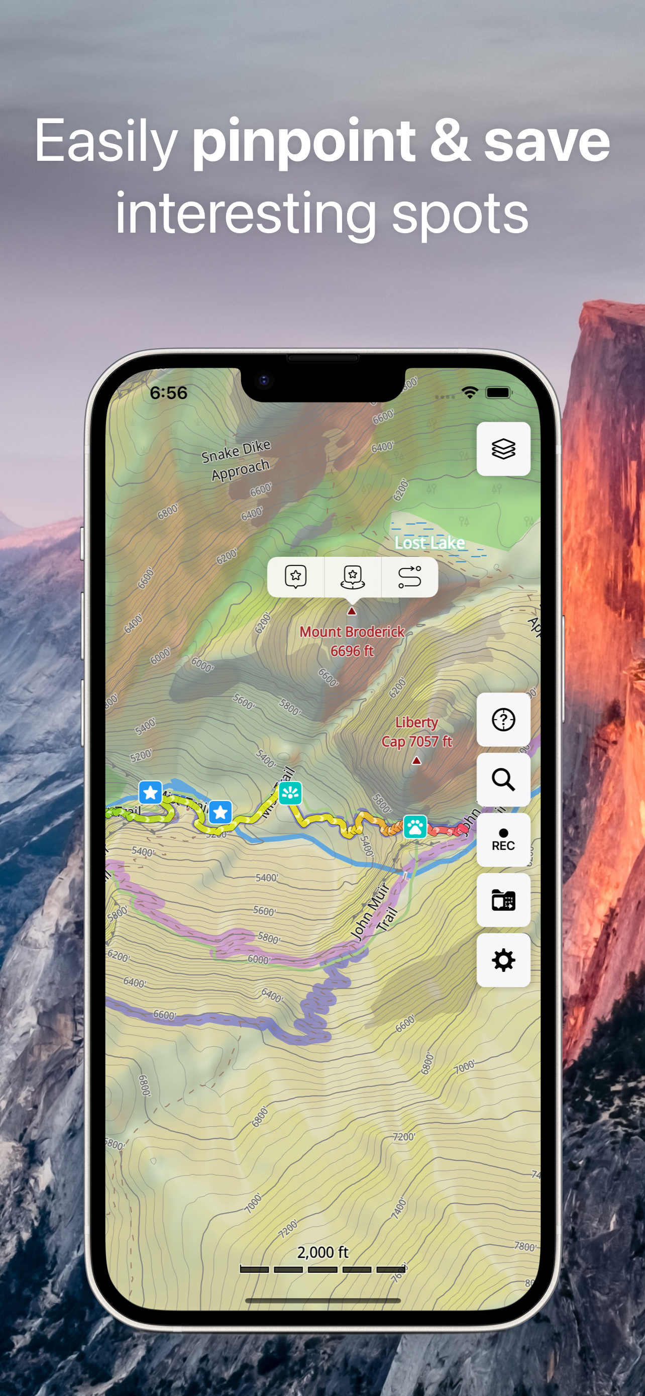
MARKERS
• Save and organize your favorite spots, hidden gems, and important locations directly on your map.
• Easily identify your saved places with a diverse selection of map icons.
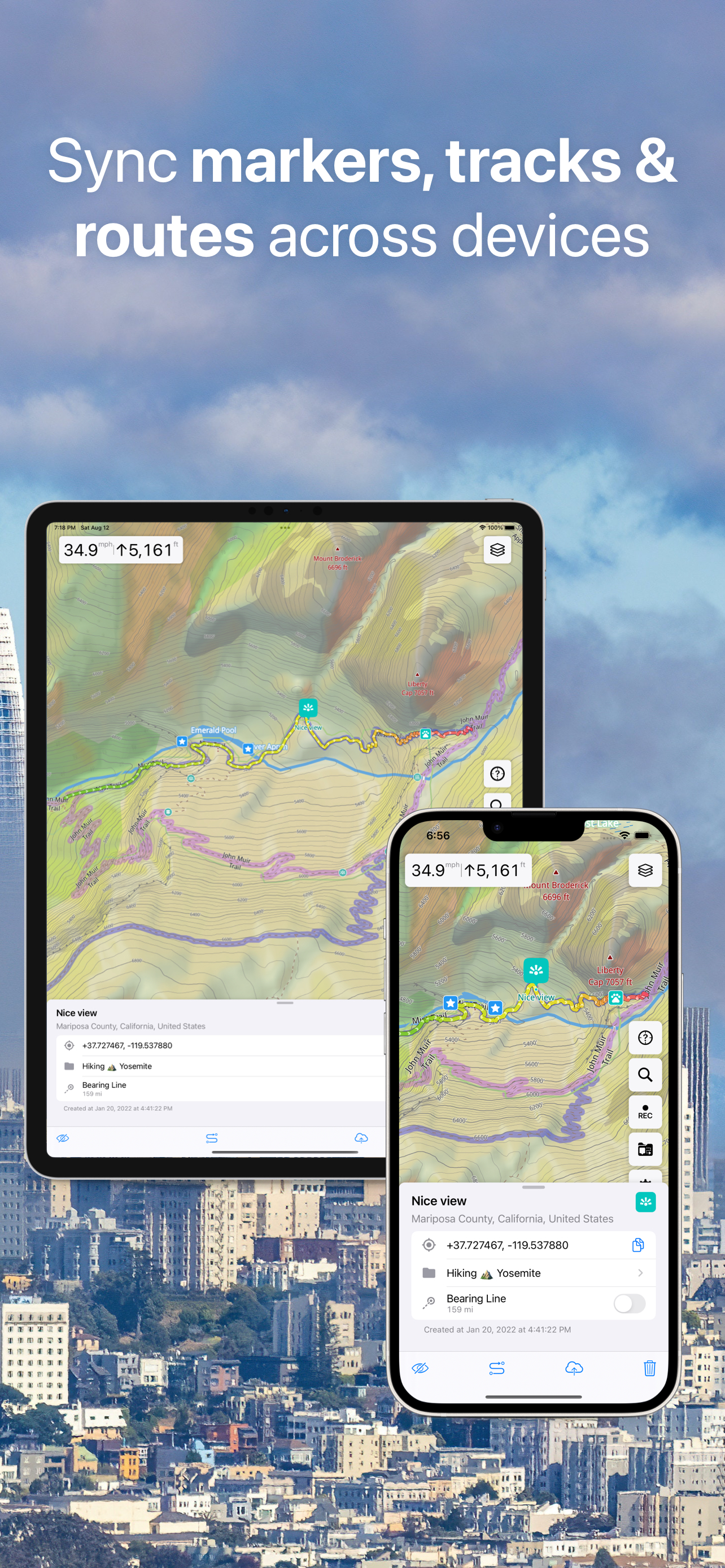
SYNCHRONIZATION
• Keep your tracks, markers, and collections seamlessly synced across all your devices.
• Your valuable map data is securely backed up to a server, so you never lose it.
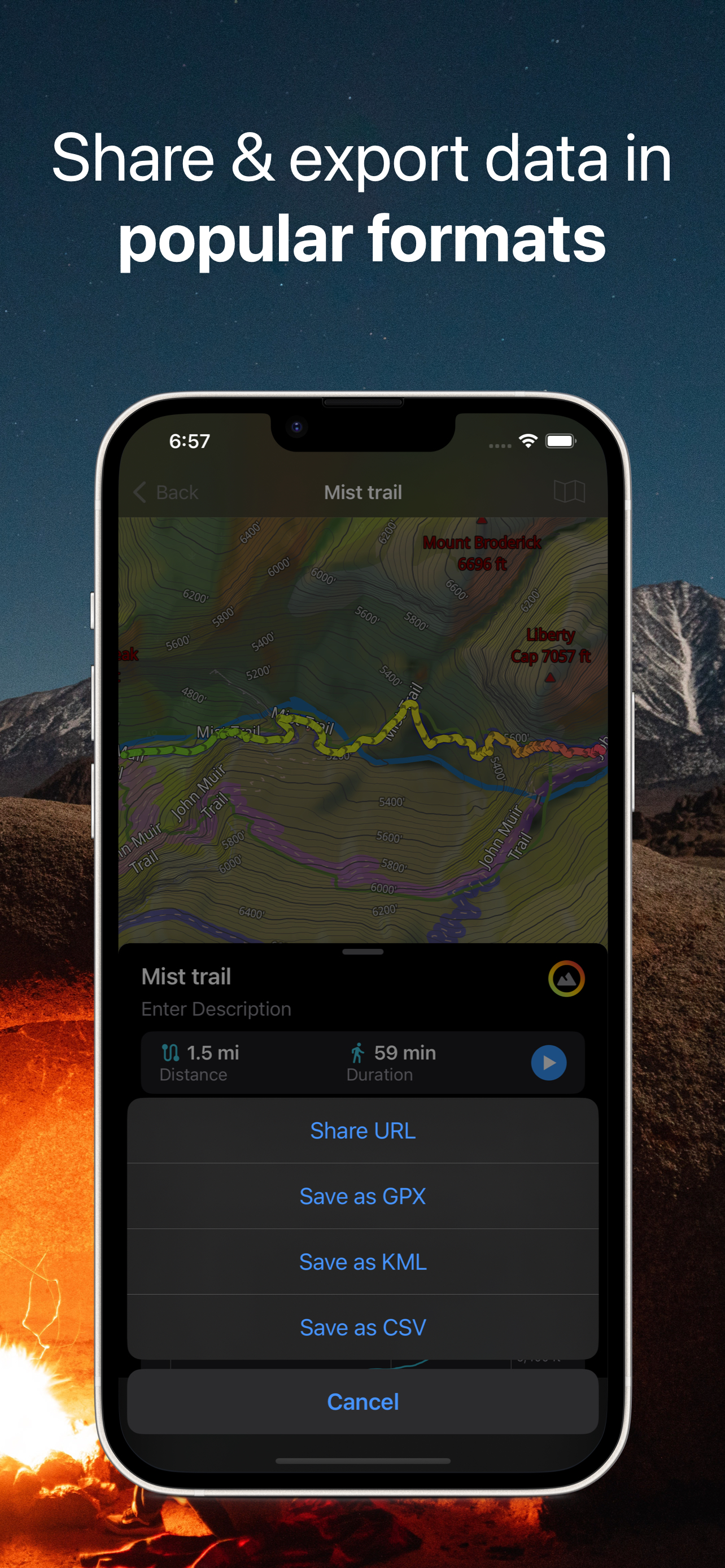
IMPORT AND EXPORT
• Easily share your adventures or back up your data by exporting tracks, bookmarks, or entire collections as KML or GPX files.
• Keep your travel data neatly organized in collections for quick and easy access.
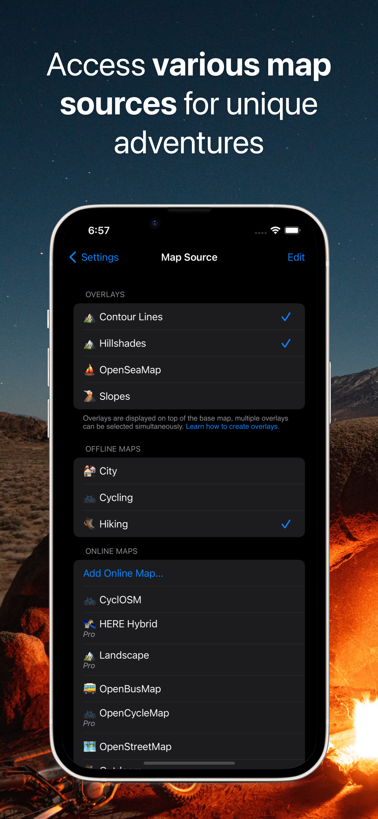
• Expand your map library by importing offline maps in sqlitedb or mbtiles format.
ONLINE MAP SOURCES from thunderforest.com [Pro]:
Access specialized online map layers like OpenCycleMap, Outdoors, Transport, and more with your Pro subscription.
ADDITIONAL FEATURES
• Display custom map overlays with .GeoJSON file support.
• Effortlessly zoom with one finger.
• Keep track of your journey with the built-in trip computer showing speed and altitude.
• Stay oriented with the tracking mode.
• View precise coordinates and map scale.
• Customize map object visibility to declutter your view.
• Choose from 11 different map display languages.
• Adjust label sizes for optimal readability.
PRO SUBSCRIPTION
Unlock the full power of Guru Maps! While the free version lets you create up to 15 markers, record 15 tracks, and download 3 vector maps, a Pro subscription gives you:
• Unlimited markers: Save every spot that matters.
• Record unlimited GPS tracks
• Download unlimited offline maps
• Sync between devices
• Use Pro map sources
Guru Maps offers two payment options (prices may vary by location):
• monthly or yearly subscription (with 7-day trial version),
• one-time purchase for lifetime license.
Terms of Service and Privacy Policy: https://gurumaps.app/terms_of_service
Continued use of GPS running in the background can dramatically decrease battery life.
Hide
Show More...