Hiking & Skiing - PeakVisor
Peak Finder with 3D Maps
#1 Keyword Rankings
Today
Top 10 Rankings
Today
Top 30 Rankings
Today
Top 100 Rankings
Today

Description

PeakVisor will make you a champion of mountain navigation, putting state-of-the-art Peak Identification, 3D Maps, Trails, and outdoor GPS tracking into the palm of your hand. Our app is a one-stop shop for all your mountain adventures: hiking, skiing, climbing, mountain biking, and more. But PeakVisor is more than just another outdoors app; it’s an immersion into a carefully crafted 3D world that will give you an unprecedented understanding of the nuances of a mountain’s terrain.

“PeakVisor uses your iPhone’s camera and augmented reality (AR) technology to display names and elevations of nearby peaks. The information will appear on your phone like magic.”
- App Store, Take the Trail Less Traveled

Here’s a brief orientation on the tools we offer to get oriented in the mountains:

● 3D Maps
As human athletic achievement progresses in the mountains, so does the technology to assist your adventures. With PeakVisor, you unlock the topo maps of the future; our cutting-edge technology with high-precision terrain modeling offers deep insight into the mountain landscape of your choice. With one glance, you be blessed with years of knowledge about an area’s terrain.

● Identify Peaks
Identify more than a million mountains, hills, buttes, spires, and more from all over the world, with a detailed profile for each of them! Our app shows you altitude, topographic prominence, mountain range, national parks or reserves, as well as photos and additional Wikipedia articles.

● Plan Hiking Routes
A vast network of worldwide hiking trails and walking pathways included in PeakVisor’s 3D Maps will help you compose a hiking route which includes evaluating the distance you can expect to hike as well as a route’s elevation profile and estimated time for completion.

● Skiing
In winter mountain sports, PeakVisor’s topographic 3D Maps allow a visual understanding of the terrain and provide detailed information about mountain lifts, ski resort trails, and backcountry ski touring routes. The app also offers features such as winter mode and a slope steepness overlay to identify avalanche terrain on your route.

● Cable Cars and Mountain Huts are inlaid onto our 3D Maps, complete with schedules. This is especially useful in Europe, where many objectives involve a cable car ride to gain some altitude, lest you want to do some genuinely punishing climbs. And you haven’t experienced the old-world mountain culture until you’ve had a memorable meal and night at a rustic mountain hut in the high country.

● Peak Bagging
The app offers monthly climbing challenges and Peak Bagging competitions to keep the motivation where it needs to be…UP.

● Animated Flyover Videos
You can even initiate a ‘Flyover,’ our visually stunning animations that give you a token video of your route to show family and friends or inspire some memories down the road.

● GPS Tracking
Track any outdoor adventures, whether hiking, skiing, mountain biking, etc. Post-adventure, you can visualize your route in the miniature 3D world, check out stats like distance and elevation gain, and export a GPX file of your new route.

● Lock-Screen Navigation

● All Features Work Offline

PeakVisor is the Swiss army knife for outdoor adventure, one that you will soon find indispensable while in the mountains. With so many features at your fingertips, you’ll find value from the app whenever you're on the trail.

PeakVisor PRO is a premium subscription that allows you to use the app without any limitations. By subscribing to PeakVisor PRO you make it possible for us to focus on the continued development of the app. PeakVisor PRO is available as a monthly or annual subscription. We have no advertising on the app; all revenue comes from our user subscriptions. We constantly modify the app and offer an update each week, always with new features and fewer bugs. You may find more details in our Terms and Privacy Policy by the link → https://peakvisor.com/en/terms.html
Hide.. Show more..

In-Apps

3D Maps & AR Peak Finder
$89.99
One Year of Hiking & Skiing
$29.99
One Month of Hiking & Skiing
$4.99

Screenshots

User Rating

4.58 out of 5

10,740 ratings in United States

5 star
8,490
4 star
1,162
3 star
426
2 star
154
1 star
508

Ratings History

Reviews

Rip Off

Decent Basics on

So expensive. Standard issue pay $5 for nothing useful. $89 for the full app and the only version anyone would ever use. Don’t waste your money.

My goodness, it has updates every few days!

Chooch440 on

I just don't understand why this app has so many updates. I'm glad I didn't pay for it because I'm deleting it now. Too many other apps out there which don't require updates as often as this one. Very irritating! Goodbye, you have been fired! The tribe has spoken!

Not great

paxilee on

Really difficult to read. Will try a different app.

A ‘must have’ for road trips.

MattyDuck on

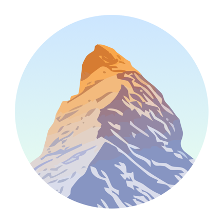
When you just follow unexpected signs to a National Park and end up surrounded by unfamiliar mountains, nothing else will do.

Great app BUT loses place if you look at another app!

azurerain on

Please fix this issue.

Really worthless app

SendingOutAnSOS on

Even as a mountain activity enthusiast who’s traveled the world over for treks and ski outings, this app is a perfect example of the world having way too many worthless apps that are nothing but data collecting scams. DELETE.

Too slow

Not happy #23 on

Too much downloading time, too slow to identify peak, identifies peaks behind the one that I want and never tells me the one closest to me. Do not like this app. Will cancel pro version today - the same day I loaded the app. ( I don't see a cancel option anywhere in the menu. So now I have to waste my time trying to figure out how to get this thing canceled before I have to pay for it.)

2Mucho

Hurtbytr on

Too much.

Can’t identify mountains

Dodgerny on

I used to use this app all the time but now every time I open it it stares blankly at me while trying to access wifi to “download vicinity data”. Not sure about most people but if I’m looking at mountains I don’t have access to wifi. I’m lucky if I have access to cellular.

Deleted! 👎🏾👎🏾👎🏾

Cavernicola! on

No longer patient with this inaccurate information.

Store Rankings

Ranking History

Category Rankings

Chart
Category
Rank
Top Grossing
3
Top Grossing
3
Top Grossing
3
Top Grossing
4
Top Grossing
6

Keywords

Users may also like

Name
PeakFinder
The mountains are calling!
FarOut Guides
GPS Maps: Hiking Biking Paddle
Gaia GPS: Mobile Trail Maps
Hiking, Overlanding, Camping
Garmin Explore™
Explore with a Garmin device
FATMAP: Hike, Trail & Ski Maps
3D Maps & Outdoor Guides
Outdooractive
Reliable planning & navigation
Colorado Trail Explorer
Colorado's Official Trail Map
CalTopo
Backcountry mapping evolved
onX Backcountry Trail Maps GPS
Biking, Skiing, Hiking Trails
Earthmate
Text and Navigate with inReach
Show More

Revenue and Downloads

Gain valuable insights into Sentieri e Mappe 3D PeakVisor performance with our analytics. Sign up now to access downloads, revenue, and more.

App Info

Category
Travel
Languages
Russian, English, Spanish, Italian, Catalan, Korean, German, Polish, Portuguese, Slovak, Chinese, French, Japanese
Recent version
5.12 (3 days ago )
Released on
Dec 21, 2016 (7 years ago )
Last updated
6 days ago