Tres bon et utile!!
Super app, bien utile! Reste plus qu'a faire le reste de l'europe!! J'aime!!

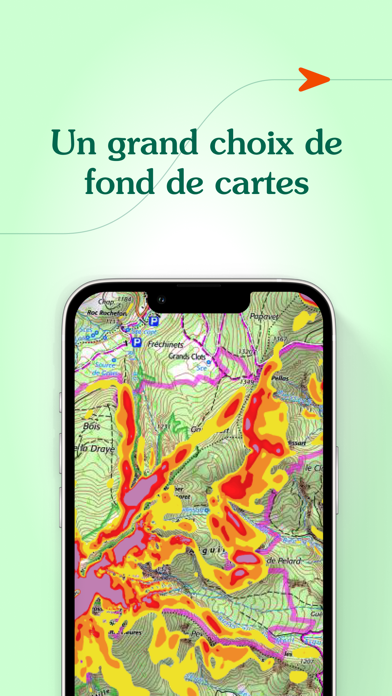
Yes, Iphigénie is free to download, however it contains in-app purchases or subscription offerings.
🤔 The Iphigénie app's quality is mixed. Some users are satisfied, while others report issues. Consider reading individual reviews for more context.
Iphigénie has several in-app purchases/subscriptions, the average in-app price is €13.99.
To get estimated revenue of Iphigénie app and other AppStore insights you can sign up to AppTail Mobile Analytics Platform.

4 out of 5
3 ratings in Italy
Super app, bien utile! Reste plus qu'a faire le reste de l'europe!! J'aime!!
...na fetecchia!!!!
Non ti fa vedere nulla. Vorrebbero Che si comprasse ma non mi fido e quindi la cancelleró!!
Ovviamente limitata al territorio francese ma dettagliatissima permette di avere su iPad una cartografia in diverse scale fino al 25'000 cosí da poter visualizzare con un solo strumento le direttrici principali fino al dettaglio topografico piú fine. Anche le opzioni di ricerca delle località sono perfette. L'ho utilizzata in viaggio col camper ed é stata utilissima evitandomi di dover sfogliare cartine di diverso formato per la programmazione degli itinerari
It's slow
Ma quando in Italia una applicazione come questa con tutta la cartografia al 25.000?
L’application Iphigénie est un indispensable pour la randonnée en France. Toutefois la plupart de ses fonctionnalités sont quasiment inutilisable du fait d’une ergonomie déplorable. Degré zéro de l’affordance, tout y est compliqué et non standard. L’application peut même dans certaines situations devenir dangereuse, par exemple lorsque vous pensez avoir à tord téléchargé les tuiles et que non, hors réseau rien ne fonctionne plus. Aucune confirmation… Bref l’application a beau être géniale, si la majorité des utilisateurs n’y comprennent rien, c’est qu’il y a un problème. Avez vous sérieusement fait des tests utilisateurs pendant et après la phase de conception ? En 2024, à l’heure où l’ux design est devenu indispensable dans tous les services numériques, l’application Iphigénie fait office de dinosaure et représente bien mal le service public comme l’ign. R.C Enseignant-chercheur en design
Bonjour. La nouvelle limitation de tuiles en cache est très pénalisante. Régulièrement en montagne sans réseau ou en mode avion pour économiser la batterie, j’ai absolument besoin de ce cache. En vacances, je consulte également beaucoup les cartes IGN, et elles ne se mettent pas en cache vu que la limite doit être atteinte. J’étais jusqu’alors très satisfait de l’appli, j’ai l’abonnement IGN et l’appli payante, mais là cela devient problématique.
Mon compte est débité, mais l’application ne s’ouvre pas donc inutilisable 😡😡😡je vais demander le remboursement si le problème n’est pas résolu
Interface très peu intuitive, vrai point négatif de cette application. Il manque des outils de mesure de distance à vol d’oiseau pour évaluer rapidement un parcours.
|
Chart
|
Category
|
Rank
|
|---|---|---|
|
Top Grossing
|

|
2
|
|
Top Free
|
|
59
|
|
Top Grossing
|

|
79
|
|
Top Grossing
|

|
90
|
|
Top Free
|

|
241
|
| Name | Downloads (30d) | Monthly Revenue | Reviews | Ratings | Recent release | |
|---|---|---|---|---|---|---|

SityTrail
Hiking Trail GPS Offline Maps
|
Unlock
|
Unlock
|
1
|
|
1 month ago | |

OutDoors GPS France - IGN Maps
Plan Hiking & Biking Routes
|
Unlock
|
Unlock
|
1
|
|
1 year ago | |

Topo GPS - Topographic maps
Plan and follow gpx routes
|
Unlock
|
Unlock
|
1
|
3
|
1 week ago | |

Visorando Walking Routes
Outdoor GPS working offline
|
Unlock
|
Unlock
|
2
|
|
2 months ago | |

Geovelo : GPS per bici
Ciclabili e navigazione GPS
|
Unlock
|
Unlock
|
3
|
|
1 week ago | |

IGNrando' – France hiking maps
Hiking & cycling with IGN maps
|
Unlock
|
Unlock
|
1
|
|
1 week ago | |

GPX viewer
The paper map reinvented
|
Unlock
|
Unlock
|
1
|
|
2 weeks ago | |

Hika - Hiking trails and maps
Hike and walk with GPS routes
|
Unlock
|
Unlock
|
0
|
|
1 week ago | |

Cartes IGN
Découvrez la France autrement
|
Unlock
|
Unlock
|
1
|
|
4 days ago | |

MaRando – FFRandonnée
Sentiers, promenades, GR, GPS
|
Unlock
|
Unlock
|
0
|
|
2 months ago |

