
Legal Land Map
PLSS Data on a Satellite map
#1 Keyword Rankings
Today
Top 10 Rankings
Today
Top 30 Rankings
Today
Top 100 Rankings
Today
Description
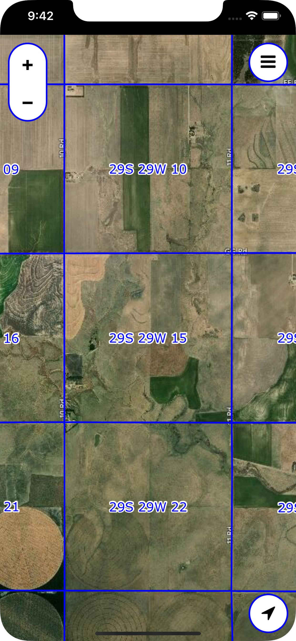
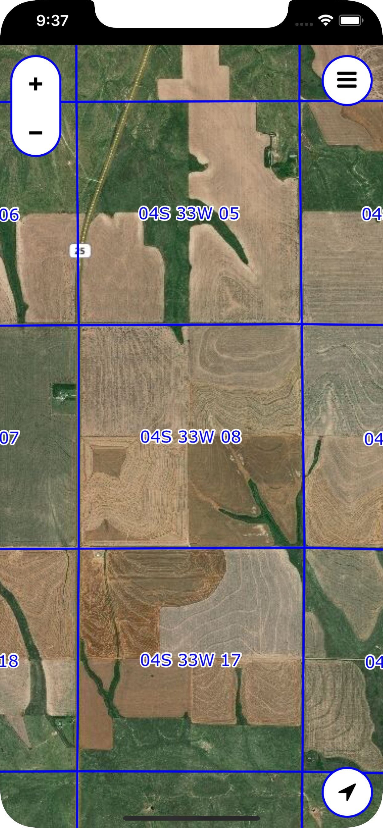
The PLSS (Public Land Survey System) is a system in which land is divided into rectangular townships and sections.
This app displays legal section names (e.g. "21W 13S 6") and borders, overlaid on a satellite map.
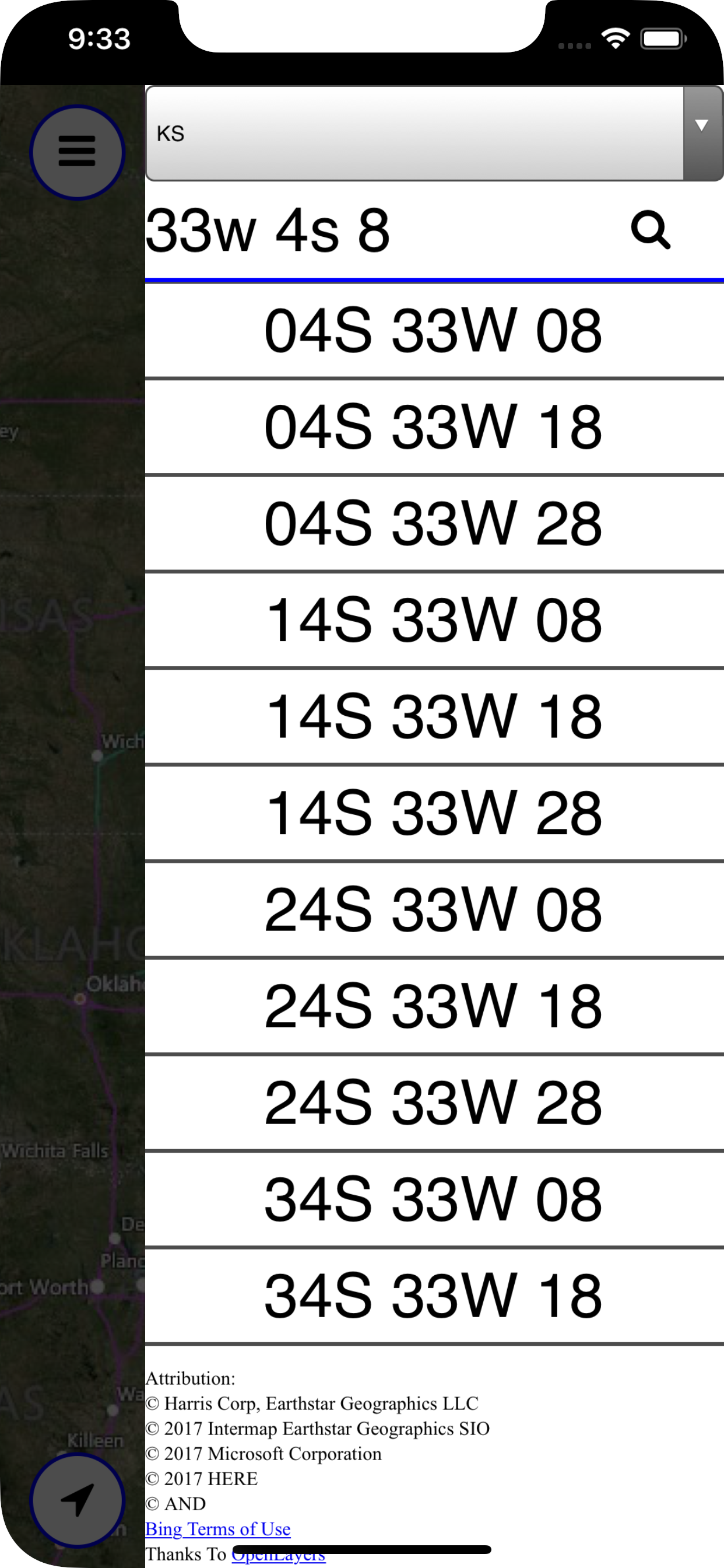
You can search for sections by their legal name.
NOTE: Not all locations are supported. Please check the list below for your state or provnce.
Supported states and provinces:
USA:
AL
AZ
AR
CA
CO
FL
ID
IL
IN
IA
KS
LA
MI
MN
MS
MO
MT
NE
NV
NM
ND
OH - Partial support
OK
OR
SD
UT
WA
WI
WY
Canada:
AB
BC (No Searching)
MB
ON (No Searching)
SK
Hide..
Show more..
This app displays legal section names (e.g. "21W 13S 6") and borders, overlaid on a satellite map.
You can search for sections by their legal name.
NOTE: Not all locations are supported. Please check the list below for your state or provnce.
Supported states and provinces:
USA:
AL
AZ
AR
CA
CO
FL
ID
IL
IN
IA
KS
LA
MI
MN
MS
MO
MT
NE
NV
NM
ND
OH - Partial support
OK
OR
SD
UT
WA
WI
WY
Canada:
AB
BC (No Searching)
MB
ON (No Searching)
SK
Screenshots
 User Rating
0 out of 5
0 ratings in Ecuador
Ratings History
Reviews
App doesn't have any reviews yet
Store Rankings
Ranking History
App Ranking History not available yet
Category Rankings
|
Chart
|
Category
|
Rank
|
|---|---|---|
|
Top Paid
|

|
29
|
|
Top Paid
|

|
344
|
|
Top Paid
|

|
381
|
|
Top Paid
|

|
393
|
Keywords
Users may also like
| Name | Reviews | Recent release | |
|---|---|---|---|

S1 Mobile Map Viewer
Maps for public lands
|
0
|
3 years ago | |

GPS.cards
|
0
|
1 month ago | |

GPS Location Dashboard
GPS info at your fingertips!
|
0
|
3 years ago | |

Survey Help
|
0
|
1 year ago | |

Kml Viewer-Kml Converter app
Two in one app
|
0
|
9 months ago | |

Phone Тracker — Localizar Am
|
1
|
9 years ago | |
Moab ATV Jeep Trails
32 miles S. of I-70 in E. Utah
|
0
|
3 years ago | |

Branson Tourist Guide
|
0
|
1 year ago | |

Nebraska Traveler
|
0
|
1 year ago | |

Dodge City Days
|
0
|
1 year ago |
Show More
Revenue and Downloads
Gain valuable insights into Legal Land Map performance with our analytics. Sign up now
to
access downloads, revenue, and more.
App Info
- Category
- Navigation
- Publisher
- David Holdeman
- Languages
- English
- Recent version
- 2.0 (2 weeks ago )
- Released on
- Oct 28, 2017 (6 years ago )
- Also available in
- United States, Canada, Philippines, Poland, Peru, New Zealand, Norway, Netherlands, Nigeria, Malaysia, Mexico, Lebanon, Kazakhstan, Kuwait, South Korea, Japan, Italy, Pakistan, India, Portugal, Romania, Russia, Saudi Arabia, Sweden, Singapore, Thailand, Turkey, Taiwan, Ukraine, Vietnam, South Africa, Dominican Republic, Argentina, Austria, Australia, Azerbaijan, Belgium, Brazil, Belarus, Switzerland, Chile, China, Colombia, Czechia, Germany, Denmark, United Arab Emirates, Algeria, Ecuador, Egypt, Spain, Finland, France, United Kingdom, Greece, Hong Kong, Hungary, Indonesia, Ireland, Israel
- Last updated
- 1 month ago