
Description
Use the patent pending Bye Bye Button to quickly and gracefully exit awkward situations. Bad date? Long winded coworker? Annoying Neighbor? BYE BYE!!!The Bye Bye Button Application wirelessly interacts with the Bye Bye Button device to help you quickly and discreetly generate a fake (yet REAL!) phone call to get you out of undesirable situations.
Simply setup the application once, let it run in the background, and when you press the button, you'll get a "real" phone call from anyone you choose in your contact list (We briefly link the real incoming call to your chosen contact, then erase the trace after your getaway). Because we generate real phone calls, you don't have to have the application unlocked, and you don't have to plan ahead.
PLEASE NOTE: because we generate real phone calls and text messages that cost money, we will end up adding some kind of paid service in the future. The paid service will likely be along the lines of a monthly service fee, a per use service fee, or possibly some combination therein. Because we generate real calls and texts, you might incur additional costs from your carrier when using these features of this application. Use of this application is subject to our terms and conditions.
Say "Hello" to the Bye Bye Button and "BYE BYE" to awkward social situations!
Terms of Use: https://www.byebyebutton.com/pages/end-user-license-agreement
Hide
Show More...
Simply setup the application once, let it run in the background, and when you press the button, you'll get a "real" phone call from anyone you choose in your contact list (We briefly link the real incoming call to your chosen contact, then erase the trace after your getaway). Because we generate real phone calls, you don't have to have the application unlocked, and you don't have to plan ahead.
PLEASE NOTE: because we generate real phone calls and text messages that cost money, we will end up adding some kind of paid service in the future. The paid service will likely be along the lines of a monthly service fee, a per use service fee, or possibly some combination therein. Because we generate real calls and texts, you might incur additional costs from your carrier when using these features of this application. Use of this application is subject to our terms and conditions.
Say "Hello" to the Bye Bye Button and "BYE BYE" to awkward social situations!
Terms of Use: https://www.byebyebutton.com/pages/end-user-license-agreement
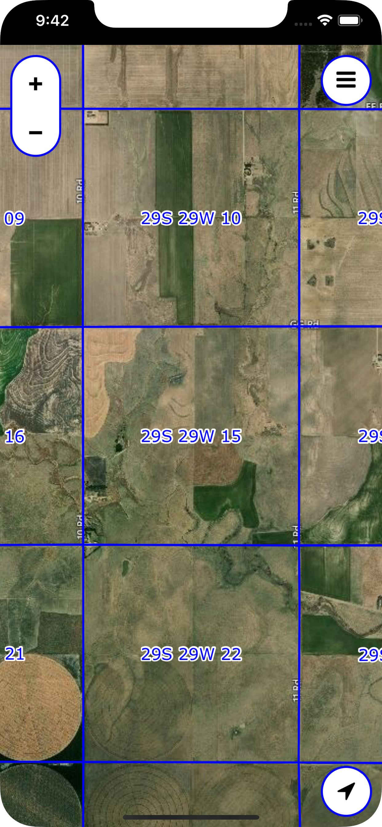
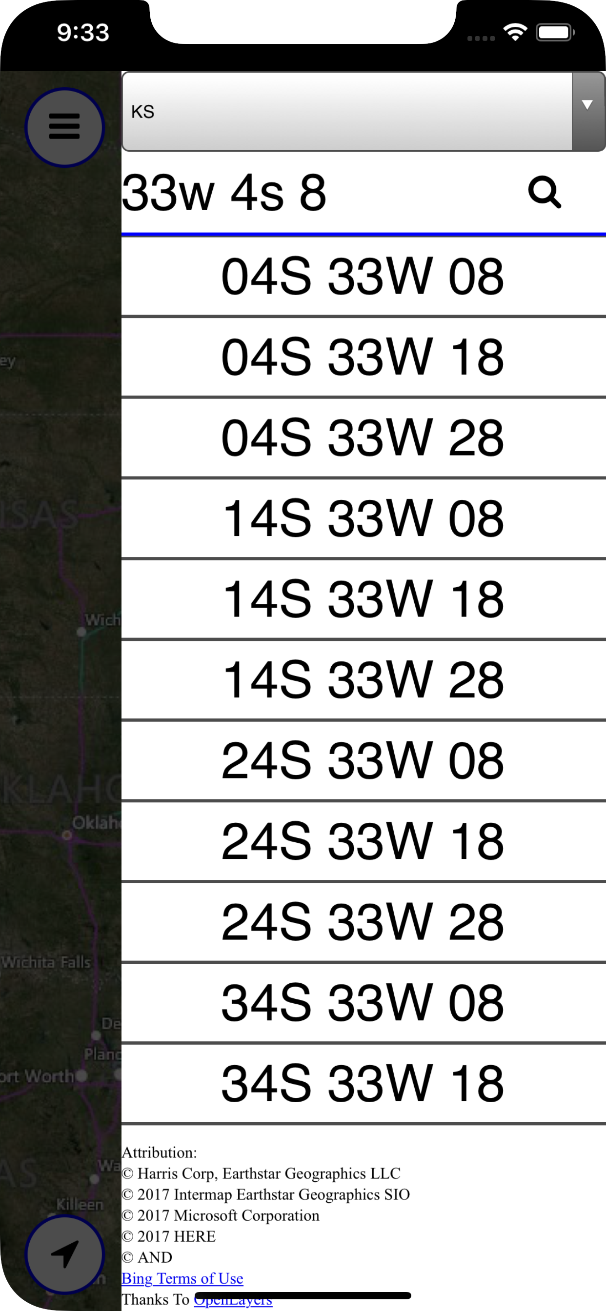
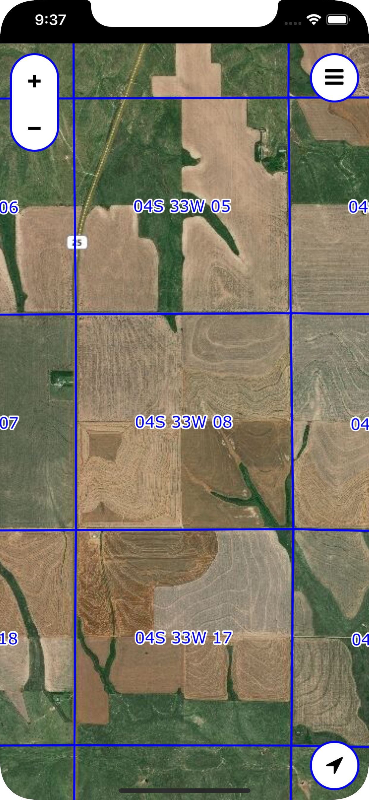
Screenshots
Legal Land Map FAQ
-
Is Legal Land Map free?
Yes, Legal Land Map is completely free and it doesn't have any in-app purchases or subscriptions.
-
Is Legal Land Map legit?
Not enough reviews to make a reliable assessment. The app needs more user feedback.
Thanks for the vote -
How much does Legal Land Map cost?
Legal Land Map is free.
-
What is Legal Land Map revenue?
To get estimated revenue of Legal Land Map app and other AppStore insights you can sign up to AppTail Mobile Analytics Platform.

User Rating
App is not rated in Italy yet.
Ratings History
Legal Land Map Reviews
Store Rankings
Ranking History
App Ranking History not available yet
Category Rankings
|
Chart
|
Category
|
Rank
|
|---|---|---|
|
Top Paid
|

|
162
|
|
Top Paid
|

|
237
|
|
Top Paid
|

|
296
|
|
Top Paid
|

|
310
|
|
Top Paid
|

|
349
|
Legal Land Map Competitors
Legal Land Map Installs
Last 30 days
Legal Land Map Revenue
Last 30 daysLegal Land Map Revenue and Downloads
Gain valuable insights into Legal Land Map performance with our analytics.
Sign up now to access downloads, revenue, and more.
Sign up now to access downloads, revenue, and more.
App Info
- Category
- Navigation
- Publisher
- David Holdeman
- Languages
- English
- Recent release
- 2.0 (11 months ago )
- Released on
- Oct 28, 2017 (7 years ago )
- Also available in
- United States, Canada, Argentina, Austria, Azerbaijan, Belgium, Brazil, Belarus, Switzerland, Chile, China, Colombia, Czechia, Germany, Denmark, Dominican Republic, Algeria, Ecuador, Egypt, Spain, Finland, France, United Kingdom, Greece, Hong Kong SAR China, Hungary, Indonesia, Ireland, Israel, Italy, Japan, South Korea, Kuwait, Kazakhstan, Lebanon, Mexico, Malaysia, Nigeria, Netherlands, Norway, New Zealand, Peru, Philippines, Pakistan, Poland, Portugal, Romania, Russia, Saudi Arabia, Sweden, Singapore, Türkiye, Taiwan, Vietnam, South Africa, Australia, Ukraine, Thailand, India, United Arab Emirates
- Last Updated
- 2 months ago
This page includes copyrighted content from third parties, shared solely for commentary and research in accordance with fair use under applicable copyright laws. All trademarks, including product, service, and company names or logos, remain the property of their respective owners. Their use here falls under nominative fair use as outlined by trademark laws and does not suggest any affiliation with or endorsement by the trademark holders.