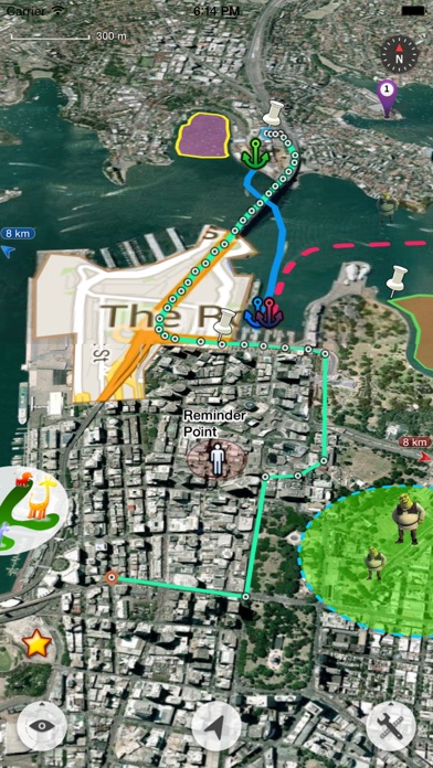
Yellow screen bug
Yellow screen appears on app start. It goes after changing the zoom level

Yes, Map Plus is free to download, however it contains in-app purchases or subscription offerings.
✅ The Map Plus app appears to be high-quality and legitimate. Users are very satisfied.
Map Plus has several in-app purchases/subscriptions, the average in-app price is ₹549.00.
To get estimated revenue of Map Plus app and other AppStore insights you can sign up to AppTail Mobile Analytics Platform.

4.59 out of 5
27 ratings in India
Yellow screen appears on app start. It goes after changing the zoom level
Satellite map disappear in few seconds after loading.
Great way to document your journey and an effective way to search search your photos.
All Apple Apps should perform like this.
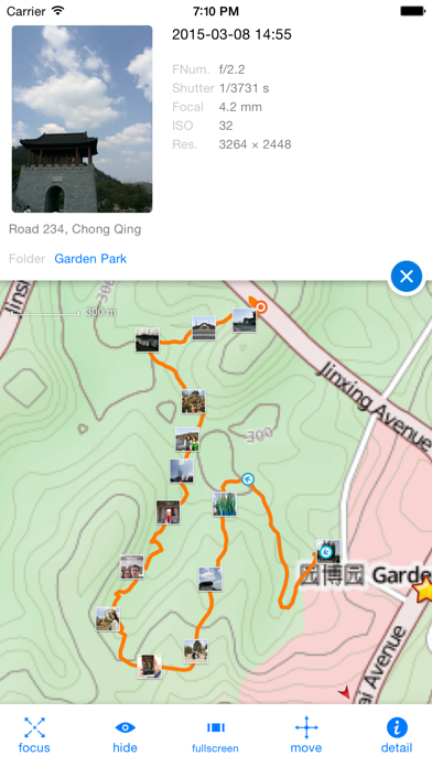
Love it. Have used for several years. I imported an accurate map of our riding area obtained from US forestry service. Now all of my friends want to use my phone to see where we are on the forestry map. J D
Best app to create a hiking map, mark out trails, keep track of workouts, etc. The tools are not really intuitive, but with some patience, it’s usable, and worth it
I moved to a new area. I wanted to buy a house so I made a map with layers from public maps that included flooding, hillside instability and earthquakes, apartment locations, and crime reports for the last five years. I use the Realestate app Redfin to notify me of houses per my specifications, and then I would look at them on my map to see any major problems. Very easy, very good app.
The new update messed up everything that was coded in with the custom properties and conditional styles. My app is only showing orange lines and not what I have placed. No response for helping to resolve this issue with the new update
Very impressed with this app. We’re able to mark off areas on maps. Great alternative to Zeemaps. Recommended must have for any company that canvasses.
I love Map plus. But It needs tutorials so dyslexic people like me can figure out all the functions quicker. I’m a map guy and it’s excellent mapping tool.
|
Chart
|
Category
|
Rank
|
|---|---|---|
|
Top Grossing
|

|
54
|
|
Top Grossing
|

|
55
|
|
Top Grossing
|

|
81
|
|
Top Grossing
|

|
88
|
|
Top Grossing
|

|
92
|
| Name | Downloads (30d) | Monthly Revenue | Reviews | Ratings | Recent release | |
|---|---|---|---|---|---|---|
Maps+
For power users
|
Unlock
|
Unlock
|
109
|
|
2 years ago | |

Topo Maps+
Offline Topographic Maps & GPS
|
Unlock
|
Unlock
|
2
|
|
1 week ago | |

Tomstrails GPS UTM
UTM Grid Reference
|
Unlock
|
Unlock
|
1
|
|
3 years ago | |

Compass 55. Map & GPS kit.
Land, air, marine navigation
|
Unlock
|
Unlock
|
5
|
|
1 week ago | |

BackCountry Navigator XE
Topo Maps and GPS for Outdoors
|
Unlock
|
Unlock
|
0
|
|
1 month ago | |

Mgrs & Utm Map
|
Unlock
|
Unlock
|
1
|
|
3 months ago | |

KML Collection: Import Maps
N/A
|
Unlock
|
Unlock
|
1
|
1
|
6 months ago | |

Global Mapper Mobile
|
Unlock
|
Unlock
|
1
|
|
2 months ago | |

Coordinator-Collect Coordinate
Collect Coordinate
|
Unlock
|
Unlock
|
0
|
|
4 weeks ago | |

CarryMap
Offline maps & data collection
|
Unlock
|
Unlock
|
0
|
|
1 week ago |
