Mapillary
Street-level imagery
#1 Keyword Rankings
Today
Top 10 Rankings
Today
Top 30 Rankings
Today
Top 100 Rankings
Today

Description

Mapillary is the street-level imagery platform that scales and automates mapping using collaboration, cameras, and computer vision.

Anyone can capture images of any place, as often as needed, with any camera—including smartphones. Mapillary combines all images into a collaborative street-level view of the world that’s available for anyone to explore and use for improving maps, cities, and mobility. Computer vision technology provides a smooth viewing experience and speeds up mapping through machine-extracted map data.

Capturing with the Mapillary mobile app is the easiest way to join our contributor network. Let’s get started!

CREATE YOUR OWN STREET-LEVEL VIEWS
You control when and where to capture to create the freshest street-level imagery. Mapillary’s technology combines all images into a navigable view and blurs faces and license plates for privacy.

ACCESS AND OPEN UP DATA
Mapillary contributors are people, organizations, companies, and governments in 190 countries. Millions of images are added to the dataset every week, which you can explore right here in the mobile app.

MAKE BETTER MAPS
Use imagery and machine-extracted data to add details to maps and geospatial datasets. Mapillary integrates with tools like OpenStreetMap iD editor and JOSM, HERE Map Creator, and ArcGIS. To access the available map data, go to mapillary.com/app.
Hide.. Show more..

Screenshots

User Rating

4.55 out of 5

11 ratings in Sweden

5 star
8
4 star
2
3 star
0
2 star
1
1 star
0

Ratings History

Reviews

Manuel mode not working

Valter Isander on

Nowadays no manual mode. I can change Auto/Manual, but moving the camera in manual mode gives exposings. Not useful anymore. 90% bad photos.

Radera foton

du är dumm 7;84848 on

Kan ni lägga till så man kan radera foton. Nu måste man gå in på datorn och skicka in en ansökan om att ta bort de. Kan ni också göra det snabbare att ladda upp foton

Love this app

Terje13 on

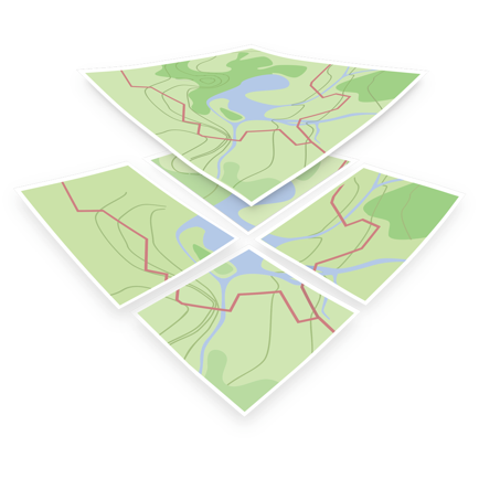
I mapped my hometown with my iPhone.

Buggin' out!

ezrollergbg on

Crash när man ska välja kameran. Kom med den här versionen.

Fin grej

Divers_23 on

Tycker idéen är lite smårolig, absolut. Men har så jäkla svårt att se varför jag skulle vilja använda den...

Intressant för den som är intresserad av kartor

En lycklig man on

Fungerar bra och stabilt. Appen kan till exempel användas av den som har ett intresse av öppna kartor eller vill fotografera vägen till en speciell plats.

Love the update!

Uddardnas on

Great improvements! Now I just want to capture more photos.

Enkel och snabb app

srara_77 on

Enkel, snygg app och en bra ide. Bilder kommer upp på kartan nästan med detsamma. Kul!

Store Rankings

Ranking History

Category Rankings

Chart
Category
Rank
Top Free
411
Top Free
492

Keywords

Users may also like

Name
OsmAnd Maps Travel & Navigate
Offline maps for travel
Open GPX Tracker
No ads, no in-app purchases
Magic Earth Navigation & Maps
Offline Maps, Traffic
OpenMaps - Open Source Maps
Maps for free spirits
Drive Street Viewer
Move forward automatically
Organic Maps Offline Vandring
Leder, resor, GPS-navigering
ArcGIS Navigator
Rally Roadbook Reader
Rally Navigator Mobile App
Every Door
OSM editor for POI & entrances
OpenMapTiles
Show More

Revenue and Downloads

Gain valuable insights into Mapillary performance with our analytics. Sign up now to access downloads, revenue, and more.

App Info

Category
Photo Video
Publisher
Mapillary AB
Languages
Arabic, English, Spanish, Hebrew (modern), Hindi, Dutch, Indonesian, Italian, Japanese, Chinese, Korean, Portuguese, Polish, French, Swedish, German, Thai, Turkish, Ukrainian, Hungarian, Russian, Vietnamese
Recent version
6.0.3 (3 days ago )
Released on
Nov 22, 2013 (10 years ago )
Last updated
3 weeks ago