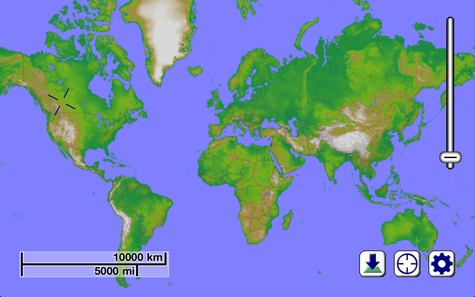
With Mapster, you can view, download, and store incredibly detailed maps (which include stunning topographical hillshading and contour lines) for any part of the Earth. Whether you're interested in finding new hiking trails, ski runs, back streets, freeways, or just want to explore the physical geography of our planet, you will never run out of things to discover. Now, you can have maps available even in places where you have no Internet service - when you need them the most!
There is more involved to providing accurate, practical, and visually appealing maps than just drawing lines where roads are. Our Earth isn't flat, so the way it appears on your screen shouldn't be either. To this end, we have spent a lot of time collecting topographical information for the entire planet, and presenting it in an intuitive and practical way. If there is a small hill or valley in the area you are interested in looking at, it will likely be obvious in Mapster. This provides all kinds of practical benefits for the outdoor enthusiast - if you're the type of person who enjoys hiking or cycling, you'll know ahead of time what to expect.
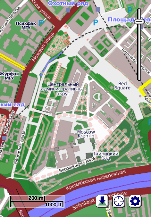
Of course, there is a lot more to Mapster than just a visualization of the terrain in an area. We use data from the OpenStreetMap project to be able to show you where roads, trails, stores, coffee shops, and hundreds of different types of features can be located. Approximately a billion points make up the current OpenStreetMap data set, and the collection is continuing to grow at an astounding rate.
Mapster doesn't rely on mapping data that quickly becomes outdated. Approximately once per month, our servers update the map information with the latest changes submitted by hundreds of thousands of users around the world, and keep your iPhone, iPod, or iPad current automatically. As a Mapster user, you obtain privileged access to incredible maps of our entire planet, at a level of detail never before seen.
By using your device's built-in ability to determine its location (through a combination of GPS, cell phone triangulation, and WiFi site analysis technologies), you'll always know what's "around the next corner". And if you're the sort of person who likes to explore areas where there is no cell phone or Internet service, that's no problem. Unlike some other map software that requires a live Internet connection to provide you with information, the map details you download to your device are cached, so they stick around and are available even when you're in the middle of nowhere (perhaps not so surprisingly, some of the most interesting places on the planet are "in the middle of nowhere"). If you are planning on exploring an area, all you need to do is tell Mapster to download the details of that location before you leave.
There's quite literally an entire planet out there waiting to be explored, whether you're looking for new restauraunts in your community, or kayaking down a river surrounded by a tropical rainforest (though for the latter, we'd suggest also bringing along a waterproof bag to keep your iPhone/iPod/iPad in). With Mapster along for the ride, you'll see the Earth as you never have before.
NOTE: To prevent excessive bandwidth on our servers providing the map data, the free version of this app is restricted to downloading a fixed amount of map data per day, roughly equivalent to around 5 or 10 minutes of panning around and zooming in interactively (and obviously much less if you decide to batch download maps). To remove this restriction, inexpensive monthly and yearly subscriptions are available as in-app purchases which give you access to obtaining as much map data as you'd like.
Hide..Show more..
In-Apps
Unlimited downloads for 1 Year
$9.99
Unlimited downloads for 30 days
$1.99
Screenshots
User Rating
4.85 out of 5
13 ratings
in United States
5 star
12
4 star
0
3 star
1
2 star
0
1 star
0
Ratings History
Reviews
Highly detailed for remote places
Kudos to everyone who loads data into these maps. The off road routes are incredibly accurate. Some of the routes are simply worn out paths in taller grass. It definitely helped me with navigating to more remote places (Africa, Central Asia, and New Mexico). In urban areas the maps were accurate with hotels and hospitals even in smaller towns and villages. I used this with other cell data map apps (with I’m guessing more fresh info), which created nice overlays. Where this app really helped me was with planning an overland journey through remote areas and when cell coverage dropped. I used this with bad elf, a sat gps that plugs in your smart phone or tablet. If you have your maps already downloaded the bad elf will show where you are on the map. I wouldn't use this for commuting but its a big help for off the beaten path type of adventure. I hope this helps!
Terrible
Not a true topo map. More of a street map with topo markings. No trails, no smaller bodies of water and no better than mapquest. Plus they have a stupid tile system you have to purchase to keep using it. Absolute garbage.
Great Program
This is an awesome topographic map app! I wish I could give it 10 stars!
Great App!
This app is just what it says it is. It provides a better traditional map experience than Google maps in many ways. It is just a clear map with extraordinary detail. So far, I have found it to be accurate. In fact, in a new subdivision, Mapster has the actual, current and correct street names whereas Google has the old proposed street names!
It's a really well thought out app with a built in user manual that gives lots of good background, how to contribute, and a lot of interesting detail in how it is put together and works.
When paired with a GPS receiver, the tracking is smooth, quick and responsive. It updates position frequently. The tracking with this map is much quicker and smoother than any other GPS nav app or system I have used.
The only complaint I have is that at the highest level of detail the text is hard to read. You can zoom in and out to read it but it would be nice if that could be made a little more readable without doing that.
I highly recommend this app, either by itself or with a GPS receiver. I've been using it on an iPad Mini with Retina.
Great
You can tell were you are even without Internet, witch is great if your lost and don't have service
Mapster meets my objective
I needed a simple iPhone app that would download a map of a trail that I was lookong forward to hiking, see my position with respect to the trail and be able to do it without a data connection. Mapster does exactly that.
Surprisingly good!
I like to go out into the woods and walk around. Not sure why, I just do. Find old footpaths and see where they go, that kind of thing. I've probably tried around a hundred different mapping/GPS apps in the last couple of years and this is one of only 2 or 3 that I continue to find useful. No matter where I am, it finds every little trail and almost always shows me something useful and interesting without the hassle of similar apps. I'm reviewing it because I think it probably gets lost in the shuffle of sleeker/better marketed/pricier apps. And that's a shame, because there's a whole hidden world of prehistory just off the side of the road, and this little app knows just how to get there.
Garbage
Negative five stars! This map data is so old that a 12 year old subdivision does not show up. Imagine trying to find a new road or trail. This is crap. Do not download
Where is Israel?
Why don't you recognize Israel as a country? I am deleting your app
Old Map Data
Attractive rendering of map, but data is well over 6 months old. Openstreetmap improves on a daily basis, why software developers spend time on an attractive map display, then fail to keep to the underlying data somewhat current is beyond me.