** France’s No1 mapping and GPS app – Ideal for following hiking and biking routes in total confidence – Official Topo Maps (IGN) can be downloaded so app works anywhere regardless of signal so you’ll never become lost again! – Other Maps include Satellite, and Road maps – Find & Follow routes across Europe – Record, save & share routes online. **
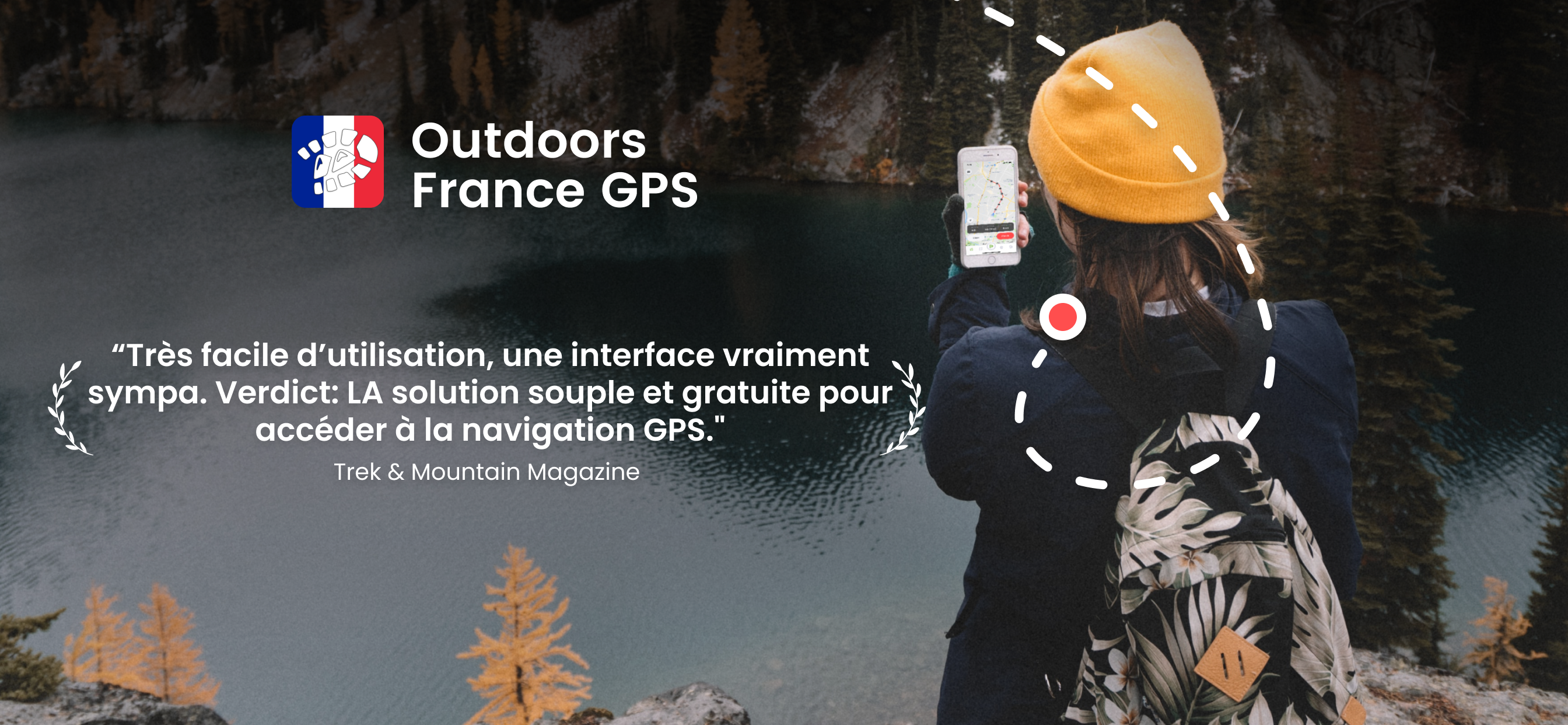
***** “Extremely easy to use and looks great. Verdict: an easy and low cost way to get into GPS navigation.” -[Trek & Mountain Magazine].
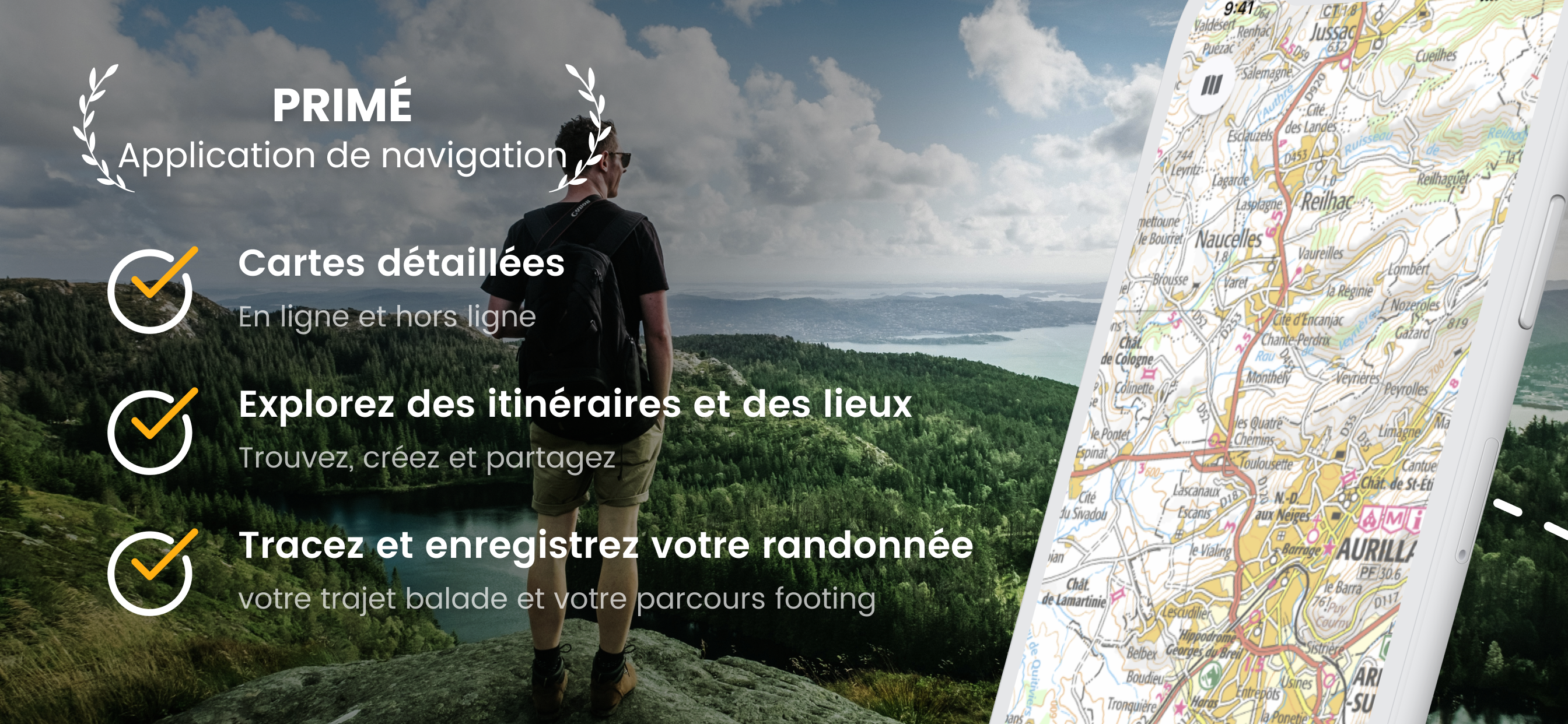
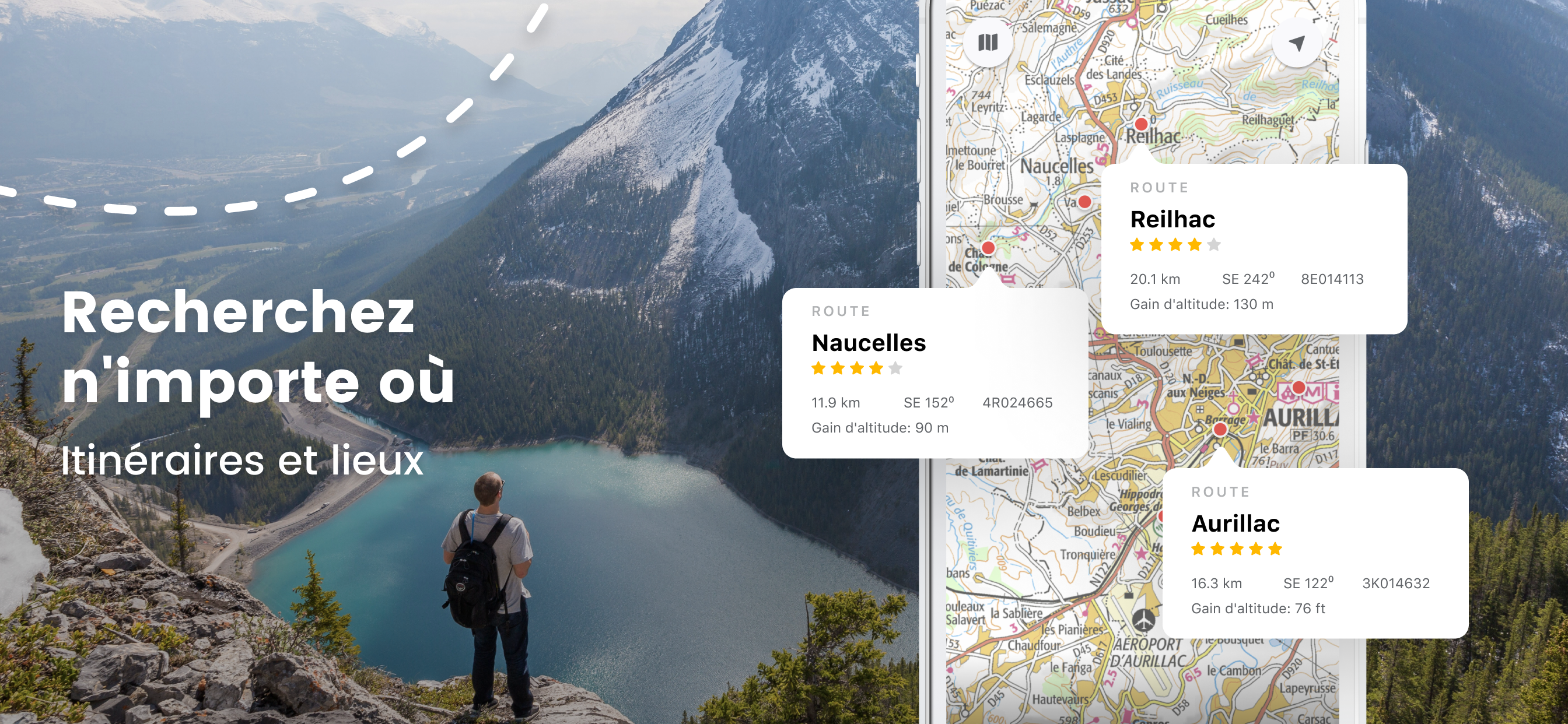
POWERFUL GPS FUNCTIONS
OutDoors France turns your phone into a fully functioning outdoor GPS;
• Find your location in seconds.
• Find or create your ideal route.
• Follow your route easily with in-built Compass and super-clear direction view.
• No need for a paper map nor expensive specialist GPS to enjoy a trip with confidence.
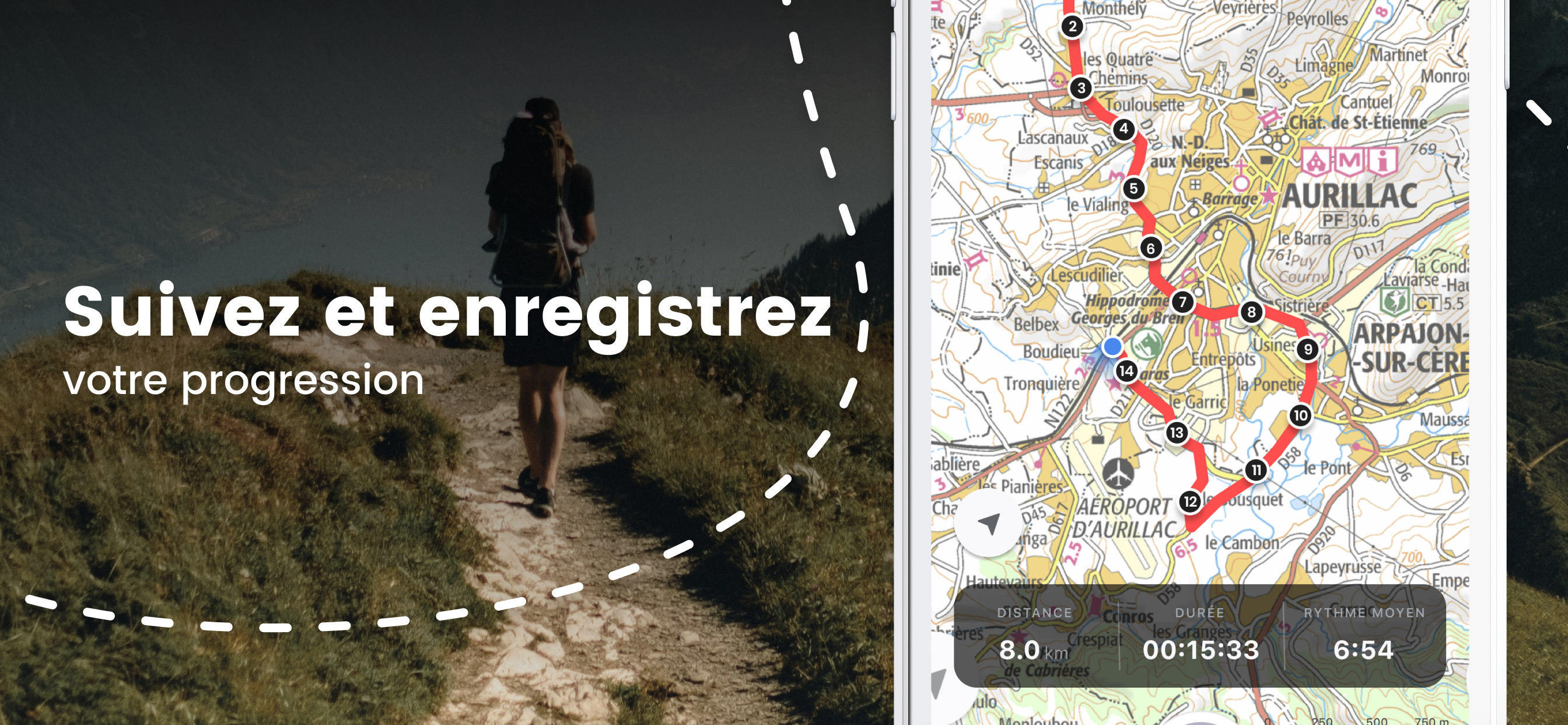
• Watch the app track your route on the map with statistics (route record).
• Current position stays centre (great for cycling).
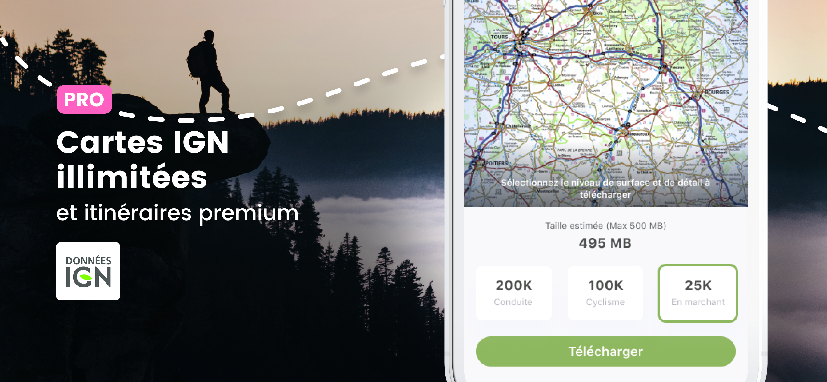
GREAT CHOICE OF MAPS – UNLIMITED FREE DOWNLOADS – TOPO MAPS (IGN)
• No need for phone signal - map downloads are stored on your iPhone.
• 5 free map types include; Topo Maps*, Road Maps, Satellite view, Terrain & Hybrid
• You can rotate the online maps & tilt the Terrain map to give a 3D effect.
• View your chosen maps in glorious full screen (minimize icons).
• Large map downloads make it really easy to manage your maps.
* Topo Maps are France’s official highly detailed topographical maps licensed by IGN.
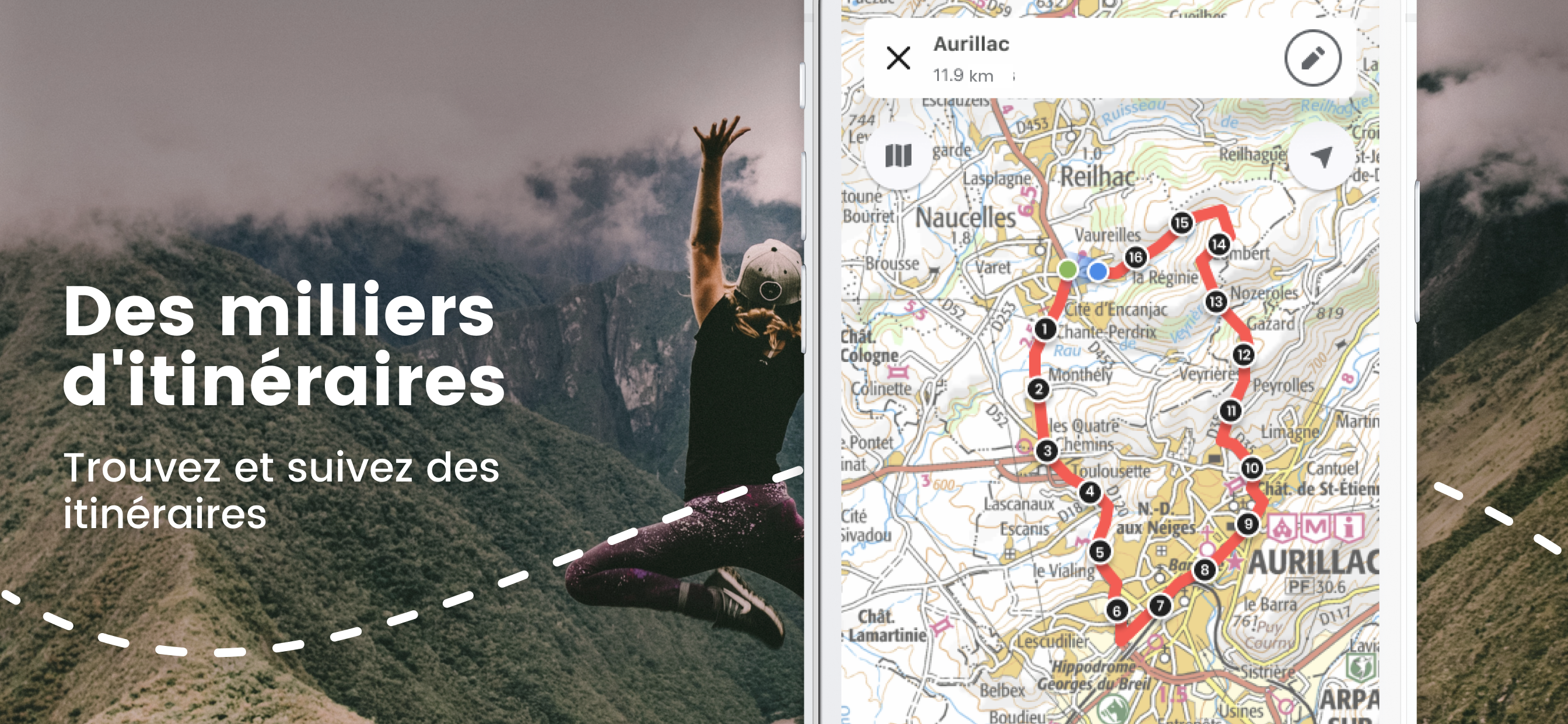
FREE ROUTE BUILDING WEBSITE & COMMUNITY
• Plan, edit and share routes.
• Use our Map Search tool for finding routes all over France.
• View graphical elevation profiles, total climb & distances.
• Move routes between iPhone, iPad and website in seconds.
• Share routes on Facebook, Twitter, Email (or Import/Export GPX files).
NOTE: Continued use of GPS running in the background can dramatically decrease battery life.
You can subscribe to IGN Unlimited Maps. Your subscription will be £30 for 365 days from the date of subscription, charged to your iTunes Account, and will automatically renew unless cancelled at least 24 hours before the end of the current period. Auto-renew can be turned off anytime by going to your Account Settings in iTunes after purchase. No cancellation of the current subscription is allowed during active subscription period. Any unused portion of a free trial period, if offered, will be forfeited when purchasing a subscription.
Terms of Use: http://outdoorsgps.com/terms
Privacy Policy: http://outdoorsgps.com/privacy
Hide..Show more..
In-Apps
IGN Maps PRO
£29.99
France Place Finder
£0.99
12 Month Subscription to Online maps for France
£19.99
Screenshots
User Rating
4.51 out of 5
436 ratings
in United Kingdom
5 star
293
4 star
104
3 star
19
2 star
9
1 star
11
Ratings History
Reviews
Don’t like this app
I asked for a refund and got one.
You zoom in to see map details and it’s a blur.
The IGN 1:25000 maps used are not the latest available and have paths missing.
I’m now trying IGNrando’ app which has great zoom and the latest maps and is cheaper.
I haven’t tested any other functionality of either app yet.
If you haven’t already, check out the French geoportail map website. It’s great for looking at maps on a computer.
IGN needs to take a look at OS
I don’t understand why people are raving about the quality of the maps. IGN could do much better in terms of clarity and detail, particularly compared to OS 25k. But actually, openstreetmap and even Gmaps are better than both of them.
No planning route option
It’s a basic mapping application so gets 2 stars. It is without the features you would expect from modern navigation app. I’ve got the pro IGN version for France, maps are okay, but there seems to be no way to plan/plot a route prior to setting off. These guys need to look at what OS maps provide for the UK to see what functionality they are missing. It’s a poor offering and desperately needs improvement
Great map difficult to read towns on cycle map
Really good mapping but would be good if cycle map could overlay the main IGN map as OS Maps does well.
Hiking in France with one app
Topographic maps are outstanding for hiking in France, because based on historical geographical databases from the main national research institute. All small and marked paths are included. Even paths below tree cover are correct, despite being invisible from satellite or aerial photos, thanks to IGN agents walking there with recording instruments.
App doesn’t work offline at all (v4.25)
I have used Outdoors France for several years, and it worked reasonably OK. But this year June 2019 just as I was going abroad an update was released, this removed all the offline maps, then I find I can’t download them because in v4.24 the app crashed when you tried to select the area for download. This bit was fixed in v4.25 but then when you select the area of say 5MB, but when it starts to download it says it’s 20GB!!! I’ve tried letting it run past the original estimate but it appears to be downloading all of France if it’s really 20GB. Despite some initial replies which got us to v4.24, no response for over a week!!! The app is still broken. So my advice is sadly that you MUST fully test the offline capability BEFORE committing to this app.
I bought this app, as part of the Outdoors GPS UK subscription, which works beautifully. Sadly this year the Outdoors France has let me down badly and I had to buy Viewranger instead.
Further to the above, and by way of feedback for developers. First you really do need to carefully test your product before rolling out updates.
Also, when it’s working correctly the offline Map selection is imprecise. By that I mean that you select a given area and it’s hard to know exactly whether what you selected will cover you exactly, so you end up downloading larger maps than needed.
For users, it’s therefore important that before you use it in a remote area without an internet connection, that you fully check that what you think you downloaded is actually available offline. It’s not possible to check what area you have downloaded, except by going offline and testing the actual route where you wish to walk/cycle etc.
Otherwise the app works fine, and I’m sure that the developers will fix it. My advice to anyone else, is NEVER update a working app before you go on holiday!!! Also if you own two devices, make sure that you change the iPhone/iPad settings so that it does NOT update your other device. I updated my iPhone, but the iPad was still working. Then a day later the iPad had automatically updated and so I was left without any working mapping for France.
Updated....August 2019. After several months of the app not working, the developers have released a completely new version 5.0 It’s fixed the problems with the version above. But my comments above regarding updating before or whilst you are away and needing your app to work are still are still advised.
The new App, has a few minor bugs, which I've already r
Rubbish
Downloaded tiles to view offline, managed to look at them once then they disappeared. Was told only mainland France is covered but friend has downloaded same tiles of Corsica and they can clearly be viewed on their iPad offline.
Still rubbish. 2 weeks in Corsica and a week in the French alps and the developers NOW say there is an update. TOO LATE. my holidays are over and I have paid for a worthless app. REFUND REQUIRED!!!!!
Ok Until V5
I used this app for about 6 months and was quite happy with it.
With the latest update, V5, I can no longer download 1:25k IGN maps.
Looking at alternative apps, I have found that by comparison, the rendering with this app is very poor.
Best walking app for France
As the title says, this is the best walking map for France. I never fear being lost or not getting home.
Ok, work needed
I like the app, but it is a bit clunky. The help needs work, as does the subscription access and the interface needs some customer input - it is very hard to use, although with effort it’s good. Come on guys, get some customer feedback and improve the interface - it will pay you back.