Have fun getting lost with Pocket Earth!
• Detailed worldwide maps and travel guides • Topographic contour maps for the outdoors • Works completely offline even with GPS • Great when abroad or in the wilderness, NO data roaming charges • Online routing with Voice Guidance and much more!
• We give you one offline city for free, in-app upgrade to access unlimited worldwide offline maps and topographic maps feature. Bonus: All of Africa Standard maps are always free, and other rotating locations.
« Reviews »
“I love this technology” – Natali Morris, Tech Reporter, NBC’s Today Show
Editor's Pick Best Offline Map App – thedigitaltrekker.com
“The best travel app in the world… Don’t leave home without it!” – bonvoyageurs.com
“Very impressive app with unmatched features.” – toptenreviews.com
« Maps »
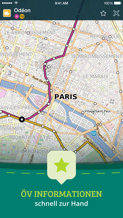
• Beautiful Retina quality maps at a fraction of the size! The fastest and most beautiful offline maps on the App Store!
• Detailed and interactive worldwide maps! More than 100,000 places!
• Access your maps online and offline! Saves on data roaming costs!
• Personalize the maps to show the info you want!
• Online Routing with directions. Save your multi-stop itineraries for offline voice guided navigation!
• Online street address search and contacts integration!
• Did we mention everything is offline? Works anywhere- cities, small towns, even in the middle of nowhere. Never any roaming charges. We dare you to try it!
« For the Traveler »
• Find out about thousands of interesting places - hotels, restaurants, bars, tourist sites, even get metro and public transit info!
• Our super wide area Nearby search is also super fast!
• Have all the travel info you need with more than 25,000 detailed Wikivoyage Travel Guides and more than 1 million Wikipedia articles in 7 languages! All offline of course!
• Customizable Pins and favorites groups! Add notes and mark and share favorite spots!
• Share maps links and your current location!
« For the Adventurer »
• An in-app purchase option offers topographic maps. Get high performance, high accuracy 10m / 50ft contour display world-wide. The ONLY offline app that lets you download large areas, even entire countries! Contours are displayed on our existing maps for all Activities.
• Hiking and Cycling maps! Great for geocaching and getting off the track!
• GPS track recording lets you see what route you took! Great for hikes, cycling and off road! Never get lost again!
• Import/Export support for GPX and CSV files! Share with friends using PE Archives.
• Displays and lets you search for map coordinates in all common formats (including DD, DDM, DMS, MGRS, UTM/UPS, GeoHash, and what3words)!
• Numerous GPS settings for your preferred configuration including compass and heading arrow or rotation, look ahead mode, accuracy and recording settings.
...and much more - so try it out!
« How's it Work? »
Just select the cities, regions, or even whole countries you want to download, and it will be available for offline use, complete with information on thousands of POIs (Points of Interest), and optionally, topographic maps, travel guides and Wikipedia articles.
To learn more about Pocket Earth or the community driven open data sources that we use, please visit our website.
Don’t forget this:
1. Continued use of GPS running in the background can dramatically decrease battery life. Only the GPS Route Navigation and GPS Track Recording features will use the GPS when running in background.
2. This app uses data from the amazing community driven open mapping project called openstreetmap.org! Coverage detail may vary by region, please visit our website to check the map detail for your regions of interest.
3. Does not currently support all asian texts on the map (Chinese, Japanese, etc).
Gratuliere zu dieser sehr guten App. Ich hätte jedoch noch ein paar Wünsche, mit denen ich vielleicht nicht allein bin:
Sehr gut ist:
Detailreichtum der Karten, Anzeige von Strassennamen und Hausnummern, Alle möglichen Straßen, Wege und Pfade
Was ich mir noch wünsche:
Höhenlinien andersfarbig oder weniger kräftig darstellen (evtl. Individuell einstellbar), das fördert die Lesbarkeit.
Wanderweg: Strichstärke ist fast gleich wie die von Höhenlinien. Ein stärkerer Unterschied würde die Lesbarkeit verbessern.
Bei der Tourenplanung (hiking oder zu Fuß) folgt die Route immer den einfacheren Wegen, sie “springt” wenn ich z.B. einen Klettersteig in die Tour integrieren will, auf einen “normalen” Wanderweg. Dieses automatische “Umspringen” sollte abgestellt werden können.
I love that is shows house numbers
The street address shown over a structure is a super useful feature that exists on this map. Only available in cities that publish that information on their city maps, but still very useful! 3-9-2023
Nicht offline
Funktioniert nicht offline wie versprochen. Nicht brauchbar
Excellent
Très utile pour les voyages et les déplacements. L’utilitaire fonctionne également hors ligne lorsque la carte a été téléchargée.
Extrêmement utile pour les déplacements à pied. On peut en effet facilement préparer son itinéraire pédestre, les propositions d’itinéraire sont bonnes. Je l’utilise aussi pour télécharger des tracés GPS pour la randonnée pédestre. Sa fonction de zoom et de mémorisation des lieux est très pratique.
Vivement recommandé
Cool
Its very good!
The must-have app for map fiends
This really my favourite of all apps. Worth every euro for the additional whistles and bells. It can be used offline and outstrips the abilities of google maps for most purposes.
For map friends a must-have application.
Exactly what I need !
Have gone for walks and hiking at home and traveled around the world during years using PocketEarth. It is exactly what I need. It works when do not have internet and keeps the information. Thank you !!
Einfach gut
Die App hat und auf einigen Reisen gut unterstützt, auch Kuba durchquerten wir damit.
Nun bereiten wir Kanada (Osten) vor und sind überzeugt, dass unsere Rundreise wieder perfekt gelingen wird.
Besten Dank
Genial
Pocket Earth hat uns zuverlässig durch die USA und Kanda geführt. Jetzt sind wir sind in Italien - Pocket Earth kennt auch hier jede Ecke ;)
Super!,
Umfassende Funktionalität
Super App, speziell: Velo-Routenplaner, auch für Rennvelo geeignet Dank Routen nur auf befestigten Strassen. Allerdings ist diese Funktion nicht ganz zuverlässig. Mit in App Kauf weltweite Detailkarten sogar mit Höhenkurven. Was noch fehlt: Anzeige des Höhenprofils einer geplanten Route.