OsmAnd Maps Reise & Navigation
Offline-Karten für die Reise
#1 Keyword Rankings
Today
Top 10 Rankings
Today
Top 30 Rankings
Today
Top 100 Rankings
Today

Description

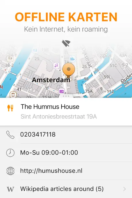
OsmAnd ist eine Offline-Weltkartenanwendung auf Basis von OpenStreetMap (OSM), mit der Sie unter Berücksichtigung der bevorzugten Straßen und Fahrzeugabmessungen navigieren können. Planen Sie Routen basierend auf Steigungen und zeichnen Sie GPX-Tracks ohne Internetverbindung auf.
OsmAnd ist eine Open-Source-App. Wir sammeln keine Nutzerdaten und Sie entscheiden, auf welche Daten die App Zugriff hat.

Haupteigenschaften:

Kartenansicht
• Auswahl der auf der Karte anzuzeigenden Orte: Sehenswürdigkeiten, Essen, Gesundheit und mehr;
• Suche nach Orten nach Adresse, Name, Koordinaten oder Kategorie;
• Kartenstile für die Bequemlichkeit verschiedener Aktivitäten: Tourenansicht, Seekarte, Winter und Ski, topografisch, Wüste, Offroad und andere;
• Schattierungsrelief und steckbare Konturlinien;
• Möglichkeit, verschiedene Kartenquellen übereinander zu legen;

GPS Navigation
• Zeichnen einer Route zu einem Ort ohne Internetverbindung;
• Anpassbare Navigationsprofile für verschiedene Fahrzeuge: Autos, Motorräder, Fahrräder, 4x4, Fußgänger, Boote, öffentliche Verkehrsmittel und mehr;
• Ändern Sie die erstellte Route unter Berücksichtigung des Ausschlusses bestimmter Straßen oder Straßenoberflächen;
• Anpassbare Informations-Widgets über die Route: Entfernung, Geschwindigkeit, verbleibende Fahrzeit, Entfernung zum Abbiegen und mehr;

Routenplanung und Aufzeichnung
• Zeichnen einer Route Punkt für Punkt mit einem oder mehreren Navigationsprofilen;
• Routenaufzeichnung mit GPX-Tracks;
• GPX-Tracks verwalten: eigene oder importierte GPX-Tracks auf der Karte anzeigen und durch diese navigieren;
• Visuelle Daten über die Route - Abfahrten/Aufstiege, Entfernungen;
• Möglichkeit, GPX-Tracks in OpenStreetMap zu teilen;

Erstellen von Punkten mit unterschiedlicher Funktionalität
• Favoriten;
• Markierungen;

OpenStreetMap
• Bearbeiten von OSM;
• Kartenaktualisierung mit einer Häufigkeit von bis zu einer Stunde;

Zusatzfunktionen
• Kompass- und Radiuslineal;
• Mapillary-Schnittstelle;
• Nachtthema;
• Große Benutzer-Community auf der ganzen Welt, Dokumentation und Support;

Kostenpflichtige Funktionen:


Maps+ (In-App oder Abonnement)
• Apple CarPlay-Unterstützung;
• Unbegrenzte Kartendownloads;
• Topodaten (Höhenlinien und Gelände);
• Nautische Tiefen;
• Offline-Wikipedia;

OsmAnd Pro (Abonnement)
• Alle Maps+-Funktionen;
• OsmAnd Cloud (Sicherung und Wiederherstellung);
• Wettervorhersage auf der Karte online/offline;
• Routenlinie anpassen;
• Stündliche Kartenaktualisierungen.
Hide.. Show more..

In-Apps

Europa
CHF 15.00
Wikipedia
CHF 0.00
OsmAnd Maps+
CHF 30.00
Contour lines
CHF 9.00
Alle Weltkarten
CHF 20.00
Nautische Karte
CHF 2.00
OsmAnd Pro jährlich
CHF 30.00
OsmAnd Pro monatlich
CHF 2.50
OsmAnd Maps+ jährlich
CHF 10.00
OsmAnd: All inclusive Jährlich
CHF 9.00

Screenshots

User Rating

4.53 out of 5

496 ratings in Switzerland

5 star
352
4 star
91
3 star
31
2 star
8
1 star
14

Ratings History

Reviews

L’outil ultime de cartographie en voyage

DidierBurkhalter on

Les différentes cartographies sont riches et détaillées et les fonctionnalités sont très complètes. Je note particulièrement: - le partage de fichiers Gpx par AirDrop et particulièrement les fichiers de cartographie pour éviter de les télécharger à l’étranger lors de voyages, et échangeables entre appareils du même compte. - la possibilité de partager les paramètres sur un appareil Androïd. - la fonction CarPlay ❤️ - la création et la consultation de traces.

Not suitable for car navigation

MxLaP on

It is not useful for car navigation as it can’t cope with tunnels. It will freeze until it gets signal from GPS so you might miss exits. Google Maps is way better. Also destination search is not convenient. Main use was following gpx tracks and some bike routing for which it is o.k. But tends to crash when zooming maps on I Phone. Also searching map is not easy as it defaults to current position always when moving map. Maps are not topo so for bike nav have now replaced it with Komoot and Outdooractive. In my opinion not first choice anymore.

A lot of features, but unusable as map

nounours_77 on

Coming back to OSMand after having used PocketEarth for many years (which is the best app, but unfortunately not maintainend anymore). I'm still impressed by the wealth of features, and much configuration options. As OSMand is originally a routing app, and was not a map, it has largely improved the map-features. Map rendering is much better than it was. Still: it is unusable as a map for serious navigation (watching at the map, and do human navigation - not automatic navigation along a route as understood the developper in the reply), as the map rotates when you zoom with two fingers, and there is (yet!) no way to deactivate this. So each time you zoom, you have the risk that the map turns, which will completely desorient yourself. And if you do not realise it, you will walk the wrong way and get lost. If you realise it, you can press to north up button. This means, after each two finger zoom I have to press a button. So, really pitty for this nice app, but this big problem makes it unuseable if you want to use it as a map. It still might be very good for autonavigation (which I don't use). EDIT after reply. And I'm currently working with the devs to solve the issue, they are very responsive!!! Hope I can delete this feedback soon.

Great

Tomthechef2 on

very useful app. One thing: Contour lines downloads seem not to work although I bought a subscription. The download item seems grayed out and when hitting the purple download button, nothing happens. Any reason why this is?

Génial

catete58 on

Le top du top

Remarquable mais....

Sympa53 on

Remarquable application. Mais.... J'habite dans une rue de 12 immeubles depuis bientôt 7 ans et cette rue ne figure pas encore sur la carte! Dans la navigation, l'indication de la vitesse autorisée manque beaucoup trop souvent. La navigation et les cartes doivent être améliorées. Pour le reste c'est la meilleure application du genre. Elle est exceptionnelle.

Versteckte Kosten 🤮

mhkkhrfvjigf on

Jede Karte muss noch dazu gekauft werde. Dann sollte man die App nicht Kostenlos anbieten!

Top

jdkfjenföfjjflgoejdöüykd on

Fünf sterne!

Praktische Hilfe

Sicher unterwegs on

Ich schätze diese App als hilfreiche Begleitung - auch ohne Abo!

Planing of hiking parkurse

mcaprari on

Really nice application, however i dont manage to plan a parcurse, like start and end with some defined point ln the middle

Store Rankings

Ranking History

Category Rankings

Chart
Category
Rank
Top Grossing
5
Top Grossing
5
Top Grossing
8
Top Grossing
8
Top Grossing
10

Keywords

Users may also like

Name
Guru Maps — GPS Offline Karten
Navigation & Routenplaner
Navitel Navigator
GPS Navigation, Offline Karten
Topo GPS - Topographic maps
Topografische Karten
Topo Maps+
GPS Maps for Hike, Hunt, Trail
Open GPX Tracker
No ads, no in-app purchases
Magic Earth Navigation & Maps
Offline Maps, Traffic
Scenic Motorcycle Navigation
Plan, Ride & Track moto Routes
GPX viewer
The paper map reinvented
Organic Maps: Navi & Karten
Navigation ohne Internet, GPS
دليلة البر
Show More

Revenue and Downloads

Gain valuable insights into OsmAnd Maps Travel & Navigate performance with our analytics. Sign up now to access downloads, revenue, and more.

App Info

Category
Travel
Publisher
OsmAND B.V.
Languages
Assamese, tz, ck, Arabic, Sanskrit, hs, Breton, Esperanto, Danish, Azerbaijani, Armenian, Russian, Bulgarian, Croatian, Icelandic, Galician, Catalan, Hungarian, Hindi, Afrikaans, Georgian, Indonesian, Interlingua, Turkish, Tamil, Serbian, Occitan, Welsh, Bengali, Norwegian Bokmål, Basque, Hebrew (modern), Greek (modern), Kurdish, Kannada, German, Estonian, Latvian, Norwegian Nynorsk, Czech, Slovak, Slovene, Panjabi, Japanese, French, Bosnian, Persian, Polish, Telugu, Ukrainian, Urdu, Uzbek, Swedish, Belarusian, Lithuanian, Chinese, Burmese, Romanian, Italian, Finnish, English, Dutch, Portuguese, Mongolian, Sardinian, Spanish, Vietnamese, Aragonese, Albanian, Tatar, Korean, Macedonian, Marathi, Malayalam
Recent version
4.7.6 (1 month ago )
Released on
Apr 21, 2015 (9 years ago )
Last updated
2 weeks ago