Facile à utiliser
Super petite application pour mes déplacements en montagne ou même sur les sentiers publics ou encore lors de mes déplacements à vélo.


4.46 out of 5
65 ratings in United Kingdom
Super petite application pour mes déplacements en montagne ou même sur les sentiers publics ou encore lors de mes déplacements à vélo.
I upgraded to pro version and never receive email confirmation. The app is good but I can’t use all the features because I’m not able to login.
This map is very good. The level of detail is superb and the fact that you can select the amount of detail in settings is great. I particularly like the fact that this maps show every single rail line that has ever existed even where the lines have been closed for decades. Shows just how badly the UK rail network was managed in the 1960s. This app is definitely worth the upgrade fee to pro.
The maps use far less memory than other systems and you really can use them for free over small areas but it is amazingly cheap to buy the whole world. It is really easy to use compared to, say, View Ranger. The footpath coverage is not as full as some other systems but is still pretty good. Even if you have a more complex app on your device you might consider having this as well as it is so easy to use and occupies so little memory. I'd advise anyone to have a quick look - you will get the hang of it straight away. EDIT: Actually, the maps are on the large size compared to OpenAndroMaps but, as they are so easy to load and unload, this is not a big deal. The app's ease of use IS a big deal.
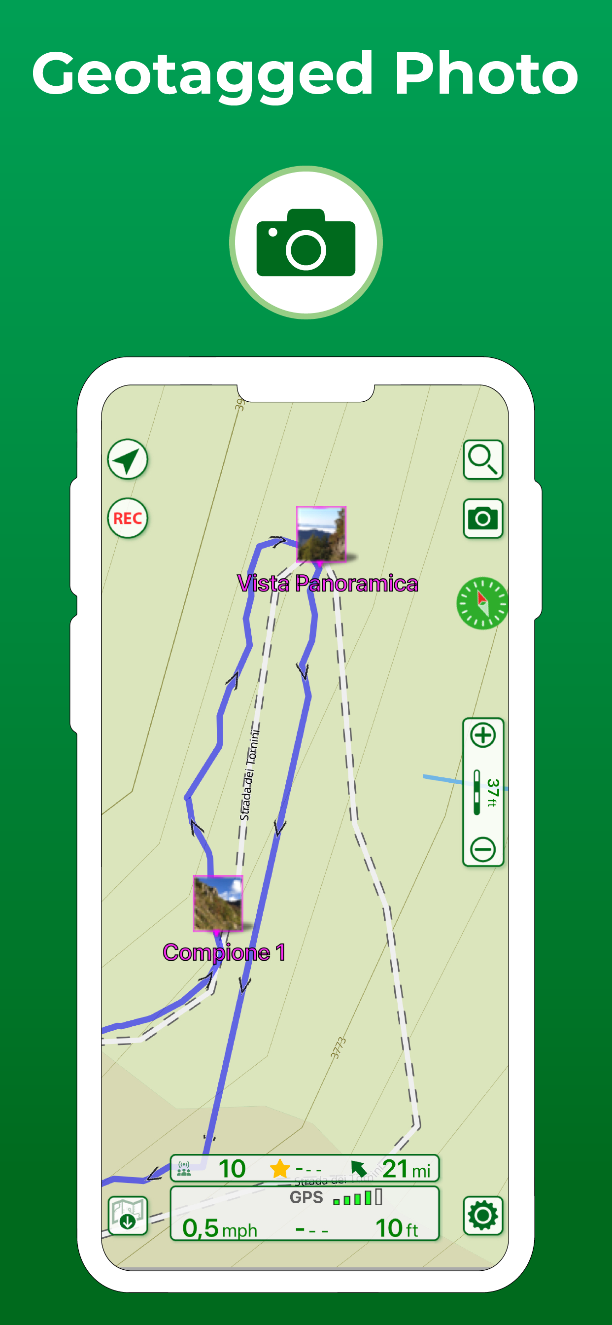
Downloaded this great little app to use while walking on holiday in Spain. It does exactly what it says - without all the extra frills of Google et al. GPS logging was accurate and the ability to tag photos a nice bonus touch. Highly recommended.
|
Chart
|
Category
|
Rank
|
|---|---|---|
|
Top Grossing
|

|
36
|
|
Top Grossing
|

|
54
|
|
Top Grossing
|

|
91
|
|
Top Grossing
|

|
97
|
|
Top Free
|
|
189
|
| Name | Reviews | Recent release | |
|---|---|---|---|

georesq
|
0
|
3 weeks ago | |

Outdoor Trentino
|
1
|
4 months ago | |

Topo Maps+
Offline Topographic Maps & GPS
|
10
|
1 week ago | |

Open GPX Tracker
No ads, no in-app purchases
|
13
|
1 year ago | |

Via Francigena – Official App
A trip in the Europe heart
|
1
|
2 years ago | |

WHIP LIVE Moto, Bike, Trekking
Track • Navigate • Explore
|
2
|
1 week ago | |

Sentieri in Tasca
|
0
|
3 months ago | |

Mappa Digitale Sentiero Italia
La mappa digitale ufficiale
|
0
|
3 months ago | |

Mountain Maps
|
1
|
2 weeks ago | |

Altimeter Mountain GPS Tracker
Altimeter & Tracker For Hikers
|
0
|
3 months ago |