Educational
Not part of the firefighters family, but find this app very educational regarding wildfires and the various factors that effect its spread.


4.7 out of 5
10 ratings in United States
Not part of the firefighters family, but find this app very educational regarding wildfires and the various factors that effect its spread.
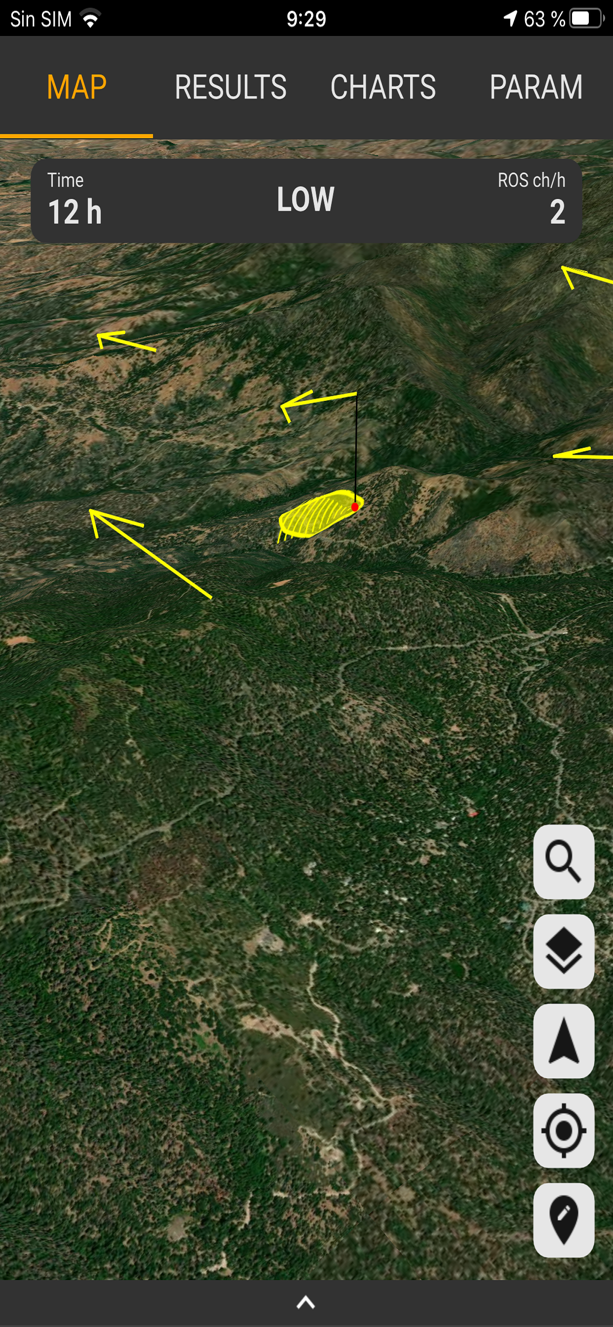
I too would like to email a report from the app show inputs and outputs for documentation. Also, export of the fire perimeters in kml(Google Earth) format would be a great addition. Maybe a future update could use the UCSD open source API, to run a predicted Perimeter such as those created using FARSITE modeling. Then select basic surface model (current state) or FARSITE model. UCSD map application is called WIFIRE, but appears to be California only at this time.
I really like this app. Great making modeling accessible and easy to use. Since I work for a government agency I would like it even better if I could email the results to myself for documentation. I apologize if it has that capability and I have missed it
| Name | Reviews | Recent release | |
|---|---|---|---|

IRPG App (2022)
Incident Response Pocket Guide
|
8
|
2 years ago | |

AskRail
|
11
|
1 week ago | |

IFSTA Company Officer 6
|
14
|
2 months ago | |

FIRESCOPE FOG (ICS 420-1)
|
3
|
1 year ago | |
SimsUshare
|
16
|
2 years ago | |

DRR Rescue
Urban Technical Rescue
|
23
|
4 days ago | |

Waterbomber Wildfire Tracker
Track Waterbombers on radar
|
7
|
3 months ago | |

CAL FIRE Wellness
|
3
|
7 months ago | |

EV Rescue - Electric Vehicles
Emergency Response Guides
|
5
|
1 month ago | |

S-SV EMS Field Resource Guide
|
0
|
1 week ago |