Best of the best
Wow! Amazing!

Ja, PeakVisor ist kostenlos herunterzuladen, enthält jedoch In-App-Käufe oder Abonnements.
🤔 Die Qualität der PeakVisor-App ist gemischt. Einige Nutzer sind zufrieden, während andere Probleme melden. Ziehen Sie in Betracht, einzelne Bewertungen für mehr Kontext zu lesen.
PeakVisor bietet mehrere In-App-Käufe/Abonnements, der durchschnittliche In-App-Preis beträgt 210.99 zł.
Um geschätzte Einnahmen der PeakVisor-App und weitere AppStore-Einblicke zu erhalten, können Sie sich bei der AppTail Mobile Analytics Platform anmelden.

4.77 von 5
854 Bewertungen in Polen
Wow! Amazing!
I tried other apps cause this seems to be expensive but after seeing how bad are the others I feel proud to support those developers. Works like a charm, gives me a lot of satisfaction when using. Great work!
Free version’s „use once a day” mode is pretty useless. Steep subscription price.
Crashes a lot. Has UI layout issues on iPhone SE. I have no idea how Apple could decide to feature this buggy app :( Canceling my trial and uninstalling. 👎🏻
Apka super ,szkoda tylko że brak języka polskiego ,ale pięć gwiazdek się należy
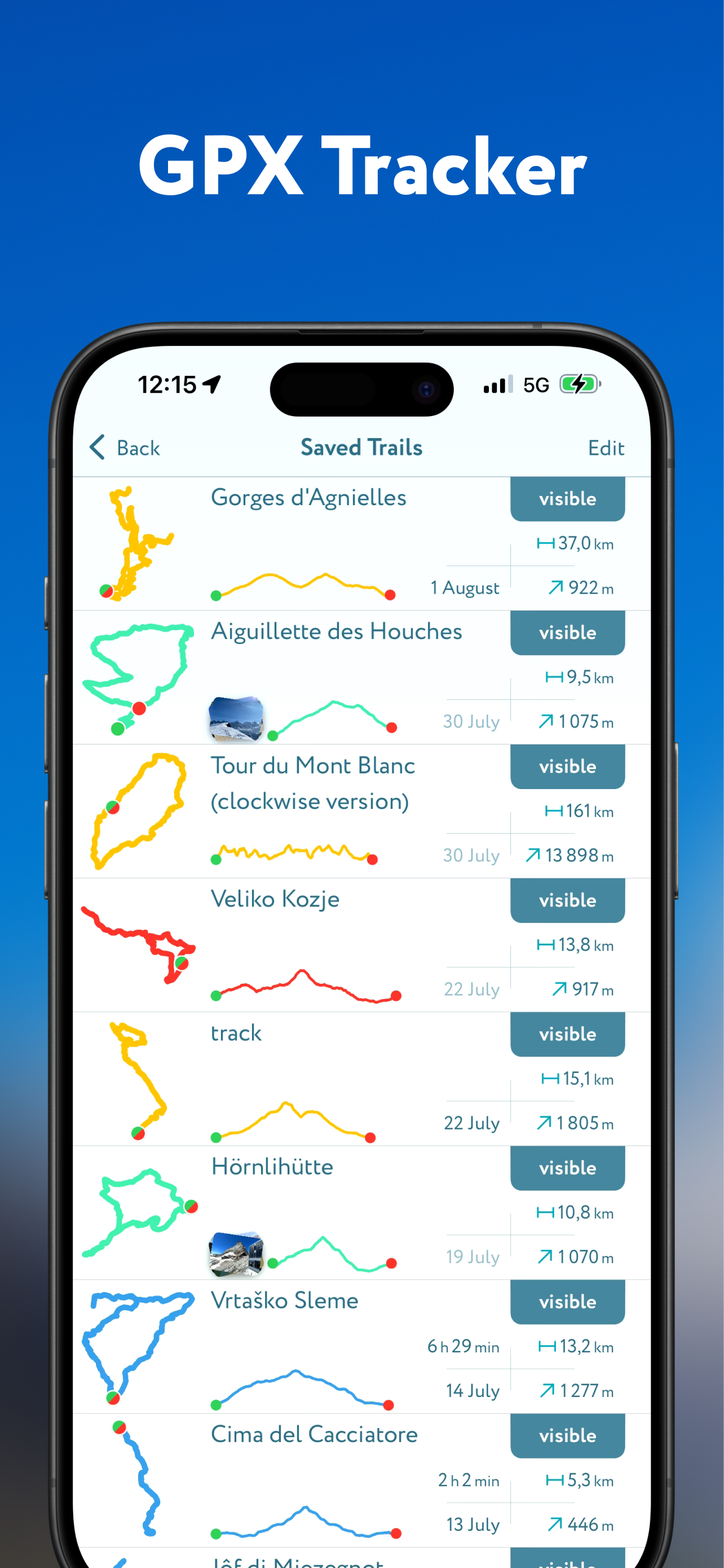
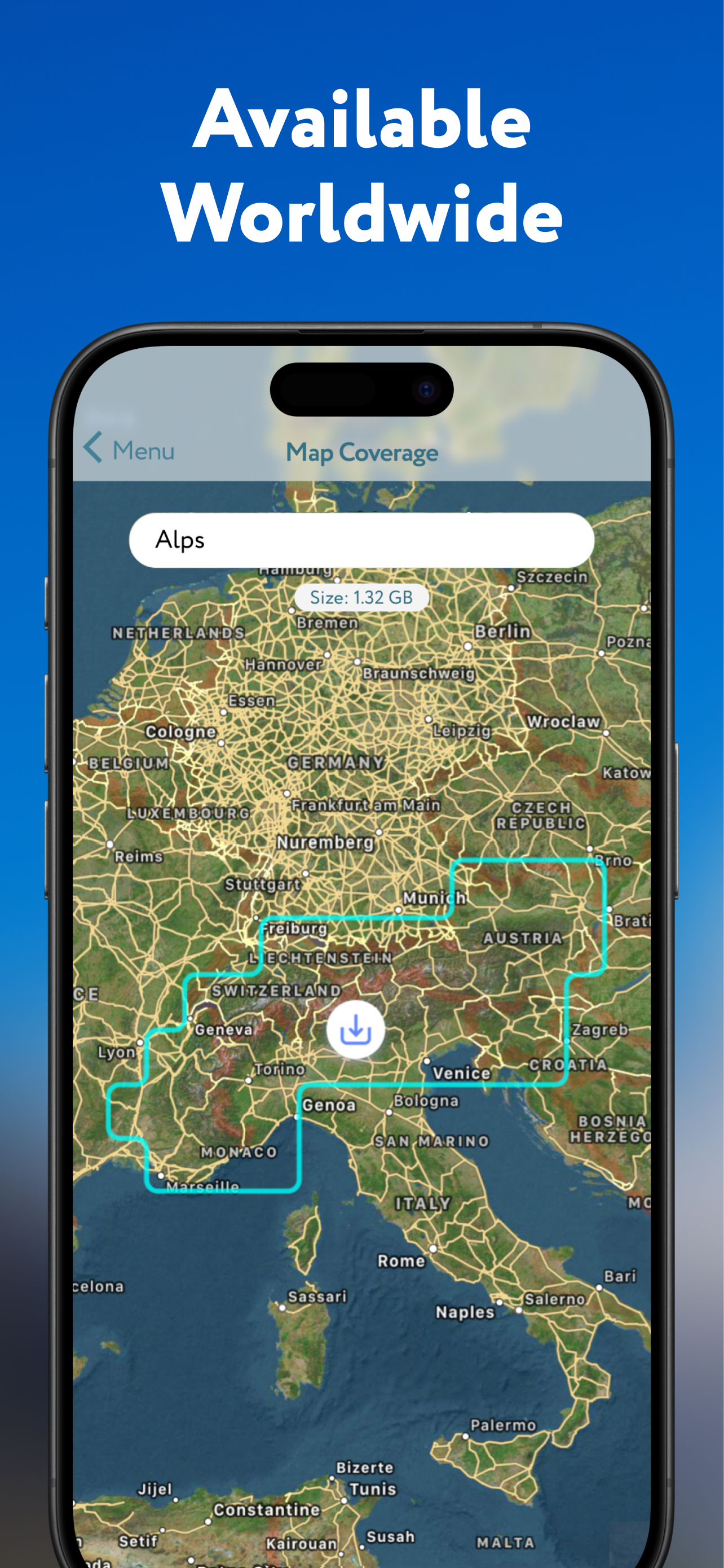
Bardzo fajna apka. Świetnie sprawdza się w górach. Oczywiście lepiej ściągnąć wcześniej mapy na telefon bo wiadomo jak w górach z zasięgiem :)
Era un App che ho scaricato per valutarla, dopo di che ho provato la versione PRO definitiva poiché non si capiva se con la versione PRO so sarebbe potuto accedere a funzionalità di consultazione maggiori, ma ahimè si è dimostrata un disastro assoluto non funzionante sia nello scrolling che nel posizionamento sulla mappa, oltre all'impossibilità o a tempistiche folli per scaricare le visualizzazioni di aree differenti o limitrofe a dove si è... con conseguente impossibilità di pianificazione... di per se se avesse offerto cosa prometteva sarebbe stata eccellente ma come scritto nel titolo probabilmente non viene assolutamente curata e sviluppata. Massima delusione.
Ho scaricato la Versione base, ma non riesco a programmare nessun giro, probabilmente è troppo complicato per me …!! Sarei interessato anche a fare l’abbonamento se fosse facile da usare 😕
Applicazione spettacolare. Degnissima sostituta di FATMAP, peccato però che non ci sia la mappa dell’esposizione.
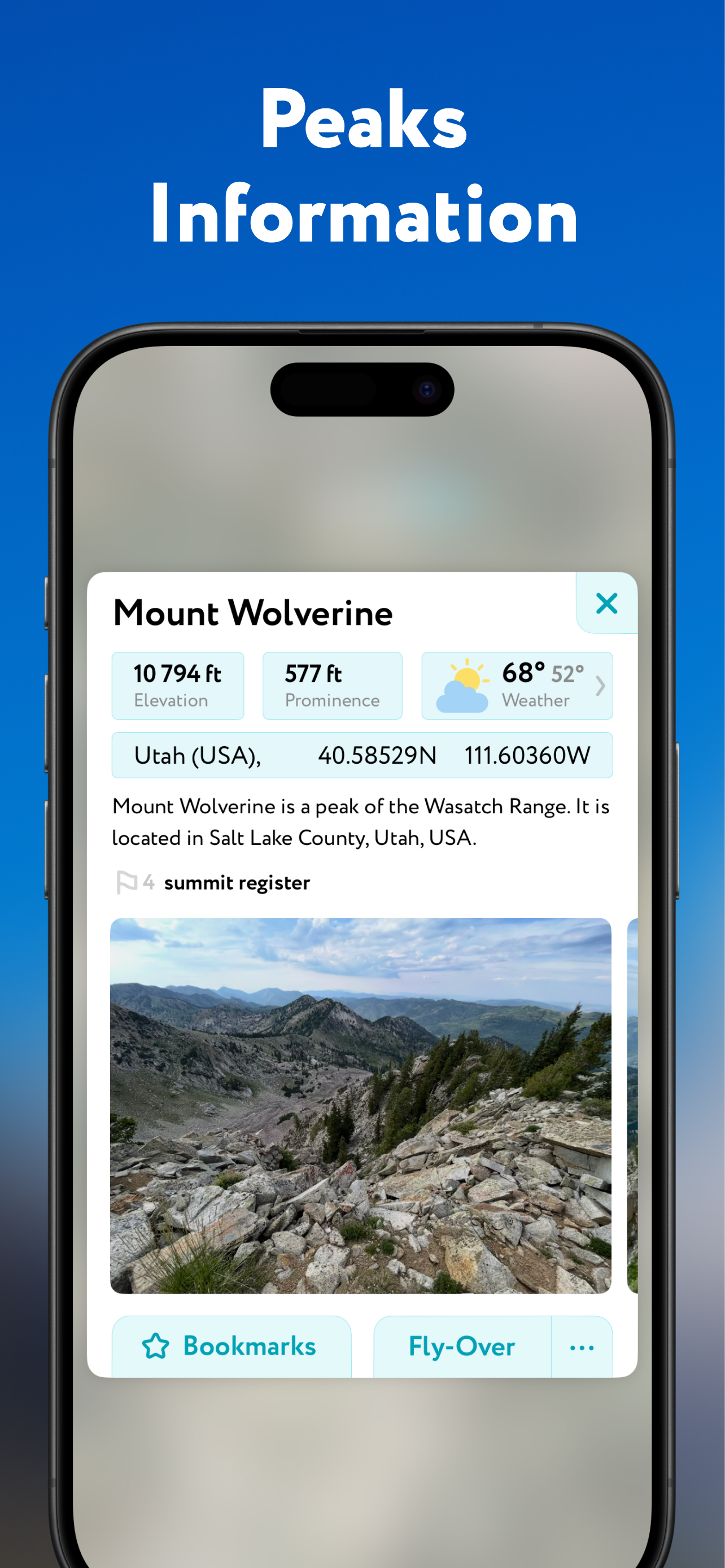
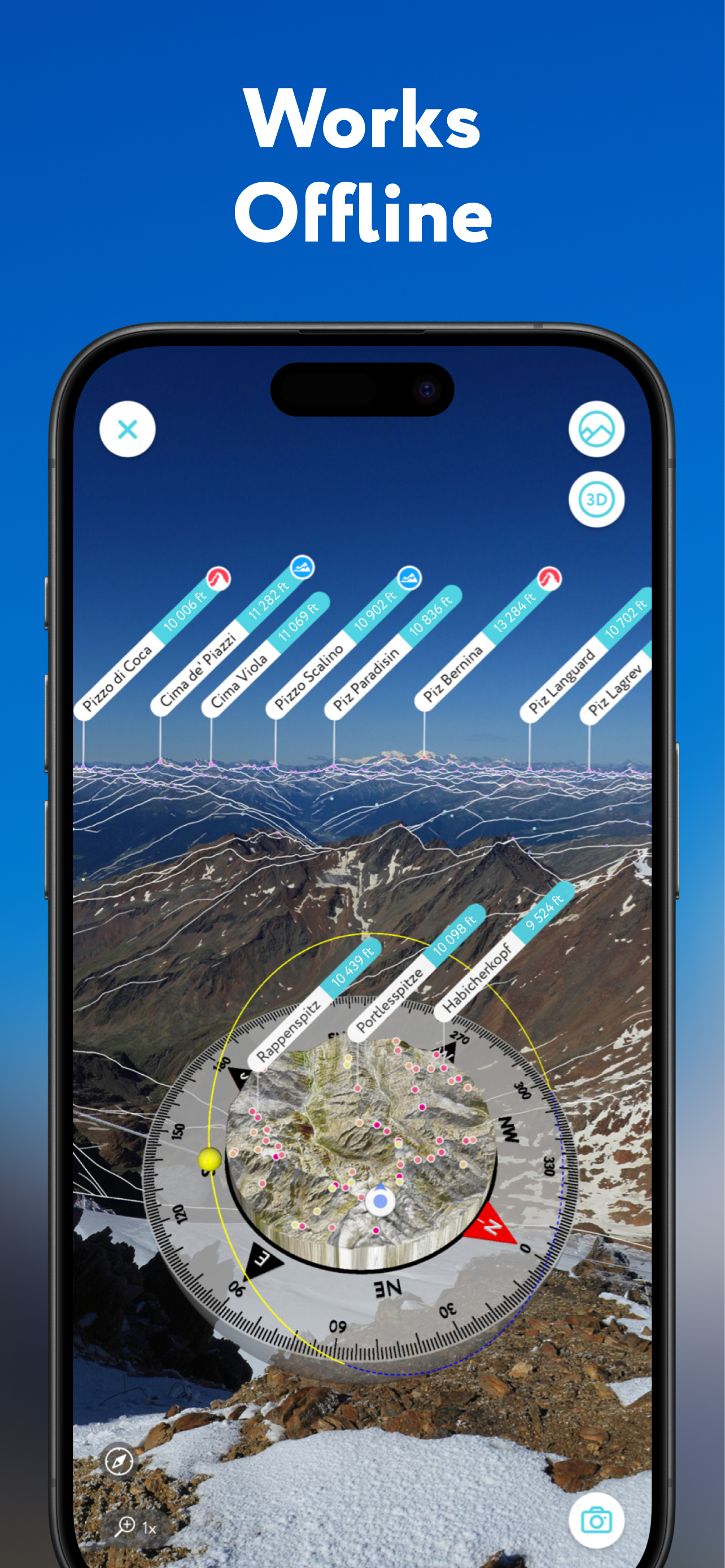
Molto utile la possibilità di visualizzare ed avere informazioni sulle cime del panorama che viene inquadrato. Sarebbe apprezzato poter scegliere la grandezza dei caratteri dei nomi delle montagne. Comunque si tratta di un’app davvero consigliata.
|
Diagramm
|
Kategorie
|
Rang
|
|---|---|---|
|
Top Umsatz
|

|
3
|
|
Top Umsatz
|

|
4
|
|
Top Umsatz
|
|
5
|
|
Top Umsatz
|

|
5
|
|
Top Umsatz
|

|
6
|
