App feedback
Would like to use the app but only have one form of log in isn’t it chief. Add sign up option for email/facebook

Ja, Hiking Maps ist kostenlos herunterzuladen, enthält jedoch In-App-Käufe oder Abonnements.
🤔 Die Qualität der Hiking Maps-App ist gemischt. Einige Nutzer sind zufrieden, während andere Probleme melden. Ziehen Sie in Betracht, einzelne Bewertungen für mehr Kontext zu lesen.
Hiking Maps bietet mehrere In-App-Käufe/Abonnements, der durchschnittliche In-App-Preis beträgt £38.66.
Um geschätzte Einnahmen der Hiking Maps-App und weitere AppStore-Einblicke zu erhalten, können Sie sich bei der AppTail Mobile Analytics Platform anmelden.

4.57 von 5
904 Bewertungen in Vereinigtes Königreich
Would like to use the app but only have one form of log in isn’t it chief. Add sign up option for email/facebook
Great app
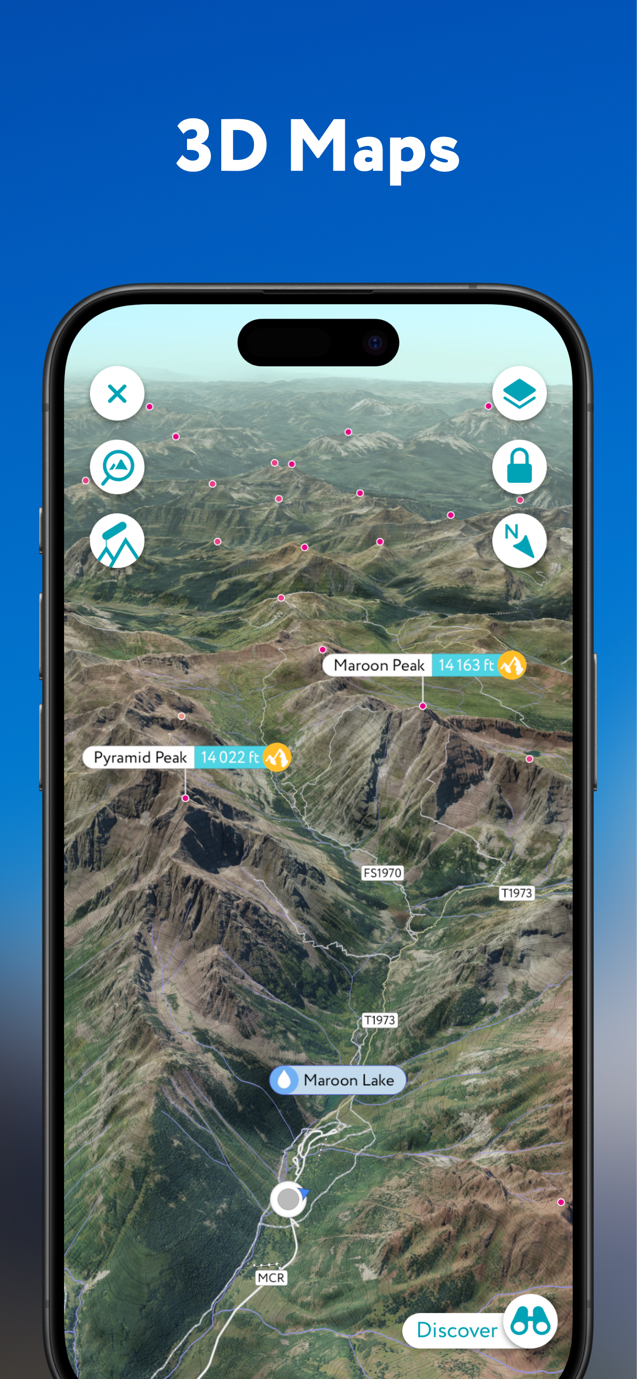
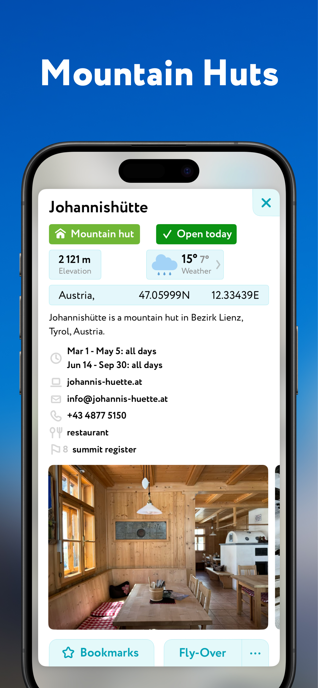
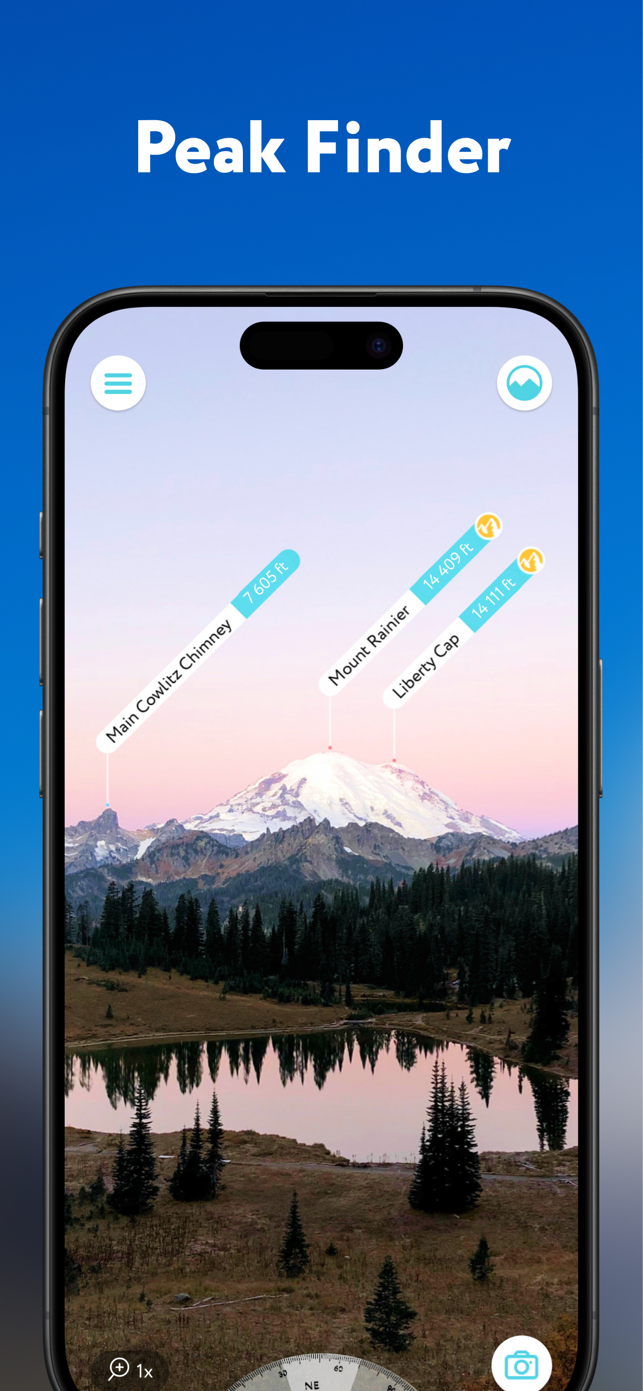
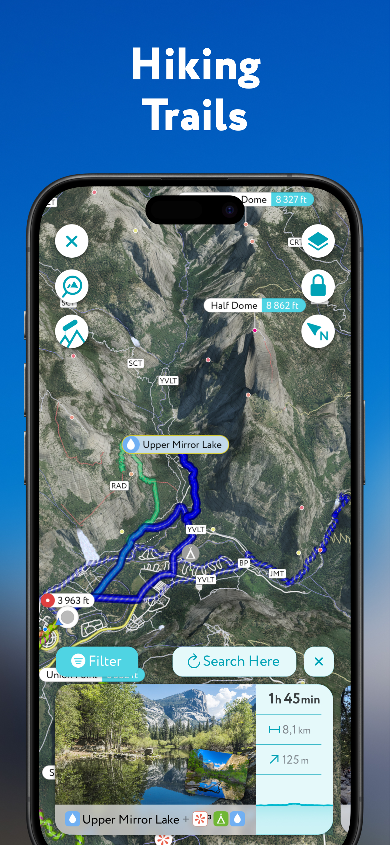
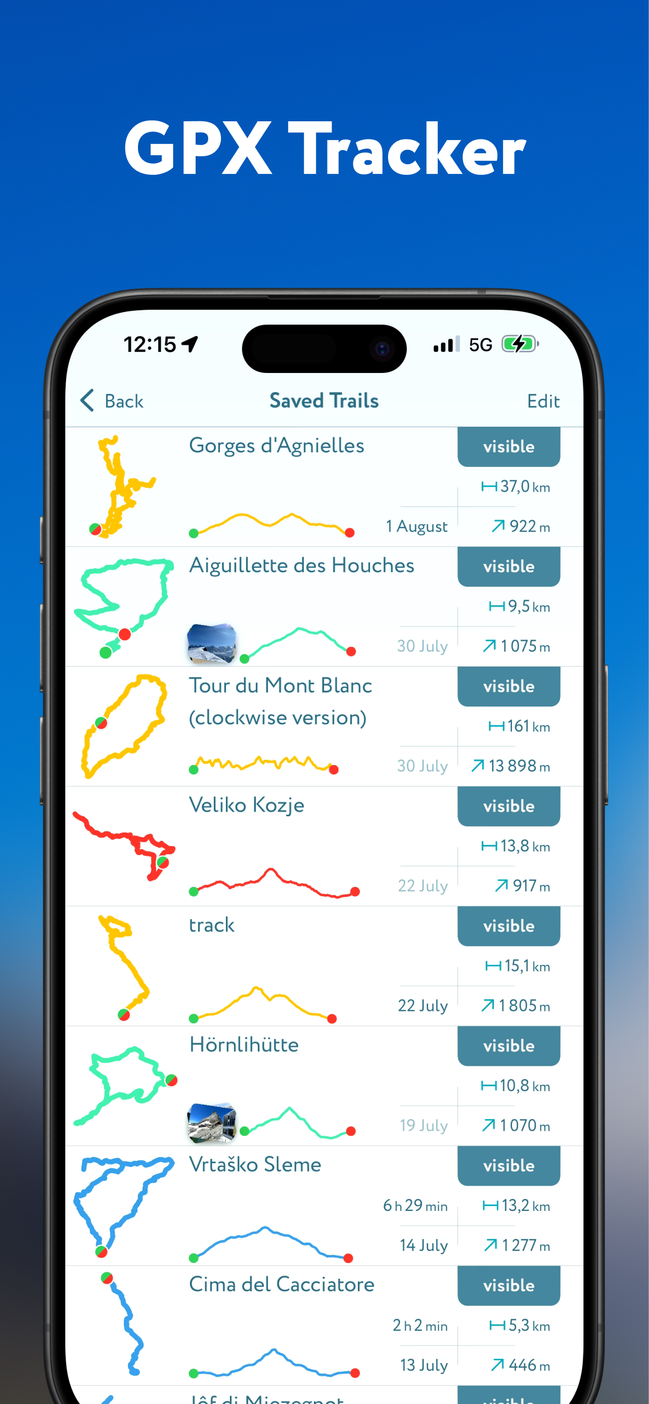
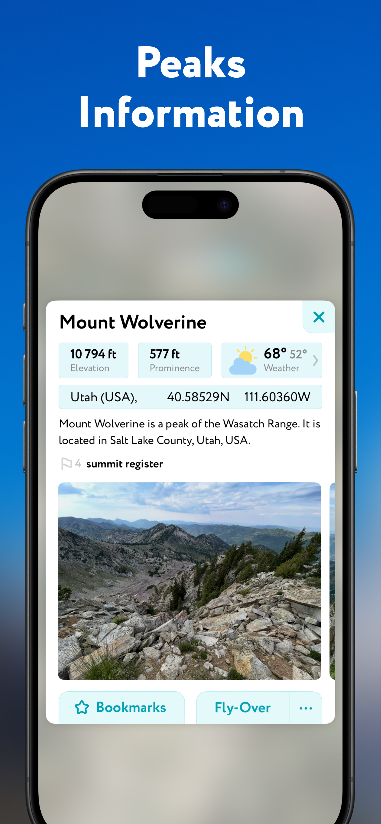
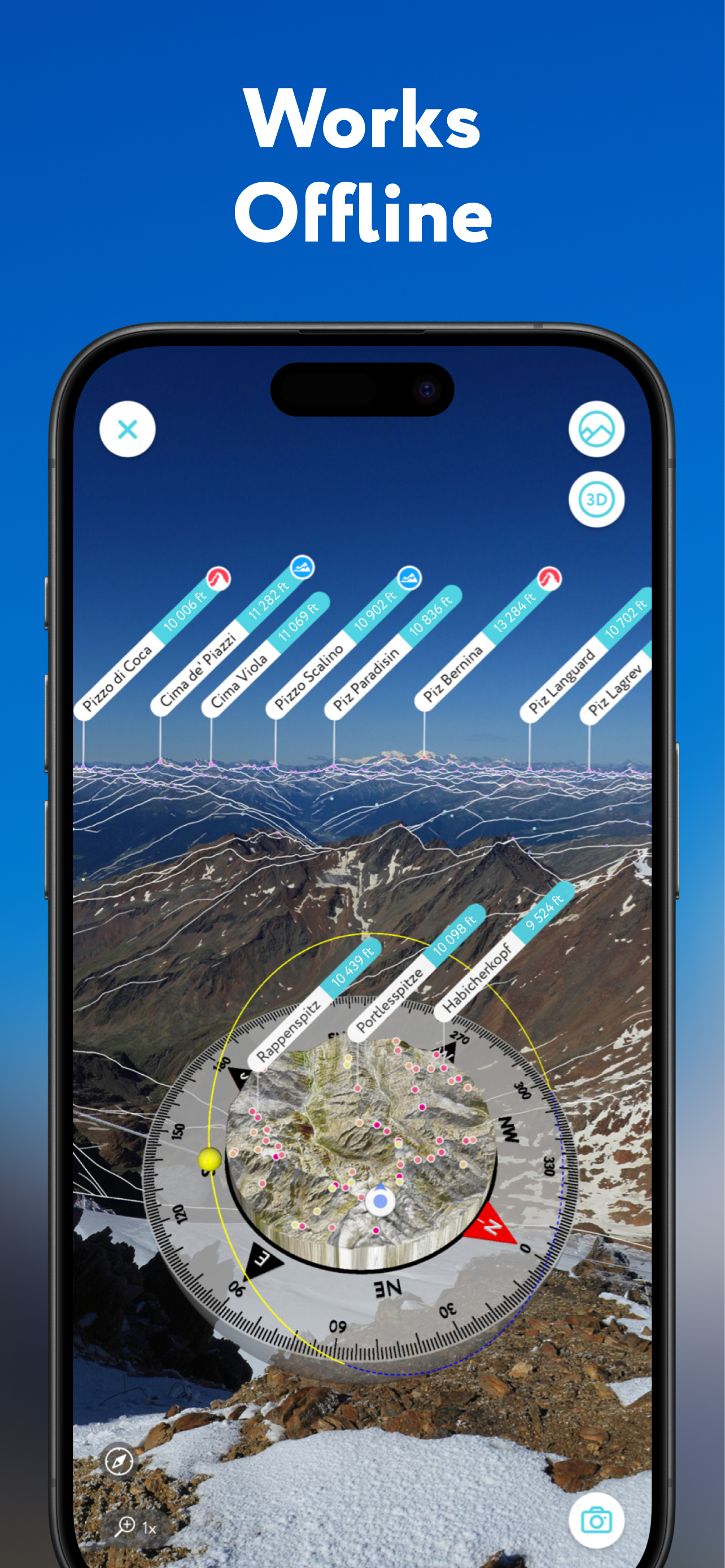
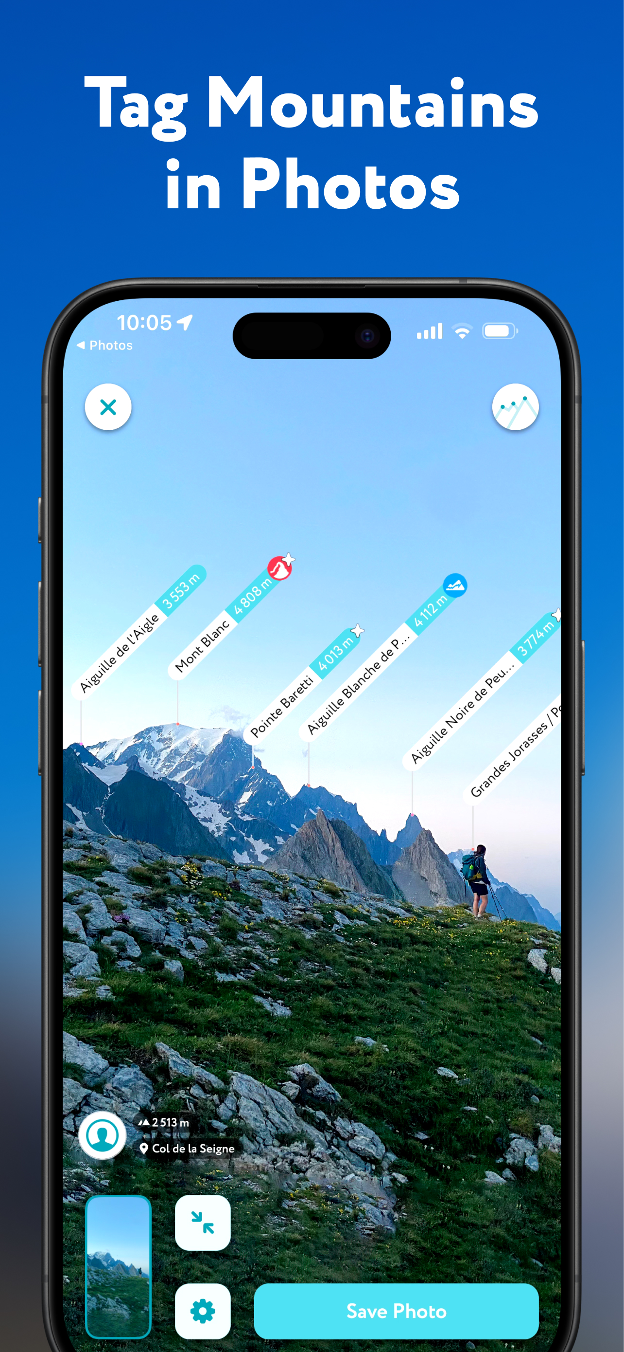
I started using PeakVisor on an iPhone 14 Pro during a hiking holiday based in Corvara in Badia. A few things I like about PeakVisor compared to other apps… Our local lift pass matched exactly with the 18 lifts that were shown very clearly using animation as open on PeakVisor. There are many closed lifts during the summer season so seeing which ones were open made planning our route very easy. The opening hours on the refugios… very helpful when you want food and drink near the end of a hike. It’s super fast , including rotating the 3D view. The suggested routes are really helpful. Importing my own routes. And the connection to Garmin… I cycled the Sella Ronda… the app effortlessly recorded the 4 main passes and lists all the hill peaks you have visited. Peak identification works really well, including the search. All the details in my profile including check-ins and categories like passes. Also bookmarks each categorised. Uploading photos. Hike recording. Lots more detailed functionality, but easy to access. What a fantastic app! I’m now back in Scotland, but it works just as good with local walks on much smaller hills.
Good apps to learn and he mountain peaks. Could improve to have bigger labels with the names of the peaks, eg by zooming in or touching the label.
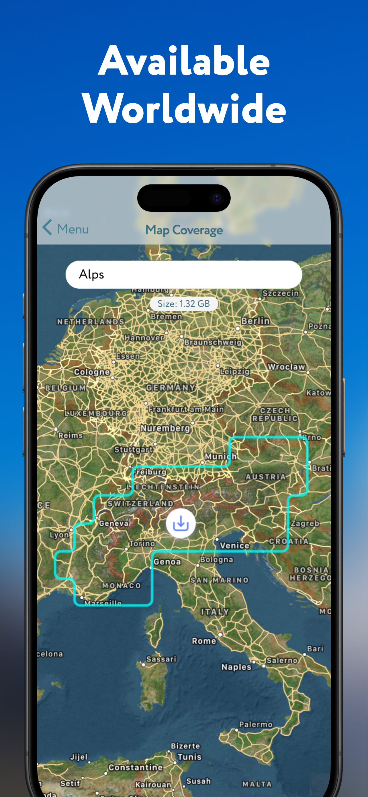
The free version doesn’t show anything at all, only one location. You move 50mt and the app won’t show anything, asking you to upgrade to a 20 euros a month subscription. Waste of time
Fantastic app - currently midway through a walk across Europe and PeakVisor has been my loyal companion the whole way.
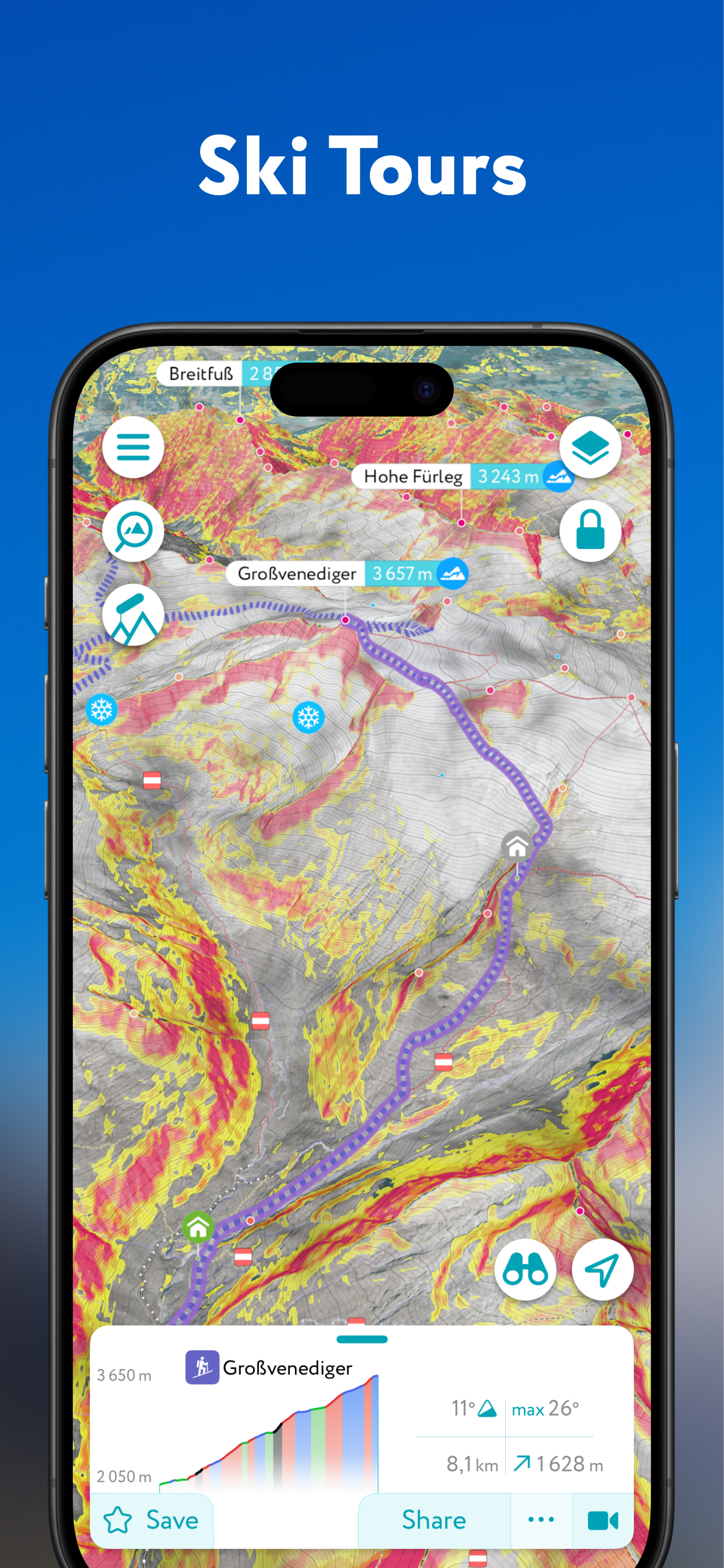
I think this is a fantastic concept it just doesn’t work in practice. It’s a bit glitchy - getting alignment with the hills for example. I’ve tried using this on the hills - and it’s tried to download the vicinity whilst on top of the mountain, another time I tried to navigate down a hill using the path show on the map - but it was difficult to get the map fixed in one place so I could follow it - it then drained my battery very quickly. I like the idea of checking in. But overall I don’t see the value in paying for it in its current state. Maybe once it’s a bit more user friendly I’d be willing to try again.
Great idea... if it actually worked! The peaks, hills and tors it marks are never in alignment with where they actually are in real life so it’s completely useless and I want my money back.
Download but it just turns my screen blank
Instantly kills my phone battery. Would have to take an external battery with me to be able to use this app.
|
Diagramm
|
Kategorie
|
Rang
|
|---|---|---|
|
Top Umsatz
|

|
3
|
|
Top Umsatz
|

|
4
|
|
Top Umsatz
|

|
5
|
|
Top Umsatz
|

|
5
|
|
Top Umsatz
|

|
6
|
