Memory-Map for All

Offline Mapping GPS Navigation

Veröffentlicht von: Memory-Map

Beschreibung

Download maps for Offline GPS Navigation. No mobile data connection required.
Your favorite maps and charts from OS, Hema, NOAA, and many more.
Fully customizable map, data display and toolbar buttons.
Powerful overlay data management, using nested categories and GPX files
Backup and load maps from thumb drive.
Use the same maps and sync your overlay data to other mobile devices and desktop computers
Interactive Route Profile showing terrain elevation
Track Altitude and Speed profile graphs
Show terrain ascent, descent, max elevation and estimated time for planned route
The Memory-Map for All app turns your phone or tablet into a full-featured Outdoor GPS or Marine Chart Plotter, and allows you to navigate with USGS Topo maps, NOAA Marine charts, and many other specialist maps, without needing a mobile internet signal.
Maps are downloaded on-the-fly and can be pre-loaded, so they are ready to be used offline. Once the app and maps are loaded to the phone or tablet, cellular network coverage or internet connection is not required for real time GPS navigation.
The Memory-Map for All app can be used as a standalone GPS navigator, but it can also be used in conjunction with the Windows PC or Mac app (free download) for planning, printing and loading up maps, waypoints and routes to the phone/tablet.
Memory-Map for All includes free access to 1:250,000 scale topographic maps and many other free maps around the world. More detailed maps are available for download and purchase with a free try-before-you-buy, time-limited demo option. Available maps include Ordnance Survey, Hema, USGS quads, NOAA, UKHO, and DeLorme. Maps can be used on your PC as well as your phone and tablet. The Cloud Sync feature allows you to keep the overlay data consistent on all your devices.
Features include:
Access a vast range of Worldwide maps and charts.
Automatically downloads a free map of your current location
Create and edit marks and routes.
Import and export marks, routes and tracks in the open GPX format
Interactive graphs of terrain elevation, GPS Altitude and Speed profile
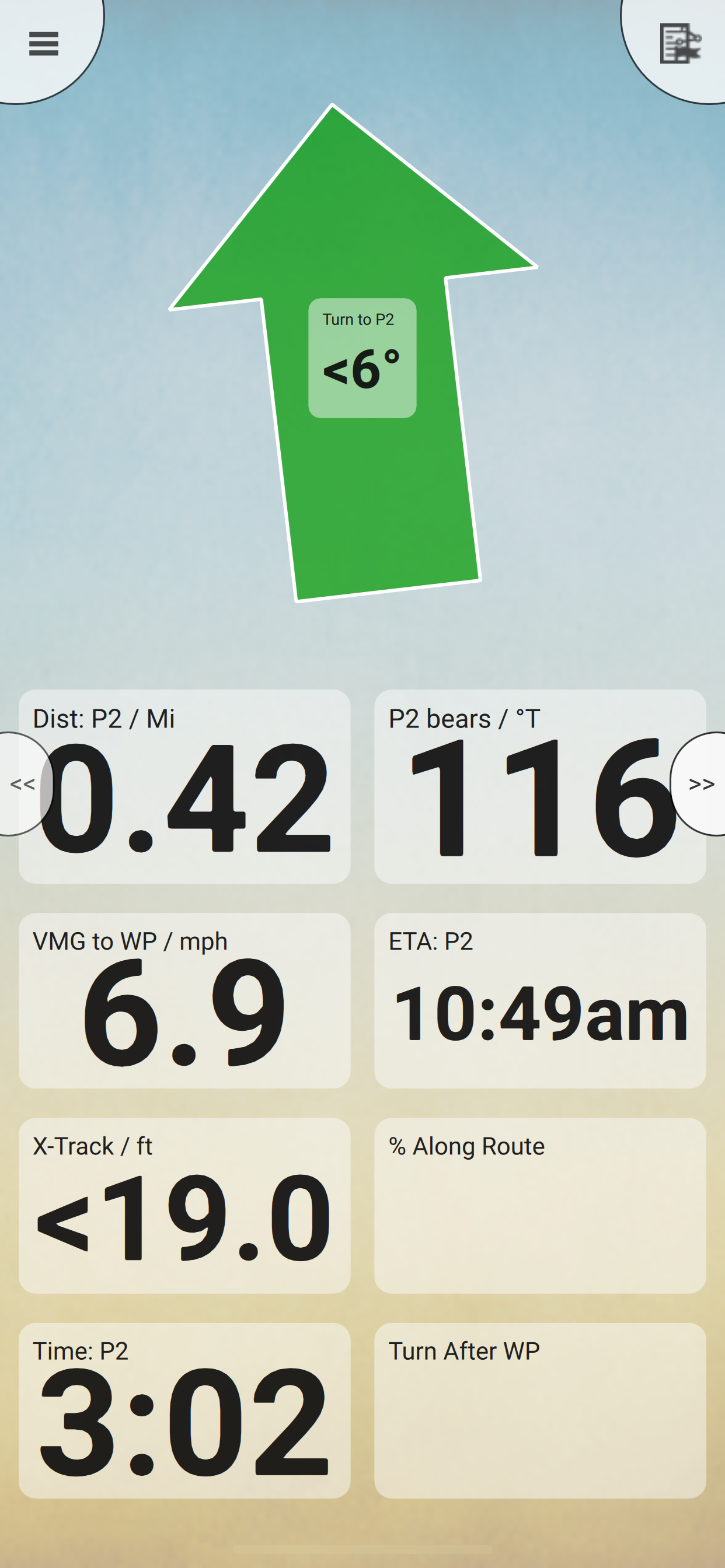
Display; Position, Course, Speed, Heading, Altitude and averages
Position coordinates include Lat/Long, UTM, GB Grid, Irish Grid, Military Grid.
Units displayed in Statute, Nautical or Metric, with separate unit setting for Height
Support for GPS and Compass sensors, where available.
Placename search index can be used offline.
Moving map, lock GPS position and automatically scroll the map
Records breadcrumb trail / tracklogs.
Share position marks, routes and tracklogs as GPX files
Full marine instrumentation features, with AIS, DSC and Anchor alarm
NMEA data interface via WiFi
Barometer & relative altitude
Import custom icons for POI
Ausblenden Mehr anzeigen...

Screenshots

Memory Häufige Fragen

  • Ist Memory kostenlos?

    Ja, Memory ist komplett kostenlos und enthält keine In-App-Käufe oder Abonnements.

  • Ist Memory seriös?

    🤔 Die Qualität der Memory-App ist gemischt. Einige Nutzer sind zufrieden, während andere Probleme melden. Ziehen Sie in Betracht, einzelne Bewertungen für mehr Kontext zu lesen.

    Danke für die Stimme

  • Wie viel kostet Memory?

    Memory ist kostenlos.

  • Wie hoch ist der Umsatz von Memory?

    Um geschätzte Einnahmen der Memory-App und weitere AppStore-Einblicke zu erhalten, können Sie sich bei der AppTail Mobile Analytics Platform anmelden.

Benutzerbewertung
Die App ist in Indien noch nicht bewertet.
Bewertungsverlauf

Memory Bewertungen

Seems bad

Marsmite on

Vereinigtes Königreich

I don’t know why this has such positive reviews. It seems very poor. Nothing is really working on my iPad. Even the free road atlas is just terrible and either too tiny or too pixelated to be useful, depending on zoom level. Not usable. I haven’t tried loading my own maps into this app yet, so perhaps that’s where it shines.

Superb app

140t31 on

Vereinigtes Königreich

I rate this app very highly. I use it regularly for research and always when visiting the battlefields. It’s superb and I wouldn’t be without it

Extremely user friendly

skiing bean on

Vereinigtes Königreich

I have used Memory Map for many years to support architectural photography projects l. It allows me to plan a route for the day. The introduction of the online Memory Map for All has made it even easier. The client service has been great - fast and knowledgeable.

Been with Memory Map for decades now useless

Thumper7575 on

Vereinigtes Königreich

I’ve spent a lot with Memory Map. Now my maps wont download onto my new devices. Contacted Memory Map UK and they say they have had lots of complaints like mine. No support whatsoever, don’t buy this app. Leslie

Much better

rbdkycpt kf on

Vereinigtes Königreich

Thank goodness for this newer ‘for all’ app. I’ve used Memory Map for maybe 15 years. There was a real issue when I first changed to an iPhone and loaded the iPhone app - The button to centre the map is stupidly positioned under the screen close bar. This might not matter when you’re walking, but for cycling it was a disaster. Fortunately this newer app is much better thought out, though it seems I can’t immediately access the many maps downloaded on the old app. Over the years I’ve used Memory map to cycle the length of GB a number of times, and across and around France. The biggest shame is that there are no longer foreign maps for sale, and as I get older and have more time, the opportunity to ride across more of Europe is becoming apparent. I’ll have to find another app that allows me to do this.

My go to marine navigation app

Saildon Ald on

Vereinigtes Königreich

Used the old app for years and very pleased with the improvements in the new app.

Frustrating

wjvh-Durham on

Vereinigtes Königreich

There is nothing intuitive about using this App. It is so frustrating. The Help function is useless. Dreadful. Long time customer desperately looking for an alternative now.

Much better than the OS app

A Nonymous (of course) on

Vereinigtes Königreich

I had previously used ViewRanger on my iPad mini for UK hill walking, with downloaded OS maps. When that app sadly disappeared (taking “my” purchased map segments with it) I hunted around for a useable alternative. The “official” OS app remains frustratingly not-quite-useable, so I’ve given up on it. MemoryMap isn’t perfect, but it’s certainly the best available way to download and use OS maps on your iPad for hill walking. Great that we can purchase “lifetime” access to the maps (at least until MemoryMap goes bust, gets bought out, or whatever). The user interface for downloading map data for specific areas onto the iPad is non-intuitive, but does work. So, how could it be improved? My main gripe is that cut-and-paste on the Mac desktop application doesn’t work. Come on guys, this is the 21st century! Competent UI design doesn’t get any more basic than this. Needless to say, I always carry a paper OS map as a backup, but with MemoryMap I never have to use it. Although the paper map will still be mine, and still useable, in 10 or 20 years’ time. Let’s hope the same is true for “my” MemoryMap maps.

Excellent mapping App

Pocketmuncha on

Vereinigtes Königreich

I’ve used Memory Map software and app for years. Really simple to use, I prefer the fact you can buy maps rather than pay an annual subscription. Great functionality.

Brilliant Software

Skipper Dave on

Vereinigtes Königreich

I have used Memory-Map for many years and more recently, Memory-Map for All. I use it with ordinance survey maps to plan walks in the UK and with Admiralty charts for Sailing both around the UK and further field. The app is extremely easy to use both on land and at sea.

Store-Rankings

Ranking-Verlauf
App-Ranking-Verlauf noch nicht verfügbar
Kategorien-Rankings
Diagramm
Kategorie
Rang
Top Kostenlos
178
Top Kostenlos
208
Top Kostenlos
276
Top Kostenlos
314

Schlüsselwörter

Memory Konkurrenten

Name
OutDoors GB - Offline OS Maps
GPS includes 15 National Parks
Outside Maps
4WD Maps - Offline Topo Maps
Offroad 4x4 GPS Navigation
Cabbie's Mate
GPS OS Grid Reference
Great Britain and Ireland
BackCountry Navigator XE
Topo Maps and GPS for Outdoors
Raymarine
Mobile Companion for Raymarine
Tides Planner
Discover the Flinders Ranges
CAMPERX - the camping guide
Campsites, parks & road trips

Memory Installationen

Letzte 30 Tage

Memory Umsatz

Letzte 30 Tage

Memory Einnahmen und Downloads

Gewinnen Sie wertvolle Einblicke in die Leistung von Memory mit unserer Analytik.
Melden Sie sich jetzt an, um Zugriff auf Downloads, Einnahmen und mehr zu erhalten.
This page includes copyrighted content from third parties, shared solely for commentary and research in accordance with fair use under applicable copyright laws. All trademarks, including product, service, and company names or logos, remain the property of their respective owners. Their use here falls under nominative fair use as outlined by trademark laws and does not suggest any affiliation with or endorsement by the trademark holders.