Finally
Nice to have a mapping program that doesn’t take a computer genius to figure out. All I wanted was maps I can use to see where things are without the big whistle and bells. And the big $$$$


Ja, Nautical Charts & Maps ist komplett kostenlos und enthält keine In-App-Käufe oder Abonnements.
🤔 Die Qualität der Nautical Charts & Maps-App ist gemischt. Einige Nutzer sind zufrieden, während andere Probleme melden. Ziehen Sie in Betracht, einzelne Bewertungen für mehr Kontext zu lesen.
Nautical Charts & Maps ist kostenlos.
Um geschätzte Einnahmen der Nautical Charts & Maps-App und weitere AppStore-Einblicke zu erhalten, können Sie sich bei der AppTail Mobile Analytics Platform anmelden.

Nice to have a mapping program that doesn’t take a computer genius to figure out. All I wanted was maps I can use to see where things are without the big whistle and bells. And the big $$$$
Downloading charts for offline use crashes app randomly on a fully updated iPad. Wish there was a trial version that I could have used BEFORE I threw away $8.99. App deleted, money wasted.
Used it in Destin FL to navigate a rented pontoon boat.
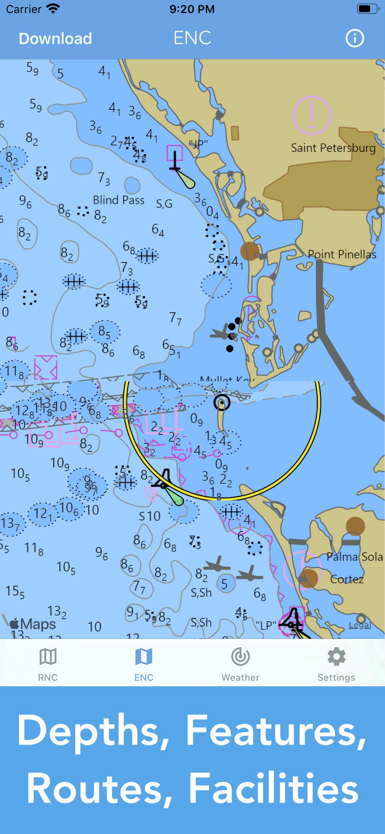
I mistakenly thought that this was a legitimate NOAA product. Turns out it uses NOAA charts but is in no way associated with NOAA. It has absolutely no tools available for plotting routes in advance or tracking while underway. Useless for advance plotting and dead reckoning.
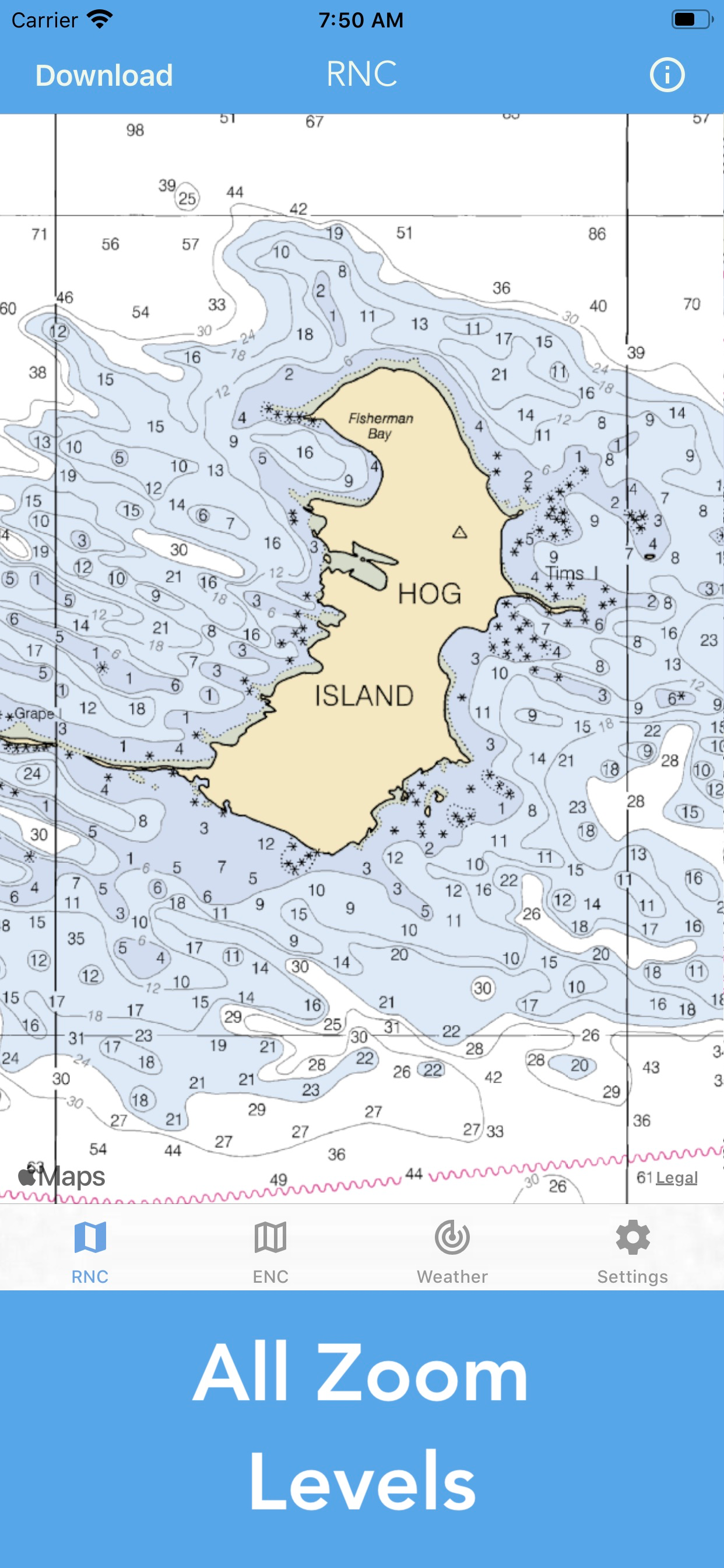
You can download charts and scroll around/zoom, but that’s about it. No real interactivity on the chart (being able to click on chart details like channel markers to get expanded details? Nope. Ability to set waypoints in a course? Nope. Ability to measure distance between two arbitrary points? Nope). It’s not bad, it’s just not really useful on the boat.
Fine looking map, are charts available for N.E. Oklahoma?
Complete waste of money if u want it for fresh water.. doesn’t even show water only a yellow screen
This App provides great charts, however we live in the state of Washington near Canada which also has beautiful waterways that we love to explore, the provided charts Do Not include these needed Canadian waters charts. I’ll be glad to update the star rating to 5 stars if you’ll provide charts for the waterways between Washington and Alaska (the Canadian coastal waters). You have a really good thing going, please make it Great by adding the West Coast Canadian waterway charts!
Simple chart program. Puts you on a Noaa chart. Lacks tools were accustomed to. Great value though. I’m hoping the developer will add a few tools. I’d gladly pay more if they’d add marks routing and a caliper tool. Keep it simple though. I payed 50 bucks for the original Navionics. Was really happy to do so. Now that they’ve gotten greedy and made it a ridiculous subscription I’m out. This app and its potential are a breath of fresh air.
Waste of money. Can’t add routes or waypoints. Useless
|
Diagramm
|
Kategorie
|
Rang
|
|---|---|---|
|
Top Bezahlt
|

|
60
|
|
Top Bezahlt
|

|
66
|
|
Top Bezahlt
|

|
70
|
|
Top Bezahlt
|
|
85
|
|
Top Umsatz
|
|
90
|

