Stops working
App crashes upon opening, pls get it fixed.
Ja, Pilots Atlas ist kostenlos herunterzuladen, enthält jedoch In-App-Käufe oder Abonnements.
⚠️ Die Pilots Atlas-App hat schlechte Bewertungen und negatives Feedback. Die Nutzer scheinen mit der Leistung oder den Funktionen unzufrieden zu sein.
Pilots Atlas bietet mehrere In-App-Käufe/Abonnements, der durchschnittliche In-App-Preis beträgt 185.90 HK$.
Um geschätzte Einnahmen der Pilots Atlas-App und weitere AppStore-Einblicke zu erhalten, können Sie sich bei der AppTail Mobile Analytics Platform anmelden.

4.36 von 5
56 Bewertungen in Sonderverwaltungsregion Hongkong
App crashes upon opening, pls get it fixed.
Good maps but Very confusing and not user friendly
Latest version makes pop ups every time you open it to tell you to pay more and buy the next version.
It charges me for the second time when I install it on my new iPad with the same login ID!!!
Would have rated higher if I was able to center the map in the centre of the South Pacific. Currently I have to scroll from right to left to see some of the islands in the pacific.
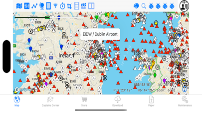
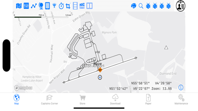
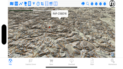
The app is a good tool for anyone wanting to gain better route awareness from GA to the airlines. The tools included are useful and the layout is friendly and allows for a smooth user experience. The 3 levels of customisable layers are helpful. The FIR boundaries are brilliant. One major drawback though is the lack of proper database which becomes evident on a long haul flight or flights in some eastern countries (Russia/Kazaksta/China). Also lacking is the ability to type some coordinates easily (i.e. the app should recognise the N41E065 format). This app would be a definite 5 if these few points were corrected!
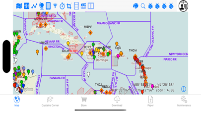
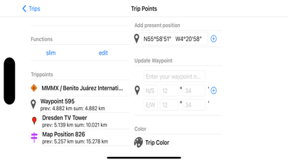
Firstly there is no doubt that this is a fantastic app and a useful tool which I have had much use out of! Very detailed maps, just looks great too. I would suggest a couple of additions which would help improve the app further: • There are a few waypoints missing around the globe which requires manual insertion for your route/trip, it would be great if your manually inserted waypoints were saved to a database which could then be used for other routes/trips without having to manually add the same waypoint again for each trip you create. • Crossing 180W/E is a problem, it would be a lot better if the map was more fluid and you had the ability to scroll freely past this point. It would also more accurately represent the flight path. Otherwise a great app which I will continue to use in the foreseeable future.
A lot of waypoints are not there. App misses part of the map at and around the 180W. App does not 'dynamically scroll' through the 180W. Useless
There are some good functions but it bugs when u have a track that crosses the 180w and the new layout for entering tracks is horrible. I don't think expanding it horizontally is a good idea. I can't see my wpts when I'm entering them in search. Pls fix
I am a Boeing 777 captain for an international carrier an decided to try out this app after searching for a good, comprehensive, in-flight addition to my iPad navigation apps. I combine it with a Bad Elf GPS PRO standalone receiver and it is just as incredibly accurate as the 777's on-board GPS's. Of course it's not used for navigation but it's accuracy is certainly capable in case of emergency. It raises "situational awareness" (SA) immense which is useful for any pilot or even non-pilot/aviation enthusiast" out there. I used it for the first time on a long haul flight from Amsterdam to Hong Kong - was able to input the entire route and plot all the waypoints with pin-point accuracy. Unfortunately you have to type individual waypoint names and as was mentioned already, no airways are capable of being loaded so waypoint entry takes time. Hope that changes. Good terrain awareness features, good data for enroute airports. Map doesn't "move" with you as you fly along like a car GPS so you must scroll-swipe across with your finger if you go off the edge of the map - but not an issue as there is a "present-position" button icon you can press to slew yourself to the center of your screen wherever you are. Plenty of filters to clutter/de-clutter as you wish. With continuous improvements this will be the app to beat. Very happy and money well worth spent just for the increased "SA." I bought the whole world and excited to travel with it. To the previous reviewer who couldn't view the active waypoints - I too thought I had this problem but figured it out serendipitously - just "double-tap" a waypoint on the active route with your finger and all the waypoint names appear. Double-tap again to turn off! Useful on a long flight with a lot of waypoints.
|
Diagramm
|
Kategorie
|
Rang
|
|---|---|---|
|
Top Umsatz
|

|
55
|
|
Top Umsatz
|

|
55
|
|
Top Umsatz
|

|
98
|
|
Top Umsatz
|

|
100
|
| Name | Downloads (30d) | Monatlicher Umsatz | Rezensionen | Bewertungen | Letzte Veröffentlichung | |
|---|---|---|---|---|---|---|

Direct-To Aviation GPS VFR IFR
Air Navigation for Pilots
|
Freischalten
|
Freischalten
|
0
|
|
vor 3 Wochen | |

PILOTLOG - CrewLounge AERO
Pilot logbook - Roster import
|
Freischalten
|
Freischalten
|
2
|
1
|
vor 1 Woche | |

Lido mBriefing
|
Freischalten
|
Freischalten
|
0
|
|
vor 1 Monat | |

AeroNOTAM
Get NOTAMs simple and quick
|
Freischalten
|
Freischalten
|
0
|
|
vor 1 Woche | |

AeroChart
Aeronautical Charts
|
Freischalten
|
Freischalten
|
0
|
|
vor 7 Monaten | |

FlyGo Air Navigation
Aviation App for Pilots
|
Freischalten
|
Freischalten
|
1
|
|
vor 2 Tagen | |

SkyCharts XC EFB
Geo plates and charts
|
Freischalten
|
Freischalten
|
0
|
|
vor 1 Jahr | |

FLYLOG.io - For Pilots
Pilot Logbook & Navigation
|
Freischalten
|
Freischalten
|
0
|
|
vor 2 Tagen | |

Lido mPilot
|
Freischalten
|
Freischalten
|
0
|
|
vor 1 Woche | |

Jeppesen Aviator
|
Freischalten
|
Freischalten
|
0
|
|
vor 3 Wochen |

