Whympr : Mountain & Outdoor

Hike, climb, ski, alpinism

Veröffentlicht von: Whympr

Beschreibung

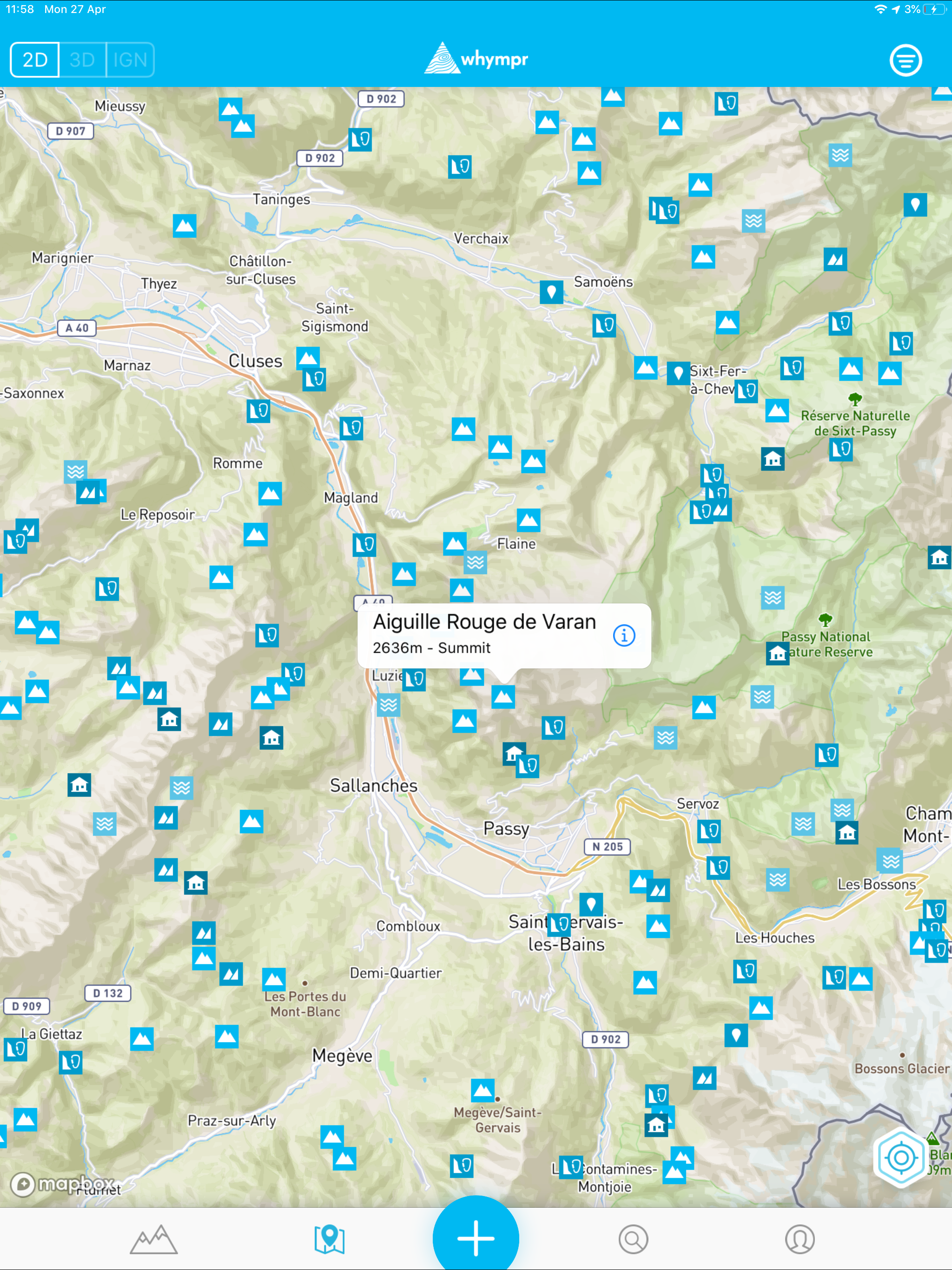
Whympr is the app that gathers all the information you need to prepare and share your mountain and outdoor adventures. It's perfect for hiking, climbing, trail running, mountain biking, ski touring, snowshoeing, and mountaineering.
Explore new horizons
Discover over 100,000 routes worldwide, sourced from trusted platforms like Skitour, Camptocamp, and tourist offices. You can also purchase routes written by mountain professionals such as François Burnier (Vamos), Gilles Brunot (Ekiproc), and many others, available in packs or individually.
Find an adventure that fits your level and preferences
Use our filters to choose the perfect route based on your activity, skill level, and preferred points of interest.
Create your own routes and track your adventures
Plan your route in detail by creating tracks before your trip, and analyze the distance and elevation gain.
Access topographic maps, including USGS
Explore a collection of topographic maps, including IGN, SwissTopo, Italy’s Fraternali map, and many more, plus Whympr’s outdoor map that covers the globe. Visualize slope inclinations for complete route preparation.
3D Mode
Switch to 3D view and explore different map backgrounds in 3D.
Access routes even offline
Download your routes to consult them offline, even in the most remote areas.
Get comprehensive weather forecasts
Check mountain weather forecasts provided by Meteoblue, including past conditions and predictions, as well as freezing levels and sunshine hours.
Stay updated with avalanche bulletins
Access daily avalanche bulletins from official sources in France, Switzerland, and the United States.
Stay informed on recent conditions
Join a community of over 300,000 users sharing their outings, helping you stay up-to-date on the latest terrain conditions.
Identify surrounding peaks
With the “Peak Viewer” augmented reality tool, discover the names, altitudes, and distances of the peaks around you in real-time.
Protect the environment
Activate the "sensitive area" filter to avoid protected zones and help preserve local wildlife and nature.
Capture unforgettable moments
Add geotagged photos to your map and comment on your outings to keep lasting memories.
Share your adventures
Share your trips with the Whympr community and on your social media channels.
Create your digital adventure logbook
Track your outings to keep a record of your adventures, access your logbook, visualize your activities on a map, and see your stats on your dashboard.
Upgrade to Premium for the full experience
Download the base app for free and enjoy a 7-day free trial of the Premium version. Subscribe for only €24.99/year and unlock exclusive features, including IGN France and SwissTopo maps, offline mode, advanced route filters, detailed weather reports, GPS track recording, route creation with elevation and distance calculation, GPX imports, and much more.
Our commitment to the planet
Whympr donates 1% of its revenue to 1% for the Planet, contributing to environmental preservation.
Made in Chamonix
Proudly developed in Chamonix, Whympr is the official partner of ENSA (National School of Ski and Mountaineering) and SNAM (National Union of Mountain Guides).
Ausblenden Mehr anzeigen...

In-App-Käufe

Italian maps
$22.99
Premium Bronze
$29.49
Premium Silver
$29.99
Pro Topo Range
$26.99
Pro Topo Route
$1.99
Detailed Sector
$17.99
Pro Topo Sector
$8.99
Premium - 1 month
$8.99
Premium - 3 months
$14.99
Pro Topo Detailed Route
$3.99
Whympr Premium
$24.99
Pro Topo Detailed +
$22.99
Pro Topo Basic+
$5.99
Outdoor Pack
$34.99

Screenshots

Whympr Häufige Fragen

  • Ist Whympr kostenlos?

    Ja, Whympr ist kostenlos herunterzuladen, enthält jedoch In-App-Käufe oder Abonnements.

  • Ist Whympr seriös?

    ⚠️ Die Whympr-App hat schlechte Bewertungen und negatives Feedback. Die Nutzer scheinen mit der Leistung oder den Funktionen unzufrieden zu sein.

    Danke für die Stimme

  • Wie viel kostet Whympr?

    Whympr bietet mehrere In-App-Käufe/Abonnements, der durchschnittliche In-App-Preis beträgt $18.24.

  • Wie hoch ist der Umsatz von Whympr?

    Um geschätzte Einnahmen der Whympr-App und weitere AppStore-Einblicke zu erhalten, können Sie sich bei der AppTail Mobile Analytics Platform anmelden.

Benutzerbewertung
Die App ist in Libanon noch nicht bewertet.
Bewertungsverlauf

Whympr Bewertungen

Appli indispensable pour la montagne

El guidos on

Frankreich

Avec la disparition de Fatmap, il n’existe plus grand chose en terme d’appli optimisée pour la pratique montagne. Un point d’amélioration demeure : impossible d’exploiter une trace GPX créée dans l’appli directement sur Garmin Connect sans passer par une appli intermédiaire. Erreur : « oups, le fichier n’est pas un type de course ». Hors, pour transférer la trace vers sa montre Garmin, la manipe doit être simple et rapide. Je l’ai déjà fait remonter par un autre canal, mais je double le coup ici.

Simpa

D'éco on

Frankreich

Bien, un plus avec la météo, dommage qu’il y ait un côté « strava » ou plus précisément social

quel dommage

alex730 on

Frankreich

cette application pourrait être bien, il y a encore du travail dessus. Cela dit, c’est vraiment dommage de forcer l’utilisation avec la nouvelle web app qui impose un abonnement beaucoup plus cher pour les utilisateurs d iphigénie. Surtout les anciens comme moi avant nous avions une super application pour ordinateur. Maintenant elle n’existe plus. Et nous devons annuler notre abonnement pour reprendre celui à 40e. C’est vraiment dommage, et je ne pense pas que cette méthode soit la bonne.

UI terrible

Sounken on

Frankreich

L’interface utilisateur est a revoir, ce n’est pas intuitif. Quand on clique sur les tracés de la carte, cela ne fait rien. De base on à pas de rando à proximité Impossible de trouver comment suivre une rando. À croire qu’on ne peux que créer les notre. Dommage beaucoup de retard face aux concurrents même s’il y a de bonnes idées

Totally mediocre arnaque

Van der Merwe, Karl-Jan on

Frankreich

They now present this as a Fatmap alternative. Ridiculous! The content is years out of date and there isn’t even a slope layer for anywhere other than France. Arnaque!

Appli nulle

henrival on

Frankreich

Nul

Déçue

Ophélight on

Frankreich

Je suis déçue de cette application. Elle doit être connectée alors qu’il n’y a pas de réseau en montagne. Plusieurs fois je me suis retrouvée en train d’ enregistrer ou de suivre une trace et l’appli quitte inopinément au milieu, alors que je l’avais téléchargée hors ligne. Une fois même totalement déconnectée de mon compte et alors là sans réseau, impossible de se reconnecter. Du coup pas confiance, il faut avoir plusieurs backup, mais je ne peux pas m’y fier. Heureusement les développeurs sont réactifs a répondre aux mails, ils ont pu récupérer mes données perdues, mais je ne pense pas que les bugg ont étés corrigés. Point positifs : les fonds de cartes Norvégiens . Pour un séjours en Norvège j’ai pu bosser. Mais sur terrain pas confiance a la stabilité de l’appli. Heureusement qu’il y a du réseau partout la bas. Je ne renouvelle pas mon abonnement.

Merci

ça hdf on

Frankreich

Dingue L inclinaisons en couleur est top pour préparer les rando. Merci

Pourquoi je ne m’abonne pas

Marc Francois on

Frankreich

Deux étoiles pour: Ne pas valoriser un site qui voudrait faire aussi bien que des sites internet gratuits Ne pas prendre pour des pigeons les utilisateurs. Je m’explique : l’intérêt de ce site voudrait qu’il soit participatif car ce serait bien sûr la qualité d’Iphigénie et des cartes irremplaçables IGN augmenté des traces et des avis en temps réel des meilleures courses à faire en fonction des conditions météo et de la neige. Ce qui signifierait que les randonneurs non contents d’enrichir gratuitement la base de données de Whympr se feraient en plus plumer par un abonnement hors norme. Désolé pour les développeurs: ce n’est pas l’esprit montagne, mais bon courage sauf à changer l’orientation commerciale du logiciel avec par exemple, un encouragement participatif gratuit…!

Plantage des le depart

monappstore on

Frankreich

Impossible d’ouvrir l’application 3 messages d’erreurs et des ressources non disponibles File get content Authkey No such file or directory Application pas terminée Développeurs amateurs

Store-Rankings

Ranking-Verlauf
App-Ranking-Verlauf noch nicht verfügbar
Kategorien-Rankings
Diagramm
Kategorie
Rang
Top Umsatz
74
Top Kostenlos
238
Top Kostenlos
251

Whympr Konkurrenten

Name
Staying Alive
Anyone can save a Life
Maps 3D - Hike & Bike
GPS for Bike, Hike & Ski
FREQUENCE Running
OpenRunner – Bike, hike, trail
Route planner & topo maps
SAUV Life
Sauver une vie
RunMotion Coach - Running
Adaptive Training Plan & Tips
Marathon Pour Tous Paris 2024
RunnrZ / Running Routes
Find Custom Running Routes
Nolio
Kiprun Pacer Courir Running
Melba: Game for Couples
Spice up, Connect, Explore
carte Vitale

Whympr Installationen

Letzte 30 Tage

Whympr Umsatz

Letzte 30 Tage

Whympr Einnahmen und Downloads

Gewinnen Sie wertvolle Einblicke in die Leistung von Whympr mit unserer Analytik.
Melden Sie sich jetzt an, um Zugriff auf Downloads, Einnahmen und mehr zu erhalten.
This page includes copyrighted content from third parties, shared solely for commentary and research in accordance with fair use under applicable copyright laws. All trademarks, including product, service, and company names or logos, remain the property of their respective owners. Their use here falls under nominative fair use as outlined by trademark laws and does not suggest any affiliation with or endorsement by the trademark holders.