GNSS View

Разработчик: NEC
Скачивания
Доход

Описание

This application enables you to see where the Quasi-Zenith Satellite System in the sky!
●What is QZSS?
Quasi-Zenith Satellite System (QZSS) is a Japanese satellite positioning system composed mainly of satellites in quasi-zenith orbits (QZO).
Satellite positioning systems use satellite signals to calculate position information. One famous example is the American Global Positioning System (GPS) and the QZSS is sometimes called the Japanese GPS.
For details, please refer to the following Website "Quasi-Zenith Satellite System".
URL : https://qzss.go.jp/en
●What is GNSS View?
GNSS View provides that iOS version application that is based on the website application "GNSS View".
This application enables you to know position of positioning satellites such as QZSS and GPS in the specified time and location.
The positioning satellites displayed in the GNSS View are not based on the satellite information directly received by the smartphone but are displayed based on the satellite arrangement calculated based on the publicly released orbit information.
●GNSS View 3 functions
【Main】
・You can move to the Position Radar screen or AR Display screen from the application startup screen.
・You can see the operating manual and privacy policy of this application via the website.
【Position Radar】
・It is provided radar view of positioning satellites such as QZSS and GPS as a sky plot at the specified time and location.
・Positioning satellites can be specified from QZSS, GPS, GLONASS, BeiDou, Galileo, SBAS.
・You can also select specified signal satellites to see on the radar.
・You can see selected satellites by setting elevation mask angle.
・You can switch east and west of satellite arrangement, turn on / off rotation, and switch on / off display of satellite number.
・It displays HDOP, VDOP, the total number of satellites and the number of each positioning satellites in the satellite arrangement displayed on the radar.
【AR Display】
・Position of positioning satellites such as QZSS and GPS on the sky from your current location is able to see through your camera at the specified time.
・In order to display satellites, it is necessary to turn on the position information of the smartphone and complete the positioning. Therefore, it may take time to display.
・Positioning satellites can be specified from QZSS, GPS, GLONASS, BeiDou, Galileo, SBAS.
・You can also select specified signal satellites to see on the radar.
・You can see selected satellites by setting elevation mask angle.
●Supported versions
・iOS 17
・iOS 16
・iOS 15
・iOS 14
・iOS 13
・iOS 12
Hide Показать больше...

Скриншоты

GNSS View Частые Вопросы

  • Приложение GNSS View бесплатное?

    Да, GNSS View полностью бесплатное и не содержит встроенных покупок или подписок.

  • Является ли GNSS View фейковым или мошенническим?

    Недостаточно отзывов для надежной оценки. Приложению нужно больше отзывов пользователей.

    Спасибо за ваш голос

  • Сколько стоит GNSS View?

    Приложение GNSS View бесплатное.

  • Сколько зарабатывает GNSS View?

    Чтобы получить оценку дохода приложения GNSS View и другие данные AppStore, вы можете зарегистрироваться на платформе мобильной аналитики AppTail.

Оценки пользователей
Приложение еще не оценено в Беларусь.
История оценок

GNSS View Отзывы Пользователей

DLしたけど日本語に対応してない

ナ ガ セ on

Япония

せめて言語設定で英語(共通言語なので有るのはいいと思うが)と日本語(日本のストアでDL出来るんだから)くらいは選べるようにして欲しい

勘違い

ひらけんゴーゴー on

Япония

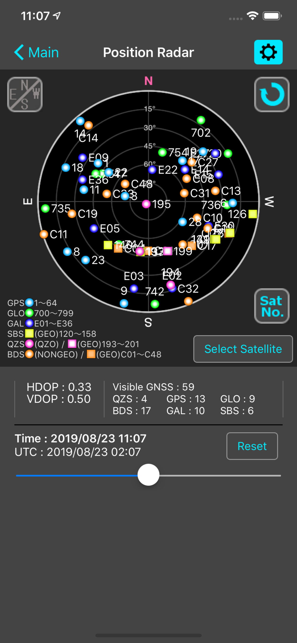
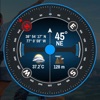
スマホの受信しているGPSが表示されているわけではないので、GPSの受信状況を確認するアプリではなかった。

現在の受信情報ではない

うえまき on

Япония

衛星の軌道と時刻と現在位置から計算して、コンパスやカメラを通してAR表示してくれるだけです もちろんそれだけでも有難いのですが、できたら現在受信している衛星を表示してくれる機能も欲しかったです

みちびきの位置が手軽に分かる

Folth on

Япония

GPS系の衛星の現在地を予測表示するアプリ。 この中にはみちびき(QZSS)も含まれているが、「みちびき」の名前では無いので少し不親切。 調べれば分かるとは言え、一応NECの公式アプリなのだから、馴染みのある愛称位併記しても良さそうなものだが。 あと、恐らくこのアプリは国産ではない。何故ならアプリ内の表記が全て英語だからである。 地名でさえ英語表記なのは驚きを隠せない。 おまけに言語設定もないので、国産ではないのはこれだけでも明らかである。 無論、英語表記であるが簡単な英単語の羅列なので、問題ないと言えば問題無いのだが、外人の製作アプリならいざ知らず、NECの銘が入ったアプリでこのお粗末さは酷いのでは無いか? とは言え、好みに応じてみちびきだけ表示と言った設定も出来る(これが一番気に入った)他、仕様上電波受信出来ないデバイスでも使えるので、これらを勘案して星を4個とする。 なお、説明書だけは日本語で、ウェブ上に用意してある(オフラインヘルプは無い)という事は付言しておく。

衛星配置が最新のものになりません

KITO_WYM on

Япония

アプリ起動時に"Failed to get the orbit data."というエラーメッセージが出てしまい、衛星配置のデータが最新のものになりません。 2016/7/1のデータを使っている旨が表示されますが、それ以降に軌道修正された衛星のコンスタレーションは正確に表示されません。 アプリの使い勝手は良いので星5つとしたいのですが、最新のアルマナックデータを使えないのでは致命的なので、修正をお願いします。

Оценки

История позиций в топах
Позиции в категории
Рейтинг
Категория
Позиция
Топ бесплатных
101
Топ бесплатных
151
Топ бесплатных
173
Топ бесплатных
175
Топ бесплатных
204

Ключевые слова

GNSS View Конкуренты

Name
GPS information
GPS, Altitude, Speed & Map
スーパー地形
GPS対応3D地図アプリ〜山から街まで高低差を極めるツール
Drone Maps Japan
UAS/UAV No-fly Zones in Japan
My GPS Coordinates
Find your current location.
NMEA Gps
Eos Tools Pro
AR地形模型
ARで地形模型が出現!さらにGPS軌跡も表示
Satellite Info GPS Status
GPS Tools® - Find,Track & Trek
Location,Speed,Compass & More
RouteHistory
Record and display routes

GNSS View Установки

Last 30 days

GNSS View Доход

Last 30 days

GNSS View Доходы и Загрузки

Получите ценные инсайты о производительности GNSS View с помощью нашей аналитики.
Зарегистрируйтесь сейчас, чтобы получить доступ к статистика загрузок и доходов и многому другому.