Theodolite HD

AR Navigation Viewfinder

Разработчик: Craig Hunter
Скачивания
Доход

Описание

Theodolite HD is a multi-function viewfinder that combines a compass, two-axis inclinometer, rangefinder, GPS, map, nav calculator, and geo-overlay photo/movie camera into one indispensable app. Theodolite was one of the very first augmented reality (AR) apps when it was released in 2009, and it’s been downloaded and used by millions of customers since then. Uses are endless, and the app is great for land measurements, outdoor sports, sightseeing, navigation, and finding your way around. Theodolite is a pro grade app and is used extensively by surveyors, geologists, architects, engineers, competitive sportsmen, first responders, military personnel, and search and rescue workers around the world.
Theodolite lets you take data-overlay photos and movies with 2X-8X zoom. Overlay geographical data, angle markings, date/time, author/company info, and project notes directly on photos and movies for later reference. The same data is written into the metadata record of images, making image files self-contained data records. Third-party apps can tap into Theodolite's advanced camera functions with a camera sharing feature.
View current position on the built-in map with optional offline Outdoors maps that include topo contours, roads, trails, landmarks, campgrounds, ski lifts, and more. Live map markers continually update distance/heading relative to the current location and also show wayfinding info in the main viewfinder. Draw polygons on the map to mark things like property boundaries and trails, and import/export polygon data via KML.
Share map markers and nav calculator points with other users of Theodolite via text messages or e-mail. This powerful capability opens up a wide range of collaborative uses including team land surveying, accident investigations, spotting wild fires, triangulation of landmarks, and advanced tactical observation and targeting. With an optional in-app purchase to enable team tracking, you can share location with up to 20 people on Theodolite's map.
Theodolite includes features for serious users like a reference angle mode, nav calculator, map marker import/export, manual and automatic data logging with CSV and KML export, clipboard integration, %grade display, mil compass readout, optical rangefinders (including a mil-based reticle, sniper-style stadiametric graphs, and a variable 4X-24X scope), and night filters to improve use in dark conditions.
Theodolite can provide location in military grid reference system (MGRS) coordinates, Universal Transverse Mercator (UTM) coordinates, British/Irish National Grids, US National Grid, Maidenhead locator system, Map Grid of Australia, and six latitude/longitude formats. Optional US State Plane coordinates include SPCS27 and SPCS83 zones covering all US States. The optional Datum Pack adds over 230 geodetic datums to the app to improve position computation from GPS data, covering regions and countries on all continents around the world.
AR Layers include navigational aids like the sun, moon, planets, and Polaris (North star), and the optional US Mountain Summits layer that shows over 70,000 US mountain summits in the viewfinder.
Theodolite has been shown in Apple Keynotes, featured on the App Store, and has been a #1 selling Navigation app in App Stores around the world. Since its introduction in 2009, Theodolite has defined augmented reality navigation. The app continually introduces new technologies, pushing the limits of iOS app development and taking advantage of new hardware capabilities.
Find out why Apple named Theodolite one of the most amazing apps available and showed it being used to explore the Great Wall of China. Where will you take it on your next adventure?
Note: Theodolite HD is an iPad app -- see the regular “Theodolite” app for use on an iPhone or iPod Touch. And be sure to check out the all-new "Theodolite for Watch" and put Theodolite on your wrist!
Скрыть Показать больше...

Встроенные покупки

Team Tracking
USD 1.99
World Datum Pack
USD 2.99
1,000 Outdoors Map Tiles
USD 0.99
5,000 Outdoors Map Tiles
USD 4.99
10,000 Outdoors Map Tiles
USD 8.99
20,000 Outdoors Map Tiles
USD 17.99
US State Plane Coordinates
USD 24.99
US Mountain Summits AR Layer
USD 2.99

Скриншоты

Theodolite HD Частые Вопросы

  • Приложение Theodolite HD бесплатное?

    Да, Theodolite HD можно скачать бесплатно, однако в приложении есть встроенные покупки или подписки.

  • Является ли Theodolite HD фейковым или мошенническим?

    ✅ Приложение Theodolite HD кажется качественным и надежным. Пользователи очень довольны.

    Спасибо за ваш голос

  • Сколько стоит Theodolite HD?

    Theodolite HD имеет несколько покупок/подписок внутри приложения, средняя цена покупки составляет USD 8.24.

  • Сколько зарабатывает Theodolite HD?

    Чтобы получить оценку дохода приложения Theodolite HD и другие данные AppStore, вы можете зарегистрироваться на платформе мобильной аналитики AppTail.

Оценки пользователей
Приложение еще не оценено в Азербайджан.
История оценок

Theodolite HD Отзывы Пользователей

Must have для инженеров!

Горный хрусталь on

Россия

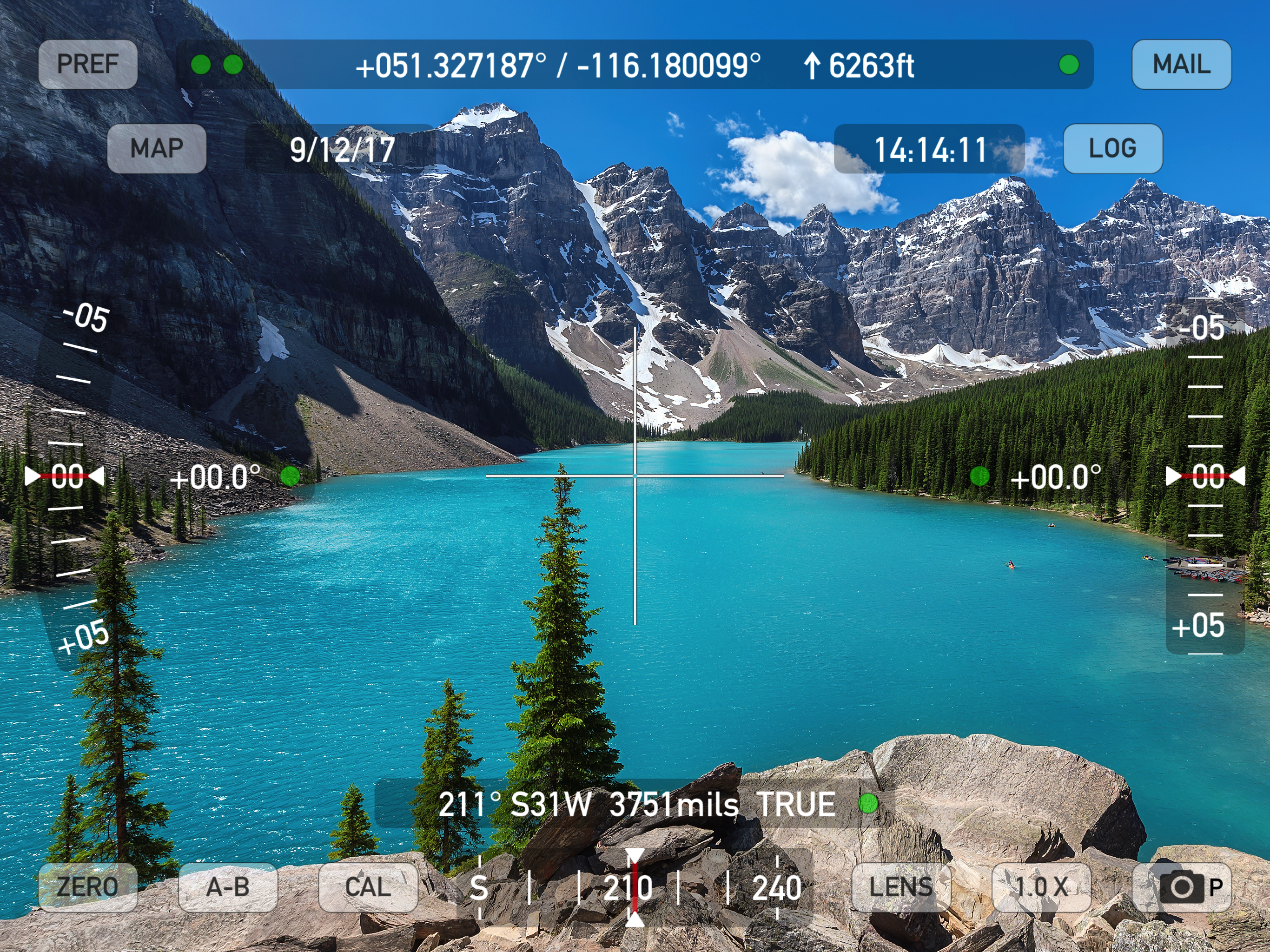
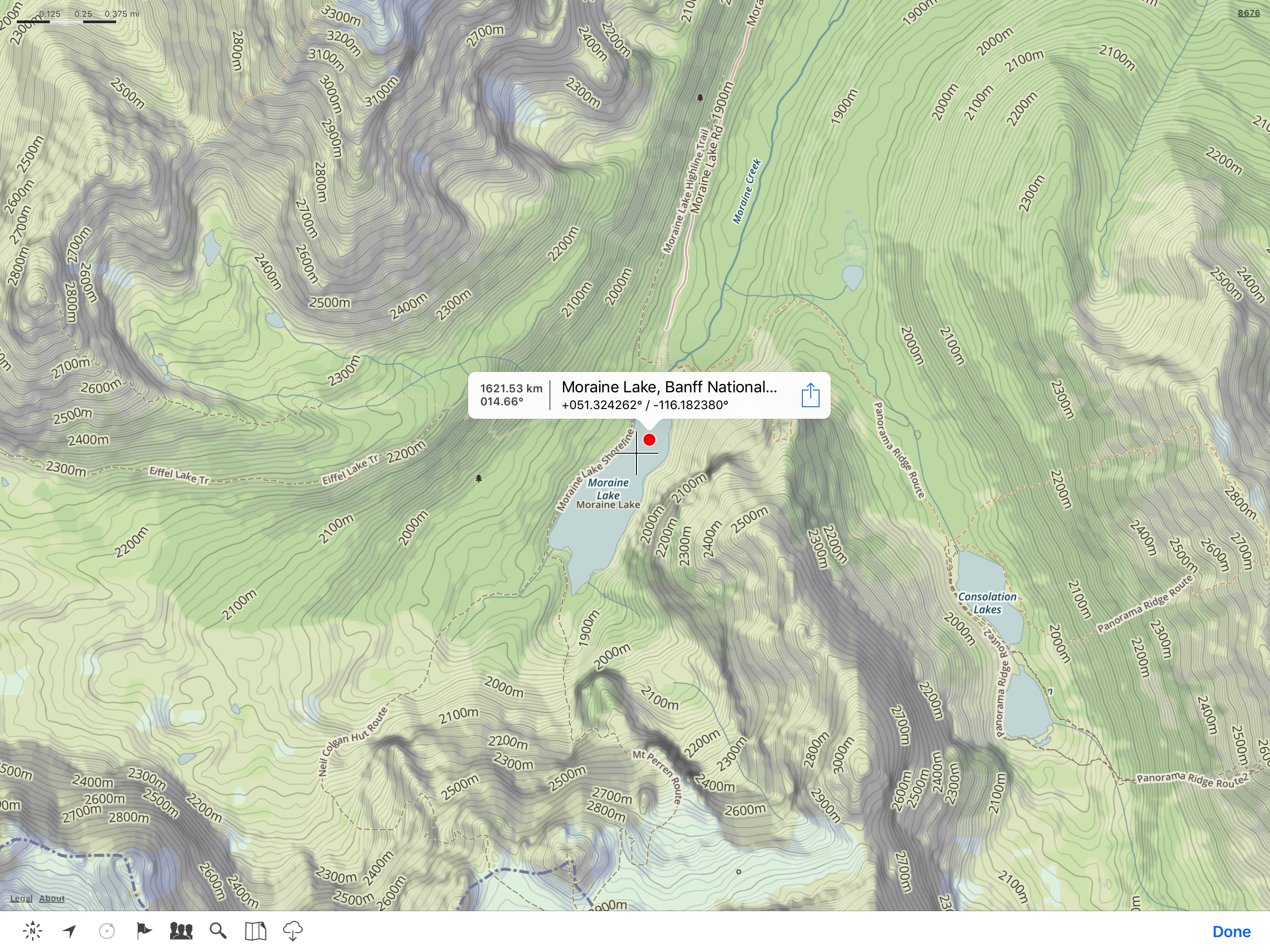
Часто пользуюсь на работе в для фиксации проектных и фактических положений трубопроводов в режиме <карта>. Мастхэв для всех инженеров-строителей. А так же пригодится всем геодезистам в качестве ассистента ;)

Fantastic

Plumb, Bob on

Соединенные Штаты

Great app for anyone hobbyist to professional

Useful documentation

Geodejohn on

Соединенные Штаты

The app has become very useful for improving my field notions and data gathering! Very pleased with and recommend for anyone wanting to develop better standards of field data documention.

Problem today is fixed. Thanks.

Steve C. in Colorado on

Соединенные Штаты

Thanks for the quick fix. 5 stars!

Great app for survey and back country flying

?what next? on

Соединенные Штаты

This is a very useful app. It has excellent features, is fairly intuitive, and very powerful.

Theodite and using for off road excursions

markrobots on

Соединенные Штаты

I just found out how to use the video portion of this program. I just wish I could get this level of quality for my android and windows computers where I could change cameras. But I have enjoyed it for years taking stills for showing information of places I have visited.

Fascinating App

Jeffjmr on

Соединенные Штаты

From picture hanging to landscaping there is no end to the ways you can imagine to use this app. Great fun!

Love it

plastiqman on

Соединенные Штаты

Love this app

Theodolite

Daledawg on

Соединенные Штаты

Amazing.⭐️⭐️⭐️⭐️⭐️⭐️

Awesome

Pilot Red on

Соединенные Штаты

It does a lot of things like a surveyor transit will do. Very handy.

Оценки

История позиций в топах
История рейтингов пока не доступна
Позиции в категории
Рейтинг
Категория
Позиция
Топ платных
478

Ключевые слова

Theodolite HD Конкуренты

Name
Spyglass
AR Compass, GPS & Offline Maps
aprs.fi
APRS in real time
Topo Nomad
USGS Topographical Maps
Eos Tools Pro
Touch GIS
Advanced field data collection
You Need A Map
Offline 3D topo maps
Virtual Dashboard
Helm and Navigation Display
FlightSpan
iGIS for iPad
AW Skyflight

Theodolite HD Установки

30дн.

Theodolite HD Доход

30дн.

Theodolite HD Доходы и Загрузки

Получите ценные инсайты о производительности Theodolite HD с помощью нашей аналитики.
Зарегистрируйтесь сейчас, чтобы получить доступ к статистика загрузок и доходов и многому другому.