Must have для инженеров!
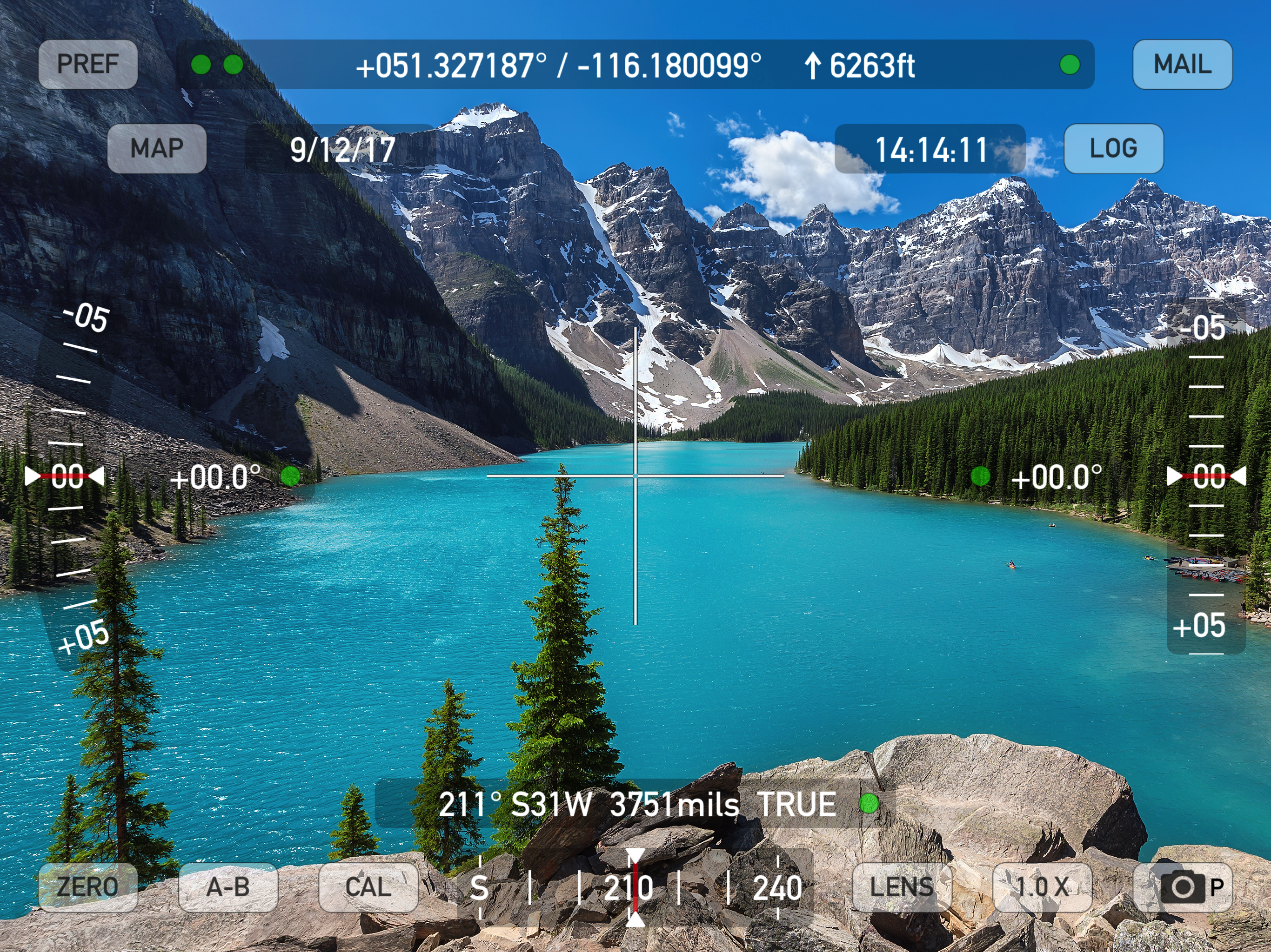
Часто пользуюсь на работе в для фиксации проектных и фактических положений трубопроводов в режиме <карта>. Мастхэв для всех инженеров-строителей. А так же пригодится всем геодезистам в качестве ассистента ;)


Да, Theodolite HD можно скачать бесплатно, однако в приложении есть встроенные покупки или подписки.
✅ Приложение Theodolite HD кажется качественным и надежным. Пользователи очень довольны.
Theodolite HD имеет несколько покупок/подписок внутри приложения, средняя цена покупки составляет €9.37.
Чтобы получить оценку дохода приложения Theodolite HD и другие данные AppStore, вы можете зарегистрироваться на платформе мобильной аналитики AppTail.

4.57 из 5
7 оценок в Италия
Часто пользуюсь на работе в для фиксации проектных и фактических положений трубопроводов в режиме <карта>. Мастхэв для всех инженеров-строителей. А так же пригодится всем геодезистам в качестве ассистента ;)
Sono anni che la uso. Insostituibile
I moved to IOS7, the app now crashes immediately. Can we expect un update?
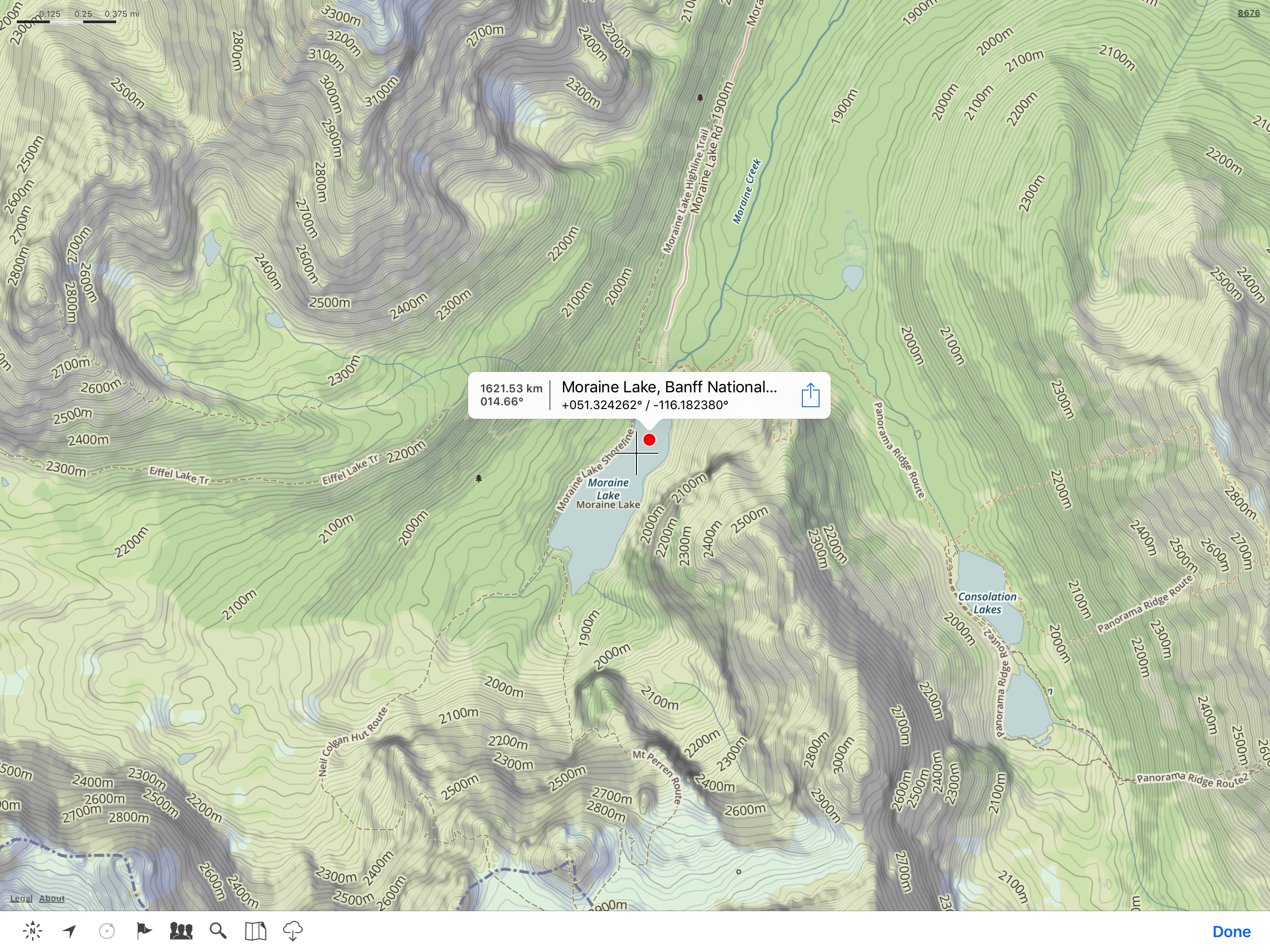
Poter puntare un punto ed avere la posizione gps sarebbe il massimo!
utile
App davvero unica nel suo genere!! Consigliatissima!!
Ottimo
Fa quel che dice e funziona!
Tutto ok
È veramente un ottima applicazione. Complimenti!
|
Рейтинг
|
Категория
|
Позиция
|
|---|---|---|
|
Топ платных
|

|
478
|
| Name | Скачивания (30d) | Ежемесячный доход | Отзывы | Оценки | Последнее обновление | |
|---|---|---|---|---|---|---|

Spyglass
GPS, compass and maps toolkit
|
Открыть
|
Открыть
|
189
|
|
2 месяца назад | |

Sit(x)
SA Solution for any Situation
|
Открыть
|
Открыть
|
0
|
|
6 месяцев назад | |

Topo Nomad
USGS Topographical Maps
|
Открыть
|
Открыть
|
0
|
|
1 год назад | |

Eos Tools Pro
|
Открыть
|
Открыть
|
2
|
|
4 месяца назад | |

You Need A Map
Offline 3D topo maps
|
Открыть
|
Открыть
|
2
|
|
9 месяцев назад | |

FlightSpan
|
Открыть
|
Открыть
|
0
|
|
1 неделю назад | |

W&B Helicopters
AIRBUS Helicopters
|
Открыть
|
Открыть
|
0
|
|
1 год назад | |

H145 Flight Perfo
H145 Performance Calculator
|
Открыть
|
Открыть
|
0
|
|
1 год назад | |

AyeTides XL
|
Открыть
|
Открыть
|
0
|
|
1 месяц назад | |
3D GIS Digital Elevation Model
Real-World Data Digital Model
|
Открыть
|
Открыть
|
0
|
|
3 года назад |
