AngelNav is a brand new app for iOS developed in collaboration with Tom Cunliffe. Primarily it is a full chart plotter currently favouring raster charts, but it has many additional features including the ability to carry out traditional navigation directly on the screen.
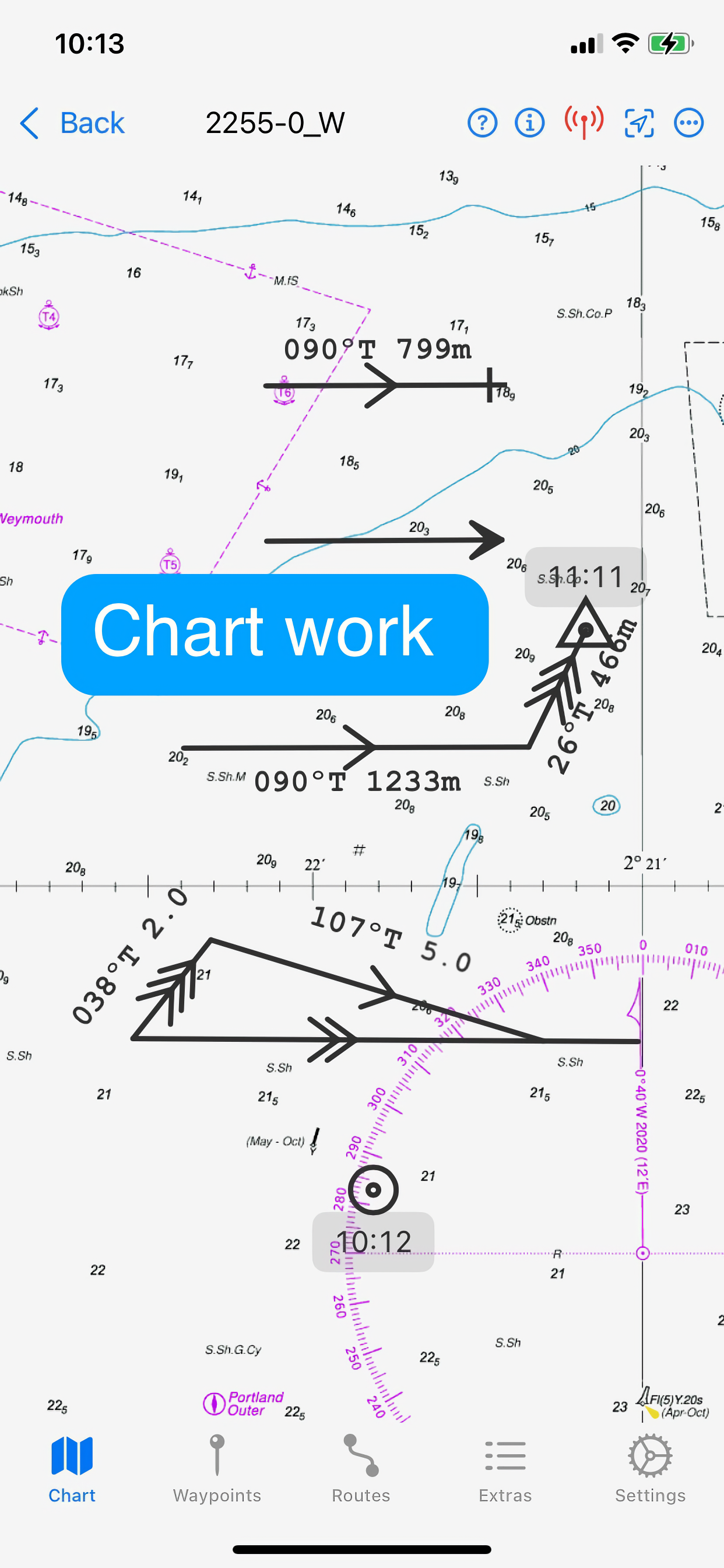
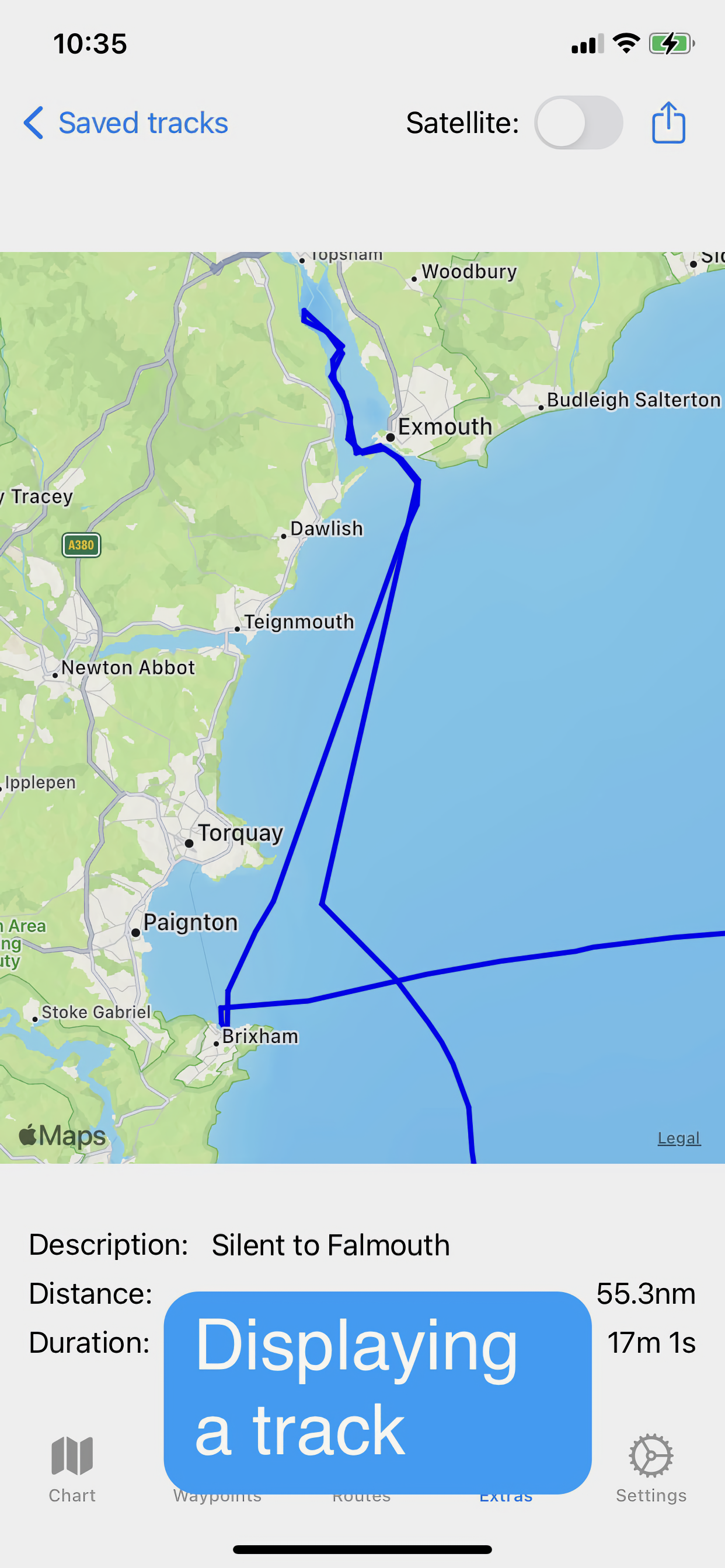
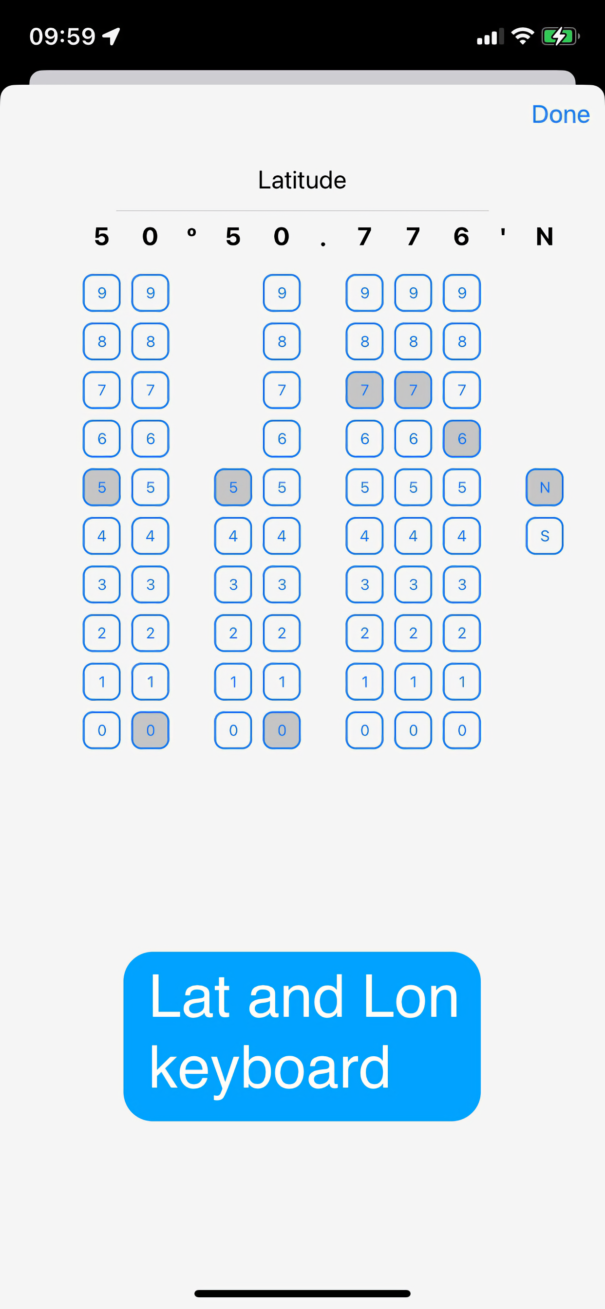
The capacity to generate classical chart work is vitally important in the event of a GPS failure, but hitherto has required pencil, plotters, and paper charts. AngelNav allows traditional techniques to be carried out using an iPad or iPhone screen instead of a paper chart. An estimated position can be plotted, position lines drawn from sighted bearings and fixes recorded. Course-to-steer diagrams are readily constructed.
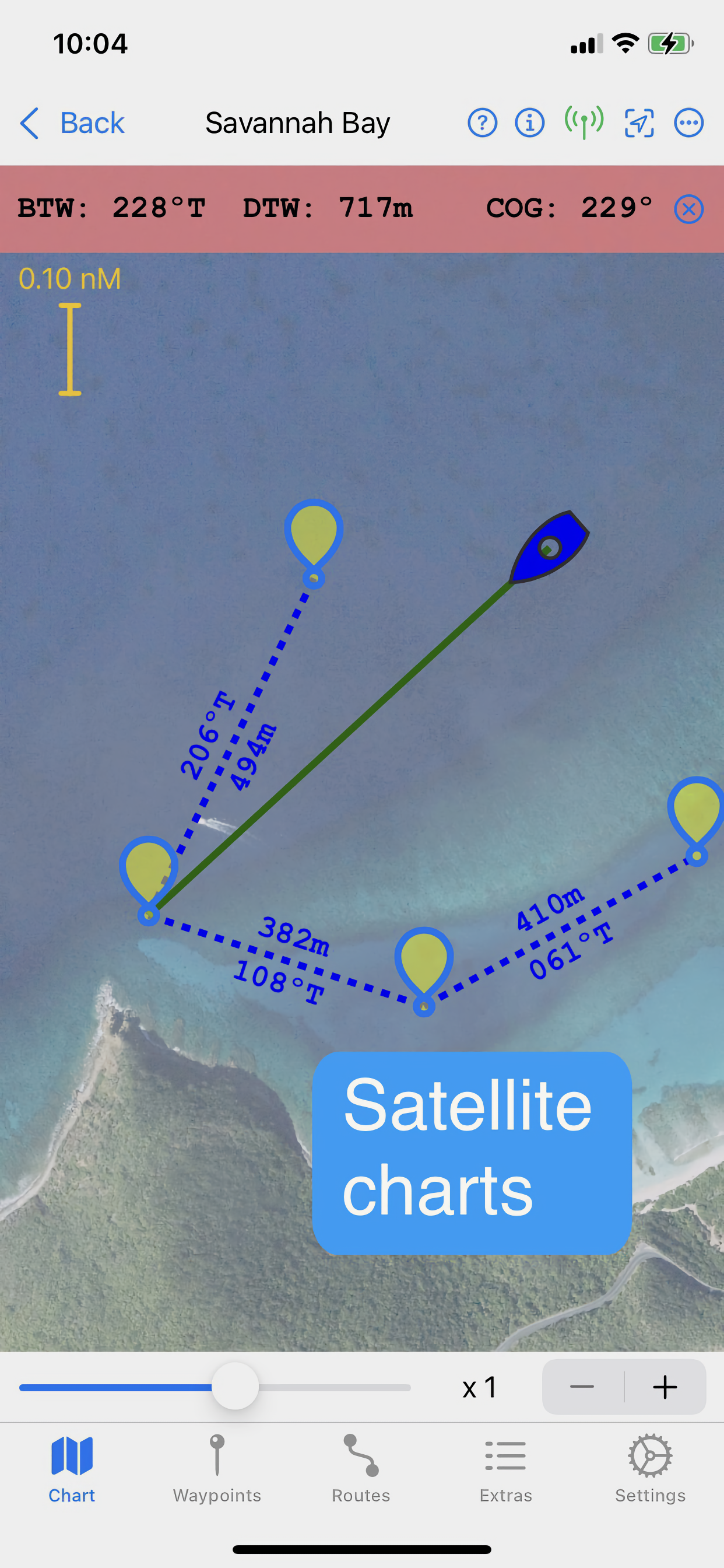
AngelNav can read most types of raster chart including the UKHO subscription charts, as well as KAP/BSB files and GeoTIFF files. Like its sister application for macOS, AngelPilot, it can easily create and read its own satellite charts.
AngelNav can take satellite navigation data from a variety of sources, including the device's stand-alone GPS, the boat's NMEA over WiFi, and SignalK. It will also display AIS information if available.
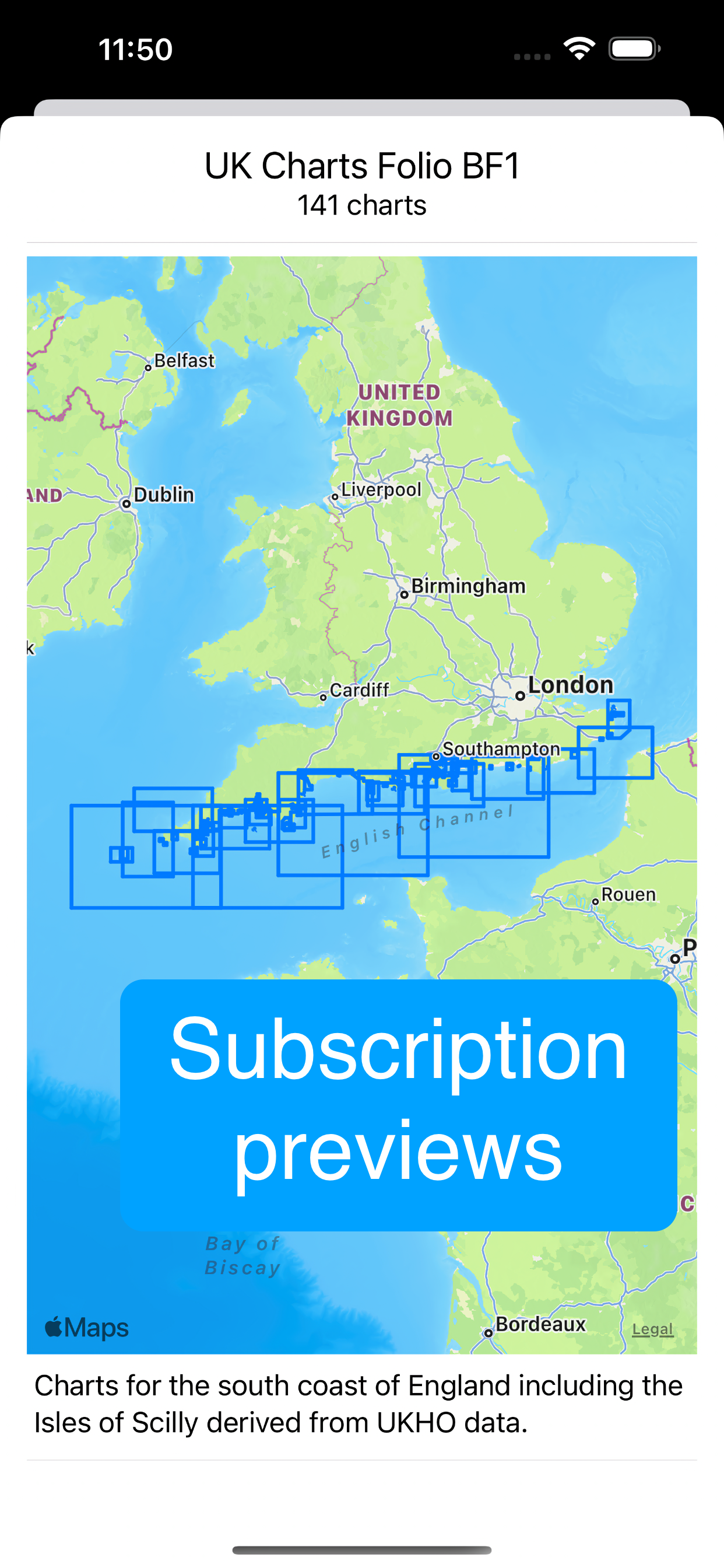
Annual subscriptions are available as in-app purchases for UKHO charts covering the whole of the UK. These are divided into 8 folios so that you can subscribe only to the charts that you need.
The app is free to use in its basic form, with additional functions and charts available as in-app purchases. This allows a user to fully evaluate the app without charge, and then to purchase the features and charts required.
Free features:
Chart plotter (Demo chart included)
Traditional navigation techniques
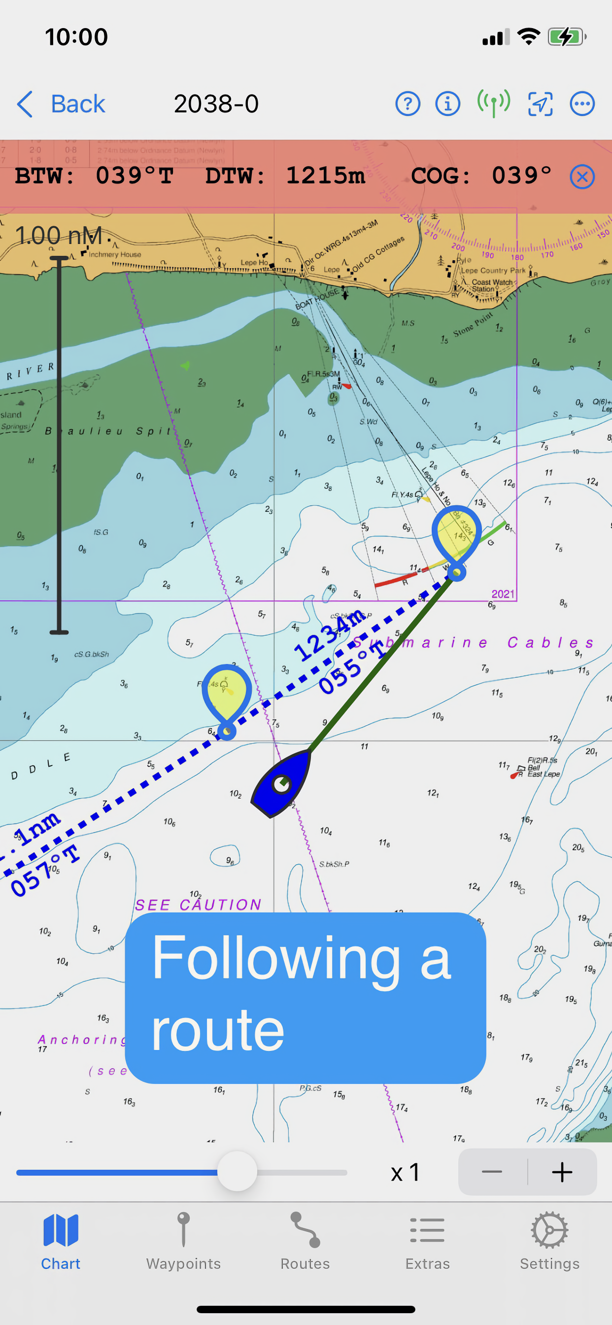
Waypoints and Routes
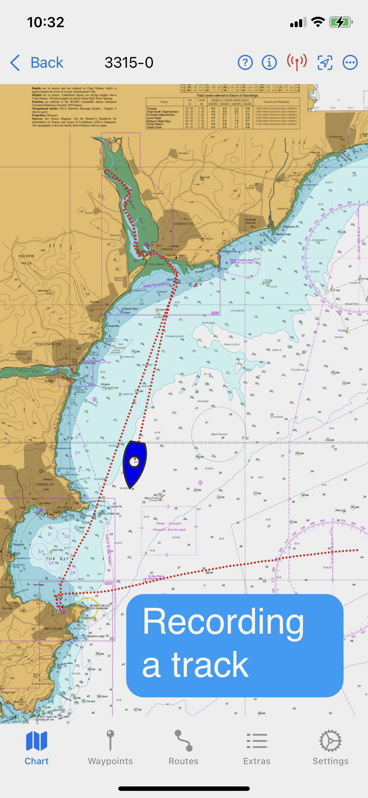
Track recording and display
Reads navigational data
Simulation mode
Paid for features (in-app purchases):
Open KAP/BSB files
Open GeoTIFF files
Open Satellite charts
Display AIS targets (if AIS information is available)
Subscription Charts:
Charts of UK coastal waters derived from UKHO data divided into 8 folios
Key features:
Brand new app written from the ground up
Carry out traditional navigation techniques on screen
Free to download to for evaluation, with in-app purchases to add only the features required
Custom keyboard for entry of waypoint latitude and longitude
Subscribe to and display charts derived from UKHO dat
Open KPA/BSB and GeoTIFF files (in-app purchase required)
Create Satellite charts for off line use (in-app purchase required)
Display AIS targets on the chart (in-app purchase required)
NOTE: The continued use of GPS running in the background can dramatically decrease battery life
HideShow More...
In-Apps
UKHO BF2
€29.99
UKHO BF1
€29.99
UKHO BF3
€29.99
UKHO BF4
€29.99
AIS
€5.99
Satellite charts
€5.99
BITides 25
€7.99
Imray ID30
€79.99
Log
€5.99
GeoPDF files
€5.99
Imray ID40
€79.99
Imray ID50
€79.99
Imray ID60
€79.99
Imray ID70
€79.99
Screenshots
AngelNav FAQ
Is AngelNav free?
Yes, AngelNav is free to download, however it contains in-app purchases or subscription offerings.
Is AngelNav legit?
🤔 The AngelNav app's quality is mixed. Some users are satisfied, while others report issues. Consider reading individual reviews for more context.
Thanks for the vote
How much does AngelNav cost?
AngelNav has several in-app purchases/subscriptions, the average in-app price is €39.42.
Whether or not you like the idea of being able to use traditional nav techniques in an app the support for this app is second to none. Offline help is built into the app and there is a free forum where you can post questions which are answered often within minutes if not hours. The new tides module gave me excellent information when planning a passage around the Mull of Kintyre and a full regional UKHO folio subscription for £25 seems reasonable value to me
Updated Review
Initially disappointed about the seeming absence of large scale charts, I am happy to report that Developer support has been simply excellent. In good faith I purchased a folio with a title that sounded like the one I needed. Unfortunately the charts I actually wanted were in another folio. The Developer took onboard that the error was understandable and I’m grateful to have been given a code for the correct folio at no cost to me. A five star service and a really good charting App.
OK for passage-making
Love the concept, enjoy the charts. But the paucity of large scale charts in the folios make this an unsatisfying and potentially risky experience inshore. For instance, on passage from Beachy Head towards Chichester Harbour there are no large scale charts for the Looe Channel. Or am I missing something?
The developer replied with two chart numbers, but neither appears in the folio I have purchased for the south coast: “The Looe channel is included in chart numbers 1652 and 2045”?
Excellent App
The very best Navigation App for sailors of sail or power boats. Gives you the opportunity to complete traditional navigation on a digital chart. So much better than many apps which significantly increase journey times.
Easy to use. An absolute must have App.
Great Nav software based on source of truth raster charts
Ive used AngelNav for several years. It has clearly been developed by sailors for sailors. Based on source of truth raster charts with auto selection of the largest scale for ‘here and now’ you dont have to worry about a bored developer having a bad day transcribing the paper chart into code, or having zoomed enough to see that rock!
The comprehensive software offers the usual bells and whistles like MOB and AIS, but also supports trad nav, for example multi hour trad nav ‘course to steer’ is easily done with the tide info right in front of you on the chart.
The race feature makes course noting and plotting a doddle, with the TWA feature helping brief the crew about whats next. Local Waypoints are easily downloaded from gpx files.
The support has been really responsive, even to the point of identifying an idiosyncratic issue with my ipad.
I guess its not better known because they are apple only and are spending too much time developing rather than marketing. Give it a go is my recommendation. AT £25 In the UK your IMHO local chart folio for a year is about the same as a picnic lunch.
Great idea difficult to use
Chartwork lines are difficult to move. Handles often fail to respond to touch. Using iPad mini 6th gen. Please fix.
Great concept, execution somewhat lacking
Downloaded the App, bought the KAP plugin and the Imray ID50 (Western Med) only to discover there is no clickable main chart, so you have to scroll through reams of charts in order to find the correct chart. I would have thought that linking the charts, like in OpenCPN would be a relatively easy thing to do for a coder. Staying true to printed charts is one thing, adding extra functionality on top of that would have been a real bonus.
Tidal heights and flows
In a recent update to Angelnav tide tables and streams have been added. This is a fantastic addition to and already great product.
Good app, great support!
Getting to grips with how it works over the season and really starting to like it. Route planning is very easy to do and subsequently follow.
Had an issue with AIS not working, but response from support was fantastic.
Learnt about some upcoming developments, which I’m really looking forward to, as this would make this 5 star and a real contender for similar apps.
Definitely ‘getting there’
Have used this extensively over about 2,500 miles of cruising around UK & Ireland alongside other navigational programs. It enables you to keep your traditional skills up to date without paying a fortune (and finding space for) a plethora of paper charts. It provides an immediate back up to your MFD and once you make the effort to understand how to switch between charts it’s all rather simple. However, accessing tidal diamonds to plan a long passage (particularly with cyclical tides) is a pain; it would be great if the developer could make this easier with perhaps animated tides *in addition* to providing the basic info. Such a mod would make it worth 5+ stars.
This page includes copyrighted content from third parties, shared solely for commentary and research in accordance with fair use under applicable copyright laws. All trademarks, including product, service, and company names or logos, remain the property of their respective owners. Their use here falls under nominative fair use as outlined by trademark laws and does not suggest any affiliation with or endorsement by the trademark holders.