
AngelNav
Charting app made by sailors
#1 Keyword Rankings
Today
Top 10 Rankings
Today
Top 30 Rankings
Today
Top 100 Rankings
Today
Description
AngelNav is a brand new app for iOS developed in collaboration with Tom Cunliffe. Primarily it is a full chart plotter currently favouring raster charts, but it has many additional features including the ability to carry out traditional navigation directly on the screen.
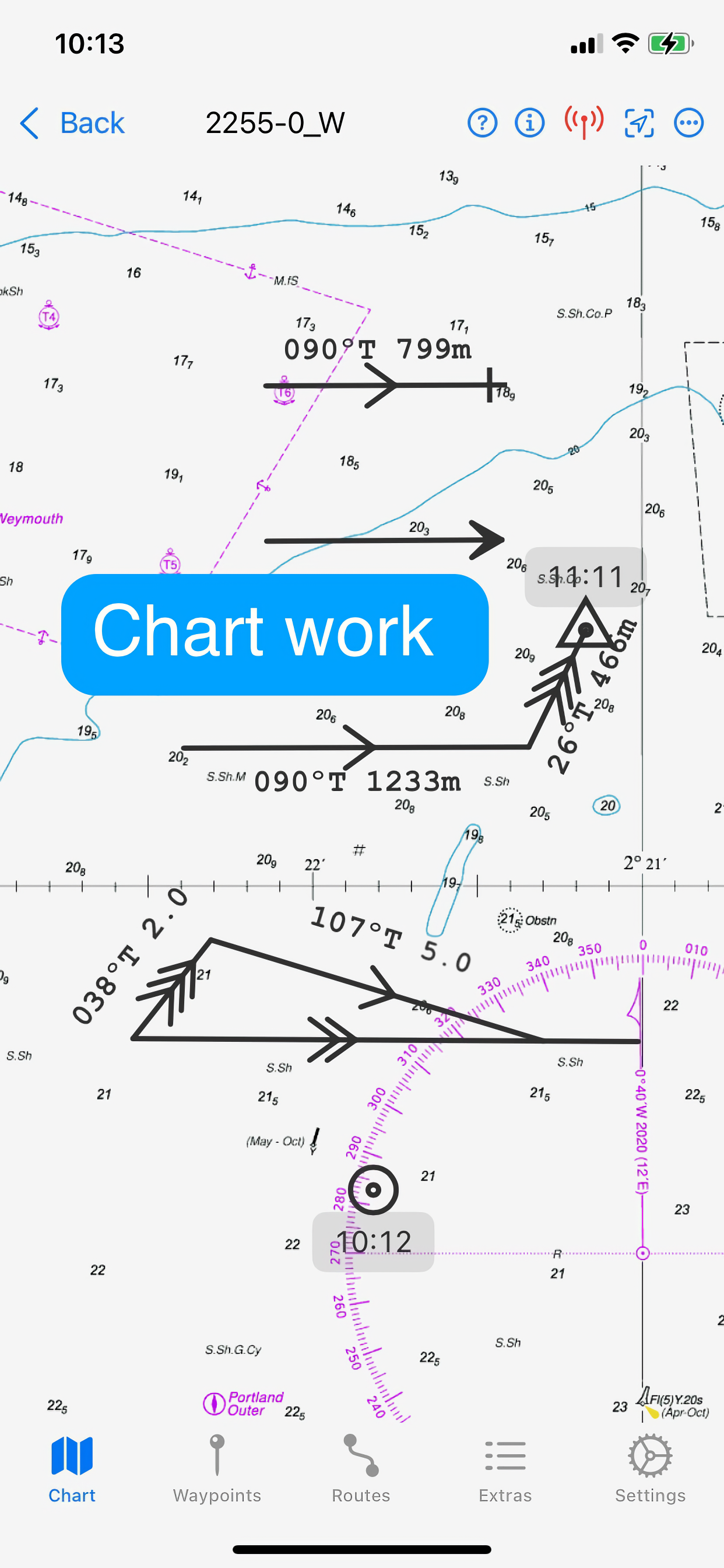
The capacity to generate classical chart work is vitally important in the event of a GPS failure, but hitherto has required pencil, plotters, and paper charts. AngelNav allows traditional techniques to be carried out using an iPad or iPhone screen instead of a paper chart. An estimated position can be plotted, position lines drawn from sighted bearings and fixes recorded. Course-to-steer diagrams are readily constructed.
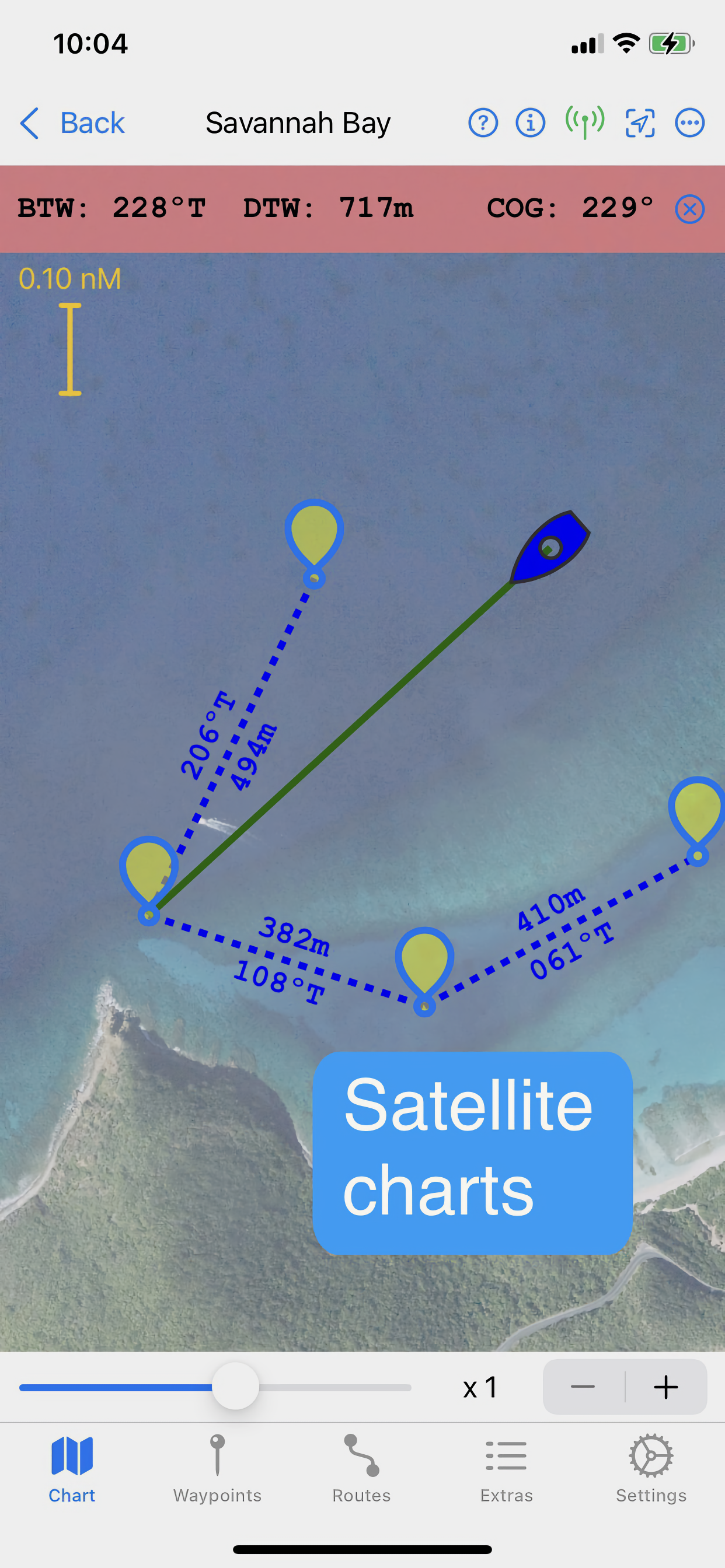
AngelNav can read most types of raster chart including the UKHO subscription charts, as well as KAP/BSB files and GeoTIFF files. Like its sister application for macOS, AngelPilot, it can easily create and read its own satellite charts.
AngelNav can take satellite navigation data from a variety of sources, including the device's stand-alone GPS, the boat's NMEA over WiFi, and SignalK. It will also display AIS information if available.
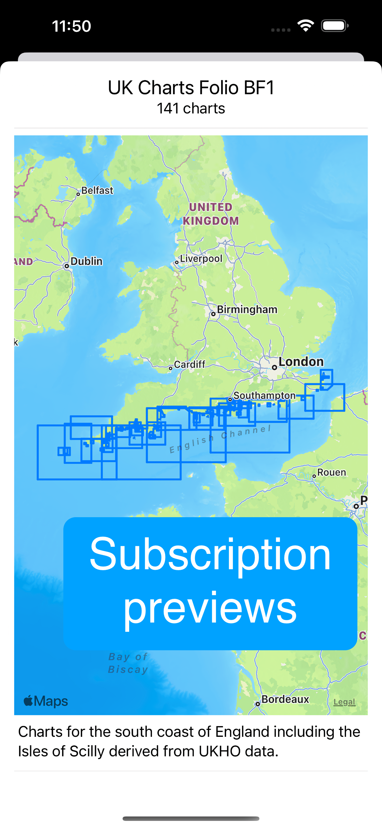
Annual subscriptions are available as in-app purchases for UKHO charts covering the whole of the UK. These are divided into 8 folios so that you can subscribe only to the charts that you need.
The app is free to use in its basic form, with additional functions and charts available as in-app purchases. This allows a user to fully evaluate the app without charge, and then to purchase the features and charts required.
Free features:
Chart plotter (Demo chart included)
Traditional navigation techniques
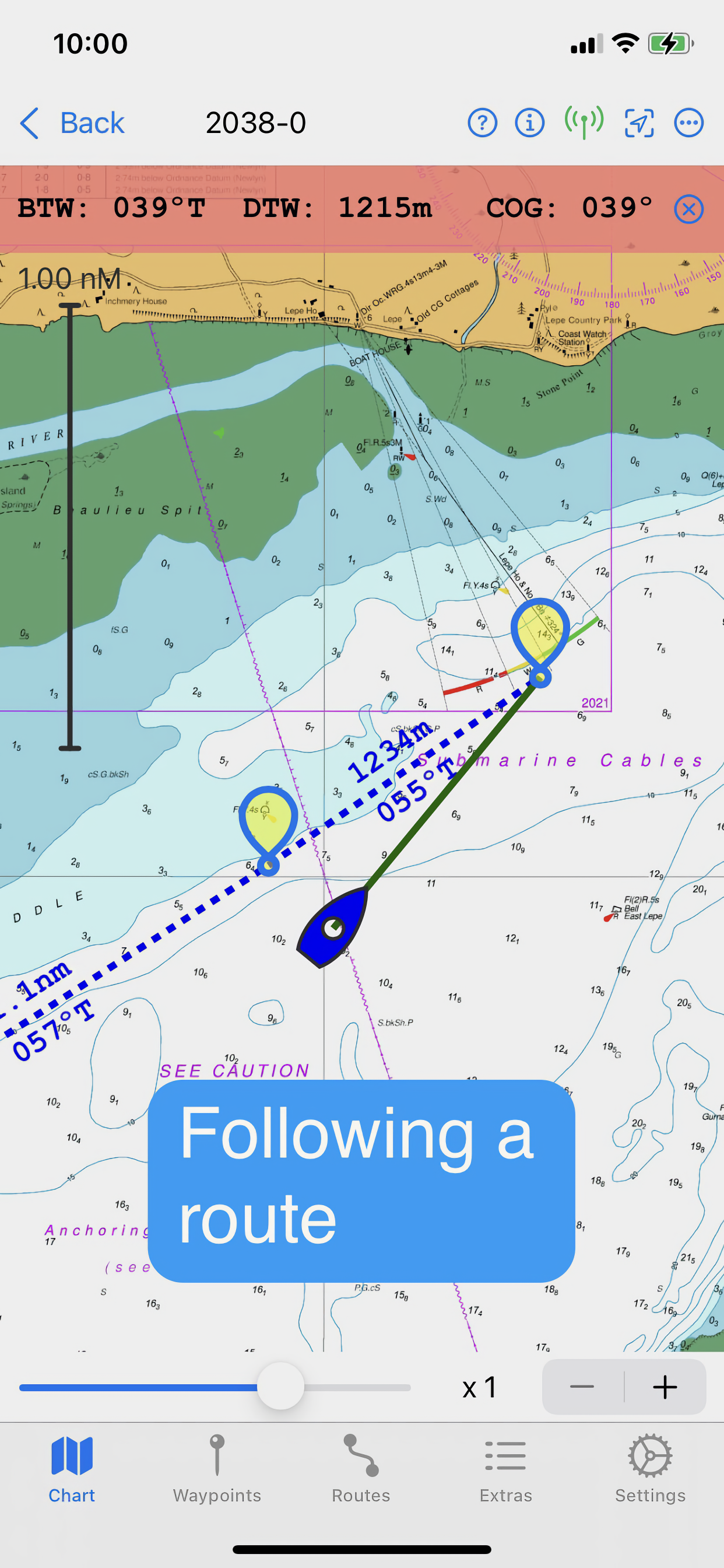
Waypoints and Routes
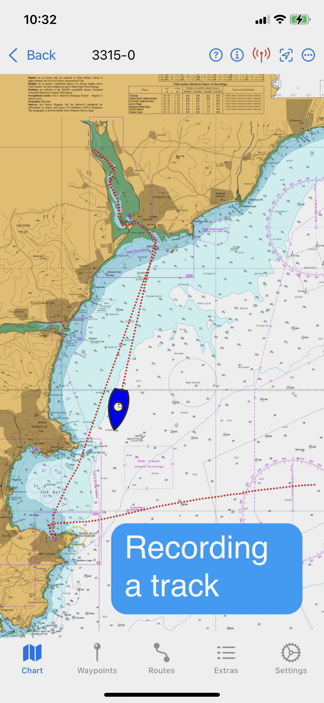
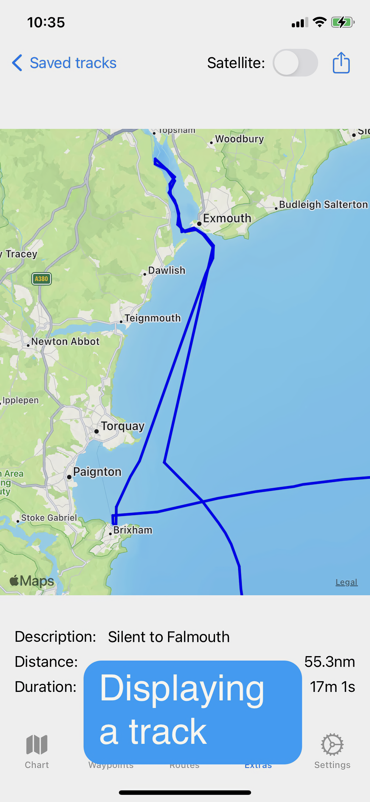
Track recording and display
Reads navigational data
Simulation mode
Paid for features (in-app purchases):
Open KAP/BSB files
Open GeoTIFF files
Open Satellite charts
Display AIS targets (if AIS information is available)
Subscription Charts:
Charts of UK coastal waters derived from UKHO data divided into 8 folios
Key features:
Brand new app written from the ground up
Carry out traditional navigation techniques on screen
Free to download to for evaluation, with in-app purchases to add only the features required
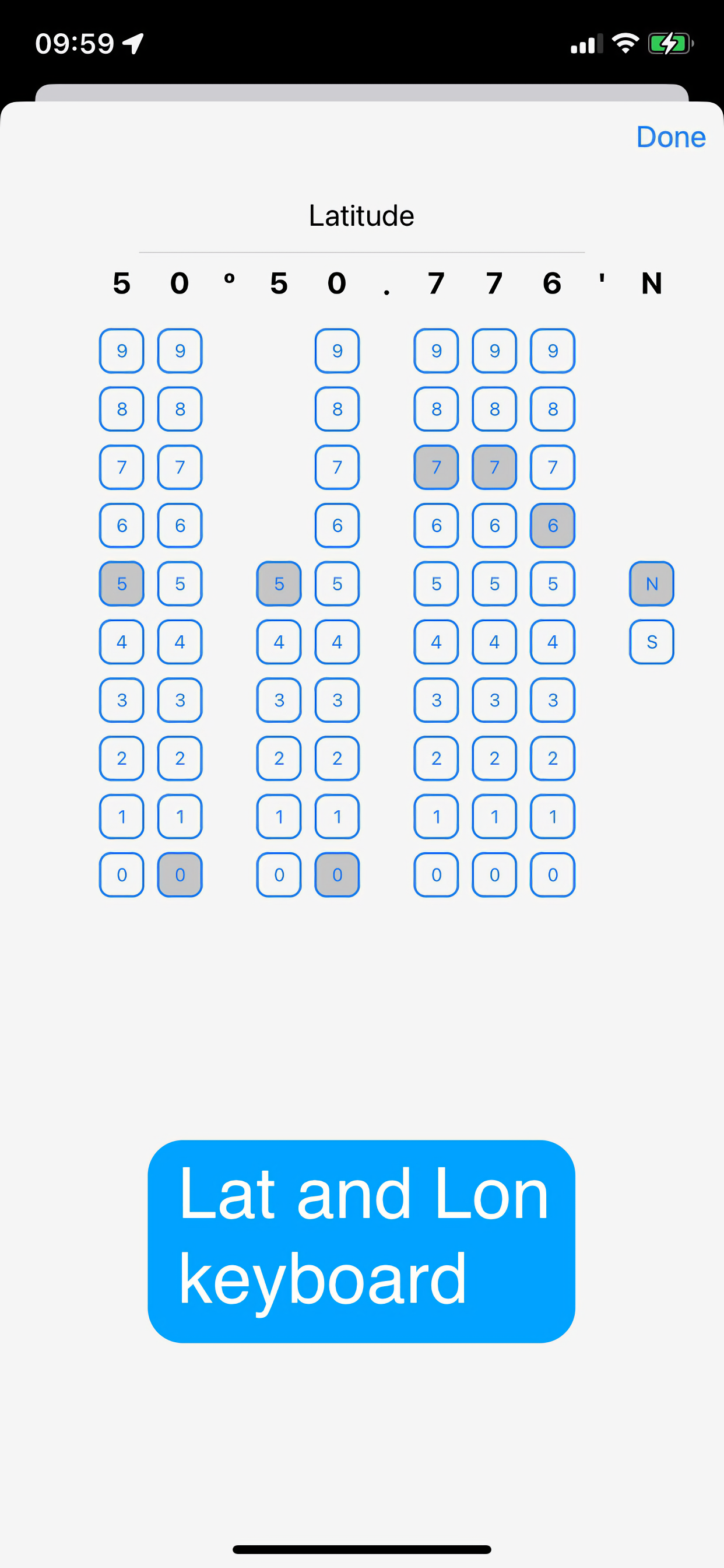
Custom keyboard for entry of waypoint latitude and longitude
Subscribe to and display charts derived from UKHO dat
Open KPA/BSB and GeoTIFF files (in-app purchase required)
Create Satellite charts for off line use (in-app purchase required)
Display AIS targets on the chart (in-app purchase required)
NOTE: The continued use of GPS running in the background can dramatically decrease battery life
Hide..
Show more..
The capacity to generate classical chart work is vitally important in the event of a GPS failure, but hitherto has required pencil, plotters, and paper charts. AngelNav allows traditional techniques to be carried out using an iPad or iPhone screen instead of a paper chart. An estimated position can be plotted, position lines drawn from sighted bearings and fixes recorded. Course-to-steer diagrams are readily constructed.
AngelNav can read most types of raster chart including the UKHO subscription charts, as well as KAP/BSB files and GeoTIFF files. Like its sister application for macOS, AngelPilot, it can easily create and read its own satellite charts.
AngelNav can take satellite navigation data from a variety of sources, including the device's stand-alone GPS, the boat's NMEA over WiFi, and SignalK. It will also display AIS information if available.
Annual subscriptions are available as in-app purchases for UKHO charts covering the whole of the UK. These are divided into 8 folios so that you can subscribe only to the charts that you need.
The app is free to use in its basic form, with additional functions and charts available as in-app purchases. This allows a user to fully evaluate the app without charge, and then to purchase the features and charts required.
Free features:
Chart plotter (Demo chart included)
Traditional navigation techniques
Waypoints and Routes
Track recording and display
Reads navigational data
Simulation mode
Paid for features (in-app purchases):
Open KAP/BSB files
Open GeoTIFF files
Open Satellite charts
Display AIS targets (if AIS information is available)
Subscription Charts:
Charts of UK coastal waters derived from UKHO data divided into 8 folios
Key features:
Brand new app written from the ground up
Carry out traditional navigation techniques on screen
Free to download to for evaluation, with in-app purchases to add only the features required
Custom keyboard for entry of waypoint latitude and longitude
Subscribe to and display charts derived from UKHO dat
Open KPA/BSB and GeoTIFF files (in-app purchase required)
Create Satellite charts for off line use (in-app purchase required)
Display AIS targets on the chart (in-app purchase required)
NOTE: The continued use of GPS running in the background can dramatically decrease battery life
In-Apps
- UKHO MS1
- SAR 99.99
- UKHO MS2
- SAR 99.99
- UKHO MS3
- SAR 99.99
- Imray ID20
- SAR 299.99
- Imray ID30
- SAR 299.99
- Imray ID40
- SAR 299.99
- Imray ID50
- SAR 299.99
- Imray ID60
- SAR 299.99
- Imray ID70
- SAR 299.99
- Imray ID100
- SAR 299.99
Screenshots

 User Rating
0 out of 5
0 ratings in Saudi Arabia
Ratings History
Reviews
App doesn't have any reviews yet
Store Rankings
Ranking History
App Ranking History not available yet
Category Rankings
|
Chart
|
Category
|
Rank
|
|---|---|---|
|
Top Grossing
|

|
9
|
|
Top Grossing
|

|
56
|
Keywords
Users may also like
| Name | Reviews | Recent release | |
|---|---|---|---|

Imray Navigator
|
0
|
1 year ago | |

iStreams West Scotland
|
0
|
3 months ago | |

iStreams Irish Sea
N/A/
|
0
|
3 months ago | |

Premier Marinas
Weather & Tidal Information
|
0
|
3 weeks ago | |

iStreams Solent
|
0
|
3 months ago | |

SailTies: Logbook GPS Tracking
Sailing Resume, Qualifications
|
0
|
4 weeks ago | |

iStreams English Channel
Smart tidal streams utility
|
0
|
3 months ago | |

Ocean Signal
Setup Ocean Signal Products
|
0
|
6 months ago | |

N/A/
N/A/
|
0
|
3 months ago | |

Whats Ashore
Cruising, Smarter, Together.
|
0
|
1 year ago |
Show More
Revenue and Downloads
Gain valuable insights into AngelNav performance with our analytics. Sign up now
to
access downloads, revenue, and more.
App Info
- Category
- Navigation
- Publisher
- SailTrack Limited
- Languages
- English
- Recent version
- 1.2.5 (1 month ago )
- Released on
- Apr 19, 2023 (1 year ago )
- Also available in
- United Kingdom, Canada, United States, Taiwan, Russia, Sweden, Mexico, New Zealand, Norway, Netherlands, Nigeria, Malaysia, Poland, Lebanon, Kazakhstan, Kuwait, South Korea, Japan, Peru, Philippines, Pakistan, India, Portugal, Romania, Saudi Arabia, Singapore, Thailand, Turkey, Ukraine, Vietnam, South Africa, Dominican Republic, Argentina, Austria, Australia, Azerbaijan, Belgium, Brazil, Belarus, Switzerland, Chile, China, Colombia, Czechia, Germany, Denmark, Italy, Algeria, Ecuador, Egypt, Spain, Finland, France, Greece, Hong Kong, Hungary, Indonesia, Ireland, Israel, United Arab Emirates
- Last updated
- 1 week ago