AngelNav is a brand new app for iOS developed in collaboration with Tom Cunliffe. Primarily it is a full chart plotter currently favouring raster charts, but it has many additional features including the ability to carry out traditional navigation directly on the screen.
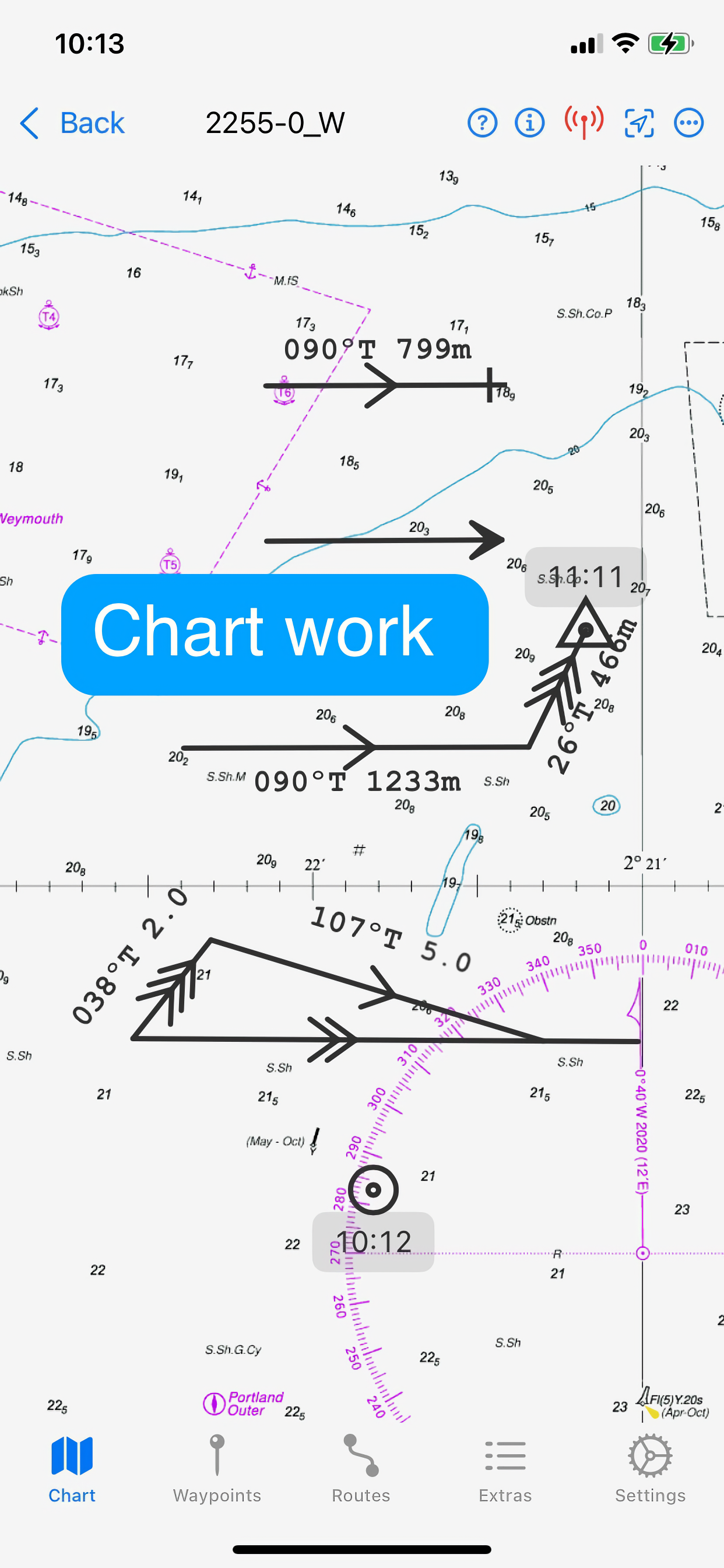
The capacity to generate classical chart work is vitally important in the event of a GPS failure, but hitherto has required pencil, plotters, and paper charts. AngelNav allows traditional techniques to be carried out using an iPad or iPhone screen instead of a paper chart. An estimated position can be plotted, position lines drawn from sighted bearings and fixes recorded. Course-to-steer diagrams are readily constructed.
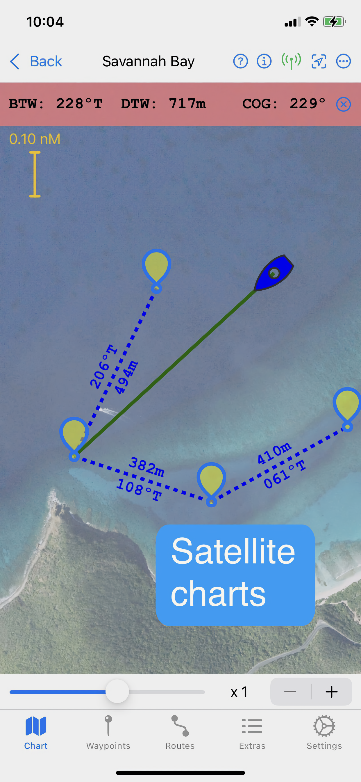
AngelNav can read most types of raster chart including the UKHO subscription charts, as well as KAP/BSB files and GeoTIFF files. Like its sister application for macOS, AngelPilot, it can easily create and read its own satellite charts.
AngelNav can take satellite navigation data from a variety of sources, including the device's stand-alone GPS, the boat's NMEA over WiFi, and SignalK. It will also display AIS information if available.
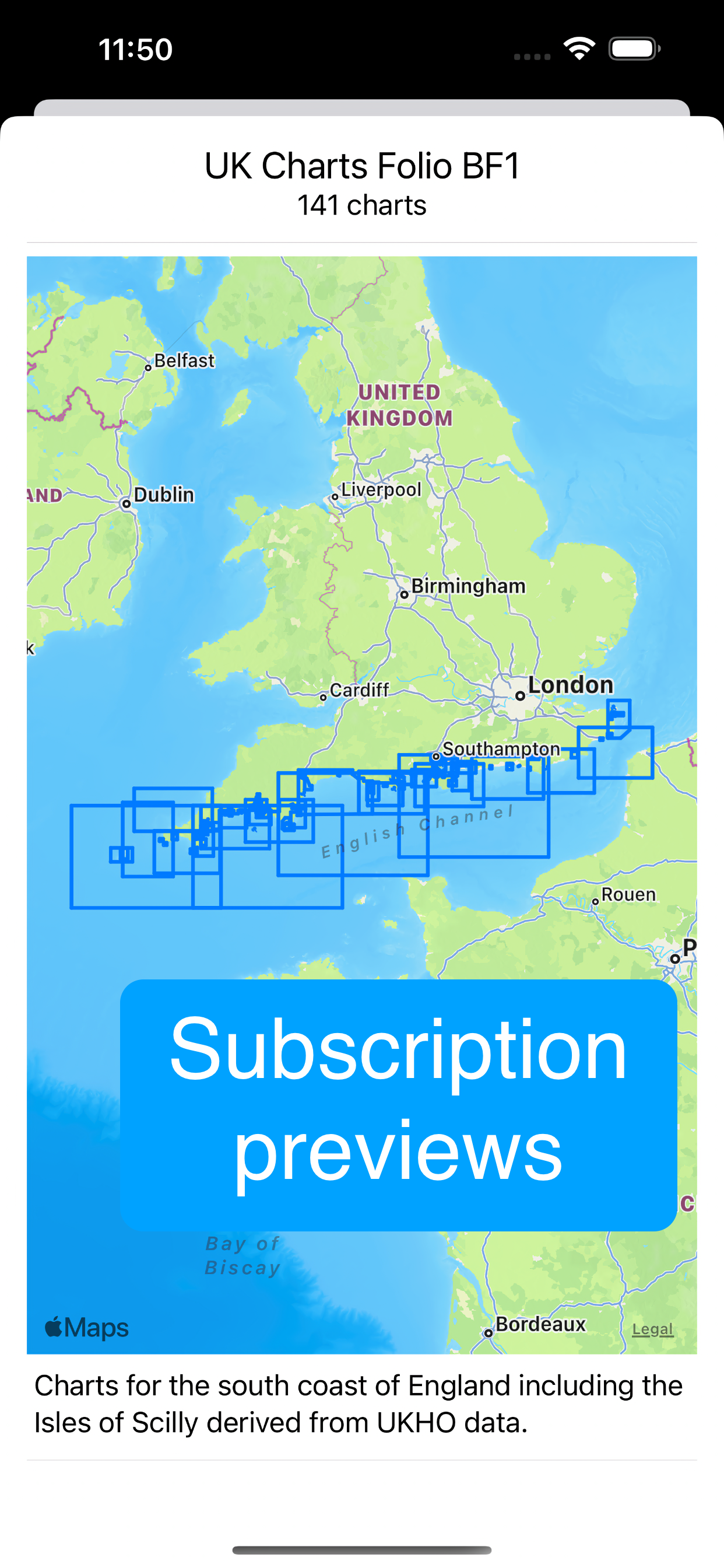
Annual subscriptions are available as in-app purchases for UKHO charts covering the whole of the UK. These are divided into 8 folios so that you can subscribe only to the charts that you need.
The app is free to use in its basic form, with additional functions and charts available as in-app purchases. This allows a user to fully evaluate the app without charge, and then to purchase the features and charts required.
Free features:
Chart plotter (Demo chart included)
Traditional navigation techniques
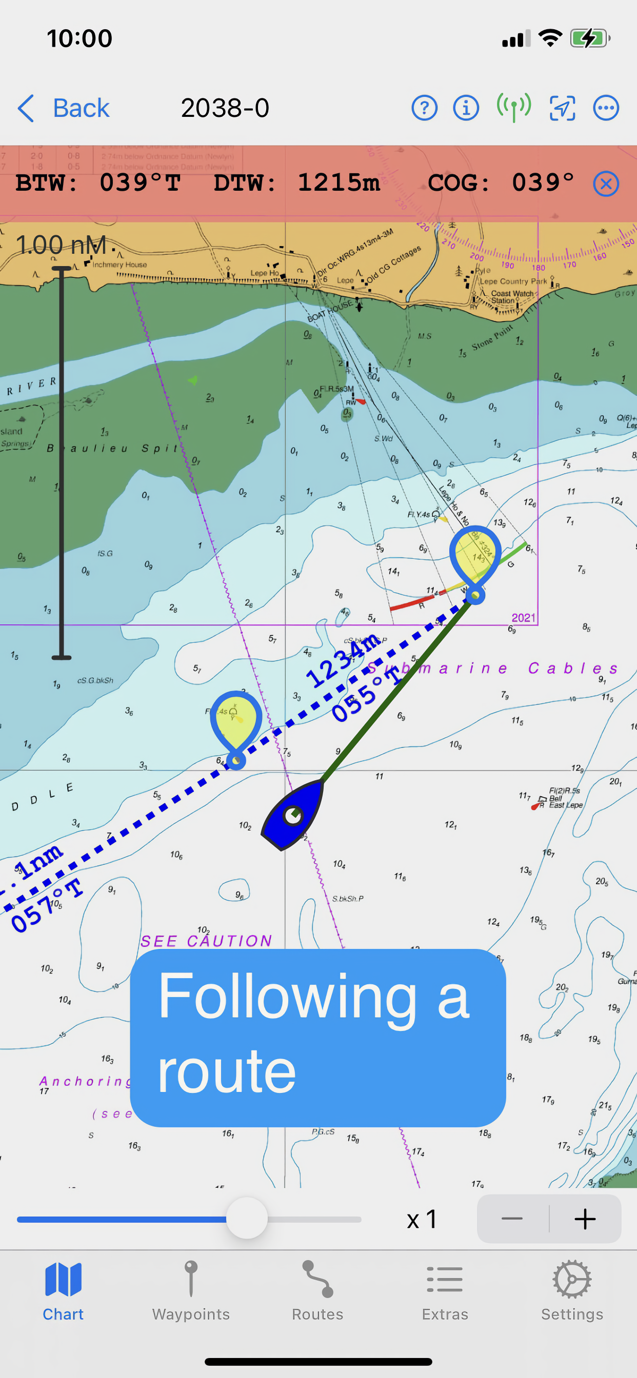
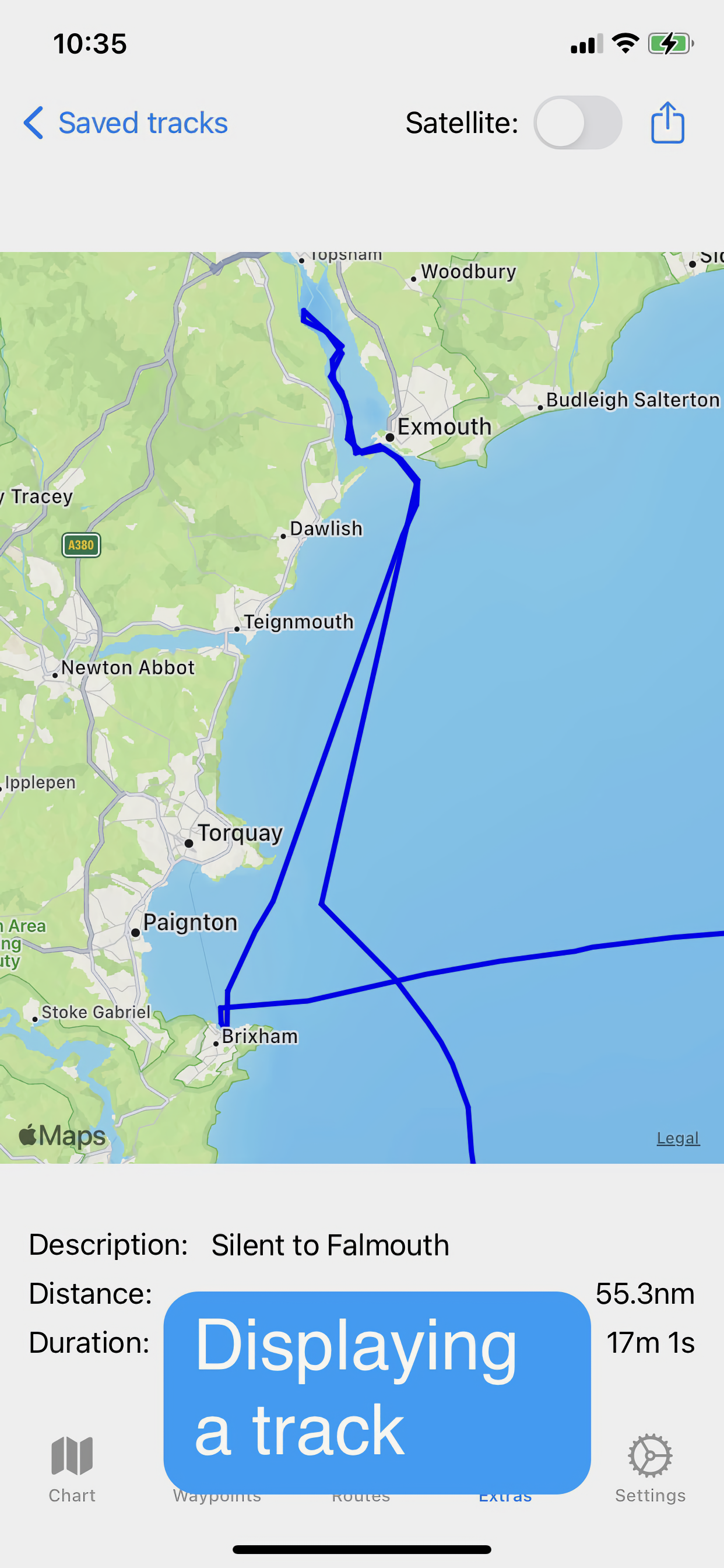
Waypoints and Routes
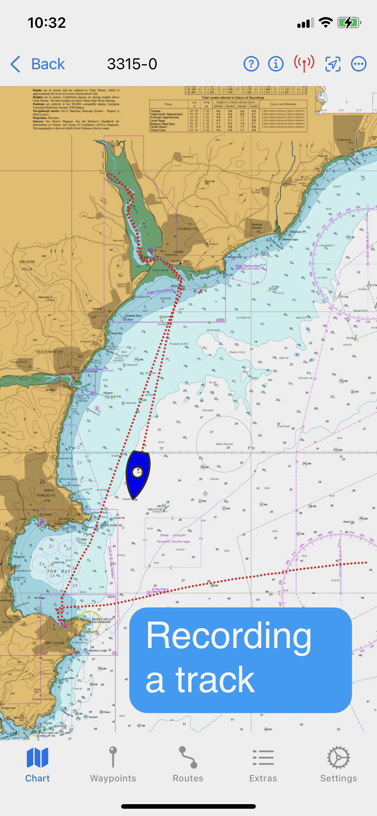
Track recording and display
Reads navigational data
Simulation mode
Paid for features (in-app purchases):
Open KAP/BSB files
Open GeoTIFF files
Open Satellite charts
Display AIS targets (if AIS information is available)
Subscription Charts:
Charts of UK coastal waters derived from UKHO data divided into 8 folios
Key features:
Brand new app written from the ground up
Carry out traditional navigation techniques on screen
Free to download to for evaluation, with in-app purchases to add only the features required
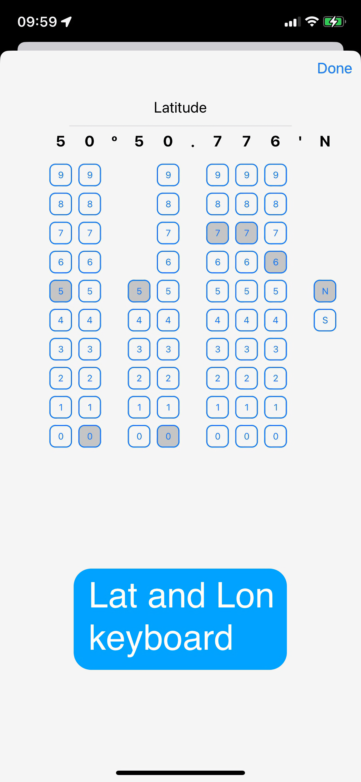
Custom keyboard for entry of waypoint latitude and longitude
Subscribe to and display charts derived from UKHO dat
Open KPA/BSB and GeoTIFF files (in-app purchase required)
Create Satellite charts for off line use (in-app purchase required)
Display AIS targets on the chart (in-app purchase required)
NOTE: The continued use of GPS running in the background can dramatically decrease battery life
Hide..Show more..
In-Apps
AIS
£4.99
UKHO BF1
£24.99
UKHO BF2
£24.99
UKHO BF3
£24.99
UKHO BF5
£24.99
UKHO BF7
£24.99
UKHO BF8
£24.99
KAP files
£4.99
Race Wizard
£2.99
Satellite charts
£4.99
Screenshots
User Rating
4 out of 5
11 ratings
in United Kingdom
5 star
4
4 star
4
3 star
2
2 star
1
1 star
0
Ratings History
Reviews
Definitely ‘getting there’
Have used this extensively over about 2,500 miles of cruising around UK & Ireland alongside other navigational programs. It enables you to keep your traditional skills up to date without paying a fortune (and finding space for) a plethora of paper charts. It provides an immediate back up to your MFD and once you make the effort to understand how to switch between charts it’s all rather simple. However, accessing tidal diamonds to plan a long passage (particularly with cyclical tides) is a pain; it would be great if the developer could make this easier with perhaps animated tides *in addition* to providing the basic info. Such a mod would make it worth 5+ stars.
AngelNav
This is an excellent navigational app. Has all the features of traditional nav techniques but able to use in a modern way. Excellent for planning trips. Once one learns all it features and how to handle the charts it will become your go to app for navigation. One can also use the features without resorting to reading glasses!
Jck
Useful tool for planning
I’m a user of paper charts for passage planning. Up until now that meant bringing my chart folio home from the boat. With Angelnav I can now create all of my passage plans in the comfort of my home before heading to the boat. Switching from paper to Angelnav is a simple process, replacing pencil for a tap on screen a passage plan with CTS for each waypoint is easily produced. Having looked at other apps and being a South coast sailor for me Angelnav offers great value, no other app offers these features at this price point. In future editions tide tables and tidal flow atlas would be a perfect addition.
Great potential
This is a revised review since the developers helpful comments of 17 July. I strongly advise watching Tom Cunliffe’s YouTube video which makes changing between charts, the subject of my earlier criticism, so much clearer. The ability to draw bearings and other marks directly onto the screen just as you would a paper chart is possibly unique and makes this app a potential clear winner, especially if you don’t want to rely totally on GPS or just want to practice the basic navigational skills which anyone calling themselves a Yachtsman/woman should have if venturing offshore or on longer coastal passages. While some criticise the cost of chart portfolios, they’re still massively cheaper than paper versions and without their bulk. However, one of the great features of vector charts is the animated way that tidal information is presented. If the developers could find a way perhaps to hybridise or at least to make that information more easily accessible then this app would be far beyond the competition. A target could be to replicate the seamless tidal information given in TZ iBoat.
Great potential but….
The ability to draw bearings and other marks directly onto the screen just as you would a paper chart is possibly unique and makes this app a potential clear winner. However, the clunky method of changing charts is also just like changing between paper charts; you put one away and open the other. Certainly not an issue if you enjoy that ‘old fashioned experience’ but compared to the seamless scrolling you get with other electronic chart programs it’s a step backwards - and frustratingly easy to ‘lose’ the area you’re working in and have to search the whole chart menu repeatedly. Competitors also have easy-to-see animated tides while this appears to still rely on the traditional tidal diamonds. This may well be deliberate but again, it feels like a retrograde step for an electronic chart. However, I’m impressed by the pro-active approach of the developers. If they could address these issues then this app would easily deserve 5 stars.
Interesting app
I see the very useful potential here of using trad nav on electronics, I get it. However I have the Memory Map app which I purchased to use the excellent Antares Charts. I recall that it was a requirement to purchase the Admiralty charts to make Antares work, though I don’t recall the detail. I don’t want to purchase the Admiralty charts twice so I backed up the charts from MemoryMap to another folder and set AngelNav to use this folder for chart data - but it seems that AngelNav won’t read these chart files. Any ideas?
I like the look of this but…
This looks like a really interesting app. Unfortunately the base map is just a blur. It would be helpful to have a time limited sample map (of my area) to evaluate whether this works for me.
Although Navionics (and others) offer a cheaper way to get map coverage the reality is that most of us don’t move that far from our cruising areas and the cost of a folio is pretty reasonable given the additional detail.
One question: Is it possible to sync routes etc. with chart plotters or other apps?
Small scale passage charts?
The introductory information indicates that folio BF1 includes passage charts (eg Isle of Wight to Cap de la Hague) but they seem to be missing
Unsure
I’d like to be able to try this app out with a chart for a trial before committing to buying one.
Location while using app
Looks like a useful bit of software
but
I selected find location ‘While using app’
unfortunately it doesn’t turn off location when you stop using the app
I had to go into ‘settings’ and the app and turn the setting to ‘never’ to get the blue location notification to go away
I posted this here because I couldn’t see any option to report bugs
I’m sure it will get fixed when the developer clicks on the correct box in the appropriate object 😵💫