Warum kann ich die Schriftgrösse in der Karte nicht einstellen?
Die App ist super, aber ab einem Alter 50 Jahren nicht mehr zu benutzen 😌die Schrift in der Karte ist zu klein.

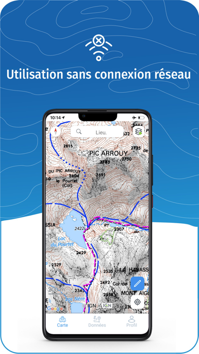
Yes, IGNrando' is free to download, however it contains in-app purchases or subscription offerings.
🤔 The IGNrando' app's quality is mixed. Some users are satisfied, while others report issues. Consider reading individual reviews for more context.
IGNrando' has several in-app purchases/subscriptions, the average in-app price is €16.99.
To get estimated revenue of IGNrando' app and other AppStore insights you can sign up to AppTail Mobile Analytics Platform.

4.7 out of 5
87 ratings in Germany
Die App ist super, aber ab einem Alter 50 Jahren nicht mehr zu benutzen 😌die Schrift in der Karte ist zu klein.
DesW
17€/a - c‘est trop chère
Je m’en sers surtout pour organiser des sorties Vélo électrique ou des petites randonnées . C’est très pratique pour voir si on suit bien l’itinéraire et les ateliers, nous aident à maîtriser l’application
J’utilise tous les jours depuis que je me suis mis à la marche, rien à dire, au top …
Au top. Après quelques temps avec une application non opérationnelle sur iPad Pro; tout fonctionne à nouveau maintenant grâce à la réactivité des services Ign (cocorico !) Quel plaisir de se baser sur des cartes très détaillées et des données maj continuellement. Je recommande grandement cette application !
Avoir l’application mobile sur Mac OS, on a beau dire mais merci Apple. Mais il y a aussi le site IGNrando.fr.
Après plusieurs semaines d’appli non utilisable. On fait quoi pour l’abonnement que j’ai continué de payer pendant ce temps ?
Je l’utilise pour préparer mes randos et mes sorties à vélo. Je recommande !
Depuis la mise à jour de iPadOS vers la version 18.1.1 l’application ne s’ouvre plus. Comment faire ?
|
Chart
|
Category
|
Rank
|
|---|---|---|
|
Top Grossing
|

|
4
|
|
Top Grossing
|

|
33
|
|
Top Grossing
|

|
53
|
|
Top Grossing
|

|
90
|
|
Top Free
|
|
188
|
| Name | Downloads (30d) | Monthly Revenue | Reviews | Ratings | Recent release | |
|---|---|---|---|---|---|---|

Iphigénie | The Hiking Map App
IGN maps, hiking, outdoor
|
View
|
View
|
13
|
|
1 day ago | |

SityTrail
Hiking Trail GPS Offline Maps
|
View
|
View
|
0
|
|
1 month ago | |

OutDoors GPS France - IGN Maps
Plan Hiking & Biking Routes
|
View
|
View
|
3
|
|
1 year ago | |

Visorando – Wanderideen
Wander-GPS mit Offline-Modus
|
View
|
View
|
0
|
|
2 months ago | |

Geovelo: Fahrrad GPS
Fahrrad-Navigation per GPS
|
View
|
View
|
31
|
|
1 week ago | |

GPX viewer
The paper map reinvented
|
View
|
View
|
15
|
|
2 months ago | |

Hika - Hiking trails and maps
Hike and walk with GPS routes
|
View
|
View
|
0
|
|
3 weeks ago | |

Les Pépites de France
Les Pépites de France
|
View
|
View
|
0
|
|
6 days ago | |

Cartes IGN
Découvrez la France autrement
|
View
|
View
|
0
|
|
1 week ago | |

MaRando – FFRandonnée
Sentiers, promenades, GR, GPS
|
View
|
View
|
0
|
|
4 weeks ago |
